close
Trail Conditions
- Unknown
- Snow Groomed
- Snow Packed
- Snow Covered
- Snow Cover Inadequate
- Freeze/thaw Cycle
- Icy
- Prevalent Mud
- Wet
- Variable
- Ideal
- Dry
- Very Dry
Trail Flow (Ridden Direction)
Trailforks scans users ridelogs to determine the most popular direction each trail is ridden. A good flowing trail network will have most trails flowing in a single direction according to their intension.
The colour categories are based on what percentage of riders are riding a trail in its intended direction.
The colour categories are based on what percentage of riders are riding a trail in its intended direction.
- > 96%
- > 90%
- > 80%
- > 70%
- > 50%
- < 50%
- bi-directional trail
- no data
Trail Last Ridden
Trailforks scans ridelogs to determine the last time a trail was ridden.
- < 2 days
- < 1 week
- < 2 weeks
- < 1 month
- < 6 months
- > 6 months
Trail Ridden Direction
The intended direction a trail should be ridden.
- Downhill Only
- Downhill Primary
- Both Directions
- Uphill Primary
- Uphill Only
- One Direction
Contribute Details
Colors indicate trail is missing specified detail.
- Description
- Photos
- Description & Photos
- Videos
Trail Popularity ?
Trailforks scans ridelogs to determine which trails are ridden the most in the last 9 months.
Trails are compared with nearby trails in the same city region with a possible 25 colour shades.
Think of this as a heatmap, more rides = more kinetic energy = warmer colors.
- most popular
- popular
- less popular
- not popular
ATV/ORV/OHV Filter
Max Vehicle Width
inches
Radar Time
x
Activity Recordings
Trailforks users anonymized public ridelogs from the past 6 months.
- mountain biking recent
- mountain biking (>6 month)
- hiking (1 year)
- moto (1 year)
Activity Recordings
Trailforks users anonymized public skilogs from the past 12 months.
- Downhill Ski
- Backcountry Ski
- Nordic Ski
Jump Magnitude Heatmap
Heatmap of where riders jump on trails. Zoom in to see individual jumps, click circles to view jump details.
Trails Deemphasized
Trails are shown in grey.
Only show trails with NO bikes.
Save the current map location and zoom level as your default home location whenever this page is loaded.
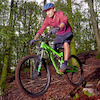
SaveBike Park with lift. Good facilities with toilets and a small shop where you can buy beverages. They usually grill burgers during the day for hungry bikers, even vegan/vegetarian options.
Check Facebook for updates on events.
Check Facebook for updates on events.
source: https://kesbergetbikepark.com/
Primary Trail Type: All-Mountain & Downhill
Access Info:
The parking is located next to the road leading to the park, it's within sight of the facility.
Links
This region uses the Uk/Euro style trail grading system.
Activities Click to view
- Mountain Bike
9 trails
Bike Park Details
- 1
- 1
- 4
- 3
Region Status
Open as of Aug 20, 2021- Day Ticket
- kr180 SEK
- Uplift Type
- T-Bar
Stats
- Global Ranking
- #8,673
- State Ranking
- #426
- Trails (view details)
- 9
- Trails Mountain Bike
- 9
- Total Distance
- 2 miles
- Total Descent Distance
- 2 miles
- Total Descent
- 1,009 ft
- Total Vertical
- 158 ft
- Highest Trailhead
- 514 ft
- Reports
- 9
- Ridden Counter
- 345
Popular Kesberget Bikepark Mountain Biking Trails
| status | title | difficulty | rating |
|---|---|---|---|
| Svartberget Enduro | |||
| Gröne Orm | |||
| Keso | |||
| Spanjoren | |||
| Tyskline | |||
| Bumlingen | |||
| Elduro | |||
| Droppet | |||
| Karusellen |
Videos of Kesberget Bikepark Mountain Bike

trail: Keso
0:31 |
228 |
Jan 16, 2011
Recent Trail Reports
| status | trail | date | condition | info | user |
|---|---|---|---|---|---|
| Gröne Orm | May 29, 2022 @ 3:19am May 29, 2022 | Dry | wikisara | ||
| Svartberget Enduro | May 29, 2022 @ 3:19am May 29, 2022 | Dry | wikisara | ||
| Elduro | Aug 19, 2021 @ 9:22am Aug 19, 2021 | Ideal | PiloS | ||
| Tyskline | Aug 19, 2021 @ 9:22am Aug 19, 2021 | Ideal | PiloS | ||
| Keso | Aug 19, 2021 @ 9:22am Aug 19, 2021 | Unknown | PiloS |
Activity Feed
| username | action | type | title | date | |
|---|---|---|---|---|---|
 | wikisara | add | report | Gröne Orm and 1 more | May 30, 2022 @ 7:44am May 30, 2022 |
 | OQcBLF | ridden | trail | Spanjoren | May 27, 2022 @ 8:00am May 27, 2022 |
| olag | ridden | trail | Svartberget Enduro and 3 more | May 23, 2022 @ 3:59am May 23, 2022 |
| OQcBLF | ridden | trail | Gröne Orm | Apr 27, 2022 @ 9:10am Apr 27, 2022 |
 | PiloS | add | report | Elduro and 2 more | Aug 20, 2021 @ 12:02am Aug 20, 2021 |
Nearby Areas
| name | distance | ||||
|---|---|---|---|---|---|
| Vårgårda Östra | 12 | 9 | 2.6 km | ||
| Herrljunga Norra | 1 | 2 | 5.4 km | ||
| Vårgårda Västra | 6 | 5 | 7 km | ||
| Skogsbygden | 6 | 3 | 10.8 km | ||
| Alingsås Norra | 39 | 59 | 11.5 km |
- By vegansson
 & contributors
 - Admins: nivis, Marleey, martinlindstr, wikisara, JBohden, patrikandersson
- #46143 - 460 views
- kesberget bikepark activity log | embed map of Kesberget Bikepark mountain bike trails |
Downloading of trail gps tracks in kml & gpx formats is enabled for Kesberget Bikepark.
You must login to download files.