close
Trail Conditions
- Unknown
- Snow Groomed
- Snow Packed
- Snow Covered
- Snow Cover Inadequate
- Freeze/thaw Cycle
- Icy
- Prevalent Mud
- Wet
- Variable
- Ideal
- Dry
- Very Dry
Trail Flow (Ridden Direction)
Trailforks scans users ridelogs to determine the most popular direction each trail is ridden. A good flowing trail network will have most trails flowing in a single direction according to their intension.
The colour categories are based on what percentage of riders are riding a trail in its intended direction.
The colour categories are based on what percentage of riders are riding a trail in its intended direction.
- > 96%
- > 90%
- > 80%
- > 70%
- > 50%
- < 50%
- bi-directional trail
- no data
Trail Last Ridden
Trailforks scans ridelogs to determine the last time a trail was ridden.
- < 2 days
- < 1 week
- < 2 weeks
- < 1 month
- < 6 months
- > 6 months
Trail Ridden Direction
The intended direction a trail should be ridden.
- Downhill Only
- Downhill Primary
- Both Directions
- Uphill Primary
- Uphill Only
- One Direction
Contribute Details
Colors indicate trail is missing specified detail.
- Description
- Photos
- Description & Photos
- Videos
Trail Popularity ?
Trailforks scans ridelogs to determine which trails are ridden the most in the last 9 months.
Trails are compared with nearby trails in the same city region with a possible 25 colour shades.
Think of this as a heatmap, more rides = more kinetic energy = warmer colors.
- most popular
- popular
- less popular
- not popular
ATV/ORV/OHV Filter
Max Vehicle Width
inches
Radar Time
x
Activity Recordings
Trailforks users anonymized public ridelogs from the past 6 months.
- mountain biking recent
- mountain biking (>6 month)
- hiking (1 year)
- moto (1 year)
Activity Recordings
Trailforks users anonymized public skilogs from the past 12 months.
- Downhill Ski
- Backcountry Ski
- Nordic Ski
Jump Magnitude Heatmap
Heatmap of where riders jump on trails. Zoom in to see individual jumps, click circles to view jump details.
Trails Deemphasized
Trails are shown in grey.
Only show trails with NO bikes.
Save the current map location and zoom level as your default home location whenever this page is loaded.
SaveAlpinveien 9
1708 Sarpsborg
Åpent lørdag 11-17.
1708 Sarpsborg
Åpent lørdag 11-17.
Primary Trail Type: All-Mountain & Downhill
Land Status: Ski Resort
 google parking directions
Links
- Official allpine park website
- Priser/Prices
- Skjeberg Cyleklub
- kjerringaasendownhill on Facebook
- Winter Ski Map
Files
Activities Click to view
- Mountain Bike
14 trails
- E-Bike
14 trails
- Hike
0 trails
- Trail Running
0 trails
Bike Park Details
- 1
- 4
- 5
- 1
Region Status
Open as of Oct 19, 2019- Day Ticket
- kr280 NOK
- Uplift Type
- T-Bar
Stats
- Trails (view details)
- 14
- Trails Mountain Bike
- 14
- Trails E-Bike
- 14
- Total Distance
- 3 miles
- Total Descent
- 2,808 ft
- Total Vertical
- 427 ft
- Highest Trailhead
- 701 ft
- Reports
- 30
- Photos
- 22
- Ridden Counter
- 310
Popular Kjerringåsen Alpinsenter Trails
Photos of Kjerringåsen Alpinsenter Mountain Bike
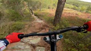
trail: Omveien
88 |
May 2, 2020 @ 2:45pm
May 2, 2020
trail: Dropp Zone
39 |
May 2, 2020 @ 2:45pm
May 2, 2020
trail: Dropp Zone
52 |
May 2, 2020 @ 2:45pm
May 2, 2020
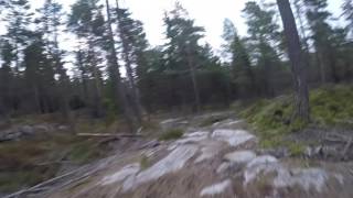
trail: Nedre Trollstien
90 |
Oct 21, 2019 @ 4:03am
Oct 21, 2019
trail: Nedre Trollstien
56 |
Feb 10, 2017 @ 3:51pm
Feb 10, 2017
trail: Nedre Trollstien
94 | | 1 comments
Feb 10, 2017 @ 3:45pm
Feb 10, 2017
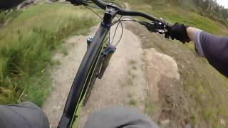
trail: Nedre Gubben
74 |
Feb 9, 2017 @ 12:49pm
Feb 9, 2017
trail: Nedre Gubben
74 |
Feb 9, 2017 @ 12:49pm
Feb 9, 2017
trail: Nedre Gubben
117 | | 1 comments
Feb 8, 2017 @ 11:53am
Feb 8, 2017
trail: Nedre Gubben
117 | | 1 comments
Feb 8, 2017 @ 11:53am
Feb 8, 2017Videos of Kjerringåsen Alpinsenter Mountain Bike
trail: Revehiet
1:16 |
10 |
May 26, 2022 , Sarpsborg
trail: Omvei På Omveien
5:37 |
214 |
Jan 25, 2019 , Sarpsborg

trail: Omveien
5:37 |
205 |
Jan 25, 2019 , Sarpsborg

trail: Bjørnefaret
1:19 |
232 |
Oct 25, 2018 , Sarpsborg

trail: Nedre Trollstien
6:19 |
200 |
Oct 25, 2018 , Sarpsborg
trail: Øvre Trollstien
6:19 |
142 |
Oct 25, 2018 , Sarpsborg

trail: Øvre Gubben
6:19 |
179 |
Oct 25, 2018 , Sarpsborg

trail: Øvre Gubben
2:04 |
257 |
Feb 13, 2018 , Sarpsborg
Recent Trail Reports
| status | trail | date | condition | info | user |
|---|---|---|---|---|---|
| Omveien | Apr 19, 2021 @ 8:17am Apr 19, 2021 | Ideal | knutspeed | ||
| Nedre Trollstien | Apr 19, 2021 @ 8:17am Apr 19, 2021 | Variable | knutspeed | ||
| Bjørnefaret | Jul 26, 2020 @ 5:57am Jul 26, 2020 | Wet | NorwegianTrailblazer | ||
| Omvei På Omveien | Apr 18, 2020 @ 2:21am Apr 18, 2020 | Ideal | knutspeed | ||
| Øvre Trollstien | Apr 18, 2020 @ 2:21am Apr 18, 2020 | Ideal | knutspeed | ||
| Øvre Gubben | Apr 18, 2020 @ 2:21am Apr 18, 2020 | Ideal | knutspeed | ||
| Nedre Gubben | Apr 18, 2020 @ 2:21am Apr 18, 2020 | Ideal | knutspeed | ||
| Revehiet | Apr 18, 2020 @ 2:21am Apr 18, 2020 | Ideal | knutspeed | ||
| Snarveien | Apr 18, 2020 @ 2:21am Apr 18, 2020 | Ideal | knutspeed | ||
| Tvillingen | Apr 18, 2020 @ 2:21am Apr 18, 2020 | Ideal | knutspeed |
Activity Feed
| username | action | type | title | date | |
|---|---|---|---|---|---|
 | mtbboy1993 | add | video | Revehiet - Kjerringåsen DH | May 26, 2022 @ 9:00pm May 26, 2022 |
| mtbboy1993 | add | trail | T-lift and 1 more | Apr 30, 2021 @ 5:53pm Apr 30, 2021 |
 | knutspeed | add | report | Omveien and 1 more | Apr 19, 2021 @ 12:32pm Apr 19, 2021 |
 | NorwegianTrailblazer | add | report | Omveien and 1 more | Jul 26, 2020 @ 4:48am Jul 26, 2020 |
| hagen89 | add | photo | at Omveien in Sarpsborg, Norway and 2 more | May 2, 2020 @ 2:47pm May 2, 2020 |
Nearby Areas
| name | distance | ||||
|---|---|---|---|---|---|
| Moåsen | 2 | 2 | 2.8 km | ||
| Stikkaåsen | 4 | 2 | 1 | 4.5 km | |
| Sarpsborgmarka | 3 | 11 | 5.4 km | ||
| Kalnesskogen | 21 | 16 | 2 | 5.7 km | |
| Hasleskogen | 1 | 6 km |
Activity Type Stats
| activitytype | trails | distance | descent | descent distance | total vertical | rating | global rank | state rank | photos | reports | routes | ridelogs |
|---|---|---|---|---|---|---|---|---|---|---|---|---|
| Mountain Bike | 14 | 3 miles | 2,808 ft | 3 miles | 427 ft | #9,321 | #92 | 22 | 30 | 69 | ||
| E-Bike | 14 | 3 miles | 2,808 ft | 3 miles | 427 ft | #3,353 | #61 | 30 |
- By mtbboy1993
 TRAILFORKS SSK & contributors
 - Admins: apply
- #15409 - 3,172 views
- kjerringåsen alpinsenter activity log | embed map of Kjerringåsen Alpinsenter mountain bike trails | kjerringåsen alpinsenter mountain biking points of interest
-
- subscribe
- 3d map
Downloading of trail gps tracks in kml & gpx formats is enabled for Kjerringåsen Alpinsenter.
You must login to download files.