close
Trail Conditions
- Unknown
- Snow Groomed
- Snow Packed
- Snow Covered
- Snow Cover Inadequate
- Freeze/thaw Cycle
- Icy
- Prevalent Mud
- Wet
- Variable
- Ideal
- Dry
- Very Dry
Trail Flow (Ridden Direction)
Trailforks scans users ridelogs to determine the most popular direction each trail is ridden. A good flowing trail network will have most trails flowing in a single direction according to their intension.
The colour categories are based on what percentage of riders are riding a trail in its intended direction.
The colour categories are based on what percentage of riders are riding a trail in its intended direction.
- > 96%
- > 90%
- > 80%
- > 70%
- > 50%
- < 50%
- bi-directional trail
- no data
Trail Last Ridden
Trailforks scans ridelogs to determine the last time a trail was ridden.
- < 2 days
- < 1 week
- < 2 weeks
- < 1 month
- < 6 months
- > 6 months
Trail Ridden Direction
The intended direction a trail should be ridden.
- Downhill Only
- Downhill Primary
- Both Directions
- Uphill Primary
- Uphill Only
- One Direction
Contribute Details
Colors indicate trail is missing specified detail.
- Description
- Photos
- Description & Photos
- Videos
Trail Popularity ?
Trailforks scans ridelogs to determine which trails are ridden the most in the last 9 months.
Trails are compared with nearby trails in the same city region with a possible 25 colour shades.
Think of this as a heatmap, more rides = more kinetic energy = warmer colors.
- most popular
- popular
- less popular
- not popular
ATV/ORV/OHV Filter
Max Vehicle Width
inches
Radar Time
x
Activity Recordings
Trailforks users anonymized public ridelogs from the past 6 months.
- mountain biking recent
- mountain biking (>6 month)
- hiking (1 year)
- moto (1 year)
Activity Recordings
Trailforks users anonymized public skilogs from the past 12 months.
- Downhill Ski
- Backcountry Ski
- Nordic Ski
Jump Magnitude Heatmap
Heatmap of where riders jump on trails. Zoom in to see individual jumps, click circles to view jump details.
Trails Deemphasized
Trails are shown in grey.
Only show trails with NO bikes.
Save the current map location and zoom level as your default home location whenever this page is loaded.
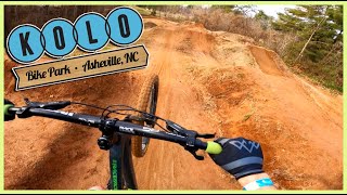
SaveKolo Bike Park
Primary Trail Type: Cross-Country
eBikes Allowed:
Yes
Land Status: Private Property
Land Manager: Kolo Bike Park
Access Info:
85 Expo Dr.
Disclaimer:
Waiver/pass required
Links
Activities Click to view
- Mountain Bike
21 trails
- E-Bike
16 trails
Bike Park Details
- 1
- 9
- 8
- 2
- 1
Region Status
Open as of May 15, 2020- Day Ticket
- $21 USD
Stats
- Avg Trail Rating
- Trails (view details)
- 21
- Trails Mountain Bike
- 21
- Trails E-Bike
- 16
- Total Distance
- 3 miles
- Total Descent Distance
- 2 miles
- Total Descent
- 440 ft
- Total Vertical
- 94 ft
- Highest Trailhead
- 2,123 ft
- Reports
- 32
- Ridden Counter
- 1,404
Popular Kolo Bike Park Mountain Biking Trails
Videos of Kolo Bike Park Mountain Bike

11:22 |
213 |
Mar 8, 2021
10:02 |
384 |
Mar 13, 2020
Recent Trail Reports
| status | trail | date | condition | info | user |
|---|---|---|---|---|---|
| Ropes | Dec 16, 2020 @ 9:52am Dec 16, 2020 | Unknown | Kolo-Flow | ||
| Bubbalicious | May 15, 2020 @ 10:36am May 15, 2020 | Unknown | 906Yooper906 TRAILFORKS | ||
| Boardwalk | May 15, 2020 @ 10:36am May 15, 2020 | Unknown | 906Yooper906 TRAILFORKS | ||
| Crent Beek | May 15, 2020 @ 10:35am May 15, 2020 | Unknown | 906Yooper906 TRAILFORKS | ||
| Gravel climb hill | May 15, 2020 @ 10:34am May 15, 2020 | Unknown | 906Yooper906 TRAILFORKS | ||
| Fore | May 15, 2020 @ 10:34am May 15, 2020 | Unknown | 906Yooper906 TRAILFORKS | ||
| Diving Board | May 15, 2020 @ 10:34am May 15, 2020 | Unknown | 906Yooper906 TRAILFORKS | ||
| Upper Island | May 15, 2020 @ 10:33am May 15, 2020 | Unknown | 906Yooper906 TRAILFORKS | ||
| Lower island | May 15, 2020 @ 10:33am May 15, 2020 | Unknown | 906Yooper906 TRAILFORKS | ||
| Jamaica | May 15, 2020 @ 10:33am May 15, 2020 | Unknown | 906Yooper906 TRAILFORKS |
Activity Feed
| username | action | type | title | date | |
|---|---|---|---|---|---|
 | Robertoreza | wishlist | region | Kolo Bike Park | Jun 12, 2022 @ 1:11pm Jun 12, 2022 |
| bluemarsh | wishlist | region | Kolo Bike Park | May 17, 2022 @ 6:30pm May 17, 2022 |
 | DownhillDaniel20 | vote | trail | Park Place and 1 more | May 2, 2022 @ 6:11am May 2, 2022 |
| Fanderson | wishlist | skillpark | Kolo Skills Park / Jump Line | Apr 29, 2022 @ 10:00pm Apr 29, 2022 |
| Oldsk0ol | wishlist | skillpark | Kolo Skills Park / Jump Line | Apr 11, 2022 @ 9:08pm Apr 11, 2022 |
Recent Comments
| username | type | title | comment | date | |
|---|---|---|---|---|---|
| trail | Super technical jumps and has hips, goalpost... | May 2, 2022 @ 5:48am May 2, 2022 |
Nearby Areas
| name | distance | ||||
|---|---|---|---|---|---|
| Richmond Hill | 2 | 3 | 1.8 km | ||
| Biltmore Estate | 6 | 3 | 2.8 km | ||
| Alex's Forest | 6.4 km | ||||
| Warren Wilson College | 7.8 km | ||||
| Bent Creek Experimental Forest | 18 | 15 | 2 | 8.3 km |
Bike & Skill Parks
| name | type | city | rating |
|---|---|---|---|
| Kolo Skills Park / Jump Line | skill park | Asheville |
Activity Type Stats
| activitytype | trails | distance | descent | descent distance | total vertical | rating | global rank | state rank | photos | reports | routes | ridelogs |
|---|---|---|---|---|---|---|---|---|---|---|---|---|
| Mountain Bike | 21 | 3 miles | 440 ft | 2 miles | 95 ft | #5,312 | #2,306 | 32 | 1,497 | |||
| E-Bike | 16 | 2 miles | 282 ft | 1 mile | 95 ft | #2,073 | #478 | 27 | 156 |
- By Kolo-Flow
 & contributors
 - Admins: apply
- #33161 - 3,887 views
- kolo bike park activity log | embed map of Kolo Bike Park mountain bike trails |
-
- subscribe
- 3d map
Downloading of trail gps tracks in kml & gpx formats is enabled for Kolo Bike Park.
You must login to download files.