close
Trail Conditions
- Unknown
- Snow Groomed
- Snow Packed
- Snow Covered
- Snow Cover Inadequate
- Freeze/thaw Cycle
- Icy
- Prevalent Mud
- Wet
- Variable
- Ideal
- Dry
- Very Dry
Trail Flow (Ridden Direction)
Trailforks scans users ridelogs to determine the most popular direction each trail is ridden. A good flowing trail network will have most trails flowing in a single direction according to their intension.
The colour categories are based on what percentage of riders are riding a trail in its intended direction.
The colour categories are based on what percentage of riders are riding a trail in its intended direction.
- > 96%
- > 90%
- > 80%
- > 70%
- > 50%
- < 50%
- bi-directional trail
- no data
Trail Last Ridden
Trailforks scans ridelogs to determine the last time a trail was ridden.
- < 2 days
- < 1 week
- < 2 weeks
- < 1 month
- < 6 months
- > 6 months
Trail Ridden Direction
The intended direction a trail should be ridden.
- Downhill Only
- Downhill Primary
- Both Directions
- Uphill Primary
- Uphill Only
- One Direction
Contribute Details
Colors indicate trail is missing specified detail.
- Description
- Photos
- Description & Photos
- Videos
Trail Popularity ?
Trailforks scans ridelogs to determine which trails are ridden the most in the last 9 months.
Trails are compared with nearby trails in the same city region with a possible 25 colour shades.
Think of this as a heatmap, more rides = more kinetic energy = warmer colors.
- most popular
- popular
- less popular
- not popular
ATV/ORV/OHV Filter
Max Vehicle Width
inches
Radar Time
x
Activity Recordings
Trailforks users anonymized public ridelogs from the past 6 months.
- mountain biking recent
- mountain biking (>6 month)
- hiking (1 year)
- moto (1 year)
Activity Recordings
Trailforks users anonymized public skilogs from the past 12 months.
- Downhill Ski
- Backcountry Ski
- Nordic Ski
Jump Magnitude Heatmap
Heatmap of where riders jump on trails. Zoom in to see individual jumps, click circles to view jump details.
Trails Deemphasized
Trails are shown in grey.
Only show trails with NO bikes.
Save the current map location and zoom level as your default home location whenever this page is loaded.
SaveVenez profiter d’un domaine hors norme, entre grands espaces préservés et parcours travaillés, pour petits et grands, débutants ou experts À 30 minutes d’Annecy, la station vous ouvre les portes de son espace naturel de VTT, baptisé « La Clusaz Bike Park », situé au coeur des forêts de montagne. 125 km de parcours balisés s’offrent ainsi à vous, comprenant 20 pistes et circuits aux niveaux variés, du circuit de découverte au tracé d’enduro, et un Bike Park, le tout desservi par 3 remontées mécaniques.
(English description)
Come and enjoy mountain biking as you’ve never experienced it before on the wide-open preserved landscapes, along prepared trails. There’s something for everyone here, for all ages and all abilities! Only 30 minutes from Annecy, the resort gives access to its natural MTB trails, tracks and routes, known as “Le Domaine” in the heart of the mountains. “La Clusaz Bike Park” stretches over 125km of well-maintained trails including 19 tracks for different levels, an initiation to Enduro track, and a Bike Park, all served by 3 ski lifts.
source: La Clusaz website
Primary Trail Type: All-Mountain & Downhill
Links
Files
- PLAN-BIKEPARK.jpg (9.61 MB)
This region uses the Uk/Euro style trail grading system.
Activities Click to view
- Mountain Bike
55 trails
- E-Bike
37 trails
- Hike
30 trails
- Trail Running
30 trails
- Snowmobile
1 trails
- Snowshoe
1 trails
- Downhill Ski
5 trails
- Backcountry Ski
5 trails
- Nordic Ski
1 trails
Region Details
- 13
- 3
- 14
- 21
- 3
Region Status
Open as of Sep 26, 2020- Day Ticket
- 20 EUR
- Uplift Type
- Chair Lift
- Season start
- Jun 12
- Season end
- Sep 26
Stats
- Avg Trail Rating
- Trails (view details)
- 59
- Trails Mountain Bike
- 55
- Trails E-Bike
- 37
- Trails Hike
- 30
- Trails Trail Running
- 30
- Trails Snowmobile
- 1
- Trails Snowshoe
- 1
- Trails Downhill Ski
- 5
- Trails Backcountry Ski
- 5
- Trails Nordic Ski
- 1
- Total Distance
- 51 miles
- Total Descent
- 23,787 ft
- Total Vertical
- 4,350 ft
- Highest Trailhead
- 7,726 ft
- Reports
- 118
- Photos
- 18
- Ridden Counter
- 1,947
Popular La Clusaz Bike Park Mountain Biking Trails
La Clusaz Bike Park Mountain Bike Routes
| title | rating | distance |
|---|---|---|
| Enduro des Annes | 11 miles | |
| Les Ecotagnes | 6 miles | |
| Sud Aravis | 6 miles |
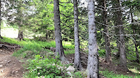
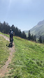
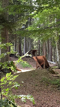
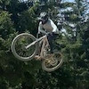
Photos of La Clusaz Bike Park Mountain Bike
trail: Crêt du Loup
13 |
Sep 13, 2021 @ 1:23pm
Sep 13, 2021
trail: La descente du Loup - Bleu
17 |
Sep 13, 2021 @ 1:23pm
Sep 13, 2021
trail: La descente du Loup - Bleu
8 |
Sep 13, 2021 @ 1:23pm
Sep 13, 2021
trail: Les Tétras
10 |
Sep 13, 2021 @ 1:23pm
Sep 13, 2021
trail: Freeride Zone
38 |
Jun 25, 2021 @ 1:41am
Jun 25, 2021
trail: Les Encarnes - Upper
43 |
Jun 20, 2021 @ 7:07am
Jun 20, 2021
trail: Les Encarnes - Upper
43 |
Jun 20, 2021 @ 7:07am
Jun 20, 2021
trail: Les Encarnes - Upper
37 |
Apr 7, 2020 @ 12:30am
Apr 7, 2020Videos of La Clusaz Bike Park Mountain Bike
trail: Bois Du Plan - Upper
8 |
Jun 12, 2022
trail: La descente du Loup - Bleu
5 |
Sep 27, 2021
trail: Début - Sud Aravis
3 |
Sep 27, 2021

61 |
Aug 18, 2021
34 |
Jun 20, 2021

trail: Les Encarnes - Upper
4:19 |
66 |
Apr 17, 2020

0:07 |
46 |
Apr 9, 2020

trail: Bois Du Plan - Lower
4:58 |
135 |
Aug 16, 2016
Current Trail Warnings
| status | trail | date | condition | user | info |
|---|---|---|---|---|---|
| Variante du Loup - Mid | Jun 20, 2022 @ 6:49am Jun 20, 2022 | Dry | Charliedp |
Recent Trail Reports
| status | trail | date | condition | info | user |
|---|---|---|---|---|---|
| La descente du Loup - Bleu | May 29, 2022 @ 2:14am May 29, 2022 | Unknown | ktnkgb | ||
| La descente du Loup | May 29, 2022 @ 2:13am May 29, 2022 | Dry | ktnkgb | ||
| La Grenèche | Aug 14, 2021 @ 3:31am Aug 14, 2021 | Very Dry | rinsoz | ||
| P'tit Loup - Vert | Aug 14, 2021 @ 3:31am Aug 14, 2021 | Ideal | rinsoz | ||
| P'tit Loup - Bleu | Aug 14, 2021 @ 3:31am Aug 14, 2021 | Ideal | rinsoz | ||
| P'tit Loup - Rouge | Aug 14, 2021 @ 3:31am Aug 14, 2021 | Ideal | rinsoz | ||
| Les Tétras | Jul 27, 2021 @ 12:27am Jul 27, 2021 | Ideal | Charliedp | ||
| Bois Du Plan - Upper | Jul 27, 2021 @ 12:27am Jul 27, 2021 | Ideal | Charliedp | ||
| Bois Du Plan - Mid | Jul 27, 2021 @ 12:27am Jul 27, 2021 | Ideal | Charliedp | ||
| Bois Du Plan - Lower | Jul 27, 2021 @ 12:27am Jul 27, 2021 | Ideal | Charliedp |
Activity Feed
| username | action | type | title | date | |
|---|---|---|---|---|---|
 | Carsten73 | wishlist | region | La Clusaz Bike Park | Jun 30, 2022 @ 4:53am Jun 30, 2022 |
 | Charliedp | vote | trail | La Motte - Upper | Jun 24, 2022 @ 11:59am Jun 24, 2022 |
| Charliedp | update | trail | Le Loup - Upper and 1 more | Jun 20, 2022 @ 9:48am Jun 20, 2022 |
| Charliedp | add | report | Le Loup - Upper | Jun 20, 2022 @ 6:49am Jun 20, 2022 |
| Charliedp | add | trail | Liaison Merle | Jun 20, 2022 @ 6:42am Jun 20, 2022 |
Recent Comments
| username | type | title | comment | date | |
|---|---|---|---|---|---|
 | trail | Not a single track. It's a double... | Jun 2, 2022 @ 1:23pm Jun 2, 2022 | ||
| trail | very fun and easy singletrack | May 29, 2022 @ 10:11am May 29, 2022 | ||
| trail | Good fun! Well done handcut trail, some... | May 29, 2022 @ 2:07am May 29, 2022 | ||
| trail | Same as the upper part, It's like they tried... | May 29, 2022 @ 2:03am May 29, 2022 | ||
| trail | It's like they tried to do a new school... | May 29, 2022 @ 2:02am May 29, 2022 |
Nearby Areas
| name | distance | ||||
|---|---|---|---|---|---|
| Le Grand Bornand | 10 | 3.4 km | |||
| Flumet | 1 | 9.1 km | |||
| Praz sur Arly | 10 km | ||||
| Forêt de Saint-Laurent | 3 | 10 | 10.6 km | ||
| Les Saisies Bike Park | 3 | 9 | 2 | 11 km |
Local Badges
-

Enduro Lover - LCZ8 awarded -

Completionist0 awarded
Bike & Skill Parks
| name | type | city | rating |
|---|---|---|---|
| Skatepark La Clusaz | skill park | La Clusaz |
Activity Type Stats
| activitytype | trails | distance | descent | descent distance | total vertical | rating | global rank | state rank | photos | reports | routes | ridelogs |
|---|---|---|---|---|---|---|---|---|---|---|---|---|
| Mountain Bike | 55 | 50 miles | 21,680 ft | 34 miles | 2,874 ft | #2,268 | #16 | 18 | 118 | 3 | 810 | |
| E-Bike | 37 | 37 miles | 15,003 ft | 25 miles | 2,874 ft | #1,841 | #71 | 108 | 1 | 44 | ||
| Hike | 30 | 37 miles | 10,679 ft | 23 miles | 2,874 ft | #6,975 | #129 | 103 | 2 | 48 | ||
| Trail Running | 30 | 37 miles | 10,679 ft | 23 miles | 2,874 ft | #6,964 | #132 | 103 | 1 | 4 | ||
| Snowmobile | 1 | #7 | ||||||||||
| Snowshoe | 1 | #10 | 7 | |||||||||
| Downhill Ski | 5 | 1 mile | 2,110 ft | 1 mile | 1,063 ft | #43 | 46 | |||||
| Backcountry Ski | 5 | 1 mile | 2,110 ft | 1 mile | 1,063 ft | #45 | 206 | |||||
| Nordic Ski | 1 | #8 | 164 |
- By alii
 & contributors
 - Admins: alltta, freerider48, Charliedp
- #6900 - 5,965 views
- la clusaz bike park activity log | embed map of La Clusaz Bike Park mountain bike trails | la clusaz bike park mountain biking points of interest
-
- subscribe
- 3d map
Downloading of trail gps tracks in kml & gpx formats is enabled for La Clusaz Bike Park.
You must login to download files.