close
Trail Conditions
- Unknown
- Snow Groomed
- Snow Packed
- Snow Covered
- Snow Cover Inadequate
- Freeze/thaw Cycle
- Icy
- Prevalent Mud
- Wet
- Variable
- Ideal
- Dry
- Very Dry
Trail Flow (Ridden Direction)
Trailforks scans users ridelogs to determine the most popular direction each trail is ridden. A good flowing trail network will have most trails flowing in a single direction according to their intension.
The colour categories are based on what percentage of riders are riding a trail in its intended direction.
The colour categories are based on what percentage of riders are riding a trail in its intended direction.
- > 96%
- > 90%
- > 80%
- > 70%
- > 50%
- < 50%
- bi-directional trail
- no data
Trail Last Ridden
Trailforks scans ridelogs to determine the last time a trail was ridden.
- < 2 days
- < 1 week
- < 2 weeks
- < 1 month
- < 6 months
- > 6 months
Trail Ridden Direction
The intended direction a trail should be ridden.
- Downhill Only
- Downhill Primary
- Both Directions
- Uphill Primary
- Uphill Only
- One Direction
Contribute Details
Colors indicate trail is missing specified detail.
- Description
- Photos
- Description & Photos
- Videos
Trail Popularity ?
Trailforks scans ridelogs to determine which trails are ridden the most in the last 9 months.
Trails are compared with nearby trails in the same city region with a possible 25 colour shades.
Think of this as a heatmap, more rides = more kinetic energy = warmer colors.
- most popular
- popular
- less popular
- not popular
ATV/ORV/OHV Filter
Max Vehicle Width
inches
Radar Time
x
Activity Recordings
Trailforks users anonymized public ridelogs from the past 6 months.
- mountain biking recent
- mountain biking (>6 month)
- hiking (1 year)
- moto (1 year)
Activity Recordings
Trailforks users anonymized public skilogs from the past 12 months.
- Downhill Ski
- Backcountry Ski
- Nordic Ski
Jump Magnitude Heatmap
Heatmap of where riders jump on trails. Zoom in to see individual jumps, click circles to view jump details.
Trails Deemphasized
Trails are shown in grey.
Only show trails with NO bikes.
Save the current map location and zoom level as your default home location whenever this page is loaded.
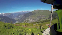
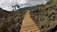
SaveLa Thuile Bike World area is located in an alpine environment and from a riding point of view, the park it can be split in two areas, following altitude zones. The highest sections that sits between 2400 and 1900 m and that is served by Chalet Express chairlift, has a smooth and linear gradient with some drops and rock slabs. No trees only low vegetation, so there is a lot of wide and deep visual angle. In case of rain the ground drains well, bet the wind can be strong.
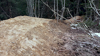
From 1900 to 1400 m (Bosco Express chairlift) the slope angle changes. The trails gets steep, off camber and rooty as they enter the woods. During hot summer some steep section can collect a good amount of dust, otherwise the ground is often covered with pine needles. There are some streams to ford and during morning rides the dew can cause some grip loss. Light here changes suddenly, the classic “sun-shadow” effect.
Funivie Piccolo San Bernardo S.p.A. offers daily, multy day or Iternational bike pass that can be purchased at the “Punto Giallo-Blu” of the Cable Car ticket office.
With the Multi day bike pass there is the chace to ride also in other resorts of the Valle D'Aosta.
With the Interational bike pass that it's possible to access also the French lifts in La Rosière.
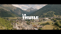
source: Bike Park La Thuile
Primary Trail Type: All-Mountain & Downhill
eBikes Allowed:
Yes
Land Status: Ski Resort
 google parking directions
 Access Info:
Ticket office Punto Giallo Blu - Frazione Entreves, La Thuile
Links
Region Supporters & Maintainers
Activities Click to view
- Mountain Bike
22 trails
- E-Bike
22 trails
Bike Park Details
- 5
- 2
- 6
- 9
Region Status
Caution as of May 21, 2021- Day Ticket
- 25 EUR
- Uplift Type
- Chair Lift
- Season start
- Jun 26
- Season end
- Sep 26
Stats
- Avg Trail Rating
- Trails (view details)
- 26
- Trails Mountain Bike
- 22
- Trails E-Bike
- 22
- Trails Hike
- 10
- Trails Trail Running
- 8
- Trails Snowshoe
- 1
- Total Distance
- 45 miles
- Total Descent
- 26,415 ft
- Total Vertical
- 3,294 ft
- Highest Trailhead
- 8,133 ft
- Reports
- 165
- Photos
- 60
- Ridden Counter
- 5,072
Popular La Thuile Bike Park Mountain Biking Trails
La Thuile Bike Park Mountain Bike Routes
| title | rating | distance |
|---|---|---|
| EWS La Thuile 2021 - race 1 race | 18 miles | |
| EWS La Thuile race 2 race | 21 miles | |
| Italian Enduro National Championship 2019 race | 21 miles | |
| EWS La Thuile 2018 race | 37 miles | |
| Coppa Italia Enduro 2015 race | 32 miles | |
| Superenduro La Thuile 2017 race | 23 miles | |
| EWS La Thuile 2016 race | 44 miles |
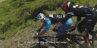
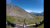
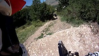
Videos of La Thuile Bike Park Mountain Bike
trail: Fresa
3:57 |
30285 |
Oct 25, 2015
trail: Touriasse
15:26 |
151 |
May 31, 2015
trail: Flow
4:08 |
375 |
Aug 30, 2014

trail: Flow
4:38 |
282 |
Jul 26, 2014
trail: Flow
7:05 |
1906 |
Jul 22, 2014
trail: Flow
3:25 |
364 |
Jul 10, 2014
trail: Flow
3:49 |
9356 |
Jun 13, 2014
trail: Flow
3:58 |
6344 |
May 30, 2014
Recent Trail Reports
| status | trail | date | condition | info | user |
|---|---|---|---|---|---|
| La Joux Connection | Mar 8, 2022 @ 1:17am Mar 8, 2022 | Icy | marcoangeletti TRAILFORKS | ||
| Maisonnetes | Oct 13, 2021 @ 1:46am Oct 13, 2021 | Variable | LaThuileMTB | ||
| Muret | Oct 13, 2021 @ 1:46am Oct 13, 2021 | Variable | LaThuileMTB | ||
| Ponteilles | Oct 13, 2021 @ 1:46am Oct 13, 2021 | Variable | LaThuileMTB | ||
| Tombeau | Oct 13, 2021 @ 1:46am Oct 13, 2021 | Variable | LaThuileMTB | ||
| LA TOUR | Oct 13, 2021 @ 1:45am Oct 13, 2021 | Variable | LaThuileMTB | ||
| Le Volpi - Lower | Oct 13, 2021 @ 1:45am Oct 13, 2021 | Variable | LaThuileMTB | ||
| Le Volpi - Upper | Oct 13, 2021 @ 1:45am Oct 13, 2021 | Variable | LaThuileMTB | ||
| Lupin | Oct 13, 2021 @ 1:45am Oct 13, 2021 | Variable | LaThuileMTB | ||
| Fresa | Oct 13, 2021 @ 1:44am Oct 13, 2021 | Variable | LaThuileMTB |
Activity Feed
| username | action | type | title | date | |
|---|---|---|---|---|---|
 | 303Attack | vote | trail | Le Volpi - Lower | Jul 5, 2022 @ 10:32pm 4 hours |
| Pedro01 | wishlist | region | La Thuile Bike Park | Jul 5, 2022 @ 2:50pm 12 hours |
 | maxcima | ridden | trail | Mulino and 4 more | Jul 5, 2022 @ 7:07am 20 hours |
| Angeleyes420 | vote | trail | Cambogia - Upper | Jun 30, 2022 @ 7:20am Jun 30, 2022 |
| ChiaraDPYWt | ridden | trail | Maisonnetes and 1 more | Jun 27, 2022 @ 11:38am Jun 27, 2022 |
Recent Comments
| username | type | title | comment | date | |
|---|---|---|---|---|---|
| trail | not really maintained…a lot of fences and... | Jun 26, 2022 @ 9:13am Jun 26, 2022 | ||
| trail | This is a nice trail, some technical parts are... | Sep 20, 2021 @ 9:13am Sep 20, 2021 | ||
| trail | Worst trail ever, if this can even be called... | Sep 20, 2021 @ 9:10am Sep 20, 2021 | ||
 | trail | Finding the trail head can be challenging and... | Aug 23, 2021 @ 9:16am Aug 23, 2021 | ||
| trail | One of my favourites in La Thuile. Challenging... | Aug 23, 2021 @ 9:12am Aug 23, 2021 |
Nearby Areas
| name | distance | ||||
|---|---|---|---|---|---|
| La Rosiere Bikezone | 1 | 1 | 5.4 km | ||
| Les Arcs Bikepark | 2 | 5 | 4 | 11.5 km | |
| La Plagne | 8 | 1 | 14.4 km | ||
| Les Houches Bike Park | 6 | 12 | 5 | 15.4 km | |
| Bike Park Tignes - Val d'Isère | 3 | 11 | 1 | 17.1 km |
Local Badges
-

Completionist0 awarded
Bike & Skill Parks
| name | type | city | rating |
|---|---|---|---|
| La Thuile MTB Skill Park | skill park | La Thuile |
Activity Type Stats
| activitytype | trails | distance | descent | descent distance | total vertical | rating | global rank | state rank | photos | reports | routes | ridelogs |
|---|---|---|---|---|---|---|---|---|---|---|---|---|
| Mountain Bike | 22 | 37 miles | 23,691 ft | 28 miles | 3,294 ft | #1,246 | #17 | 60 | 163 | 7 | 1,515 | |
| E-Bike | 22 | 37 miles | 23,691 ft | 28 miles | 3,294 ft | #371 | #11 | 160 | 7 | 15 | ||
| Hike | 10 | 24 miles | 6,493 ft | 12 miles | 3,278 ft | #3,012 | #101 | 113 | 66 | |||
| Trail Running | 8 | 13 miles | 4,547 ft | 7 miles | 3,156 ft | #2,680 | #88 | 109 | 3 | |||
| Snowshoe | 1 | 4,291 ft | 72 ft | 827 ft | 351 ft |
- By brenthillier
 NSMBA TRAILFORKS & contributors
 - Admins: elyari, LaThuileMTB
- #6605 - 8,106 views
- la thuile bike park activity log | embed map of La Thuile Bike Park mountain bike trails | la thuile bike park mountain biking points of interest
-
- subscribe
- 3d map
Downloading of trail gps tracks in kml & gpx formats is enabled for La Thuile Bike Park.
You must login to download files.