close
Trail Conditions
- Unknown
- Snow Groomed
- Snow Packed
- Snow Covered
- Snow Cover Inadequate
- Freeze/thaw Cycle
- Icy
- Prevalent Mud
- Wet
- Variable
- Ideal
- Dry
- Very Dry
Trail Flow (Ridden Direction)
Trailforks scans users ridelogs to determine the most popular direction each trail is ridden. A good flowing trail network will have most trails flowing in a single direction according to their intension.
The colour categories are based on what percentage of riders are riding a trail in its intended direction.
The colour categories are based on what percentage of riders are riding a trail in its intended direction.
- > 96%
- > 90%
- > 80%
- > 70%
- > 50%
- < 50%
- bi-directional trail
- no data
Trail Last Ridden
Trailforks scans ridelogs to determine the last time a trail was ridden.
- < 2 days
- < 1 week
- < 2 weeks
- < 1 month
- < 6 months
- > 6 months
Trail Ridden Direction
The intended direction a trail should be ridden.
- Downhill Only
- Downhill Primary
- Both Directions
- Uphill Primary
- Uphill Only
- One Direction
Contribute Details
Colors indicate trail is missing specified detail.
- Description
- Photos
- Description & Photos
- Videos
Trail Popularity ?
Trailforks scans ridelogs to determine which trails are ridden the most in the last 9 months.
Trails are compared with nearby trails in the same city region with a possible 25 colour shades.
Think of this as a heatmap, more rides = more kinetic energy = warmer colors.
- most popular
- popular
- less popular
- not popular
ATV/ORV/OHV Filter
Max Vehicle Width
inches
Radar Time
x
Activity Recordings
Trailforks users anonymized public ridelogs from the past 6 months.
- mountain biking recent
- mountain biking (>6 month)
- hiking (1 year)
- moto (1 year)
Activity Recordings
Trailforks users anonymized public skilogs from the past 12 months.
- Downhill Ski
- Backcountry Ski
- Nordic Ski
Jump Magnitude Heatmap
Heatmap of where riders jump on trails. Zoom in to see individual jumps, click circles to view jump details.
Trails Deemphasized
Trails are shown in grey.
Only show trails with NO bikes.
Save the current map location and zoom level as your default home location whenever this page is loaded.
SaveConnecticut is rich with many mountain biking options, mainly of the inimitable "New England Tech" style.
The state is organized into the eight official state counties: Fairfield County, New Haven County, Middlesex County and New London County along the coast of the Long Island Sound, and Litchfield County, Hartford County, Tolland County and Windham County inland along the Massachusetts border. All towns in each county is listed, irrespective if they have trails mapped on Trailforks or not.
Connecticut has a very active mountain biking community, with the lead taken by the six Connecticut Chapters of the New England Mountain Biking Association (NEMBA). The Chapters are listed below and the links to the Facebook page for each chapter can be found in the links below.
Fairfield County NEMBA - Fairfield County
Housatonic Valley NEMBA - The Housatonic Valley which stretches from the southern part of Litchfield County along the western edge of New Haven County, down to the Long Island Sound.
Northwest Ct NEMBA - Litchfield County and western parts of Hartford County
Central Ct NEMBA - Central Hartford County, Eastern half of New Haven County, Middlesex County and western edge of Tolland County
Quiet Corner NEMBA - Tolland County and Windham County
Southeastern Ct NEMBA - New London County
AKA: CT
Links
Stats
- Avg Trail Rating
- Trails (view details)
- 5,640
- Trails Mountain Bike
- 3,430
- Trails E-Bike
- 234
- Trails Hike
- 5,512
- Trails Trail Running
- 4,885
- Trails Horse
- 444
- Trails Dirtbike/Moto
- 96
- Trails Observed Trials
- 4
- Trails ATV/ORV/OHV
- 6
- Trails Snowmobile
- 30
- Trails Snowshoe
- 853
- Trails Backcountry Ski
- 10
- Trails Nordic Ski
- 565
- Total Distance
- 3,222 miles
- Total Descent
- 383,025 ft
- Total Vertical
- 2,448 ft
- Highest Trailhead
- 2,448 ft
- Reports
- 10,970
- Photos
- 3,890
- Ridden Counter
- 261,856
Popular Trail Networks
view all areas »Sub Regions
- Fairfield County (313)
- Hartford County (561)
- Litchfield County (342)
- Middlesex County (370)
- New Haven County (572)
- Housatonic Valley CT (83)
- New London County (575)
- Tolland County (511)
- Windham County (185)
Popular Connecticut Mountain Biking Trails
| status | title | difficulty | rating |
|---|---|---|---|
| Rishy Rockland Preserve | |||
| Sumatra Rockland Preserve | |||
| Thunderdome Rockland Preserve | |||
| Toboggan Run Cowles Park | |||
| Rollie's Revenge Rockland Preserve | |||
| Hunter's Pass (upper) Cowles Park | |||
| Mary's Ghost Rockland Preserve | |||
| Trailhead Cowles Park | |||
| Hunter's Pass (lower) Cowles Park | |||
| Rockland Loop Trail Rockland Preserve | |||
| Stream Connector Rockland Preserve | |||
| Kumbucha Rockland Preserve | |||
| Erratica Rockland Preserve | |||
| Taj Mahal Cowles Park | |||
| Microburst Cowles Park |
Connecticut Mountain Bike Routes
| title | rating | distance |
|---|---|---|
| The Branford Trail - Full Loop Branford | 28 miles | |
| Blue Arrow Route - Playground Trails Playground Trails at Nathan-Hale-Ray Middle School | 2 miles | |
| Quinebaug River Trail - Complete Loop Killingly | 11 miles | |
| 4 Summits - 17+ miles Rockland Preserve | 17 miles | |
| Rockland & Northern Exposure Rockland Preserve | 18 miles | |
| New Case Case Mountain | 11 miles | |
| Grayville Outer Loop Grayville Falls | 7 miles | |
| Cranbury Park Dual Stage Cranbury Park | 4 miles | |
| Mansfield: Novice+ Mansfield Hollow State Park | 7 miles | |
| 2021 Full SECT Nemba MBAS Route Bluff Point State Park | 17 miles |
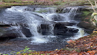
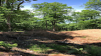
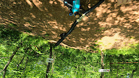
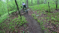
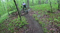
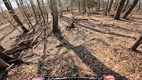
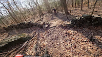
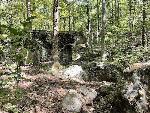
Photos of Connecticut Mountain Bike
trail: Yellow-Red Trail
16 |
Mar 15, 2022 @ 1:09pm
Mar 15, 2022
trail: Ridge View Spur
4 |
Mar 15, 2022 @ 12:18pm
Mar 15, 2022
trail: Broad Hill Road
30 |
Nov 25, 2021 @ 7:46am
Nov 25, 2021
trail: Trailhead Road
22 |
Nov 24, 2021 @ 12:02pm
Nov 24, 2021
trail: West Barndoor Hill Trail
17 |
Nov 20, 2021 @ 1:03pm
Nov 20, 2021
trail: Flowdawg
61 |
Sep 19, 2020 @ 3:06pm
Sep 19, 2020
trail: Flowdawg
111 |
Jul 13, 2020 @ 3:23am
Jul 13, 2020
trail: Jump Line
605 |
Apr 27, 2014 @ 6:55pm
Apr 27, 2014Videos of Connecticut Mountain Bike
featured
![Enders Cascade]()
trail: Cascades Boardwalk Trail
7 |
Nov 18, 2021
trail: Gentle Giants
46 |
Jun 5, 2022
trail: Gentle Giants
51 |
May 30, 2022
trail: Hurd Blue Trail
73 |
May 16, 2022
trail: Hurd Blue Trail
|
May 16, 2022
trail: Hurd Blue Trail
141 |
Mar 19, 2022
trail: Hurd Red Trail
|
Mar 19, 2022

trail: Hurd Red Trail
|
Mar 19, 2022
Activity Feed
| username | action | type | title | date | |
|---|---|---|---|---|---|
 | Ecollins109 | wishlist | route | Pomfret Forest April 2022 | Jul 5, 2022 @ 6:20pm 8 hours |
| Atron80 | wishlist | region | Westwoods | Jul 5, 2022 @ 2:50pm 11 hours |
 | DaDiYo | wishlist | route | Farrington Woods Loop | Jul 5, 2022 @ 9:02am 17 hours |
 | SpencerBoi | wishlist | route | Seth Low Round the Mountain | Jul 4, 2022 @ 3:49pm 1 day |
| Geniusjoe | add | report | Jail Break (White) | Jul 4, 2022 @ 1:31pm 2 days |
Recent Comments
| username | type | title | comment | date | |
|---|---|---|---|---|---|
 | trail | Kudos to the builders of this awesome trail... | Jun 26, 2022 @ 7:40pm Jun 26, 2022 | ||
| trail | Kudos to the builders of this awesome trail | Jun 26, 2022 @ 7:38pm Jun 26, 2022 | ||
| trail | These trails are private and you must have a... | Jun 22, 2022 @ 5:18pm Jun 22, 2022 | ||
| trail | Soo not worth it. Used to ride this 3-4 years... | Jun 17, 2022 @ 6:18pm Jun 17, 2022 | ||
 | trail | Not a biking trail but cool hiking one | Jun 11, 2022 @ 4:49pm Jun 11, 2022 |
Local Badges
-

Trail Explorer 1001,187 awarded -

10 Blue Trails567 awarded -

Completionist3 awarded -
10 Blue Trails436 awarded -
10 Blue Trails253 awarded -
Completionist2 awarded
National Scenic Trails & Official Routes
-
Goodwin Trail
- Mountain Bike
- Hike
- Trail Running
- Horse
- Snowshoe
- Nordic Ski
Bike & Skill Parks
| name | type | city | rating |
|---|---|---|---|
| Powder Ridge Mountain Park | bike park | Middlefield | |
| Powder Ridge Jumplines | skill park | Middlefield | |
| Pump Track | skill park | Middlefield | |
| Rockland Bike Park | skill park | Madison |
Activity Type Stats
| activitytype | trails | distance | descent | descent distance | total vertical | rating | global rank | state rank | photos | reports | routes | ridelogs |
|---|---|---|---|---|---|---|---|---|---|---|---|---|
| Mountain Bike | 3,430 | 1,941 mile | 214,072 ft | 791 miles | 2,218 ft | #24 | 2,585 | 10,916 | 144 | 189,661 | ||
| E-Bike | 234 | 184 miles | 13,205 ft | 74 miles | 1,621 ft | #37 | 8,762 | 7 | 1,763 | |||
| Hike | 5,512 | 3,167 miles | 373,087 ft | 1,272 mile | 2,448 ft | #21 | 1,302 | 10,885 | 84 | 12,704 | ||
| Trail Running | 4,885 | 2,928 miles | 344,180 ft | 1,180 mile | 2,448 ft | #21 | 1 | 10,878 | 16 | 5,089 | ||
| Horse | 444 | 319 miles | 21,138 ft | 121 miles | 1,309 ft | #26 | 2,611 | 31 | ||||
| Dirtbike/Moto | 96 | 59 miles | 4,029 ft | 24 miles | 1,201 ft | #38 | 2,405 | 46 | ||||
| Observed Trials | 4 | 1 mile | 43 ft | 1,598 ft | 1,125 ft | #21 | 1 | 15 | 44 | |||
| ATV/ORV/OHV | 6 | 3 miles | 135 ft | 4,803 ft | 902 ft | #36 | 1 | 2,391 | 49 | |||
| Snowmobile | 30 | 24 miles | 1,325 ft | 9 miles | 873 ft | #36 | 21 | 14 | ||||
| Snowshoe | 853 | 552 miles | 41,483 ft | 215 miles | 1,831 ft | #10 | 379 | 7 | 577 | |||
| Backcountry Ski | 10 | 6 miles | 390 ft | 2 miles | 577 ft | #26 | 12 | 237 | ||||
| Nordic Ski | 565 | 406 miles | 25,440 ft | 157 miles | 1,667 ft | #10 | 226 | 2 | 420 |
- By canadaka
 Trailforks & contributors
 - Admins: Map Team, chuktA, msmcfate, WillieJacobsz, PlumbBobM, ReckitRolley, NEMBA, HCH, NEMBAEXEC
- #3154 - 44,841 views
- connecticut activity log | embed map of Connecticut mountain bike trails | connecticut mountain biking points of interest polygons
-
- subscribe
- 3d map
Downloading of trail gps tracks in kml & gpx formats is enabled for Connecticut.
You must login to download files.