close
Trail Conditions
- Unknown
- Snow Groomed
- Snow Packed
- Snow Covered
- Snow Cover Inadequate
- Freeze/thaw Cycle
- Icy
- Prevalent Mud
- Wet
- Variable
- Ideal
- Dry
- Very Dry
Trail Flow (Ridden Direction)
Trailforks scans users ridelogs to determine the most popular direction each trail is ridden. A good flowing trail network will have most trails flowing in a single direction according to their intension.
The colour categories are based on what percentage of riders are riding a trail in its intended direction.
The colour categories are based on what percentage of riders are riding a trail in its intended direction.
- > 96%
- > 90%
- > 80%
- > 70%
- > 50%
- < 50%
- bi-directional trail
- no data
Trail Last Ridden
Trailforks scans ridelogs to determine the last time a trail was ridden.
- < 2 days
- < 1 week
- < 2 weeks
- < 1 month
- < 6 months
- > 6 months
Trail Ridden Direction
The intended direction a trail should be ridden.
- Downhill Only
- Downhill Primary
- Both Directions
- Uphill Primary
- Uphill Only
- One Direction
Contribute Details
Colors indicate trail is missing specified detail.
- Description
- Photos
- Description & Photos
- Videos
Trail Popularity ?
Trailforks scans ridelogs to determine which trails are ridden the most in the last 9 months.
Trails are compared with nearby trails in the same city region with a possible 25 colour shades.
Think of this as a heatmap, more rides = more kinetic energy = warmer colors.
- most popular
- popular
- less popular
- not popular
ATV/ORV/OHV Filter
Max Vehicle Width
inches
Radar Time
x
Activity Recordings
Trailforks users anonymized public ridelogs from the past 6 months.
- mountain biking recent
- mountain biking (>6 month)
- hiking (1 year)
- moto (1 year)
Activity Recordings
Trailforks users anonymized public skilogs from the past 12 months.
- Downhill Ski
- Backcountry Ski
- Nordic Ski
Jump Magnitude Heatmap
Heatmap of where riders jump on trails. Zoom in to see individual jumps, click circles to view jump details.
Trails Deemphasized
Trails are shown in grey.
Only show trails with NO bikes.
Save the current map location and zoom level as your default home location whenever this page is loaded.
SavePopular Trail Networks
view all areas »
No description for Georgia has been added yet!
Login or register to submit one.
Region Details
- 336
- 37
- 333
- 412
- 91
- 4
Stats
- Avg Trail Rating
- Trails (view details)
- 1,597
- Trails Mountain Bike
- 1,204
- Trails E-Bike
- 90
- Trails Hike
- 1,480
- Trails Trail Running
- 1,457
- Trails Horse
- 94
- Trails Dirtbike/Moto
- 61
- Trails Observed Trials
- 2
- Trails ATV/ORV/OHV
- 58
- Total Distance
- 2,527 miles
- Total Descent
- 370,778 ft
- Total Vertical
- 6,263 ft
- Highest Trailhead
- 6,265 ft
- Reports
- 5,902
- Photos
- 1,605
- Ridden Counter
- 109,058
Sub Regions
- Atlanta Metro (228)
- Classic South (7)
- Historic Heartland (213)
- Central Savannah River Area (58)
- Gwinnett Area (51)
- Ocmulgee Area (62)
- Historic High Country (411)
- North Georgia (16)
- Northeast Georgia Mountains (180)
- Roswell-Alpharetta Area (57)
- Southeast (4)
- The Coast (0)
- West Georgia (78)
- Cobb County (35)
- Douglas County (19)
Popular Georgia Mountain Biking Trails
| status | title | difficulty | rating |
|---|---|---|---|
| Van Michael Blankets Creek | |||
| Dwelling Alt Line Blankets Creek | |||
| Dwelling Loop Blankets Creek | |||
| Rock 'N Roll Blankets Creek | |||
| Rhythm 'N Blues Blankets Creek | |||
| Mosquito Flats Blankets Creek | |||
| Poop Chute Blankets Creek | |||
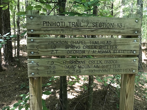
| Pinhoti Trail - Double Top Chattahoochee-Oconee National Forests Conasauga District | |||
| Mosquito Bite Blankets Creek | |||
| Chutes & Ladders Blankets Creek | |||
| Quehl Holler Blankets Creek | |||
| Pinhoti Trail Chattahoochee-Oconee National Forests Conasauga District | |||
| South Loop Blankets Creek | |||
| South loop access Blankets Creek | |||
| Kevorkian Pass Blankets Creek |
Georgia Mountain Bike Routes
| title | rating | distance |
|---|---|---|
| Sope Creek & Cochran Shoals Sope Creek | 7 miles | |
| BearHoti Ellijay | 22 miles | |
| BearHoti Shuttle Ellijay | 12 miles | |
| Mulberry Gap to Pinhoti 2 Loop Ellijay | 9 miles | |
| Dirty Sheets Gravel Loop Cochran Mill Park | 20 miles | |
| P2-P5 North to South | 23 miles | |
| P1 & P2 Ellijay | 13 miles | |
| Big ride from MG Ellijay | 46 miles | |
| Bear Creek & Pinhoti shuttle Ellijay | 15 miles | |
| 2017 Drama Queen Ellijay | 34 miles |
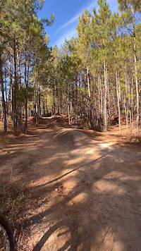
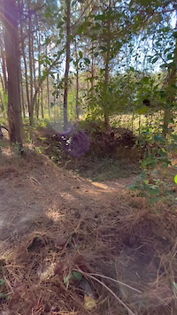
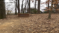
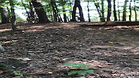
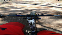
Photos of Georgia Mountain Bike
trail: Durham Rail Trail
2 |
Jul 4, 2022 @ 3:20pm
1 day
trail: Canal Singletrack
13 |
May 26, 2022 @ 3:20pm
May 26, 2022
trail: Canal Singletrack
8 |
May 26, 2022 @ 3:08pm
May 26, 2022
trail: Hickory Nut
10 |
May 25, 2022 @ 4:55pm
May 25, 2022
trail: Hickory Nut
12 |
May 25, 2022 @ 4:55pm
May 25, 2022
trail: Hickory Nut
7 |
May 25, 2022 @ 4:54pm
May 25, 2022
trail: Hickory Nut
7 |
May 25, 2022 @ 4:54pm
May 25, 2022
trail: Sope Creek Trail Access
84 |
Jul 2, 2019 @ 8:12am
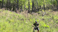
Jul 2, 2019Videos of Georgia Mountain Bike
137 |
Nov 30, 2021
134 |
Nov 30, 2021

trail: Hurricane Creek Trail
|
Nov 24, 2021

trail: Haw Creek
46 |
Jul 11, 2021
trail: Powerhouse
293 |
Jun 13, 2021
trail: El Scorcho
140 |
Apr 29, 2021
trail: El Scorcho
74 |
Apr 29, 2021
trail: Lunch Line
96 |
Apr 10, 2021
Activity Feed
| username | action | type | title | date | |
|---|---|---|---|---|---|
 | msmcfate | update | trail | Green Mountain and 1 more | Jul 5, 2022 @ 2:25pm 12 hours |
 | KacyBelewyhv | wishlist | trail | Green Mountain | Jul 5, 2022 @ 9:54am 16 hours |
| KacyBelewyhv | wishlist | route | 22 Mile link up | Jul 5, 2022 @ 9:54am 16 hours |
| Ccalabresec | ridden | trail | Amadahy Trail | Jul 5, 2022 @ 7:07am 19 hours |
| jjmilio | wishlist | trail | White twister | Jul 4, 2022 @ 6:12pm 1 day |
Recent Comments
| username | type | title | comment | date | |
|---|---|---|---|---|---|
 | trail | Fun little trail. | Jul 3, 2022 @ 4:54pm 2 days | ||
| trail | Thanks for correcting the black label on this one. | Jul 3, 2022 @ 4:52pm 2 days | ||
| trail | Anyone got any newer updates to this trail? | Jun 29, 2022 @ 6:24pm Jun 29, 2022 | ||
| trail | YT | Jun 29, 2022 @ 6:05am Jun 29, 2022 | ||
 | trail | Check everything out before sending it. Nice... | Jun 19, 2022 @ 1:39pm Jun 19, 2022 |
Local Badges
-

10 Blue Trails472 awarded -

Trail Explorer 100607 awarded -

Big Ride 30k1,327 awarded -
Big Ride 30k3,569 awarded -

10 Green Trails214 awarded -
10 Blue Trails75 awarded
National Scenic Trails & Official Routes
-
Pinhoti Trail (Georgia)
- Mountain Bike
- Hike
- Trail Running
- Horse
Bike & Skill Parks
| name | type | city | rating |
|---|---|---|---|
| North Cooper Lake Bike Park | skill park | Smyrna | |
| Pitner Road Skills Park | skill park | Acworth | |
| Pumptrack | skill park | Roswell |
Upcoming Local Events
Activity Type Stats
| activitytype | trails | distance | descent | descent distance | total vertical | rating | global rank | state rank | photos | reports | routes | ridelogs |
|---|---|---|---|---|---|---|---|---|---|---|---|---|
| Mountain Bike | 1,204 | 1,915 mile | 250,013 ft | 801 miles | 6,263 ft | #33 | 1,448 | 5,877 | 59 | 145,942 | ||
| E-Bike | 90 | 265 miles | 34,554 ft | 117 miles | 3,786 ft | #27 | 2 | 5,032 | 5 | 2,570 | ||
| Hike | 1,480 | 2,355 miles | 350,007 ft | 996 miles | 6,263 ft | #32 | 147 | 5,833 | 4 | 4,805 | ||
| Trail Running | 1,457 | 2,295 miles | 337,831 ft | 968 miles | 6,263 ft | #32 | 8 | 5,833 | 8 | 2,482 | ||
| Horse | 94 | 238 miles | 27,441 ft | 98 miles | 3,724 ft | #29 | 1,392 | 12 | ||||
| Dirtbike/Moto | 61 | 110 miles | 16,453 ft | 49 miles | 3,507 ft | #26 | 1,386 | 18 | ||||
| Observed Trials | 2 | 3 miles | 423 ft | 1 mile | 358 ft | 2 | 4 | |||||
| ATV/ORV/OHV | 58 | 97 miles | 15,322 ft | 44 miles | 3,507 ft | #30 | 1,388 | 29 |
- By canadaka
 Trailforks & contributors
 - Admins: Map Team, chuktA, msmcfate, WillieJacobsz, PlumbBobM, ReckitRolley, SORBA, lscarmic, softbatch, PlumbBobM
- #3193 - 22,026 views
- georgia activity log | embed map of Georgia mountain bike trails | georgia mountain biking points of interest polygons
-
- subscribe
- 3d map
Downloading of trail gps tracks in kml & gpx formats is enabled for Georgia.
You must login to download files.