close
Trail Conditions
- Unknown
- Snow Groomed
- Snow Packed
- Snow Covered
- Snow Cover Inadequate
- Freeze/thaw Cycle
- Icy
- Prevalent Mud
- Wet
- Variable
- Ideal
- Dry
- Very Dry
Trail Flow (Ridden Direction)
Trailforks scans users ridelogs to determine the most popular direction each trail is ridden. A good flowing trail network will have most trails flowing in a single direction according to their intension.
The colour categories are based on what percentage of riders are riding a trail in its intended direction.
The colour categories are based on what percentage of riders are riding a trail in its intended direction.
- > 96%
- > 90%
- > 80%
- > 70%
- > 50%
- < 50%
- bi-directional trail
- no data
Trail Last Ridden
Trailforks scans ridelogs to determine the last time a trail was ridden.
- < 2 days
- < 1 week
- < 2 weeks
- < 1 month
- < 6 months
- > 6 months
Trail Ridden Direction
The intended direction a trail should be ridden.
- Downhill Only
- Downhill Primary
- Both Directions
- Uphill Primary
- Uphill Only
- One Direction
Contribute Details
Colors indicate trail is missing specified detail.
- Description
- Photos
- Description & Photos
- Videos
Trail Popularity ?
Trailforks scans ridelogs to determine which trails are ridden the most in the last 9 months.
Trails are compared with nearby trails in the same city region with a possible 25 colour shades.
Think of this as a heatmap, more rides = more kinetic energy = warmer colors.
- most popular
- popular
- less popular
- not popular
ATV/ORV/OHV Filter
Max Vehicle Width
inches
Radar Time
x
Activity Recordings
Trailforks users anonymized public ridelogs from the past 6 months.
- mountain biking recent
- mountain biking (>6 month)
- hiking (1 year)
- moto (1 year)
Activity Recordings
Trailforks users anonymized public skilogs from the past 12 months.
- Downhill Ski
- Backcountry Ski
- Nordic Ski
Jump Magnitude Heatmap
Heatmap of where riders jump on trails. Zoom in to see individual jumps, click circles to view jump details.
Trails Deemphasized
Trails are shown in grey.
Only show trails with NO bikes.
Save the current map location and zoom level as your default home location whenever this page is loaded.
SavePopular Trail Networks
view all areas »
No description for Idaho has been added yet!
Login or register to submit one.
Links
Region Details
- 597
- 78
- 523
- 1,251
- 747
- 92
- 35
Local Trail Association
Stats
- Avg Trail Rating
- Trails (view details)
- 5,248
- Trails Mountain Bike
- 3,369
- Trails E-Bike
- 1,169
- Trails Hike
- 3,327
- Trails Trail Running
- 3,311
- Trails Horse
- 990
- Trails Dirtbike/Moto
- 2,260
- Trails Observed Trials
- 19
- Trails ATV/ORV/OHV
- 911
- Trails Snowmobile
- 86
- Trails Snowshoe
- 154
- Trails Downhill Ski
- 124
- Trails Backcountry Ski
- 62
- Trails Nordic Ski
- 128
- Total Distance
- 13,073 miles
- Total Descent
- 2,925,597 ft
- Total Vertical
- 11,910 ft
- Highest Trailhead
- 12,641 ft
- Reports
- 16,721
- Photos
- 7,796
- Ridden Counter
- 234,503
 Articles

Trail Towns: Boise, Idaho
Nov 16, 2021 from trailrunnermag.com
Idaho's capital city might not have mountain-town elevation, but the trail access and alpine desert climate make for ideal trail running.
A Resort for the New Generation
Nov 15, 2021 from skimag.com
Tamarack is a resort you (and the whole family) can grow with.
Five Reasons Sun Valley Is the Ultimate Ski Resort
Oct 1, 2021 from outsideonline.com
When you combine stellar terrain, world-class amenities, and spectacularly uncrowded slopes, you get a mountain experience like no other
Explore the Tetons the Hard Way in Avalanche and Cascade Canyons
May 28, 2021 from backpacker.com
Link two of the park's deepest and most spectacular valleys via a high pass.
Sub Regions
- Ada County (273)
- Adams County (3)
- Blaine County (185)
- Custer County (164)
- Eastern Idaho (530)
- Caribou Mountains (56)
- Centennial Mountains (10)
- Teton Valley (201)
- Frank Church Wilderness (0)
- Lemhi County (592)
- Magic Valley (117)
- Cassia County (17)
- Owyhee County (65)
- Panhandle (792)
- Clearwater County (45)
- Idaho County (16)
- Lake Pend Oreille (204)
- Latah County (116)
- Silver Valley (138)
- South Central Mountain Ranges (125)
- Boise Mountains (12)
- Elmore County (56)
- Southeast Idaho (247)
- St Joe (2)
- Treasure Valley (0)
- Valley County (159)
Popular Idaho Mountain Biking Trails
| status | title | difficulty | rating |
|---|---|---|---|
| Frog Trees Silver Mountain Resort | |||
| Pepsi Can Silver Mountain Resort | |||
| Afternoon Delight Silver Mountain Resort | |||
| Low Life Kellogg | |||
| Sidewinder Boise Foothills | |||
| Wildcat Silver Mountain Resort | |||
| Jackass Silver Mountain Resort | |||
| Lower Jackass Silver Mountain Resort | |||
| Flow Eagle Bike Park | |||
| Bucktail Military Reserve Park | |||
| Lower Hulls Gulch Hulls Gulch | |||
| Rabbit Run Link Eagle Bike Park | |||
| Corkscrew Silver Mountain Resort | |||
| High Life Silver Mountain Resort | |||
| Upper Log Jammin Silver Mountain Resort |
Idaho Mountain Bike Routes
| title | rating | distance |
|---|---|---|
| Divide to Twin Creek North Fork | 17 miles | |
| Yellow Peak Loop Lemhi Mountains | 22 miles | |
| Rippey Loop Barracks Lane - Mulkey Creek | 11 miles | |
| Disco Hill Loops Salmon | 23 miles | |
| CDT - Sheep Creek CDT - North Beaverheads | 13 miles | |
| Cow Creek Loop East Side | 23 miles | |
| Fisher Williams Loop White Clouds | 17 miles | |
| Idaho Bear Creek Hot Springs Loop North Caribou Highlands | 30 miles | |
| Penn - Cave - Copper Canfield Mountain Trail System | 11 miles | |
| Hang Ten- Hard Trigger Route Wilson Creek | 10 miles |
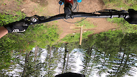
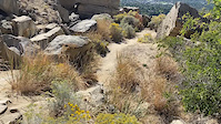
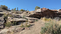
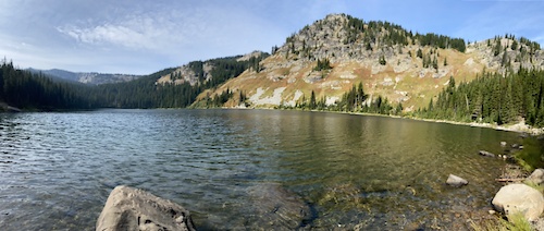
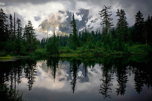
Photos of Idaho Mountain Bike
trail: Little Boulder Creek
139 |
Nov 27, 2017 @ 12:57am
Nov 27, 2017
trail: Chukar Butte
94 |
Jun 14, 2017 @ 2:49pm
Jun 14, 2017
trail: Hammer
265 |
Jan 3, 2017 @ 5:19pm
Jan 3, 2017
trail: Stormin Mormon
261 |
Dec 2, 2016 @ 2:46pm
Dec 2, 2016
trail: Stormin Mormon
471 |
Dec 2, 2016 @ 2:46pm
Dec 2, 2016
trail: Hammer
289 |
May 24, 2016 @ 9:46am
May 24, 2016
trail: Rocky Creek
203 |
Nov 1, 2015 @ 7:23am
Nov 1, 2015
trail: Rocky Creek
235 |
Dec 30, 2014 @ 7:41am
Dec 30, 2014Videos of Idaho Mountain Bike
trail: Sullivans
6 |
Jun 10, 2022
trail: Zen Garden
14 |
May 26, 2022
trail: Lower Hulls Gulch
|
May 15, 2022
trail: Auger Falls
45 |
Dec 16, 2021
trail: Hell Mary
143 |
Nov 2, 2021
trail: Table Rock Quarry
25 |
Sep 26, 2021
trail: Upper Quarry Trail
25 |
Sep 26, 2021

trail: Quigley Loop Trail
30 |
Sep 2, 2021
Activity Feed
| username | action | type | title | date | |
|---|---|---|---|---|---|
 | andreaarends | wishlist | region | Sun Valley: Bald Mountain | Jul 5, 2022 @ 11:18pm 3 hours |
| andreaarends | wishlist | region | Galena Lodge | Jul 5, 2022 @ 11:16pm 3 hours |
| KateEkJVXS | ridden | trail | Rip and Tear and 5 more | Jul 5, 2022 @ 11:11pm 3 hours |
 | Priebec | ridden | trail | Sand Mountain | Jul 5, 2022 @ 10:35pm 3 hours |
| Priebec | ridden | trail | Palouse Divide Road with Bald Mountain Road and 3 more | Jul 5, 2022 @ 10:35pm 3 hours |
Recent Comments
| username | type | title | comment | date | |
|---|---|---|---|---|---|
 | trail | Not a very good bike trail. More of a hiking... | Jul 5, 2022 @ 5:24pm 9 hours | ||
| trail | Really fun Trail! | Jul 4, 2022 @ 6:23pm 1 day | ||
 | trail | Fun downhill. But not worth the climb. | Jul 4, 2022 @ 8:53am 2 days | ||
| trail | Just awful. I was hoping a bear would just eat... | Jul 4, 2022 @ 8:53am 2 days | ||
| trail | You couldn't pay me to "ride" this again.... | Jul 4, 2022 @ 8:51am 2 days |
Local Badges
-

Top 10 Trails1 awarded -

Trail Explorer 100920 awarded -

10 Blue Trails632 awarded -

10 Green Trails483 awarded -

Big Ride 30k7,706 awarded -

Epic Ride 50k1,959 awarded
National Scenic Trails & Official Routes
-
Continental Divide Trail
- Mountain Bike
- Hike
- Trail Running
-
Great Western Trail
- Mountain Bike
- E-Bike
- Hike
- Trail Running
- Horse
- Dirtbike/Moto
- ATV/ORV/OHV
-
Idaho Centennial Trail
- Mountain Bike
- Hike
- Trail Running
-
Pacific Northwest Trail
- Mountain Bike
- Hike
- Trail Running
- Horse


Bike & Skill Parks
| name | type | city | rating |
|---|---|---|---|
| Bogus Basin | bike park | Boise | |
| Brundage Mountain Resort | bike park | McCall | |
| Kelly Canyon Resort | bike park | Ririe | |
| Lookout Pass Bike Park | bike park | Mullan | |
| Pomerelle Mountain Resort | bike park | Albion |
Upcoming Local Events
Pinkbike Articles
Feb 23, 2021
![Local Flavours: The Complete Guide to Riding in Eastern Idaho]() Local Flavours: The Complete Guide to Riding in Eastern Idaho
There is a lot of incredible mountain biking to be done in the Pocatello area and in the Teton Valley.
Jul 15, 2020
Local Flavours: The Complete Guide to Riding in Eastern Idaho
There is a lot of incredible mountain biking to be done in the Pocatello area and in the Teton Valley.
Jul 15, 2020
![Back to the Trails: Sun Valley, Idaho]() Back to the Trails: Sun Valley, Idaho
The world's first chairlift was installed in Sun Valley, Idaho in 1936 and the town has since become a prominent 4-season adventure paradise.
May 18, 2019
Back to the Trails: Sun Valley, Idaho
The world's first chairlift was installed in Sun Valley, Idaho in 1936 and the town has since become a prominent 4-season adventure paradise.
May 18, 2019
![Exploring the Mountaintop Trails of Idaho & Montana]() Exploring the Mountaintop Trails of Idaho & Montana
Taking a road trip to some of the best trails along the border of Idaho and Montana.
Exploring the Mountaintop Trails of Idaho & Montana
Taking a road trip to some of the best trails along the border of Idaho and Montana.
Pinkbike Articles
Feb 23, 2021
 Local Flavours: The Complete Guide to Riding in Eastern Idaho
There is a lot of incredible mountain biking to be done in the Pocatello area and in the Teton Valley.
Jul 15, 2020
 Back to the Trails: Sun Valley, Idaho
The world's first chairlift was installed in Sun Valley, Idaho in 1936 and the town has since become a prominent 4-season adventure paradise.
May 18, 2019
 Exploring the Mountaintop Trails of Idaho & Montana
Taking a road trip to some of the best trails along the border of Idaho and Montana.
Activity Type Stats
| activitytype | trails | distance | descent | descent distance | total vertical | rating | global rank | state rank | photos | reports | routes | ridelogs |
|---|---|---|---|---|---|---|---|---|---|---|---|---|
| Mountain Bike | 3,354 | 8,954 miles | 1,847,490 ft | 4,071 miles | 11,909 ft | #22 | 7,419 | 16,668 | 302 | 218,268 | ||
| E-Bike | 1,169 | 3,728 miles | 719,072 ft | 1,655 mile | 9,229 ft | #16 | 40 | 12,489 | 32 | 4,087 | ||
| Hike | 3,327 | 9,153 miles | 1,867,474 ft | 4,080 miles | 11,909 ft | #23 | 246 | 15,970 | 75 | 15,329 | ||
| Trail Running | 3,311 | 9,152 miles | 1,866,122 ft | 4,082 miles | 11,909 ft | #23 | 33 | 15,956 | 62 | 10,280 | ||
| Horse | 990 | 3,530 miles | 752,552 ft | 1,584 mile | 11,598 ft | #12 | 5 | 6,344 | 20 | 97 | ||
| Dirtbike/Moto | 2,258 | 6,329 miles | 1,524,121 ft | 3,093 miles | 8,783 ft | #7 | 26 | 5,378 | 11 | 397 | ||
| Observed Trials | 19 | 93 miles | 7,710 ft | 32 miles | 5,007 ft | #7 | 35 | 1 | 68 | |||
| ATV/ORV/OHV | 911 | 2,437 miles | 430,108 ft | 1,111 mile | 8,727 ft | #6 | 22 | 5,115 | 1 | 113 | ||
| Snowmobile | 86 | 536 miles | 49,331 ft | 216 miles | 6,516 ft | #8 | 5 | 60 | 2 | 50 | ||
| Snowshoe | 154 | 464 miles | 48,760 ft | 194 miles | 7,572 ft | #25 | 172 | 4 | 591 | |||
| Downhill Ski | 124 | 56 miles | 55,801 ft | 51 miles | 5,128 ft | 18 | 5,811 | |||||
| Backcountry Ski | 62 | 165 miles | 22,320 ft | 73 miles | 6,427 ft | #22 | 75 | 2 | 3,110 | |||
| Nordic Ski | 128 | 481 miles | 42,694 ft | 190 miles | 7,530 ft | #24 | 1 | 183 | 3 | 5,017 |
- By canadaka
 Trailforks & contributors
 - Admins: Map Team, chuktA, msmcfate, WillieJacobsz, PlumbBobM, ReckitRolley, chuktA, IdahoEnduroSeries, macgyver96
- #3166 - 51,202 views
- idaho activity log | embed map of Idaho mountain bike trails | idaho mountain biking points of interest polygons
-
- subscribe
- 3d map
Downloading of trail gps tracks in kml & gpx formats is enabled for Idaho.
You must login to download files.