close
Trail Conditions
- Unknown
- Snow Groomed
- Snow Packed
- Snow Covered
- Snow Cover Inadequate
- Freeze/thaw Cycle
- Icy
- Prevalent Mud
- Wet
- Variable
- Ideal
- Dry
- Very Dry
Trail Flow (Ridden Direction)
Trailforks scans users ridelogs to determine the most popular direction each trail is ridden. A good flowing trail network will have most trails flowing in a single direction according to their intension.
The colour categories are based on what percentage of riders are riding a trail in its intended direction.
The colour categories are based on what percentage of riders are riding a trail in its intended direction.
- > 96%
- > 90%
- > 80%
- > 70%
- > 50%
- < 50%
- bi-directional trail
- no data
Trail Last Ridden
Trailforks scans ridelogs to determine the last time a trail was ridden.
- < 2 days
- < 1 week
- < 2 weeks
- < 1 month
- < 6 months
- > 6 months
Trail Ridden Direction
The intended direction a trail should be ridden.
- Downhill Only
- Downhill Primary
- Both Directions
- Uphill Primary
- Uphill Only
- One Direction
Contribute Details
Colors indicate trail is missing specified detail.
- Description
- Photos
- Description & Photos
- Videos
Trail Popularity ?
Trailforks scans ridelogs to determine which trails are ridden the most in the last 9 months.
Trails are compared with nearby trails in the same city region with a possible 25 colour shades.
Think of this as a heatmap, more rides = more kinetic energy = warmer colors.
- most popular
- popular
- less popular
- not popular
ATV/ORV/OHV Filter
Max Vehicle Width
inches
Radar Time
x
Activity Recordings
Trailforks users anonymized public ridelogs from the past 6 months.
- mountain biking recent
- mountain biking (>6 month)
- hiking (1 year)
- moto (1 year)
Activity Recordings
Trailforks users anonymized public skilogs from the past 12 months.
- Downhill Ski
- Backcountry Ski
- Nordic Ski
Jump Magnitude Heatmap
Heatmap of where riders jump on trails. Zoom in to see individual jumps, click circles to view jump details.
Trails Deemphasized
Trails are shown in grey.
Only show trails with NO bikes.
Save the current map location and zoom level as your default home location whenever this page is loaded.
SavePopular Trail Networks
view all areas »
No description for Indiana has been added yet!
Login or register to submit one.
Region Details
- 95
- 16
- 147
- 169
- 72
- 5
Stats
- Avg Trail Rating
- Trails (view details)
- 739
- Trails Mountain Bike
- 504
- Trails E-Bike
- 176
- Trails Hike
- 704
- Trails Trail Running
- 706
- Trails Horse
- 26
- Trails Dirtbike/Moto
- 3
- Trails Observed Trials
- 1
- Trails ATV/ORV/OHV
- 3
- Trails Snowshoe
- 18
- Trails Backcountry Ski
- 2
- Trails Nordic Ski
- 20
- Total Distance
- 1,013 mile
- Total Descent
- 85,861 ft
- Total Vertical
- 894 ft
- Highest Trailhead
- 1,114 ft
- Reports
- 24,906
- Photos
- 858
- Ridden Counter
- 38,750
 Articles
It’s Time to Plan Your Summer Visit to Indiana Dunes
Apr 7, 2022 from outsideonline.com
Indiana Dunes National Park is an adventure gem for urban midwesterners all year long, but particularly in summer, when Lake Michigan almost...

Disabled Rider Calls for Empathy and Kindness After Being Challenged on Trails
Sep 14, 2020 from pinkbike.com
Disgusting behaviour from two mountain bikers in Indiana.
Sub Regions
- Central Indiana (146)
- Brown County (1)
- Southern Hills and Lowlands (87)
- The Great Lakes Plain (179)
- Tipton Till Plain (47)
Popular Indiana Mountain Biking Trails
| status | title | difficulty | rating |
|---|---|---|---|
| Hesitation Point Trail Brown County State Park | |||
| Hobbs Hollow Flow Trail Brown County State Park | |||
| Green Valley Trail Brown County State Park | |||
| Limekiln West Brown County State Park | |||
| Walnut Trail Brown County State Park | |||
| North Gate Connector Brown County State Park | |||
| Pine Loop Brown County State Park | |||
| Bobcat Connector Brown County State Park | |||
| Weedpatch Brown County State Park | |||
| North Tower Loop Brown County State Park | |||
| Aynes Loop Connector Brown County State Park | |||
| Aynes Loop Brown County State Park | |||
| Bobcat Brown County State Park | |||
| Shelley Trail Brown County State Park | |||
| LimeKiln East Brown County State Park |
Indiana Mountain Bike Routes
| title | rating | distance |
|---|---|---|
| Freedom Trail aMTB2 Loop Griffin Bike Park | 4 miles | |
| Creekside Trails Creekside Trails | 9 miles | |
| Town Run Trail Full Loop Town Run Trail Park | 7 miles | |
| 2021 Hard Truth Epic Route 65 Miles Brown County State Park | 61 miles | |
| 10 Miles of FUN! Brown County State Park | 10 miles | |
| Hobbs Flow to N Gate Lot Brown County State Park | 7 miles | |
| Prairie Creek Loop Prairie Creek Trails | 10 miles | |
| 2021 Hard Truth Epic Route 50 Miles Brown County State Park | 50 miles | |
| Walnut, Oka Run and Pahoka Adventure Loop Harmonie State Park | 14 miles | |
| Intro to Brown County Brown County State Park | 19 miles |
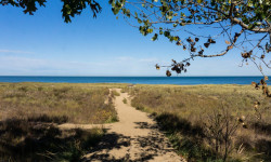
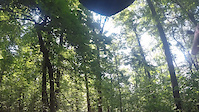
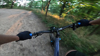
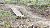
Photos of Indiana Mountain Bike
trail: Christmas Trail
156 |
Jul 8, 2019 @ 8:44am
Jul 8, 2019
trail: Christmas Trail
122 |
Jul 8, 2019 @ 8:44am
Jul 8, 2019
trail: South Loop
223 |
Jul 16, 2018 @ 8:10am
Jul 16, 2018
trail: South Loop
153 |
Jun 2, 2018 @ 6:55am
Jun 2, 2018
trail: Mann Hill Loop
139 |
Oct 24, 2016 @ 7:19pm
Oct 24, 2016
trail: Mann Hill Loop
126 |
Oct 24, 2016 @ 7:18pm
Oct 24, 2016
trail: Aynes Loop
385 |
Aug 1, 2016 @ 6:06am
Aug 1, 2016
trail: Green Valley Trail
407 |
Oct 25, 2015 @ 3:38pm
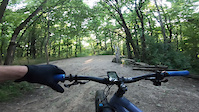
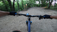
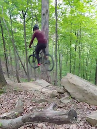
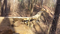
Oct 25, 2015Videos of Indiana Mountain Bike
trail: Hobbs Hollow Flow Trail
54 |
Dec 26, 2021
trail: Big Fire North
24 |
Nov 20, 2021
trail: Big Fire South
20 |
Nov 20, 2021
trail: Power Line DH
47 |
Nov 20, 2021
trail: AWOL
|
Nov 16, 2021

trail: Hobbs Hollow Flow Trail
98 |
Oct 20, 2021
trail: Hobbs Hollow Flow Trail
278 |
May 17, 2021
trail: KA-BAR
113 |
Jan 18, 2021
Activity Feed
| username | action | type | title | date | |
|---|---|---|---|---|---|
 | Object52 | add | report | 10 O'Clock Line and 18 more | Jul 4, 2022 @ 9:58am 2 days |
| magicscoot | wishlist | region | Brown County State Park | Jul 4, 2022 @ 5:42am 2 days |
| magicscoot | wishlist | region | O'Bannon Woods State Park | Jul 4, 2022 @ 5:38am 2 days |
| RichMoore65 | add | report | Advanced Trails Access and 33 more | Jul 4, 2022 @ 5:13am 2 days |
 | jeff-lenosky | add | video | I DESIGNED MY OWN TRAIL, NOW WE RIDE IT!! | AWOL Griffin Bike Park | Jul 3, 2022 @ 12:00pm 3 days |
Recent Comments
| username | type | title | comment | date | |
|---|---|---|---|---|---|
| report | Rocks are super slippery from humidity. | Jun 14, 2022 @ 6:19am Jun 14, 2022 | ||
| trail | A jump was added going east. | May 28, 2022 @ 7:04pm May 28, 2022 | ||
 | report | tree down midway .. drainage or lows wet /... | May 22, 2022 @ 8:14pm May 22, 2022 | ||
| report | Tree down towards end of trail . Some mud 90% dry | May 22, 2022 @ 8:12pm May 22, 2022 | ||
| report | Give a ride now. We did a TON of weedeating... | May 9, 2022 @ 7:19am May 9, 2022 |
Local Badges
-

Big Ride 30k1,562 awarded -

Completionist1 awarded -

10 Blue Trails51 awarded -
Big Ride 30k645 awarded -

Descent 10k Badge2 awarded -

Descent 100k Badge0 awarded
Bike & Skill Parks
| name | type | city | rating |
|---|---|---|---|
| BMX Track | skill park | Fort Wayne | |
| Indy Cycloplex BMX / Skate Park | skill park | Indianapolis | |
| Lake Sullivan BMX Track | skill park | Indianapolis | |
| Rangeline Nature Preserve Skill Park | skill park | Anderson | |
| The Headquarters Mountain Bike Skills Park | skill park | Indianapolis |
Upcoming Local Events
Activity Type Stats
| activitytype | trails | distance | descent | descent distance | total vertical | rating | global rank | state rank | photos | reports | routes | ridelogs |
|---|---|---|---|---|---|---|---|---|---|---|---|---|
| Mountain Bike | 504 | 666 miles | 47,785 ft | 241 miles | 896 ft | #45 | 841 | 24,900 | 43 | 54,091 | ||
| E-Bike | 176 | 138 miles | 4,419 ft | 40 miles | 696 ft | #32 | 1 | 16,071 | 7 | 498 | ||
| Hike | 704 | 992 miles | 83,537 ft | 370 miles | 896 ft | #44 | 10 | 23,994 | 7 | 1,721 | ||
| Trail Running | 706 | 992 miles | 83,517 ft | 370 miles | 896 ft | #44 | 5 | 23,993 | 6 | 699 | ||
| Horse | 26 | 46 miles | 2,664 ft | 15 miles | 476 ft | #37 | 5,079 | 3 | ||||
| Dirtbike/Moto | 3 | 561 ft | 26 ft | 16 ft | 1 | 5,072 | 7 | |||||
| Observed Trials | 1 | 62 ft | 5 | 6 | ||||||||
| ATV/ORV/OHV | 3 | 545 ft | 112 ft | 10 ft | 5,070 | 2 | ||||||
| Snowshoe | 18 | 11 miles | 423 ft | 3 miles | 256 ft | #45 | 4 | 3 | 4 | |||
| Backcountry Ski | 2 | 3 miles | 161 ft | 4,301 ft | 46 ft | #41 | 1 | 3 | 12 | |||
| Nordic Ski | 20 | 15 miles | 469 ft | 4 miles | 256 ft | #46 | 2 | 43 |
- By canadaka
 Trailforks & contributors
 - Admins: Map Team, chuktA, msmcfate, WillieJacobsz, PlumbBobM, ReckitRolley, Larsacus
- #3144 - 15,419 views
- indiana activity log | embed map of Indiana mountain bike trails | indiana mountain biking points of interest polygons
-
- subscribe
- 3d map
Downloading of trail gps tracks in kml & gpx formats is enabled for Indiana.
You must login to download files.