close
Trail Conditions
- Unknown
- Snow Groomed
- Snow Packed
- Snow Covered
- Snow Cover Inadequate
- Freeze/thaw Cycle
- Icy
- Prevalent Mud
- Wet
- Variable
- Ideal
- Dry
- Very Dry
Trail Flow (Ridden Direction)
Trailforks scans users ridelogs to determine the most popular direction each trail is ridden. A good flowing trail network will have most trails flowing in a single direction according to their intension.
The colour categories are based on what percentage of riders are riding a trail in its intended direction.
The colour categories are based on what percentage of riders are riding a trail in its intended direction.
- > 96%
- > 90%
- > 80%
- > 70%
- > 50%
- < 50%
- bi-directional trail
- no data
Trail Last Ridden
Trailforks scans ridelogs to determine the last time a trail was ridden.
- < 2 days
- < 1 week
- < 2 weeks
- < 1 month
- < 6 months
- > 6 months
Trail Ridden Direction
The intended direction a trail should be ridden.
- Downhill Only
- Downhill Primary
- Both Directions
- Uphill Primary
- Uphill Only
- One Direction
Contribute Details
Colors indicate trail is missing specified detail.
- Description
- Photos
- Description & Photos
- Videos
Trail Popularity ?
Trailforks scans ridelogs to determine which trails are ridden the most in the last 9 months.
Trails are compared with nearby trails in the same city region with a possible 25 colour shades.
Think of this as a heatmap, more rides = more kinetic energy = warmer colors.
- most popular
- popular
- less popular
- not popular
ATV/ORV/OHV Filter
Max Vehicle Width
inches
Radar Time
x
Activity Recordings
Trailforks users anonymized public ridelogs from the past 6 months.
- mountain biking recent
- mountain biking (>6 month)
- hiking (1 year)
- moto (1 year)
Activity Recordings
Trailforks users anonymized public skilogs from the past 12 months.
- Downhill Ski
- Backcountry Ski
- Nordic Ski
Jump Magnitude Heatmap
Heatmap of where riders jump on trails. Zoom in to see individual jumps, click circles to view jump details.
Trails Deemphasized
Trails are shown in grey.
Only show trails with NO bikes.
Save the current map location and zoom level as your default home location whenever this page is loaded.
SavePopular Trail Networks
view all areas »
No description for Kentucky has been added yet!
Login or register to submit one.
Region Details
- 44
- 28
- 169
- 257
- 52
- 2
Stats
- Avg Trail Rating
- Trails (view details)
- 777
- Trails Mountain Bike
- 552
- Trails E-Bike
- 57
- Trails Hike
- 746
- Trails Trail Running
- 744
- Trails Horse
- 65
- Trails Dirtbike/Moto
- 13
- Trails ATV/ORV/OHV
- 13
- Total Distance
- 1,042 mile
- Total Descent
- 139,290 ft
- Total Vertical
- 1,412 ft
- Highest Trailhead
- 1,750 ft
- Reports
- 3,130
- Photos
- 724
- Ridden Counter
- 23,542
 Articles
Trail Towns: What Erica Williams Loves About Lexington, Kentucky
Oct 25, 2021 from trailrunnermag.com
Fall colors, and sneaky vert. Here's what trail runners love about Lexington.
Sub Regions
- Bluegrass (93)
- Eastern Kentucky (82)
- Northern Kentucky (0)
- South Central (29)
- Southwest Kentucky (64)
Popular Kentucky Mountain Biking Trails
| status | title | difficulty | rating |
|---|---|---|---|
| Incinerator Trail Devou Park | |||
| Train Surfer Devou Park | |||
| Cherokee Loop Cherokee Park | |||
| No Net Cherokee Park | |||
| Bates-Combs Loop Devou Park | |||
| Cherokee Loop Cherokee Park | |||
| Connector Turkey Run Park | |||
| Pig's Tale Devou Park | |||
| Fresh Air Loop Waverly | |||
| Hickory Trail Turkey Run Park | |||
| Full Monty Devou Park | |||
| Twisted Bends Loop Waverly | |||
| Old Montague Road Devou Park | |||
| Cherokee Loop Cherokee Park | |||
| Back Bowl Devou Park |
Kentucky Mountain Bike Routes
| title | rating | distance |
|---|---|---|
| The Quickest Way Up Sugarcamp Mountain | 4 miles | |
| The BKXC Sugarcamp Route Prestonsburg | 11 miles | |
| The Works Capitol View Park | 9 miles | |
| The Most Challenging Climb Route Sugarcamp Mountain | 7 miles | |
| Big Hollow Mammoth Cave National Park | 11 miles | |
| Green River Race Loop Green River State Park | 6 miles | |
| Seneca bball cherokee loop Seneca Park | 8 miles | |
| Rudy Mines Route Rudy Mines Trails | 7 miles | |
| Waverly Loop Waverly | 6 miles | |
| Local Favorite #2 Sugarcamp Mountain | 5 miles |
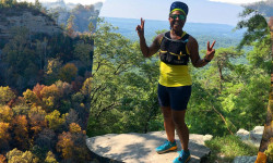
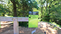
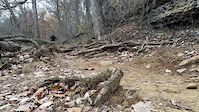
Photos of Kentucky Mountain Bike
trail: Bo Beckett Memorial Trail
1 |
Jul 2, 2022 @ 4:00pm
Jul 2, 2022
trail: Canal Trail
1 |
Jul 2, 2022 @ 12:27pm
Jul 2, 2022
trail: Bo Beckett Memorial Trail
0 |
Jul 2, 2022 @ 12:24pm
Jul 2, 2022
trail: Switchback Trail
7 |
Jun 12, 2022 @ 10:34am
Jun 12, 2022
trail: Cherokee Loop
173 |
Jul 1, 2018 @ 10:38am
Jul 1, 2018
trail: Cherokee Loop
127 |
Jul 1, 2018 @ 10:37am
Jul 1, 2018
trail: No Net
207 |
Jul 17, 2016 @ 8:50am
Jul 17, 2016
trail: No Net
160 |
Jul 17, 2016 @ 8:50am
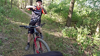
Jul 17, 2016Videos of Kentucky Mountain Bike
trail: Crazy Reds
151 |
Nov 23, 2020
trail: Cherokee Loop
0:09 |
187 |
Nov 19, 2019
1:03 |
405 |
Sep 29, 2019
trail: Fresh Air Loop
4:17 |
175 |
Sep 13, 2019
trail: Full Monty
1:36 |
488 |
Sep 12, 2019
1:37 |
297 |
Jun 20, 2019
1:03 |
362 |
May 24, 2019
1:48 |
246 |
May 9, 2019
Activity Feed
| username | action | type | title | date | |
|---|---|---|---|---|---|
 | RyanM8TPhi | wishlist | trail | Valley of the Giants Trail | Jul 5, 2022 @ 10:01pm 4 hours |
| RyanM8TPhi | wishlist | trail | Paw Paw Trail | Jul 5, 2022 @ 9:58pm 4 hours |
| Turn3John | vote | trail | Entrance Road Trail | Jul 5, 2022 @ 3:57pm 10 hours |
| Mbarnes0066 | wishlist | region | Perry County Park | Jul 4, 2022 @ 8:45am 2 days |
 | MaxLOLume | add | report | Bates-Combs Loop and 2 more | Jul 4, 2022 @ 8:11am 2 days |
Recent Comments
| username | type | title | comment | date | |
|---|---|---|---|---|---|
| trail | Great trail! Had a blast! Highly recommend if... | May 30, 2022 @ 2:32pm May 30, 2022 | ||
| trail | Trails seem in decent shape. I have tried both... | May 15, 2022 @ 9:41am May 15, 2022 | ||
| trail | trail is clear of trees | Apr 27, 2022 @ 3:41pm Apr 27, 2022 | ||
| report | Trails are clear of trees | Apr 27, 2022 @ 3:40pm Apr 27, 2022 | ||
| report | Dog park. Can't type with gloves | Apr 4, 2022 @ 7:35am Apr 4, 2022 |
Local Badges
-

Big Ride 30k2,519 awarded -

10 Green Trails99 awarded -

10 Blue Trails152 awarded -
10 Blue Trails95 awarded -

Top 10 Trails130 awarded -

Completionist0 awarded
Bike & Skill Parks
| name | type | city | rating |
|---|---|---|---|
| Mega Cavern | bike park | Louisville | |
| Derby City BMX Park | skill park | Louisville | |
| England-Idlewild Bike Park | skill park | Burlington | |
| Silo Center Bike Park | skill park | Louisville | |
| Silver Creek Pump Track | skill park | Berea |
Activity Type Stats
| activitytype | trails | distance | descent | descent distance | total vertical | rating | global rank | state rank | photos | reports | routes | ridelogs |
|---|---|---|---|---|---|---|---|---|---|---|---|---|
| Mountain Bike | 552 | 633 miles | 84,324 ft | 271 miles | 1,093 ft | #50 | 674 | 3,129 | 31 | 44,659 | ||
| E-Bike | 57 | 63 miles | 5,371 ft | 23 miles | 965 ft | #44 | 2,006 | 5 | 713 | |||
| Hike | 746 | 1,015 mile | 134,390 ft | 429 miles | 1,411 ft | #49 | 32 | 3,086 | 11 | 1,766 | ||
| Trail Running | 744 | 1,015 mile | 134,117 ft | 429 miles | 1,411 ft | #49 | 4 | 3,085 | 11 | 942 | ||
| Horse | 65 | 125 miles | 18,917 ft | 56 miles | 860 ft | #56 | 2 | 548 | 57 | |||
| Dirtbike/Moto | 13 | 14 miles | 2,369 ft | 6 miles | 390 ft | 10 | 544 | 12 | ||||
| ATV/ORV/OHV | 13 | 14 miles | 2,369 ft | 6 miles | 390 ft | 2 | 545 | 8 |
- By canadaka
 Trailforks & contributors
 - Admins: Map Team, chuktA, msmcfate, WillieJacobsz, PlumbBobM, ReckitRolley, ericpeek, Chris-Campbell
- #3215 - 13,474 views
- kentucky activity log | embed map of Kentucky mountain bike trails | kentucky mountain biking points of interest
-
- subscribe
- 3d map
Downloading of trail gps tracks in kml & gpx formats is enabled for Kentucky.
You must login to download files.