close
Trail Conditions
- Unknown
- Snow Groomed
- Snow Packed
- Snow Covered
- Snow Cover Inadequate
- Freeze/thaw Cycle
- Icy
- Prevalent Mud
- Wet
- Variable
- Ideal
- Dry
- Very Dry
Trail Flow (Ridden Direction)
Trailforks scans users ridelogs to determine the most popular direction each trail is ridden. A good flowing trail network will have most trails flowing in a single direction according to their intension.
The colour categories are based on what percentage of riders are riding a trail in its intended direction.
The colour categories are based on what percentage of riders are riding a trail in its intended direction.
- > 96%
- > 90%
- > 80%
- > 70%
- > 50%
- < 50%
- bi-directional trail
- no data
Trail Last Ridden
Trailforks scans ridelogs to determine the last time a trail was ridden.
- < 2 days
- < 1 week
- < 2 weeks
- < 1 month
- < 6 months
- > 6 months
Trail Ridden Direction
The intended direction a trail should be ridden.
- Downhill Only
- Downhill Primary
- Both Directions
- Uphill Primary
- Uphill Only
- One Direction
Contribute Details
Colors indicate trail is missing specified detail.
- Description
- Photos
- Description & Photos
- Videos
Trail Popularity ?
Trailforks scans ridelogs to determine which trails are ridden the most in the last 9 months.
Trails are compared with nearby trails in the same city region with a possible 25 colour shades.
Think of this as a heatmap, more rides = more kinetic energy = warmer colors.
- most popular
- popular
- less popular
- not popular
ATV/ORV/OHV Filter
Max Vehicle Width
inches
Radar Time
x
Activity Recordings
Trailforks users anonymized public ridelogs from the past 6 months.
- mountain biking recent
- mountain biking (>6 month)
- hiking (1 year)
- moto (1 year)
Activity Recordings
Trailforks users anonymized public skilogs from the past 12 months.
- Downhill Ski
- Backcountry Ski
- Nordic Ski
Jump Magnitude Heatmap
Heatmap of where riders jump on trails. Zoom in to see individual jumps, click circles to view jump details.
Trails Deemphasized
Trails are shown in grey.
Only show trails with NO bikes.
Save the current map location and zoom level as your default home location whenever this page is loaded.
SavePopular Trail Networks
view all areas »
No description for Maryland has been added yet!
Login or register to submit one.
Region Details
- 142
- 61
- 381
- 565
- 74
- 11
Stats
- Avg Trail Rating
- Trails (view details)
- 1,344
- Trails Mountain Bike
- 1,263
- Trails E-Bike
- 98
- Trails Hike
- 1,310
- Trails Trail Running
- 1,302
- Trails Horse
- 84
- Trails Dirtbike/Moto
- 13
- Trails Observed Trials
- 1
- Trails ATV/ORV/OHV
- 11
- Trails Snowmobile
- 1
- Trails Snowshoe
- 13
- Trails Downhill Ski
- 1
- Trails Backcountry Ski
- 6
- Trails Nordic Ski
- 4
- Total Distance
- 1,442 mile
- Total Descent
- 154,848 ft
- Total Vertical
- 3,094 ft
- Highest Trailhead
- 3,095 ft
- Reports
- 12,546
- Photos
- 2,175
- Ridden Counter
- 140,373
 Articles

Race Report: 2019 Sheduro Race Report - Frederick Watershed, Maryland
Aug 22, 2019 from pinkbike.com
One of the rockiest trail systems on the East Coast had record attendance during the 2019 Bike Doctor Sheduro
Sub Regions
- Capitol (195)
- Montgomery County (68)
- Central (648)
- Carroll County (2)
- Harford County (3)
- Eastern Shore (138)
- Southern (83)
- Western (193)
- Frederick County (133)
Popular Maryland Mountain Biking Trails
| status | title | difficulty | rating |
|---|---|---|---|
| Morning Choice Main Section Patapsco Valley State Park | |||
| Rockburn Connector Rockburn Branch Park | |||
| Ridge Trail Patapsco Valley State Park | |||
| Three Saws Frederick | |||
| Huggy Bear Frederick Watershed | |||
| Garrett's Pass Patapsco Valley State Park | |||
| Ridge Extension Patapsco Valley State Park | |||
| Twisties Rockburn Branch Park | |||
| Morning Choice East Section Patapsco Valley State Park | |||
| Belmont Trail Patapsco Valley State Park | |||
| Chin Connector Bacon Ridge | |||
| Barley and Hops Baltimore | |||
| Boundary Line Frederick Watershed | |||
| Swinging Bridge Patapsco Valley State Park | |||
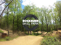
| Skills Park Trail Rockburn Branch Park |
Maryland Mountain Bike Routes
| title | rating | distance |
|---|---|---|
| Severn River Circumnavigation (Mixed Surface) Annapolis | 43 miles | |
| Yellow Loop Gambrill State Park | 7 miles | |
| Bacon Ridge Phase 1 & 2 Loop Bacon Ridge | 6 miles | |
| dssadasdadasdas Baltimore | 11 miles | |
| Anne Arundel County Epic Annapolis Waterworks Trail | 30 miles | |
| Short Loop from Hamburg Rd Frederick Watershed | 5 miles | |
| MVD Rockburn to Patapsco Avalon HOCO Loop Rockburn Branch Park | 14 miles | |
| BWI To Rockburn Skills Park Rockburn Branch Park | 9 miles | |
| Tour De Patapsco - Avalon/Glen Artney/Hilton/Orange Grove Elkridge | 20 miles | |
| Blue Watershred Frederick Watershed | 11 miles |
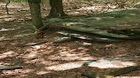
Photos of Maryland Mountain Bike
trail: Inner Petticoat
2 |
Jul 4, 2022 @ 8:09am
2 days
trail: Old Main Line Trail
3 |
Jun 30, 2022 @ 10:21pm
Jun 30, 2022
trail: Old Main Line Trail
2 |
Jun 30, 2022 @ 10:19pm
Jun 30, 2022
trail: Old Main Line Trail
2 |
Jun 30, 2022 @ 10:19pm
Jun 30, 2022
trail: Boundary Trail
90 |
May 19, 2018 @ 6:03pm
May 19, 2018
trail: Smooth Operator
234 |
Sep 20, 2012 @ 7:16am
Sep 20, 2012
trail: Smooth Operator
291 |
Sep 20, 2012 @ 7:16am
Sep 20, 2012
trail: Smooth Operator
193 |
Sep 20, 2012 @ 7:16am
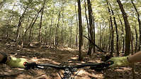
Sep 20, 2012Videos of Maryland Mountain Bike
trail: Kubla Khan
152 |
Aug 8, 2021
trail: Rockburn
36 |
Jul 20, 2021

223 |
May 24, 2021

trail: Needwood Loop
49 |
Apr 25, 2021

trail: Tuffy's Tavern
0:56 |
43 |
Sep 28, 2020
trail: Catoctin Blue Trail
5:04 |
351 |
Sep 9, 2020

trail: Fun House
4:00 |
298 |
Sep 9, 2020

trail: Three Saws
0:33 |
28 |
Sep 9, 2020
Activity Feed
| username | action | type | title | date | |
|---|---|---|---|---|---|
 | Rogersgs | add | report | yellowSingleTrack and 2 more | Jul 5, 2022 @ 6:07pm 8 hours |
 | Macandgina | wishlist | region | Liberty Watershed Trails | Jul 5, 2022 @ 2:21pm 12 hours |
 | MTBCK | add | report | Campground to Ivy Branch and 6 more | Jul 5, 2022 @ 11:47am 14 hours |
| Workmill | wishlist | route | LGP 20+ Harford Rd Start | Jul 5, 2022 @ 10:18am 16 hours |
| Workmill | wishlist | trail | Little Gunpowder Trail (White Blaze - Pleasantville Rd to Bottom Rd) | Jul 5, 2022 @ 10:16am 16 hours |
Recent Comments
| username | type | title | comment | date | |
|---|---|---|---|---|---|
| report | 2 trees down | Jul 4, 2022 @ 9:27am 2 days | ||
| trail | The flowy sections are blue, but if you ride... | Jul 3, 2022 @ 10:54pm 2 days | ||
| trail | Only a green trail compared to other trails in... | Jul 3, 2022 @ 10:20pm 2 days | ||
| trail | Very steep, good brakes and suspension... | Jul 3, 2022 @ 9:51pm 2 days | ||
| trail | Blue trail with a couple "light black" rock... | Jul 3, 2022 @ 9:35pm 2 days |
Local Badges
-

Guyton It Done!0 awarded -

Trail Explorer 100782 awarded -

Big Ride 30k1,882 awarded -

10 Blue Trails340 awarded -

Completionist6 awarded -

10 Green Trails238 awarded
National Scenic Trails & Official Routes
-
GAP - Great Allegheny Passage
- Mountain Bike
- E-Bike
- Hike
- Trail Running
-
GAP - Great Allegheny Passage (Confluence to Cumberland)
- Mountain Bike
- E-Bike
- Hike
- Trail Running
Bike & Skill Parks
| name | type | city | rating |
|---|---|---|---|
| Double Creek Bike Park | bike park | Pikesville | |
| Bacon Ridge Bike Park | skill park | Millersville | |
| Carson Farm Bike Park | skill park | Gaithersburg | |
| Chesapeake BMX | skill park | Severn | |
| Fairlands Skills Park | skill park | Burtonsville |
Activity Type Stats
| activitytype | trails | distance | descent | descent distance | total vertical | rating | global rank | state rank | photos | reports | routes | ridelogs |
|---|---|---|---|---|---|---|---|---|---|---|---|---|
| Mountain Bike | 1,263 | 1,304 mile | 136,394 ft | 518 miles | 3,094 ft | #30 | 2,011 | 12,526 | 191 | 162,700 | ||
| E-Bike | 98 | 92 miles | 8,054 ft | 36 miles | 2,484 ft | #47 | 10,925 | 13 | 1,008 | |||
| Hike | 1,310 | 1,418 mile | 145,413 ft | 556 miles | 3,015 ft | #28 | 134 | 12,382 | 37 | 7,322 | ||
| Trail Running | 1,302 | 1,415 mile | 145,082 ft | 555 miles | 3,015 ft | #28 | 26 | 12,378 | 45 | 2,149 | ||
| Horse | 84 | 90 miles | 8,153 ft | 36 miles | 1,729 ft | #31 | 4 | 2,753 | 21 | 41 | ||
| Dirtbike/Moto | 13 | 12 miles | 755 ft | 4 miles | 1,529 ft | #19 | 1 | 2,712 | 42 | |||
| Observed Trials | 1 | 1 | 5 | 69 | ||||||||
| ATV/ORV/OHV | 11 | 1 mile | 115 ft | 2,536 ft | 420 ft | #12 | 2,708 | 28 | ||||
| Snowmobile | 1 | 2,205 ft | 36 ft | 433 ft | 52 ft | #5 | 3 | 16 | ||||
| Snowshoe | 13 | 13 miles | 1,050 ft | 6 miles | 351 ft | #38 | 2 | 22 | ||||
| Downhill Ski | 1 | 2,205 ft | 36 ft | 433 ft | 52 ft | #5 | 2 | 275 | ||||
| Backcountry Ski | 6 | 3 miles | 558 ft | 1 mile | 1,201 ft | #21 | 3 | 22 | ||||
| Nordic Ski | 4 | 5 miles | 705 ft | 3 miles | 1,250 ft | #27 | 2 | 98 |
- By canadaka
 Trailforks & contributors
 - Admins: Map Team, chuktA, msmcfate, WillieJacobsz, PlumbBobM, ReckitRolley, theWVPedaler, PlumbBobM
- #3204 - 30,752 views
- maryland activity log | embed map of Maryland mountain bike trails | maryland mountain biking points of interest polygons
-
- subscribe
- 3d map
Downloading of trail gps tracks in kml & gpx formats is enabled for Maryland.
You must login to download files.