close
Trail Conditions
- Unknown
- Snow Groomed
- Snow Packed
- Snow Covered
- Snow Cover Inadequate
- Freeze/thaw Cycle
- Icy
- Prevalent Mud
- Wet
- Variable
- Ideal
- Dry
- Very Dry
Trail Flow (Ridden Direction)
Trailforks scans users ridelogs to determine the most popular direction each trail is ridden. A good flowing trail network will have most trails flowing in a single direction according to their intension.
The colour categories are based on what percentage of riders are riding a trail in its intended direction.
The colour categories are based on what percentage of riders are riding a trail in its intended direction.
- > 96%
- > 90%
- > 80%
- > 70%
- > 50%
- < 50%
- bi-directional trail
- no data
Trail Last Ridden
Trailforks scans ridelogs to determine the last time a trail was ridden.
- < 2 days
- < 1 week
- < 2 weeks
- < 1 month
- < 6 months
- > 6 months
Trail Ridden Direction
The intended direction a trail should be ridden.
- Downhill Only
- Downhill Primary
- Both Directions
- Uphill Primary
- Uphill Only
- One Direction
Contribute Details
Colors indicate trail is missing specified detail.
- Description
- Photos
- Description & Photos
- Videos
Trail Popularity ?
Trailforks scans ridelogs to determine which trails are ridden the most in the last 9 months.
Trails are compared with nearby trails in the same city region with a possible 25 colour shades.
Think of this as a heatmap, more rides = more kinetic energy = warmer colors.
- most popular
- popular
- less popular
- not popular
ATV/ORV/OHV Filter
Max Vehicle Width
inches
Radar Time
x
Activity Recordings
Trailforks users anonymized public ridelogs from the past 6 months.
- mountain biking recent
- mountain biking (>6 month)
- hiking (1 year)
- moto (1 year)
Activity Recordings
Trailforks users anonymized public skilogs from the past 12 months.
- Downhill Ski
- Backcountry Ski
- Nordic Ski
Jump Magnitude Heatmap
Heatmap of where riders jump on trails. Zoom in to see individual jumps, click circles to view jump details.
Trails Deemphasized
Trails are shown in grey.
Only show trails with NO bikes.
Save the current map location and zoom level as your default home location whenever this page is loaded.
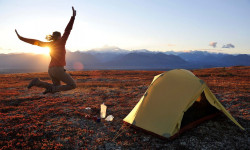
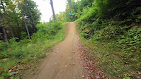
SaveMassachusetts is a mountain bikers paradise There are mountain biking trails in virtually every corner of the state with trails suitable for absolute beginners to some of the gnarliest trails you will find anywhere on the planet. While New England is notorious for its technical riding, we also have some of the smoothest flow trails anywhere.
If you want to find riding opportunities near you there are several ways to go abut it. First of course is to search Trailforks for local riding areas near you. The second alternative is to find your nearest NEMBA chapter. We have added links to all of NEMBA's websites below, where you can find your local chapter as well as contact details. The third option is to look for your nearest bike shop in the Trailforks directory and to chat to them about local riding opportunities.
Also, what sets the mountain biking community in New England apart, is the fact that we have NEMBA with all of its local Chapters. NEMBA believes that mountain bikers care about the trails they ride—that's why we are a chapter-based organization. NEMBA has 29 chapters throughout New England, each offering a wide variety of rides, events and ways to give back to the trails. Join your local NEMBA chapter and become part of our community of mountain bikers!
Stats
- Avg Trail Rating
- Trails (view details)
- 16,401
- Trails Mountain Bike
- 14,355
- Trails E-Bike
- 1,272
- Trails Hike
- 15,921
- Trails Trail Running
- 15,785
- Trails Horse
- 2,094
- Trails Dirtbike/Moto
- 483
- Trails Observed Trials
- 62
- Trails ATV/ORV/OHV
- 138
- Trails Snowmobile
- 278
- Trails Snowshoe
- 4,732
- Trails Downhill Ski
- 192
- Trails Backcountry Ski
- 187
- Trails Nordic Ski
- 2,257
- Total Distance
- 7,564 miles
- Total Descent
- 715,892 ft
- Total Vertical
- 3,491 ft
- Highest Trailhead
- 3,491 ft
- Reports
- 33,852
- Photos
- 6,930
- Ridden Counter
- 1,031,668
 Articles
The 5 Best New Thru-Hikes to Start Planning Now
Jan 4, 2022 from backpacker.com
Start planning to hike these in-progress U.S. trails in 2022.

Race Report & Video: Maxxis ESC Specialized Enduro Finals & EWS Qualifier - Thunder Mountain, MA
Oct 10, 2019 from pinkbike.com
A classic New England venue hosts the final ESC of 2019
Popular Trail Networks
view all areas »Sub Regions
- Berkshire County (348)
- Cape Cod (Barnstable County) (1,810)
- Lower Cape (178)
- Mid Cape (503)
- Outer Cape (21)
- Upper Cape (1,107)
- Essex County (2,038)
- North Shore (2,037)
- Greater Boston (1,000)
- Middlesex County (East) (692)
- Suffolk County (307)
- Martha's Vineyard (100)
- Middlesex County (Northwest) (771)
- Merrimack Valley NEMBA (472)
- Nantucket County (7)
- Pioneer Valley (1,184)
- Franklin County (400)
- Hampden County (340)
- Hampshire County (443)
- Southeast Massachusetts (4,429)
- Bristol County (467)
- Norfolk County (2,251)
- Plymouth County (1,628)
- Worcester County (2,695)
- Blackstone Valley (1,428)
- Podunk Region (187)
- Wachusett Area (721)
- Ware River Watershed (90)
Popular Massachusetts Mountain Biking Trails
| status | title | difficulty | rating |
|---|---|---|---|
| Tonto Vietnam Trail Network | |||
| Adams Lot Trail Vietnam Trail Network | |||
| Blue Pulaski Thunder Mountain Bike Park / Berkshire East Mountain Resort | |||
| The Gronk Thunder Mountain Bike Park / Berkshire East Mountain Resort | |||
| Sleeping Jake's Thunder Mountain Bike Park / Berkshire East Mountain Resort | |||
| NEMBA Trail Vietnam Trail Network | |||
| Sneaky Quickie Vietnam Trail Network | |||
| Yellow Trail Russell Mill Pond & Town Forest | |||
| Thunder Cliffs Thunder Mountain Bike Park / Berkshire East Mountain Resort | |||
| The Gigg Vietnam Trail Network | |||
| Trillium Thunder Mountain Bike Park / Berkshire East Mountain Resort | |||
| Wild Turkey Russell Mill Pond & Town Forest | |||
| Optional Rocks Vietnam Trail Network | |||
| Pump Track Russell Mill Pond & Town Forest | |||
| Hornet Thunder Mountain Bike Park / Berkshire East Mountain Resort |
Massachusetts Mountain Bike Routes
| title | rating | distance |
|---|---|---|
| Great Blue Hill Loop Blue Hills Reservation | 22 miles | |
| Vietnam Hall of Fame Vietnam Trail Network | 8 miles | |
| Mixed Bag Route - 2020 SEMASS NEMBA Turkey Afterburner - The Virtual Event Hale | 16 miles | |
| WSF Sampler Wrentham State Forest | 4 miles | |
| Wompy Loop Wompatuck State Park | 19 miles | |
| Yellow Diamond Route Harold Parker State Forest | 3 miles | |
| Deluxbury Route Duxbury Trail Network | 14 miles | |
| Epic Trail Ride Boston to Northampton: Day 1 - Boston to Littleton Somerville | 45 miles | |
| Nice and Easy Massy Massasoit State Park | 9 miles | |
| All Hale Hale | 13 miles |
Photos of Massachusetts Mountain Bike
trail: Fort Hill
119 |
Dec 1, 2021 @ 7:55am
Dec 1, 2021
trail: Double Over Time
185 |
Sep 22, 2020 @ 10:04am
Sep 22, 2020
trail: Double Over Time
195 |
Sep 22, 2020 @ 8:17am
Sep 22, 2020
trail: Shady Acres
214 |
Jul 14, 2020 @ 11:52am
Jul 14, 2020
trail: C4
420 |
Jul 13, 2020 @ 3:16am
Jul 13, 2020
trail: Fort Hill
100 |
Jul 2, 2020 @ 6:14pm
Jul 2, 2020
trail: Tornado
158 |
Jun 13, 2020 @ 3:51pm
Jun 13, 2020
trail: NEMBA Trail
1,322 | | 1 comments
Jun 2, 2006 @ 10:25am
Jun 2, 2006Videos of Massachusetts Mountain Bike
trail: Vietman Veterans Drive Ext
41 |
May 18, 2022

trail: Vietman Veterans Drive Ext
17 |
May 18, 2022
trail: YOLO
|
May 10, 2022
trail: Okotoks Pathway
37 |
Apr 27, 2022
trail: The Gronk
27 |
Mar 6, 2022

72 |
Mar 4, 2022

|
Mar 4, 2022
trail: Furnace Brook Path
16 |
Dec 8, 2021
Activity Feed
| username | action | type | title | date | |
|---|---|---|---|---|---|
 | mappermook | update | trail | Magnum P.I. | Jul 5, 2022 @ 8:45pm 5 hours |
 | Jnash911 | wishlist | route | Easy Vasqueezy Loop | Jul 5, 2022 @ 6:50pm 7 hours |
| gWjJsy | wishlist | route | Earls - Seven | Jul 5, 2022 @ 6:41pm 7 hours |
| gWjJsy | wishlist | region | Deerfield Ridge Trail Network | Jul 5, 2022 @ 6:31pm 8 hours |
| mappermook | add | report | Uncas Brook Row | Jul 5, 2022 @ 5:41pm 8 hours |
Recent Comments
| username | type | title | comment | date | |
|---|---|---|---|---|---|
| report | Wow, that was quick work. Good job. | Jul 1, 2022 @ 4:15am Jul 1, 2022 | ||
| trail | Single track suitable for a hardtail or a... | Jun 29, 2022 @ 3:58pm Jun 29, 2022 | ||
| report | Trees cleared, closing report. | Jun 29, 2022 @ 1:55pm Jun 29, 2022 | ||
| trail | Feel like this one should maybe be a double... | Jun 28, 2022 @ 7:29pm Jun 28, 2022 | ||
| report | Close to Lake Street | Jun 28, 2022 @ 4:56pm Jun 28, 2022 |
Local Badges
-

West Hill Superstar48 awarded -

Completionist1 awarded -

Completionist3 awarded -

Trail Explorer 1003,437 awarded -

10 Black Trails399 awarded -

10 Blue Trails863 awarded
National Scenic Trails & Official Routes
-
Bay Circuit Trail
- Mountain Bike
- E-Bike
- Hike
- Trail Running
-
Midstate Trail
- Mountain Bike
- Hike
- Trail Running
- Snowshoe
-
Robert Frost Trail
- Mountain Bike
- Hike
- Trail Running
Bike & Skill Parks
| name | type | city | rating |
|---|---|---|---|
| Thunder Mountain Bike Park / Berkshire East Mountain Resort | bike park | Charlemont | |
| Acton Pumptrack | skill park | Acton | |
| Allston Pumptrack | skill park | Boston | |
| Beaver Brook Pump Track | skill park | Belmont | |
| Billerica BMX | skill park | Billerica |
Activity Type Stats
| activitytype | trails | distance | descent | descent distance | total vertical | rating | global rank | state rank | photos | reports | routes | ridelogs |
|---|---|---|---|---|---|---|---|---|---|---|---|---|
| Mountain Bike | 14,355 | 6,433 miles | 539,177 ft | 2,417 miles | 3,471 ft | #8 | 6,207 | 33,723 | 518 | 501,435 | ||
| E-Bike | 1,272 | 909 miles | 81,877 ft | 323 miles | 3,471 ft | #20 | 10 | 25,425 | 31 | 3,822 | ||
| Hike | 15,921 | 7,376 miles | 653,015 ft | 2,793 miles | 3,491 ft | #6 | 589 | 33,585 | 93 | 23,693 | ||
| Trail Running | 15,785 | 7,318 miles | 645,945 ft | 2,769 miles | 3,491 ft | #6 | 33 | 33,578 | 89 | 15,478 | ||
| Horse | 2,094 | 1,120 mile | 90,971 ft | 426 miles | 2,789 ft | #7 | 8 | 8,743 | 7 | 519 | ||
| Dirtbike/Moto | 483 | 330 miles | 24,298 ft | 128 miles | 2,346 ft | #9 | 1 | 6,053 | 3 | 190 | ||
| Observed Trials | 62 | 45 miles | 4,659 ft | 19 miles | 2,346 ft | #16 | 13 | 94 | 227 | |||
| ATV/ORV/OHV | 138 | 122 miles | 10,912 ft | 50 miles | 2,365 ft | #28 | 2 | 6,021 | 173 | |||
| Snowmobile | 278 | 219 miles | 15,197 ft | 86 miles | 2,362 ft | #18 | 453 | 1 | 20 | |||
| Snowshoe | 4,732 | 2,322 miles | 189,783 ft | 904 miles | 3,491 ft | #2 | 33 | 3,624 | 27 | 1,279 | ||
| Downhill Ski | 192 | 65 miles | 40,118 ft | 55 miles | 3,415 ft | #1 | 2 | 106 | 2,913 | |||
| Backcountry Ski | 187 | 62 miles | 10,213 ft | 29 miles | 3,484 ft | #11 | 28 | 639 | 3 | 1,287 | ||
| Nordic Ski | 2,257 | 1,098 mile | 88,707 ft | 428 miles | 3,445 ft | #1 | 4 | 2,704 | 20 | 2,553 |
- By canadaka
 Trailforks & contributors
 - Admins: Map Team, chuktA, msmcfate, WillieJacobsz, PlumbBobM, ReckitRolley, NEMBA, NEMBAEXEC, JimBallantyne, brucerioux
- #3125 - 72,782 views
- massachusetts activity log | embed map of Massachusetts mountain bike trails | massachusetts mountain biking points of interest polygons
-
- subscribe
- 3d map
Downloading of trail gps tracks in kml & gpx formats is enabled for Massachusetts.
You must login to download files.