close
Trail Conditions
- Unknown
- Snow Groomed
- Snow Packed
- Snow Covered
- Snow Cover Inadequate
- Freeze/thaw Cycle
- Icy
- Prevalent Mud
- Wet
- Variable
- Ideal
- Dry
- Very Dry
Trail Flow (Ridden Direction)
Trailforks scans users ridelogs to determine the most popular direction each trail is ridden. A good flowing trail network will have most trails flowing in a single direction according to their intension.
The colour categories are based on what percentage of riders are riding a trail in its intended direction.
The colour categories are based on what percentage of riders are riding a trail in its intended direction.
- > 96%
- > 90%
- > 80%
- > 70%
- > 50%
- < 50%
- bi-directional trail
- no data
Trail Last Ridden
Trailforks scans ridelogs to determine the last time a trail was ridden.
- < 2 days
- < 1 week
- < 2 weeks
- < 1 month
- < 6 months
- > 6 months
Trail Ridden Direction
The intended direction a trail should be ridden.
- Downhill Only
- Downhill Primary
- Both Directions
- Uphill Primary
- Uphill Only
- One Direction
Contribute Details
Colors indicate trail is missing specified detail.
- Description
- Photos
- Description & Photos
- Videos
Trail Popularity ?
Trailforks scans ridelogs to determine which trails are ridden the most in the last 9 months.
Trails are compared with nearby trails in the same city region with a possible 25 colour shades.
Think of this as a heatmap, more rides = more kinetic energy = warmer colors.
- most popular
- popular
- less popular
- not popular
ATV/ORV/OHV Filter
Max Vehicle Width
inches
Radar Time
x
Activity Recordings
Trailforks users anonymized public ridelogs from the past 6 months.
- mountain biking recent
- mountain biking (>6 month)
- hiking (1 year)
- moto (1 year)
Activity Recordings
Trailforks users anonymized public skilogs from the past 12 months.
- Downhill Ski
- Backcountry Ski
- Nordic Ski
Jump Magnitude Heatmap
Heatmap of where riders jump on trails. Zoom in to see individual jumps, click circles to view jump details.
Trails Deemphasized
Trails are shown in grey.
Only show trails with NO bikes.
Save the current map location and zoom level as your default home location whenever this page is loaded.
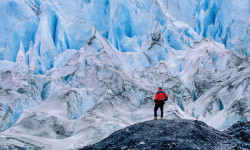
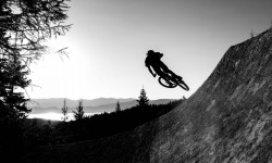
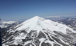
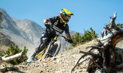
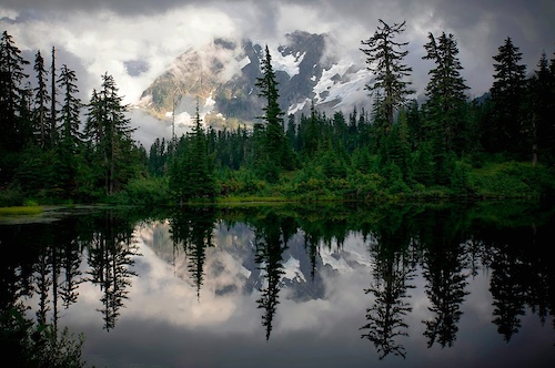
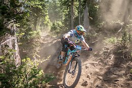
SaveMontana It's practically in the name mountain biking. Montana is a big state with a small population, and trails galore. There are many communities surrounded by dense trail networks, such as Missoula, Bozeman, Butte, and Helena, and there are small mountain towns with great access to big mountain epics, such as Red Lodge, Whitefish, or Philipsburg. In addition, cities such as Billings and Great Falls are finding the potential in rugged open lands nearby. Finally, there are also lift-served bike parks at Whitefish, Big Sky, and Philipsburg.
Stats
- Avg Trail Rating
- Trails (view details)
- 5,037
- Trails Mountain Bike
- 4,008
- Trails E-Bike
- 730
- Trails Hike
- 4,354
- Trails Trail Running
- 4,320
- Trails Horse
- 1,490
- Trails Dirtbike/Moto
- 733
- Trails Observed Trials
- 23
- Trails ATV/ORV/OHV
- 548
- Trails Snowmobile
- 87
- Trails Snowshoe
- 1,129
- Trails Downhill Ski
- 198
- Trails Backcountry Ski
- 402
- Trails Nordic Ski
- 1,152
- Total Distance
- 11,508 miles
- Total Descent
- 1,975,876 ft
- Total Vertical
- 10,195 ft
- Highest Trailhead
- 11,151 ft
- Reports
- 24,284
- Photos
- 7,646
- Ridden Counter
- 220,804
 Articles
12 Endangered Trails to Hike Before They're Gone
Jan 14, 2022 from backpacker.com
From climate change to energy development, various threats promise to wipe out what’s best about America’s 12 most endangered trails.
A Legacy of Singletrack: Montana’s first shuttle bike park opens this summer
Jul 14, 2021 from betamtb.com
The first-ever shuttle bike park is opening on private land in Montana at Legacy Bike Park near Whitefish.
Destination Guide: Where to Sleep, Eat, Drink, and Play in Big Sky
May 28, 2021 from skimag.com
From lodging to après, a ski traveler's guide to Montana's adventure mecca.
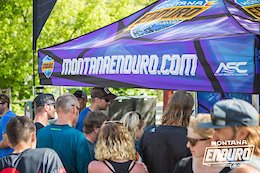
Race Report: Mitch Ropelato & Porsha Murdock Win Big Mountain Enduro Big Sky Season Opener
Aug 26, 2020 from pinkbike.com
8 stages and roughly 5000 feet of climbing dispersed between the transitions.
Sub Regions
- Beaverhead-Deerlodge (3)
- Bitterroot Valley (147)
- Central Montana (50)
- Big Snowy Mountains (27)
- Judith Basin (6)
- Smith River (17)
- Dawson County (2)
- Glacier Country (754)
- Flathead Valley (754)
- Greater Yellowstone (1,372)
- Beaverhead County (185)
- Carbon County (18)
- Gallatin County (623)
- Granite County (41)
- Jefferson County (138)
- Madison County (38)
- Park County (29)
- Silverbow County (290)
- Stillwater County (10)
- Judith Basin County (0)
- Mineral County (2)
- North Mission Valley (0)
- Northwest (2)
- Lincoln County (1)
- Saunder County (1)
- Rocky Mountain Front (101)
- Tower Rock State Park (1)
- Yellowstone County (92)
Popular Montana Mountain Biking Trails
| status | title | difficulty | rating |
|---|---|---|---|
| High Ore Connector Copper City | |||
| Lower High Ore Copper City | |||
| Green Eagle North Copper City | |||
| Fenceline The Rattlesnake | |||
| Leverich Canyon Northern Gallatin Range | |||
| Green Eagle South Copper City | |||
| Ewok The Rattlesnake | |||
| Mountain to Meadow Big Sky Resort | |||
| Sound of Music The Rattlesnake | |||
| Kashmir Whitefish Mountain Resort | |||
| Otter Pop Spencer Mountain | |||
| The Whitefish Trail / Lookout Trail - Spencer Mountain Spencer Mountain | |||
| Mount Helena Ridge Trail (Middle) South Hills | |||
| Mountain to Meadow Big Sky Community Trail System | |||
| Lookout Trail Spencer Mountain |
Montana Mountain Bike Routes
| title | rating | distance |
|---|---|---|
| Mount Helena Ridge to Show-Me-the-Horse South Hills | 6 miles | |
| MTBM - Classic Sheep Mountain Loop The Rattlesnake | 25 miles | |
| Beartrap Gulch Helena | 13 miles | |
| MacDonald Pass Helena | 7 miles | |
| North Fork Loop Big Sky Resort | 8 miles | |
| Mile to Sheep Lionhead | 27 miles | |
| Short Lower North Dry Loop Paradise Valley | 9 miles | |
| Windy Mtn Loop Highwood Mountains | 15 miles | |
| Mount Helena Ridge - Hogsback - Horse South Hills | 13 miles | |
| TNR Deer Creek Sneak Pattee Canyon | 16 miles |
Photos of Montana Mountain Bike
trail: Stuart Peak
302 |
Sep 26, 2017 @ 3:58pm
Sep 26, 2017
trail: Stuart Peak
192 |
Sep 26, 2017 @ 3:57pm
Sep 26, 2017
trail: Muskrat Creek
206 |
Jul 25, 2017 @ 9:47pm
Jul 25, 2017
trail: Muskrat Creek
184 |
Jul 25, 2017 @ 9:46pm
Jul 25, 2017
trail: Eddye McClure East
191 |
Jul 24, 2017 @ 7:34pm
Jul 24, 2017
trail: North Dry Creek
173 |
Jul 2, 2017 @ 5:04pm
Jul 2, 2017
trail: Eddye McClure East
252 |
May 29, 2017 @ 5:23pm
May 29, 2017
trail: Hall Lake
359 |
Oct 12, 2013 @ 10:28pm
Oct 12, 2013Videos of Montana Mountain Bike
featured
![Our Trails Unite Us - Helena, Montana]()
trail: 2006 Trail (north side)
1:41 |
134 |
Nov 2, 2021 , Helena

71 |
May 20, 2022

|
May 15, 2022
trail: Lobo
84 |
May 8, 2022
trail: Sketchy TwoTrack
|
Jan 26, 2022

trail: Sacajawea Summit Trail
1420 |
Jan 3, 2022

trail: Bandolero
22 |
Nov 4, 2021
trail: S-Line
63 |
Oct 23, 2021
Activity Feed
| username | action | type | title | date | |
|---|---|---|---|---|---|
 | MasterB7 | ridden | trail | Yogis | Jul 5, 2022 @ 10:50pm 3 hours |
| ute1 | wishlist | trail | CDT Targhee Pass and 1 more | Jul 5, 2022 @ 9:52pm 4 hours |
| Ramihz | add | photo | in Meridian, Idaho, United States | Jul 5, 2022 @ 8:47pm 5 hours |
| MATHISCA | add | report | Lewistown City Trails | Jul 5, 2022 @ 7:54pm 6 hours |
| Rob9q90bY | ridden | trail | CDT - Pipestone-Homestake | Jul 5, 2022 @ 7:50pm 6 hours |
Recent Comments
| username | type | title | comment | date | |
|---|---|---|---|---|---|
| trail | We came here today and all the trails were... | Jul 5, 2022 @ 7:19pm 7 hours | ||
| trail | Well marked and fun trail! | Jul 5, 2022 @ 6:42pm 7 hours | ||
| trail | Tough climb, rocky and steep | Jul 4, 2022 @ 6:24pm 1 day | ||
| report | @theposko: Thanks for the beta, bummer we... | Jul 4, 2022 @ 4:44pm 1 day | ||
| report | @Ztondre: I'd really love to be wrong about... | Jul 4, 2022 @ 4:12pm 1 day |
Local Badges
-

Tour de SWMMBA - 14 Days In A Row37 awarded -

Copper City Completionist1 awarded -
Tour de SWMMBA - Week 193 awarded -
Tour de SWMMBA - Week 317 awarded -
Tour de SWMMBA - Week 294 awarded -

Tour de SWMMBA - Week 417 awarded
National Scenic Trails & Official Routes
-
Continental Divide Trail
- Mountain Bike
- Hike
- Trail Running
-
Great Western Trail
- Mountain Bike
- E-Bike
- Hike
- Trail Running
- Horse
- Dirtbike/Moto
- ATV/ORV/OHV
-
Pacific Northwest Trail
- Mountain Bike
- Hike
- Trail Running
- Horse


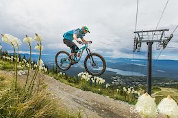
Bike & Skill Parks
| name | type | city | rating |
|---|---|---|---|
| Big Sky Resort | bike park | Big Sky | |
| Discovery Bike Park | bike park | Phillipsburg | |
| Whitefish Mountain Resort | bike park | Whitefish | |
| Armory Park Pump Track | skill park | Whitefish | |
| Big Sky Community Park Pumptrack | skill park | Big Sky |
Upcoming Local Events
-
-
-
-
Pinkbike Articles
Jun 30, 2020
![2020 Montana Enduro Series Cancelled]() 2020 Montana Enduro Series Cancelled
The Montana Bicycle Guild Inc., announced today that it is canceling the 2020 Montana Enduro Series due to the COVID-19 pandemic.
Apr 15, 2020
2020 Montana Enduro Series Cancelled
The Montana Bicycle Guild Inc., announced today that it is canceling the 2020 Montana Enduro Series due to the COVID-19 pandemic.
Apr 15, 2020
![Video: Spotlight on Grassroots Mountain Bike Racing in Montana]() Video: Spotlight on Grassroots Mountain Bike Racing in Montana
The riders, communities and sponsors that ensure grassroots mountain bike racing is alive and well in Montana.
Video: Spotlight on Grassroots Mountain Bike Racing in Montana
The riders, communities and sponsors that ensure grassroots mountain bike racing is alive and well in Montana.
Pinkbike Articles
Jun 30, 2020
 2020 Montana Enduro Series Cancelled
The Montana Bicycle Guild Inc., announced today that it is canceling the 2020 Montana Enduro Series due to the COVID-19 pandemic.
Apr 15, 2020
 Video: Spotlight on Grassroots Mountain Bike Racing in Montana
The riders, communities and sponsors that ensure grassroots mountain bike racing is alive and well in Montana.
 2020 Montana Enduro Series Schedule Announced
 Activity Type Stats
| activitytype | trails | distance | descent | descent distance | total vertical | rating | global rank | state rank | photos | reports | routes | ridelogs |
|---|---|---|---|---|---|---|---|---|---|---|---|---|
| Mountain Bike | 4,007 | 9,107 miles | 1,532,031 ft | 3,637 miles | 9,180 ft | #25 | 7,283 | 24,061 | 320 | 176,098 | ||
| E-Bike | 730 | 2,301 miles | 281,358 ft | 850 miles | 7,421 ft | #34 | 2 | 19,064 | 16 | 1,367 | ||
| Hike | 4,353 | 10,734 miles | 1,741,693 ft | 4,186 miles | 10,177 ft | #25 | 286 | 23,814 | 71 | 19,125 | ||
| Trail Running | 4,320 | 10,687 miles | 1,733,766 ft | 4,169 miles | 10,059 ft | #25 | 26 | 23,801 | 74 | 15,307 | ||
| Horse | 1,490 | 4,762 miles | 744,577 ft | 1,827 mile | 7,362 ft | #10 | 4 | 13,518 | 22 | 76 | ||
| Dirtbike/Moto | 733 | 2,579 miles | 352,822 ft | 1,010 mile | 7,028 ft | #10 | 1 | 12,552 | 9 | 274 | ||
| Observed Trials | 23 | 59 miles | 6,181 ft | 24 miles | 3,570 ft | #9 | 1 | 320 | 39 | |||
| ATV/ORV/OHV | 548 | 2,020 miles | 219,301 ft | 749 miles | 7,028 ft | #7 | 5 | 12,341 | 3 | 54 | ||
| Snowmobile | 87 | 481 miles | 36,575 ft | 147 miles | 6,604 ft | #20 | 1 | 3,446 | 2 | 48 | ||
| Snowshoe | 1,129 | 2,254 miles | 356,145 ft | 851 miles | 6,860 ft | #7 | 1 | 4,867 | 6 | 335 | ||
| Downhill Ski | 198 | 108 miles | 106,972 ft | 100 miles | 6,677 ft | 109 | 6,569 | |||||
| Backcountry Ski | 402 | 1,259 mile | 202,133 ft | 435 miles | 7,533 ft | #8 | 2 | 3,867 | 7 | 4,497 | ||
| Nordic Ski | 1,152 | 2,079 miles | 310,200 ft | 777 miles | 6,276 ft | #3 | 36 | 4,654 | 8 | 9,544 |
- By MONTANABIKERMAN
 FTF TRAILFORKS & contributors
 - Admins: Map Team, chuktA, msmcfate, WillieJacobsz, PlumbBobM, ReckitRolley, MONTANABIKERMAN, evasive, wyomont
- #3117 - 52,770 views
- montana activity log | embed map of Montana mountain bike trails | montana mountain biking points of interest polygons
-
- subscribe
- 3d map
Downloading of trail gps tracks in kml & gpx formats is enabled for Montana.
You must login to download files.