close
Trail Conditions
- Unknown
- Snow Groomed
- Snow Packed
- Snow Covered
- Snow Cover Inadequate
- Freeze/thaw Cycle
- Icy
- Prevalent Mud
- Wet
- Variable
- Ideal
- Dry
- Very Dry
Trail Flow (Ridden Direction)
Trailforks scans users ridelogs to determine the most popular direction each trail is ridden. A good flowing trail network will have most trails flowing in a single direction according to their intension.
The colour categories are based on what percentage of riders are riding a trail in its intended direction.
The colour categories are based on what percentage of riders are riding a trail in its intended direction.
- > 96%
- > 90%
- > 80%
- > 70%
- > 50%
- < 50%
- bi-directional trail
- no data
Trail Last Ridden
Trailforks scans ridelogs to determine the last time a trail was ridden.
- < 2 days
- < 1 week
- < 2 weeks
- < 1 month
- < 6 months
- > 6 months
Trail Ridden Direction
The intended direction a trail should be ridden.
- Downhill Only
- Downhill Primary
- Both Directions
- Uphill Primary
- Uphill Only
- One Direction
Contribute Details
Colors indicate trail is missing specified detail.
- Description
- Photos
- Description & Photos
- Videos
Trail Popularity ?
Trailforks scans ridelogs to determine which trails are ridden the most in the last 9 months.
Trails are compared with nearby trails in the same city region with a possible 25 colour shades.
Think of this as a heatmap, more rides = more kinetic energy = warmer colors.
- most popular
- popular
- less popular
- not popular
ATV/ORV/OHV Filter
Max Vehicle Width
inches
Radar Time
x
Activity Recordings
Trailforks users anonymized public ridelogs from the past 6 months.
- mountain biking recent
- mountain biking (>6 month)
- hiking (1 year)
- moto (1 year)
Activity Recordings
Trailforks users anonymized public skilogs from the past 12 months.
- Downhill Ski
- Backcountry Ski
- Nordic Ski
Jump Magnitude Heatmap
Heatmap of where riders jump on trails. Zoom in to see individual jumps, click circles to view jump details.
Trails Deemphasized
Trails are shown in grey.
Only show trails with NO bikes.
Save the current map location and zoom level as your default home location whenever this page is loaded.
Save** ALL trails in the Number Two Canyon area are closed from December 1st to April 15th. **
The Wenatchee River Ranger District of the Okanogan-Wenatchee National Forest will implement its seasonal road and area closure for the Number Two Canyon area. The goal of this closure is to manage deer winter range to sustain healthy populations of mule deer and elk.
The seasonal closure within the Number Two Canyon Project Area is for all recreational use from December 1 to April 15 annually, including cross-country skiing, snowshoeing, hiking, and mountain biking to avoid distress to animals during this critical period.
There are two exceptions to this closure: Forest Service Road 7101 will remain open to snowmobiles and non-motorized recreational use on the road prism from Number Two Canyon over to Mission Creek during the closure period, and FS Road 7101-500 (the road to the top of Twin Peaks) will be open to non-motorized recreational use from December 1 to January 31 annually as this is the period of deepest snow depth and deer migrate to lower elevations during this period.
This closure period may be extended prior to December 1 or later than April 15 annually in consultation with the Washington Department of Fish and Wildlife, if wintering deer are still present, or if roads are still wet and could be damaged by vehicle use.
Primary Trail Type: Cross-Country
eBikes Allowed:
No
Land Status: National Forest
 google parking directions
 Access Info:
Access: Start from Wenatchee or Number Two Canyon Road (above Wenatchee). If starting from Wenatchee, follow Western Avenue south until it hooks sharply to the right to become Number Two Canyon Road, and ride the road. If driving to reduce the outing time, drive 4.25 miles up Number Two Canyon Road and park at pavement’s end in a pullout on the south side of the road (the small parking area on the north side of the road is private and is not to be used). You can also drive another 0.7 miles past the end of pavement and park at the second gate where the dirt road you’ve been following (FS Road 7101) makes a sharp hook to the left. The condition of the dirt road changes each year depending on how badly it has been rutted by mudders -- sometimes high-clearance vehicles will be needed, sometimes not. No permits are needed to park at either of these parking areas.
Activities Click to view
- Mountain Bike
31 trails
- Hike
29 trails
- Trail Running
30 trails
Region Details
- 4
- 7
- 16
- 3
Region Status
Caution as of Apr 19, 2021Stats
- Avg Trail Rating
- Trails (view details)
- 30
- Trails Mountain Bike
- 31
- Trails E-Bike
- 3
- Trails Hike
- 29
- Trails Trail Running
- 30
- Trails Horse
- 1
- Total Distance
- 28 miles
- Total Descent
- 8,224 ft
- Total Vertical
- 2,521 ft
- Highest Trailhead
- 4,625 ft
- Reports
- 443
- Photos
- 66
- Ridden Counter
- 5,522
Popular #2 Canyon Mountain Biking Trails
#2 Canyon Mountain Bike Routes
| title | rating | distance |
|---|---|---|
| #2Loop | 8 miles | |
| The Devil's Twin | 70 miles | |
| Huge Local Loop | 29 miles | |
| #2 Big Loop | 16 miles | |
| #2 Canyon to Sage Hills | 17 miles | |
| #2 to Sage | 14 miles | |
| No. 2 Canyon to bottom of Balsamroot | 19 miles | |
| Waterbar World Loop | 8 miles | |
| 15 mile #2 Canyon Ride | popular ridelog | 15 miles |
| 16 mile #2 Canyon Ride | popular ridelog | 16 miles |
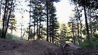
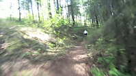
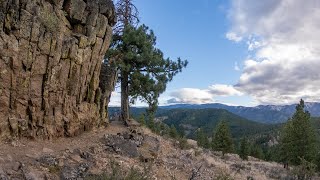
Photos of #2 Canyon Mountain Bike
trail: New Sundance
3 |
Jun 27, 2022 @ 10:25pm
Jun 27, 2022
trail: New Sundance
3 |
Jun 27, 2022 @ 10:24pm
Jun 27, 2022
trail: Double D's
6 |
Jun 27, 2022 @ 10:22pm
Jun 27, 2022
trail: Eye Candy
2 |
Jun 21, 2022 @ 8:11pm
Jun 21, 2022
trail: New Sundance
31 |
May 31, 2022 @ 11:32am
May 31, 2022
trail: Stairway to Heaven
31 |
May 31, 2022 @ 11:32am
May 31, 2022
trail: New Sundance
23 |
May 31, 2022 @ 11:30am
May 31, 2022
trail: PTD
186 |
Jul 15, 2021 @ 10:38pm
Jul 15, 2021Videos of #2 Canyon Mountain Bike
trail: PTD
270 |
Jun 21, 2021
trail: WATERSLIDE
0:45 |
623 |
May 19, 2012

trail: Stairway to Heaven
5:40 |
559 |
Aug 24, 2020 , Wenatchee
trail: Stairway to Heaven
5:40 |
231 |
Aug 24, 2020 , Wenatchee
Current Trail Warnings
| status | trail | date | condition | user | info |
|---|---|---|---|---|---|
| ROAD RAGE | Jun 28, 2022 @ 9:26pm Jun 28, 2022 | Variable | MegaBadass42069 | Trail was brushed out. A little narrow in... |
Recent Trail Reports
| status | trail | date | condition | info | user |
|---|---|---|---|---|---|
| Stairway to Heaven | Jul 2, 2022 @ 9:20am Jul 2, 2022 | Dry | ElwahReturns | ||
| Stairway to Heaven | Jul 2, 2022 @ 9:20am Jul 2, 2022 | Dry | ElwahReturns | ||
| For the view | Jul 2, 2022 @ 9:20am Jul 2, 2022 | Dry | ElwahReturns | ||
| PTD | Jul 2, 2022 @ 9:20am Jul 2, 2022 | Dry | ElwahReturns | ||
| Wag More | Jul 2, 2022 @ 9:20am Jul 2, 2022 | Dry | ElwahReturns | ||
| WATERSLIDE | Jun 26, 2022 @ 11:29am Jun 26, 2022 | Ideal | MegaBadass42069 | ||
| Easy Monday | Jun 24, 2022 @ 1:33pm Jun 24, 2022 | Dry | emaw | ||
| Eye Candy | Jun 18, 2022 @ 10:40am Jun 18, 2022 | Ideal | emaw | ||
| East Peak | Jun 18, 2022 @ 10:40am Jun 18, 2022 | Dry | emaw | ||
| New Sundance | Jun 18, 2022 @ 10:40am Jun 18, 2022 | Ideal | emaw |
Activity Feed
| username | action | type | title | date | |
|---|---|---|---|---|---|
 | tskpe | ridden | trail | Eye Candy | Jul 4, 2022 @ 2:34pm 2 days |
 | Elliotrk02 | ridden | poi | TTF and 1 more | Jul 3, 2022 @ 3:07pm 2 days |
| Elliotrk02 | ridden | trail | WATERSLIDE and 4 more | Jul 3, 2022 @ 3:01pm 2 days |
| Bchr | wishlist | route | #2 Big Loop | Jul 3, 2022 @ 9:26am 3 days |
 | homemadesalsa | wishlist | trail | Stairway to Heaven | Jul 3, 2022 @ 9:16am 3 days |
Recent Comments
| username | type | title | comment | date | |
|---|---|---|---|---|---|
 | trail | climbed the road and enjoyed the flowy, fast,... | Jun 21, 2022 @ 8:16pm Jun 21, 2022 | ||
 | trail | Fun mix of flow, roll-overs, drops, slabs and... | Jun 12, 2022 @ 3:46pm Jun 12, 2022 | ||
| trail | Super fun trail. | May 31, 2022 @ 11:35am May 31, 2022 | ||
| trail | Great loop. We rode it ccw and it rode well... | May 31, 2022 @ 11:34am May 31, 2022 | ||
| trail | Awesome trail. Good use of some neat terrain.... | May 31, 2022 @ 11:29am May 31, 2022 |
Nearby Areas
| name | distance | ||||
|---|---|---|---|---|---|
| Sage Hills | 7 | 18 | 1 | 3.5 km | |
| Devils - Mission | 3 | 11 | 3 | 4.1 km | |
| Saddle Rock Natural Area | 4 | 4.4 km | |||
| Squilchuck State Park | 9 | 5 | 1 | 7.3 km | |
| Mission Ridge Ski Area | 7.9 km |
Local Badges
-

Completionist0 awarded
Local Products
Activity Type Stats
| activitytype | trails | distance | descent | descent distance | total vertical | rating | global rank | state rank | photos | reports | routes | ridelogs |
|---|---|---|---|---|---|---|---|---|---|---|---|---|
| Mountain Bike | 31 | 28 miles | 8,225 ft | 16 miles | 2,520 ft | #1,016 | #531 | 66 | 443 | 8 | 3,335 | |
| E-Bike | 3 | 2 miles | 1,073 ft | 2 miles | 686 ft | 339 | 110 | |||||
| Hike | 29 | 26 miles | 7,851 ft | 15 miles | 2,520 ft | #852 | #523 | 426 | 1 | 53 | ||
| Trail Running | 30 | 27 miles | 8,163 ft | 16 miles | 2,520 ft | #782 | #466 | 435 | 1 | 44 | ||
| Horse | 1 | 4,528 ft | 79 ft | 213 ft | 112 |
- By thegoat9 & contributors
- Admins: EMBA-CW, TheMunly
- #5441 - 14,691 views
- #2 canyon activity log | embed map of #2 Canyon mountain bike trails | #2 canyon mountain biking points of interest
Downloading of trail gps tracks in kml & gpx formats is enabled for #2 Canyon.
You must login to download files.