close
Trail Conditions
- Unknown
- Snow Groomed
- Snow Packed
- Snow Covered
- Snow Cover Inadequate
- Freeze/thaw Cycle
- Icy
- Prevalent Mud
- Wet
- Variable
- Ideal
- Dry
- Very Dry
Trail Flow (Ridden Direction)
Trailforks scans users ridelogs to determine the most popular direction each trail is ridden. A good flowing trail network will have most trails flowing in a single direction according to their intension.
The colour categories are based on what percentage of riders are riding a trail in its intended direction.
The colour categories are based on what percentage of riders are riding a trail in its intended direction.
- > 96%
- > 90%
- > 80%
- > 70%
- > 50%
- < 50%
- bi-directional trail
- no data
Trail Last Ridden
Trailforks scans ridelogs to determine the last time a trail was ridden.
- < 2 days
- < 1 week
- < 2 weeks
- < 1 month
- < 6 months
- > 6 months
Trail Ridden Direction
The intended direction a trail should be ridden.
- Downhill Only
- Downhill Primary
- Both Directions
- Uphill Primary
- Uphill Only
- One Direction
Contribute Details
Colors indicate trail is missing specified detail.
- Description
- Photos
- Description & Photos
- Videos
Trail Popularity ?
Trailforks scans ridelogs to determine which trails are ridden the most in the last 9 months.
Trails are compared with nearby trails in the same city region with a possible 25 colour shades.
Think of this as a heatmap, more rides = more kinetic energy = warmer colors.
- most popular
- popular
- less popular
- not popular
ATV/ORV/OHV Filter
Max Vehicle Width
inches
Radar Time
x
Activity Recordings
Trailforks users anonymized public ridelogs from the past 6 months.
- mountain biking recent
- mountain biking (>6 month)
- hiking (1 year)
- moto (1 year)
Activity Recordings
Trailforks users anonymized public skilogs from the past 12 months.
- Downhill Ski
- Backcountry Ski
- Nordic Ski
Jump Magnitude Heatmap
Heatmap of where riders jump on trails. Zoom in to see individual jumps, click circles to view jump details.
Trails Deemphasized
Trails are shown in grey.
Only show trails with NO bikes.
Save the current map location and zoom level as your default home location whenever this page is loaded.
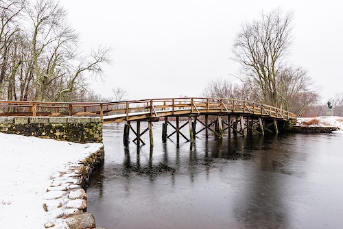
SaveThis area contains mostly easy to low intermediate trails and is great for those who are learning to ride. It contains land managed by Essex County Greenbelt and the Town of Boxford. In addition, much of the land is owned by a farm and is open to public use because of the generosity of the landowners. The adjacent Boy Scout Park area has some short trails, a Boy Scout campground, a large playground, and ballfields. Many of the trails run near private property and/or the farm. All riders and trail users should be courteous so these trails remain open to the public. Many trails are marked with green arrows on white backgrounds.
Primary Trail Type: Cross-Country
eBikes Allowed:
No
Land Status: Community Forest
 google parking directions
 Disclaimer:
Illegal singletrack has been constructed in the north end of this riding area. Please stay on marked trails only!
Recently, the farm has cleared land for new pastures. This has caused the closure of the Hill Trail and caused a few other trails to be re-routed. These changes are reflected on this website.
Recently, the farm has cleared land for new pastures. This has caused the closure of the Hill Trail and caused a few other trails to be re-routed. These changes are reflected on this website.
Activities Click to view
- Mountain Bike
20 trails
- Hike
20 trails
- Trail Running
20 trails
- Horse
0 trails
- Snowshoe
0 trails
- Nordic Ski
0 trails
Region Details
- 1
- 15
- 4
Region Status
Caution as of Jul 24, 2021Stats
- Trails (view details)
- 20
- Trails Mountain Bike
- 20
- Trails Hike
- 20
- Trails Trail Running
- 20
- Total Distance
- 6 miles
- Total Descent
- 491 ft
- Total Vertical
- 79 ft
- Highest Trailhead
- 148 ft
- Reports
- 14
- Photos
- 6
- Ridden Counter
- 320
Popular 100 Acre Woods Mountain Biking Trails
Photos of 100 Acre Woods Mountain Bike
trail: Coolidge Trail
32 |
Aug 9, 2020 @ 9:34am
Aug 9, 2020
trail: Coolidge Trail
86 |
Aug 9, 2020 @ 9:34am
Aug 9, 2020
trail: Boxford Village Trail
50 |
Aug 4, 2020 @ 2:10pm
Aug 4, 2020
trail: Boxford Village Trail
27 |
Aug 4, 2020 @ 2:10pm
Aug 4, 2020
trail: Whitney Road Connector
53 |
Aug 4, 2020 @ 1:54pm
Aug 4, 2020Recent Trail Reports
| status | trail | date | condition | info | user |
|---|---|---|---|---|---|
| Livermore Woods Trail | Jul 24, 2021 @ 2:56pm Jul 24, 2021 | Unknown | acyclist | ||
| Boxford Village Trail | Jan 10, 2021 @ 8:26am Jan 10, 2021 | Unknown | K1colbert | ||
| Whitney Road Connector | Aug 12, 2020 @ 3:42am Aug 12, 2020 | Ideal | alanabrams567 | ||
| Valley Connector | May 19, 2020 @ 12:29pm May 19, 2020 | Ideal | NewEnglandSkier13 MV NEMBA | ||
| Maddock Connector | May 19, 2020 @ 12:29pm May 19, 2020 | Ideal | NewEnglandSkier13 MV NEMBA | ||
| Dorman Descent | May 12, 2020 @ 9:26am May 12, 2020 | Dry | NewEnglandSkier13 MV NEMBA | ||
| BCT - Boy Scout Park Trail | May 12, 2020 @ 9:26am May 12, 2020 | Dry | NewEnglandSkier13 MV NEMBA | ||
| Bridge Spur | May 12, 2020 @ 9:26am May 12, 2020 | Dry | NewEnglandSkier13 MV NEMBA | ||
| Dorman Woods Trail | May 12, 2020 @ 9:26am May 12, 2020 | Dry | NewEnglandSkier13 MV NEMBA |
Activity Feed
| username | action | type | title | date | |
|---|---|---|---|---|---|
 | acyclist | ridden | trail | Livermore Woods Trail | May 22, 2022 @ 7:41pm May 22, 2022 |
| acyclist | add | report | Livermore Woods Trail | Jul 24, 2021 @ 2:57pm Jul 24, 2021 |
| K1colbert | add | report | Boxford Village Trail | Jan 10, 2021 @ 11:27am Jan 10, 2021 |
 | alanabrams567 | add | report | Whitney Road Connector | Aug 13, 2020 @ 8:10am Aug 13, 2020 |
| alanabrams567 | add | photo | in Marblehead, Massachusetts, United States and 1 more | Aug 9, 2020 @ 9:34am Aug 9, 2020 |
Nearby Areas
| name | distance | ||||
|---|---|---|---|---|---|
| Lockwood Forest | 9 | 6 | 1.2 km | ||
| Lord Forest | 10 | 1.2 km | |||
| Perkins Woods | 5 | 5 | 1.3 km | ||
| Boxford Common | 8 | 2 | 1.4 km | ||
| Boxford State Forest | 65 | 2 | 1.9 km |
National Scenic Trails & Official Routes
-
Bay Circuit Trail
- Mountain Bike
- E-Bike
- Hike
- Trail Running
Activity Type Stats
| activitytype | trails | distance | descent | descent distance | total vertical | rating | global rank | state rank | photos | reports | routes | ridelogs |
|---|---|---|---|---|---|---|---|---|---|---|---|---|
| Mountain Bike | 20 | 6 miles | 492 ft | 2 miles | 79 ft | #9,549 | #4,004 | 6 | 14 | 123 | ||
| Hike | 20 | 6 miles | 492 ft | 2 miles | 79 ft | #8,507 | #3,844 | 14 | 5 | |||
| Trail Running | 20 | 6 miles | 492 ft | 2 miles | 79 ft | #8,484 | #3,823 | 14 | 7 |
- By NewEnglandSkier13
 MV NEMBA NS NEMBA & contributors
 - Admins: SiamDelightRules
- #29169 - 2,174 views
- 100 acre woods activity log | embed map of 100 Acre Woods mountain bike trails | 100 acre woods mountain biking points of interest
Downloading of trail gps tracks in kml & gpx formats is enabled for 100 Acre Woods.
You must login to download files.