close
Trail Conditions
- Unknown
- Snow Groomed
- Snow Packed
- Snow Covered
- Snow Cover Inadequate
- Freeze/thaw Cycle
- Icy
- Prevalent Mud
- Wet
- Variable
- Ideal
- Dry
- Very Dry
Trail Flow (Ridden Direction)
Trailforks scans users ridelogs to determine the most popular direction each trail is ridden. A good flowing trail network will have most trails flowing in a single direction according to their intension.
The colour categories are based on what percentage of riders are riding a trail in its intended direction.
The colour categories are based on what percentage of riders are riding a trail in its intended direction.
- > 96%
- > 90%
- > 80%
- > 70%
- > 50%
- < 50%
- bi-directional trail
- no data
Trail Last Ridden
Trailforks scans ridelogs to determine the last time a trail was ridden.
- < 2 days
- < 1 week
- < 2 weeks
- < 1 month
- < 6 months
- > 6 months
Trail Ridden Direction
The intended direction a trail should be ridden.
- Downhill Only
- Downhill Primary
- Both Directions
- Uphill Primary
- Uphill Only
- One Direction
Contribute Details
Colors indicate trail is missing specified detail.
- Description
- Photos
- Description & Photos
- Videos
Trail Popularity ?
Trailforks scans ridelogs to determine which trails are ridden the most in the last 9 months.
Trails are compared with nearby trails in the same city region with a possible 25 colour shades.
Think of this as a heatmap, more rides = more kinetic energy = warmer colors.
- most popular
- popular
- less popular
- not popular
ATV/ORV/OHV Filter
Max Vehicle Width
inches
Radar Time
x
Activity Recordings
Trailforks users anonymized public ridelogs from the past 6 months.
- mountain biking recent
- mountain biking (>6 month)
- hiking (1 year)
- moto (1 year)
Activity Recordings
Trailforks users anonymized public skilogs from the past 12 months.
- Downhill Ski
- Backcountry Ski
- Nordic Ski
Jump Magnitude Heatmap
Heatmap of where riders jump on trails. Zoom in to see individual jumps, click circles to view jump details.
Trails Deemphasized
Trails are shown in grey.
Only show trails with NO bikes.
Save the current map location and zoom level as your default home location whenever this page is loaded.
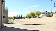
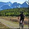
Save12 Mile Coulee is a favourite spot for a quick lap in the NW of Calgary. The trails are natural or hand-built. Walkers and runners make up 90% of trail users, so be nice...
Primary Trail Type: Cross-Country
eBikes Allowed:
Yes
AKA: The Coulee
Land Status: Managed by Local Riding Association
 google parking directions
 Access Info:
Trail access is from the community of Tuscany or from the parking lot just off Tuscany Blvd.
Activities Click to view
- Mountain Bike
15 trails
- E-Bike
15 trails
- Hike
15 trails
- Trail Running
15 trails
Region Details
- 2
- 5
- 7
- 1
Region Status
Caution as of Dec 9, 2021Stats
- Avg Trail Rating
- Trails (view details)
- 15
- Trails Mountain Bike
- 15
- Trails E-Bike
- 15
- Trails Hike
- 15
- Trails Trail Running
- 15
- Total Distance
- 10 miles
- Total Descent
- 1,436 ft
- Total Vertical
- 385 ft
- Highest Trailhead
- 3,990 ft
- Reports
- 376
- Photos
- 46
- Ridden Counter
- 3,271
Popular 12 Mile Coulee Mountain Biking Trails
12 Mile Coulee Mountain Bike Routes
| title | rating | distance |
|---|---|---|
| Chancellor Fondo 120 | 70 miles |
Photos of 12 Mile Coulee Mountain Bike
trail: Exit Strategy
58 |
Nov 18, 2020 @ 1:55pm
Nov 18, 2020
trail: Tuscany Bluff
135 |
Sep 3, 2020 @ 11:53am
Sep 3, 2020
trail: Tuscany Bluff
127 |
Sep 3, 2020 @ 11:53am
Sep 3, 2020
trail: Tuscany Bluff
121 |
Sep 3, 2020 @ 11:52am
Sep 3, 2020
trail: 12 Mile Coulee
128 |
Aug 28, 2020 @ 9:09pm
Aug 28, 2020
trail: Lose Yourself
46 |
Aug 8, 2020 @ 10:33am
Aug 8, 2020
trail: 12 Mile Coulee
250 |
Sep 25, 2019 @ 6:45am
Sep 25, 2019
trail: 12 Mile Coulee
174 |
Dec 23, 2018 @ 7:23pm
Dec 23, 2018Videos of 12 Mile Coulee Mountain Bike

trail: 12 Mile Coulee
25 |
Oct 19, 2021
trail: 12 Mile Coulee
1:20 |
278 |
Sep 14, 2016

trail: Tuscany Bluff
8:37 |
16 |
Jun 1, 2022 , Calgary
trail: 12 Mile Coulee
22 |
May 30, 2022 , Calgary
trail: 12 Mile Coulee
8:37 |
20 |
May 26, 2022 , Calgary

trail: 12 Mile Coulee
5:00 |
490 |
Nov 3, 2020 , Calgary

19:15 |
223 |
Oct 16, 2020

trail: 12 Mile Alt.
2:15 |
258 |
Jun 14, 2020 , Calgary
Recent Trail Reports
| status | trail | date | condition | info | user |
|---|---|---|---|---|---|
| Extended++ | Jun 28, 2022 @ 10:12am Jun 28, 2022 | Wet | MoosePoo | ||
| 12 Mile Coulee | Jun 19, 2022 @ 10:22am Jun 19, 2022 | Variable | curtis-p-ab | ||
| 12 Mile Connector | Jun 19, 2022 @ 10:22am Jun 19, 2022 | Variable | curtis-p-ab | ||
| 12 Mile Alt. | Jun 19, 2022 @ 10:22am Jun 19, 2022 | Variable | curtis-p-ab | ||
| Exit Strategy | Jun 9, 2022 @ 9:18am Jun 9, 2022 | Dry | jvenhuis | ||
| 12 Mile Alt. | May 27, 2022 @ 8:37am May 27, 2022 | Variable | Nochor | ||
| Highline Alt Connect | May 26, 2022 @ 3:28pm May 26, 2022 | Ideal | Iamkeri | ||
| Find Yourself | Dec 9, 2021 @ 2:09pm Dec 9, 2021 | Snow Covered | landonbailey | ||
| Tuscany Bluff | Nov 5, 2021 @ 9:21am Nov 5, 2021 | Freeze/thaw Cycle | jvenhuis | ||
| Lower West Side Highline | Oct 7, 2021 @ 6:45pm Oct 7, 2021 | Ideal | ChrisLarch |
Activity Feed
| username | action | type | title | date | |
|---|---|---|---|---|---|
 | Piktas-Seskas | wishlist | trail | 12 Mile Coulee | Jul 3, 2022 @ 11:13am 3 days |
| slowscott | vote | trail | Extended++ | Jun 29, 2022 @ 9:17am Jun 29, 2022 |
| MoosePoo | add | report | Extended++ | Jun 28, 2022 @ 3:53pm Jun 28, 2022 |
| curtis-p-ab | add | report | 12 Mile Coulee and 2 more | Jun 22, 2022 @ 4:40pm Jun 22, 2022 |
| Aggies8602 | wishlist | trail | 12 Mile Coulee | Jun 15, 2022 @ 2:05pm Jun 15, 2022 |
Recent Comments
| username | type | title | comment | date | |
|---|---|---|---|---|---|
 | trail | Everything doesn't HAVE to be on Trailforks. | Jul 3, 2021 @ 9:39am Jul 3, 2021 | ||
| trail | Good | May 19, 2021 @ 7:48pm May 19, 2021 | ||
 | trail | Fun trail with a few steep chutes to hike and... | Apr 27, 2021 @ 8:37pm Apr 27, 2021 | ||
| trail | 04/27/2021 trail is 95% dry and good to go | Apr 27, 2021 @ 10:54am Apr 27, 2021 | ||
 | trail | Jan 3, afternoon / Satisfying. Tacky awesomeness. | Jan 3, 2021 @ 4:59pm Jan 3, 2021 |
Nearby Areas
| name | distance | ||||
|---|---|---|---|---|---|
| Valley Ridge | 2 | 4 | 2 | 1.4 km | |
| Bowmont Park | 18 | 5 | 2.3 km | ||
| Canada Olympic Park | 4 | 13 | 6 | 2.6 km | |
| Bearspaw | 2 | 2.6 km | |||
| Paskapoo Slopes | 34 | 34 | 3 | 3.1 km |
Activity Type Stats
| activitytype | trails | distance | descent | descent distance | total vertical | rating | global rank | state rank | photos | reports | routes | ridelogs |
|---|---|---|---|---|---|---|---|---|---|---|---|---|
| Mountain Bike | 15 | 10 miles | 1,437 ft | 6 miles | 384 ft | #1,726 | #40 | 46 | 376 | 1 | 6,530 | |
| E-Bike | 15 | 10 miles | 1,437 ft | 6 miles | 384 ft | #525 | #23 | 362 | 35 | |||
| Hike | 15 | 10 miles | 1,437 ft | 6 miles | 384 ft | #1,332 | #36 | 374 | 32 | |||
| Trail Running | 15 | 10 miles | 1,437 ft | 6 miles | 384 ft | #1,339 | #36 | 374 | 2 | 284 |
- By pinkrobe CMBA & contributors
- Admins: AEF, warrenmacdonald, CMBA, DonYx, ryancartiers
- #10528 - 14,615 views
- 12 mile coulee activity log | embed map of 12 Mile Coulee mountain bike trails | 12 mile coulee mountain biking points of interest
Downloading of trail gps tracks in kml & gpx formats is enabled for 12 Mile Coulee.
You must login to download files.