close
Trail Conditions
- Unknown
- Snow Groomed
- Snow Packed
- Snow Covered
- Snow Cover Inadequate
- Freeze/thaw Cycle
- Icy
- Prevalent Mud
- Wet
- Variable
- Ideal
- Dry
- Very Dry
Trail Flow (Ridden Direction)
Trailforks scans users ridelogs to determine the most popular direction each trail is ridden. A good flowing trail network will have most trails flowing in a single direction according to their intension.
The colour categories are based on what percentage of riders are riding a trail in its intended direction.
The colour categories are based on what percentage of riders are riding a trail in its intended direction.
- > 96%
- > 90%
- > 80%
- > 70%
- > 50%
- < 50%
- bi-directional trail
- no data
Trail Last Ridden
Trailforks scans ridelogs to determine the last time a trail was ridden.
- < 2 days
- < 1 week
- < 2 weeks
- < 1 month
- < 6 months
- > 6 months
Trail Ridden Direction
The intended direction a trail should be ridden.
- Downhill Only
- Downhill Primary
- Both Directions
- Uphill Primary
- Uphill Only
- One Direction
Contribute Details
Colors indicate trail is missing specified detail.
- Description
- Photos
- Description & Photos
- Videos
Trail Popularity ?
Trailforks scans ridelogs to determine which trails are ridden the most in the last 9 months.
Trails are compared with nearby trails in the same city region with a possible 25 colour shades.
Think of this as a heatmap, more rides = more kinetic energy = warmer colors.
- most popular
- popular
- less popular
- not popular
ATV/ORV/OHV Filter
Max Vehicle Width
inches
Radar Time
x
Activity Recordings
Trailforks users anonymized public ridelogs from the past 6 months.
- mountain biking recent
- mountain biking (>6 month)
- hiking (1 year)
- moto (1 year)
Activity Recordings
Trailforks users anonymized public skilogs from the past 12 months.
- Downhill Ski
- Backcountry Ski
- Nordic Ski
Jump Magnitude Heatmap
Heatmap of where riders jump on trails. Zoom in to see individual jumps, click circles to view jump details.
Trails Deemphasized
Trails are shown in grey.
Only show trails with NO bikes.
Save the current map location and zoom level as your default home location whenever this page is loaded.
Save
No description for 14 Mile Creek has been added yet!
Login or register to submit one.
Activities Click to view
- Mountain Bike
5 trails
- E-Bike
0 trails
- Hike
5 trails
- Trail Running
5 trails
Region Details
- 2
- 1
- 1
- 1
Region Status
Caution as of Jun 3, 2021Stats
- Trails (view details)
- 5
- Trails Mountain Bike
- 5
- Trails Hike
- 5
- Trails Trail Running
- 5
- Total Distance
- 3 miles
- Total Descent Distance
- 3,848 ft
- Total Descent
- 90 ft
- Total Vertical
- 181 ft
- Highest Trailhead
- 426 ft
- Reports
- 19
- Photos
- 47
- Ridden Counter
- 86
Popular 14 Mile Creek Mountain Biking Trails
| status | title | difficulty | rating |
|---|---|---|---|
| 14 Mile Creek-South | |||
| The Homecoming Trail | |||
| The Pier | |||
| Waterfront Trail (Front to Allan) | |||
| Sherwood Forest Loop |
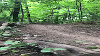
Photos of 14 Mile Creek Mountain Bike
trail: 14 Mile Creek-South
46 |
Sep 7, 2021 @ 7:20am
Sep 7, 2021
trail: 14 Mile Creek-South
39 |
Sep 7, 2021 @ 7:20am
Sep 7, 2021
trail: 14 Mile Creek-South
39 |
Sep 7, 2021 @ 7:19am
Sep 7, 2021
trail: 14 Mile Creek-South
42 |
Sep 7, 2021 @ 7:19am
Sep 7, 2021
trail: 14 Mile Creek-South
44 |
Sep 7, 2021 @ 7:19am
Sep 7, 2021
trail: 14 Mile Creek-South
31 |
Sep 7, 2021 @ 7:19am
Sep 7, 2021
trail: 14 Mile Creek-South
34 |
Sep 7, 2021 @ 7:17am
Sep 7, 2021
trail: 14 Mile Creek-South
40 |
Sep 7, 2021 @ 7:17am
Sep 7, 2021Videos of 14 Mile Creek Mountain Bike
trail: 14 Mile Creek-South
|
Sep 7, 2021
Recent Trail Reports
| status | trail | date | condition | info | user |
|---|---|---|---|---|---|
| 14 Mile Creek-South | Jun 25, 2022 @ 10:00am Jun 25, 2022 | Dry | cmyEvoSS | ||
| Waterfront Trail (Front to Allan) | Jun 19, 2022 @ 10:36am Jun 19, 2022 | Dry | lhzawd | ||
| The Homecoming Trail | Jun 19, 2022 @ 10:36am Jun 19, 2022 | Dry | lhzawd |
Activity Feed
| username | action | type | title | date | |
|---|---|---|---|---|---|
 | cmyEvoSS | add | report | 14 Mile Creek-South | Jun 25, 2022 @ 10:00am Jun 25, 2022 |
| cmyEvoSS | ridden | trail | 14 Mile Creek-South | Jun 25, 2022 @ 9:57am Jun 25, 2022 |
| lungsnlegs | add | report | 14 Mile Creek-South | Jun 21, 2022 @ 5:03am Jun 21, 2022 |
| lhzawd | add | report | Waterfront Trail (Front to Allan) and 1 more | Jun 19, 2022 @ 6:23pm Jun 19, 2022 |
| nshein01 | add | trail | Sherwood Forest Loop | May 24, 2022 @ 10:52am May 24, 2022 |
Recent Comments
| username | type | title | comment | date | |
|---|---|---|---|---|---|
| trail | Does anyone know if you are allowed to go... | Sep 10, 2021 @ 9:48am Sep 10, 2021 | ||
| trail | Best way to access is right after you turn... | Sep 4, 2021 @ 7:50pm Sep 4, 2021 | ||
 | report | Great trails | May 24, 2021 @ 3:04pm May 24, 2021 | ||
| report | Many thanks to the persons for clearing the... | Dec 6, 2020 @ 8:51am Dec 6, 2020 | ||
| trail | Coming in from Upper Muddle Road, I got stuck... | Nov 8, 2020 @ 6:26pm Nov 8, 2020 |
Nearby Areas
| name | distance | ||||
|---|---|---|---|---|---|
| Bronte Creek | 10 | 3 | 1 | 2.3 km | |
| 16 Mile Creek | 12 | 11 | 4 | 1 | 2.8 km |
| Ennisclare Park | 4 | 1 | 1 | 5.3 km | |
| Joshua's Valley Park | 10 | 14 | 1 | 2 | 6.4 km |
| Spencer Smith Park | 7.6 km |
Local Mountain Biking Directory
-
Cyclepath OakvilleBike Shop
![Cyclepath Oakville]()
-
Gears Bike Shop OakvilleBike Shop
-
Racer Sportif OakvilleBike Shop
Activity Type Stats
| activitytype | trails | distance | descent | descent distance | total vertical | rating | global rank | state rank | photos | reports | routes | ridelogs |
|---|---|---|---|---|---|---|---|---|---|---|---|---|
| Mountain Bike | 5 | 3 miles | 89 ft | 3,848 ft | 180 ft | #6,307 | #143 | 47 | 19 | 175 | ||
| Hike | 5 | 3 miles | 89 ft | 3,848 ft | 180 ft | #5,443 | #134 | 19 | 14 | |||
| Trail Running | 5 | 3 miles | 89 ft | 3,848 ft | 180 ft | #5,450 | #133 | 19 | 33 |
- By markholloway
 Trailforks & contributors
 - Admins: apply
- #42932 - 932 views
- 14 mile creek activity log | embed map of 14 Mile Creek mountain bike trails |
Downloading of trail gps tracks in kml & gpx formats is enabled for 14 Mile Creek.
You must login to download files.