close
Trail Conditions
- Unknown
- Snow Groomed
- Snow Packed
- Snow Covered
- Snow Cover Inadequate
- Freeze/thaw Cycle
- Icy
- Prevalent Mud
- Wet
- Variable
- Ideal
- Dry
- Very Dry
Trail Flow (Ridden Direction)
Trailforks scans users ridelogs to determine the most popular direction each trail is ridden. A good flowing trail network will have most trails flowing in a single direction according to their intension.
The colour categories are based on what percentage of riders are riding a trail in its intended direction.
The colour categories are based on what percentage of riders are riding a trail in its intended direction.
- > 96%
- > 90%
- > 80%
- > 70%
- > 50%
- < 50%
- bi-directional trail
- no data
Trail Last Ridden
Trailforks scans ridelogs to determine the last time a trail was ridden.
- < 2 days
- < 1 week
- < 2 weeks
- < 1 month
- < 6 months
- > 6 months
Trail Ridden Direction
The intended direction a trail should be ridden.
- Downhill Only
- Downhill Primary
- Both Directions
- Uphill Primary
- Uphill Only
- One Direction
Contribute Details
Colors indicate trail is missing specified detail.
- Description
- Photos
- Description & Photos
- Videos
Trail Popularity ?
Trailforks scans ridelogs to determine which trails are ridden the most in the last 9 months.
Trails are compared with nearby trails in the same city region with a possible 25 colour shades.
Think of this as a heatmap, more rides = more kinetic energy = warmer colors.
- most popular
- popular
- less popular
- not popular
ATV/ORV/OHV Filter
Max Vehicle Width
inches
Radar Time
x
Activity Recordings
Trailforks users anonymized public ridelogs from the past 6 months.
- mountain biking recent
- mountain biking (>6 month)
- hiking (1 year)
- moto (1 year)
Activity Recordings
Trailforks users anonymized public skilogs from the past 12 months.
- Downhill Ski
- Backcountry Ski
- Nordic Ski
Jump Magnitude Heatmap
Heatmap of where riders jump on trails. Zoom in to see individual jumps, click circles to view jump details.
Trails Deemphasized
Trails are shown in grey.
Only show trails with NO bikes.
Save the current map location and zoom level as your default home location whenever this page is loaded.
Save
No description for 16 Mile Creek has been added yet!
Login or register to submit one.
 google parking directions
Primary Trail Type: Cross-Country
google parking directions Activities Click to view
- Mountain Bike
29 trails
- Hike
24 trails
- Trail Running
23 trails
- Snowshoe
15 trails
Region Details
- 1
- 12
- 11
- 4
- 1
Region Status
Open as of Jun 20, 2021Local Trail Association
Stats
- Avg Trail Rating
- Trails (view details)
- 29
- Trails Mountain Bike
- 29
- Trails E-Bike
- 5
- Trails Hike
- 24
- Trails Trail Running
- 23
- Trails Snowshoe
- 15
- Total Distance
- 15 miles
- Total Descent
- 1,991 ft
- Total Vertical
- 204 ft
- Highest Trailhead
- 547 ft
- Reports
- 188
- Photos
- 81
- Ridden Counter
- 1,885
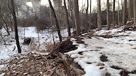
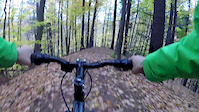
Popular 16 Mile Creek Mountain Biking Trails
Photos of 16 Mile Creek Mountain Bike
trail: 16 Mile Creek Loop
20 |
May 15, 2022 @ 9:32am
May 15, 2022
trail: 16 Mile Creek Loop
55 |
Sep 25, 2021 @ 12:34pm
Sep 25, 2021
trail: 16 Mile Creek Loop
60 |
Sep 25, 2021 @ 12:34pm
Sep 25, 2021
trail: 16 Mile Creek Loop
51 |
Aug 2, 2021 @ 3:34pm
Aug 2, 2021
trail: Flower-coaster
36 |
Jul 17, 2021 @ 10:17am
Jul 17, 2021
trail: CC Flow
34 |
Jul 17, 2021 @ 10:16am
Jul 17, 2021
trail: CC Flow
54 |
Jul 17, 2021 @ 10:16am
Jul 17, 2021Videos of 16 Mile Creek Mountain Bike
trail: B-Line
220 |
Feb 8, 2021
trail: Brace For Impact
0:11 |
1295 |
Oct 24, 2017

3:55 |
210 |
Feb 8, 2021 , Oakville

trail: 16 Mile Creek Loop
6:01 |
327 |
Feb 8, 2021 , Oakville
Recent Trail Reports
| status | trail | date | condition | info | user |
|---|---|---|---|---|---|
| CC Flow | Jul 1, 2022 @ 10:47am Jul 1, 2022 | Ideal | Kbrannion | ||
| East Bank Trail | May 15, 2022 @ 12:39pm May 15, 2022 | Ideal | Almashdi | ||
| Suicide ride | May 15, 2022 @ 12:39pm May 15, 2022 | Ideal | Almashdi | ||
| Up to the water | May 15, 2022 @ 12:39pm May 15, 2022 | Ideal | Almashdi | ||
| 16 Mile Creek Loop | May 15, 2022 @ 9:31am May 15, 2022 | Variable | Kbrannion | ||
| East Bank Trail | Jan 18, 2022 @ 11:58pm Jan 18, 2022 | Snow Covered | extremumadventura | ||
| Lions Valley Park Access Road | Jan 18, 2022 @ 11:58pm Jan 18, 2022 | Snow Covered | extremumadventura | ||
| Lions Valley Parking Connector | Jan 18, 2022 @ 11:58pm Jan 18, 2022 | Snow Covered | extremumadventura | ||
| Lions Valley Parking to East Bank Connector | Jan 18, 2022 @ 11:58pm Jan 18, 2022 | Snow Covered | extremumadventura | ||
| McCraney Creek | Jan 18, 2022 @ 11:58pm Jan 18, 2022 | Snow Covered | extremumadventura |
Activity Feed
| username | action | type | title | date | |
|---|---|---|---|---|---|
 | Kbrannion | add | report | CC Flow | Jul 1, 2022 @ 10:47am Jul 1, 2022 |
| Howard28 | wishlist | region | 16 Mile Creek | Jun 8, 2022 @ 4:50pm Jun 8, 2022 |
| RyanGoard | vote | trail | 16 Mile Creek Loop | Jun 6, 2022 @ 4:12pm Jun 6, 2022 |
| Inyertaco | wishlist | trail | Westoak Trail and 1 more | Jun 4, 2022 @ 10:46pm Jun 4, 2022 |
| Almashdi | add | report | East Bank Trail and 2 more | May 15, 2022 @ 4:37pm May 15, 2022 |
Recent Comments
| username | type | title | comment | date | |
|---|---|---|---|---|---|
 | report | They’re extending William Halton Parkway... | Dec 7, 2021 @ 1:21pm Dec 7, 2021 | ||
| trail | Not a town trail, but one cut (I hate to say,... | Aug 22, 2021 @ 12:32pm Aug 22, 2021 | ||
| trail | Please don’t put our trails on Trailforks | Jun 18, 2021 @ 10:02am Jun 18, 2021 | ||
| trail | I consider this a black diamond. Steep climb... | Jun 6, 2021 @ 12:11pm Jun 6, 2021 | ||
| report | Was there today. There is no way to go... | Apr 24, 2021 @ 3:23pm Apr 24, 2021 |
Nearby Areas
| name | distance | ||||
|---|---|---|---|---|---|
| 14 Mile Creek | 1 | 1 | 2.8 km | ||
| Bronte Creek | 10 | 3 | 1 | 3.4 km | |
| Ennisclare Park | 4 | 1 | 1 | 5.2 km | |
| Joshua's Valley Park | 10 | 14 | 1 | 2 | 6.1 km |
| Sawmill Creek | 5 | 7.3 km |
Local Badges
-

Completionist0 awarded
Local Mountain Biking Directory
-
Cyclepath OakvilleBike Shop
![Cyclepath Oakville]()
-
Gears Bike Shop OakvilleBike Shop
-
Racer Sportif OakvilleBike Shop
Activity Type Stats
| activitytype | trails | distance | descent | descent distance | total vertical | rating | global rank | state rank | photos | reports | routes | ridelogs |
|---|---|---|---|---|---|---|---|---|---|---|---|---|
| Mountain Bike | 29 | 15 miles | 1,991 ft | 7 miles | 203 ft | #3,117 | #71 | 68 | 184 | 3,122 | ||
| E-Bike | 5 | 1 mile | 177 ft | 2,490 ft | 141 ft | 128 | 31 | |||||
| Hike | 24 | 15 miles | 1,801 ft | 6 miles | 203 ft | #2,565 | #62 | 13 | 182 | 110 | ||
| Trail Running | 23 | 14 miles | 1,798 ft | 6 miles | 203 ft | #2,639 | #64 | 182 | 214 | |||
| Snowshoe | 15 | 11 miles | 1,493 ft | 5 miles | 187 ft | #186 | #26 | 54 | 1 |
- By markholloway
 Trailforks & contributors
 - Admins: apply
- #14246 - 9,717 views
- 16 mile creek activity log | embed map of 16 Mile Creek mountain bike trails | 16 mile creek mountain biking points of interest
Downloading of trail gps tracks in kml & gpx formats is enabled for 16 Mile Creek.
You must login to download files.