close
Trail Conditions
- Unknown
- Snow Groomed
- Snow Packed
- Snow Covered
- Snow Cover Inadequate
- Freeze/thaw Cycle
- Icy
- Prevalent Mud
- Wet
- Variable
- Ideal
- Dry
- Very Dry
Trail Flow (Ridden Direction)
Trailforks scans users ridelogs to determine the most popular direction each trail is ridden. A good flowing trail network will have most trails flowing in a single direction according to their intension.
The colour categories are based on what percentage of riders are riding a trail in its intended direction.
The colour categories are based on what percentage of riders are riding a trail in its intended direction.
- > 96%
- > 90%
- > 80%
- > 70%
- > 50%
- < 50%
- bi-directional trail
- no data
Trail Last Ridden
Trailforks scans ridelogs to determine the last time a trail was ridden.
- < 2 days
- < 1 week
- < 2 weeks
- < 1 month
- < 6 months
- > 6 months
Trail Ridden Direction
The intended direction a trail should be ridden.
- Downhill Only
- Downhill Primary
- Both Directions
- Uphill Primary
- Uphill Only
- One Direction
Contribute Details
Colors indicate trail is missing specified detail.
- Description
- Photos
- Description & Photos
- Videos
Trail Popularity ?
Trailforks scans ridelogs to determine which trails are ridden the most in the last 9 months.
Trails are compared with nearby trails in the same city region with a possible 25 colour shades.
Think of this as a heatmap, more rides = more kinetic energy = warmer colors.
- most popular
- popular
- less popular
- not popular
ATV/ORV/OHV Filter
Max Vehicle Width
inches
Radar Time
x
Activity Recordings
Trailforks users anonymized public ridelogs from the past 6 months.
- mountain biking recent
- mountain biking (>6 month)
- hiking (1 year)
- moto (1 year)
Activity Recordings
Trailforks users anonymized public skilogs from the past 12 months.
- Downhill Ski
- Backcountry Ski
- Nordic Ski
Jump Magnitude Heatmap
Heatmap of where riders jump on trails. Zoom in to see individual jumps, click circles to view jump details.
Trails Deemphasized
Trails are shown in grey.
Only show trails with NO bikes.
Save the current map location and zoom level as your default home location whenever this page is loaded.
SaveTrail Area close to the eastern part of the city. Trail are built, Terrain is impermeable so muddy when it rains.
Primary Trail Type: All-Mountain & Downhill
Shuttleable: YES
This region uses the Uk/Euro style trail grading system.
Activities Click to view
- Mountain Bike
11 trails
- Hike
7 trails
- Trail Running
7 trails
Region Details
- 3
- 4
- 2
Region Status
Open as of Jan 30, 2022Stats
- Avg Trail Rating
- Trails (view details)
- 11
- Trails Mountain Bike
- 11
- Trails E-Bike
- 10
- Trails Hike
- 7
- Trails Trail Running
- 7
- Total Distance
- 14 miles
- Total Descent Distance
- 10 miles
- Total Descent
- 3,039 ft
- Total Vertical
- 1,365 ft
- Highest Trailhead
- 1,528 ft
- Reports
- 167
- Photos
- 11
- Ridden Counter
- 562
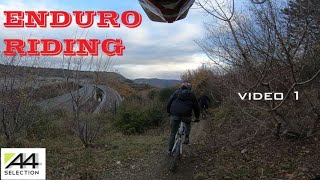
Popular 3 Camini - Cascatelle Mountain Biking Trails
Photos of 3 Camini - Cascatelle Mountain Bike
trail: Cascatelle
59 |
Jul 16, 2020 @ 6:19am
Jul 16, 2020
trail: Cascatelle
383 |
Dec 16, 2015 @ 12:17am
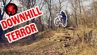
Dec 16, 2015Videos of 3 Camini - Cascatelle Mountain Bike
trail: Cascatelle
5:44 |
164 |
Feb 2, 2021 , Trieste
trail: Cascatelle
9:25 |
320 |
Feb 10, 2020 , Trieste

trail: Igor
6:34 |
447 |
Jan 26, 2020 , Trieste

trail: Cascatelle
5:11 |
460 |
Mar 14, 2019 , Trieste

trail: Igor
664 |
Nov 29, 2017 , Trieste
Recent Trail Reports
| status | trail | date | condition | info | user |
|---|---|---|---|---|---|
| Furfanti-Amicizia | Jul 1, 2022 @ 12:21am Jul 1, 2022 | Dry | AlfonsoTraverso | ||
| Cottur Cycle Path | Jul 1, 2022 @ 12:21am Jul 1, 2022 | Dry | AlfonsoTraverso | ||
| Cascatelle | Jun 8, 2022 @ 7:51am Jun 8, 2022 | Ideal | julian-mtb | ||
| Candy | Jun 2, 2022 @ 1:37am Jun 2, 2022 | Dry | GoldMountainBikers | ||
| Igor | Apr 11, 2022 @ 11:30pm Apr 11, 2022 | Ideal | Nasopanic | ||
| Exit Way From Cycle Path | Mar 24, 2022 @ 9:42am Mar 24, 2022 | Very Dry | GoldMountainBikers | ||
| Bigoletto attacco alle Iazere | Feb 24, 2022 @ 10:31am Feb 24, 2022 | Ideal | julian-mtb | ||
| Re entering Into Cycle Path | Apr 22, 2021 @ 9:59am Apr 22, 2021 | Ideal | GoldMountainBikers | ||
| Salita Tre Camini | Oct 25, 2020 @ 3:37am Oct 25, 2020 | Dry | AlfonsoTraverso | ||
| El Griza climb | Oct 18, 2020 @ 2:10am Oct 18, 2020 | Wet | martjno |
Activity Feed
| username | action | type | title | date | |
|---|---|---|---|---|---|
 | AlfonsoTraverso | add | report | Furfanti-Amicizia and 1 more | Jul 1, 2022 @ 6:13am Jul 1, 2022 |
| AlfonsoTraverso | add | report | Furfanti-Amicizia | Jun 18, 2022 @ 12:43pm Jun 18, 2022 |
 | julian-mtb | add | report | Cascatelle | Jun 8, 2022 @ 11:06am Jun 8, 2022 |
 | GoldMountainBikers | add | report | Candy | Jun 2, 2022 @ 5:28am Jun 2, 2022 |
| julian-mtb | add | report | Cascatelle | May 26, 2022 @ 11:18am May 26, 2022 |
Recent Comments
| username | type | title | comment | date | |
|---|---|---|---|---|---|
 | trail | From small tunnel under the cycle road Cottur... | Jan 18, 2021 @ 9:36am Jan 18, 2021 | ||
 | trail | very dry lots of loose rocks and fallen... | Sep 19, 2020 @ 6:21am Sep 19, 2020 | ||
| trail | This trails has many variations, at the moment... | Jul 17, 2020 @ 1:50am Jul 17, 2020 | ||
| trail | Need maintenance, very easy to mistake the... | Jul 11, 2020 @ 11:06am Jul 11, 2020 | ||
 | trail | Its very hart to find the right way because of... | Nov 5, 2017 @ 10:13am Nov 5, 2017 |
Nearby Areas
| name | distance | ||||
|---|---|---|---|---|---|
| Parco del Farneto | 8 | 2 | 1.4 km | ||
| Eastern Italian/Coastal Karst | 68 | 9 | 1 | 1.8 km | |
| Bagnoli-Dolina | 9 | 5 | 2 km | ||
| Tinjan | 1 | 1 | 4.2 km | ||
| Central Italian/Coastal Karst | 37 | 3 | 5 km |
Bike & Skill Parks
| name | type | city | rating |
|---|---|---|---|
| Trieste City Bike Park 3 Camini | skill park | Trieste |
Activity Type Stats
| activitytype | trails | distance | descent | descent distance | total vertical | rating | global rank | state rank | photos | reports | routes | ridelogs |
|---|---|---|---|---|---|---|---|---|---|---|---|---|
| Mountain Bike | 11 | 14 miles | 3,038 ft | 10 miles | 1,365 ft | #5,821 | #266 | 11 | 167 | 1,276 | ||
| E-Bike | 10 | 13 miles | 2,287 ft | 9 miles | 1,348 ft | 137 | 45 | |||||
| Hike | 7 | 12 miles | 2,162 ft | 8 miles | 1,171 ft | #6,391 | #304 | 165 | 15 | |||
| Trail Running | 7 | 12 miles | 2,162 ft | 8 miles | 1,171 ft | #6,392 | #300 | 165 | 27 |
- By Varne
 TMTBT & contributors
 - Admins: TMTBT, julian-mtb
- #26644 - 1,799 views
- 3 camini - cascatelle activity log | embed map of 3 Camini - Cascatelle mountain bike trails | 3 camini - cascatelle mountain biking points of interest
Downloading of trail gps tracks in kml & gpx formats is enabled for 3 Camini - Cascatelle.
You must login to download files.