close
Trail Conditions
- Unknown
- Snow Groomed
- Snow Packed
- Snow Covered
- Snow Cover Inadequate
- Freeze/thaw Cycle
- Icy
- Prevalent Mud
- Wet
- Variable
- Ideal
- Dry
- Very Dry
Trail Flow (Ridden Direction)
Trailforks scans users ridelogs to determine the most popular direction each trail is ridden. A good flowing trail network will have most trails flowing in a single direction according to their intension.
The colour categories are based on what percentage of riders are riding a trail in its intended direction.
The colour categories are based on what percentage of riders are riding a trail in its intended direction.
- > 96%
- > 90%
- > 80%
- > 70%
- > 50%
- < 50%
- bi-directional trail
- no data
Trail Last Ridden
Trailforks scans ridelogs to determine the last time a trail was ridden.
- < 2 days
- < 1 week
- < 2 weeks
- < 1 month
- < 6 months
- > 6 months
Trail Ridden Direction
The intended direction a trail should be ridden.
- Downhill Only
- Downhill Primary
- Both Directions
- Uphill Primary
- Uphill Only
- One Direction
Contribute Details
Colors indicate trail is missing specified detail.
- Description
- Photos
- Description & Photos
- Videos
Trail Popularity ?
Trailforks scans ridelogs to determine which trails are ridden the most in the last 9 months.
Trails are compared with nearby trails in the same city region with a possible 25 colour shades.
Think of this as a heatmap, more rides = more kinetic energy = warmer colors.
- most popular
- popular
- less popular
- not popular
ATV/ORV/OHV Filter
Max Vehicle Width
inches
Radar Time
x
Activity Recordings
Trailforks users anonymized public ridelogs from the past 6 months.
- mountain biking recent
- mountain biking (>6 month)
- hiking (1 year)
- moto (1 year)
Activity Recordings
Trailforks users anonymized public skilogs from the past 12 months.
- Downhill Ski
- Backcountry Ski
- Nordic Ski
Jump Magnitude Heatmap
Heatmap of where riders jump on trails. Zoom in to see individual jumps, click circles to view jump details.
Trails Deemphasized
Trails are shown in grey.
Only show trails with NO bikes.
Save the current map location and zoom level as your default home location whenever this page is loaded.
SaveNorth Dakota Tourism Regions per the North Dakota Association of Counties: https://www.ndaco.org/about-ndaco/regions-map/
Region Details
- 235
- 9
- 278
- 176
- 6
Stats
- Avg Trail Rating
- Trails (view details)
- 825
- Trails Mountain Bike
- 704
- Trails E-Bike
- 261
- Trails Hike
- 811
- Trails Trail Running
- 797
- Trails Horse
- 91
- Trails Dirtbike/Moto
- 13
- Trails ATV/ORV/OHV
- 18
- Trails Snowmobile
- 9
- Trails Snowshoe
- 267
- Trails Backcountry Ski
- 7
- Trails Nordic Ski
- 264
- Total Distance
- 1,248 mile
- Total Descent
- 69,782 ft
- Total Vertical
- 2,139 ft
- Highest Trailhead
- 2,941 ft
- Reports
- 1,105
- Photos
- 391
- Ridden Counter
- 6,316
Popular Trail Networks
view all areas »Sub Regions
- Maah Daah Hey (50)
- Region 1 - Tri-County (69)
- Divide County (1)
- McKenzie County (36)
- Williams County (32)
- Region 2 - Souris Basin (102)
- Bottineau County (62)
- Burke County (12)
- McHenry County (1)
- Mountrail County (1)
- Pierce County (6)
- Renville County (2)
- Ward County (18)
- Region 3 - North Central (60)
- Cavalier County (22)
- Eddy County (25)
- Ramsey County (13)
- Region 4 - Red River (59)
- Grand Forks County (44)
- Nelson County (1)
- Pembina County (14)
- Walsh County (0)
- Region 5 - Lake Agassiz (105)
- Cass County (6)
- Ransom County (64)
- Richland County (31)
- Sargent County (1)
- Steele County (1)
- Trail County (2)
- Region 6 - South Central (124)
- Barnes County (56)
- Foster County (4)
- Griggs County (30)
- Logan County (6)
- Stutsman County (28)
- Wells County (0)
- Region 7 - Lewis & Clark (129)
- Burleigh County (13)
- Emmons County (1)
- Grant County (6)
- Kidder County (1)
- McLean County (33)
- Mercer County (8)
- Morton County (31)
- Oliver County (13)
- Sheridan County (23)
- Region 8 - Roosevelt - Custer Region (55)
- Billings County (40)
- Dunn County (0)
- Golden Valley County (5)
- Slope County (2)
- Stark County (8)
Popular North Dakota Mountain Biking Trails
| status | title | difficulty | rating |
|---|---|---|---|
| The Deuce - Sully Creek to Bully Pulpit Medora | |||
| Buffalo Gap - W. River Rd. to Campground Sentinel Butte | |||
| Buffalo Gap - W. River Rd. to Maah Daah Hey Medora | |||
| Maah Daah Hey - From Buffalo Gap Medora | |||
| Buffalo Gap Sentinel Butte | |||
| Otter Creek Trail Tight And Twisty Harmon Lake Recreation Area | |||
| Otter Creek Trail Fast And Flowy Harmon Lake Recreation Area | |||
| The Deuce - Sully Creek Connector Medora | |||
| The Deuce - Bully Pulpit to Plumley Draw Medora | |||
| The Deuce - Sully Creek Connector Medora | |||
| Maah Daah Hey - To Wannagan Campground Medora | |||
| Wannagan Campground Access Trail Medora | |||
| Maah Daah Hey - Elkhorn to Beaver Creek Rd. Watford City | |||
| Maah Daah Hey - From Roosevelt to Elkhorn Campground Watford City | |||
| Iwen South Iwen Park |
North Dakota Mountain Bike Routes
| title | rating | distance |
|---|---|---|
| Harmon Full with Epic Loop 13 miles Harmon Lake Recreation Area | 13 miles | |
| Wildwood Fat Tire Festival Route Wildwood Park | 2 miles | |
| Wildwood snowshoe route Wildwood Park | 3 miles | |
| WIldwood Fat Tire Festival route Wildwood Park | 3 miles | |
| Maah Daah Hey (IMBA Epic) Dickinson | 95 miles | |
| 14 mile Sleepy Hollow Ride | popular ridelog | 14 miles |
| 8 mile Sleepy Hollow Cross-country Ride | popular ridelog | 8 miles |
| 4 mile Sleepy Hollow Ride | popular ridelog | 4 miles |
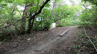
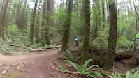
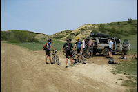
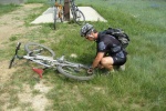
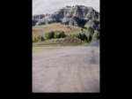
Photos of North Dakota Mountain Bike
trail: Young Hawk Interpretive Loop
2 |
Jun 30, 2022 @ 12:29pm
Jun 30, 2022
trail: Little Solider Loop
6 |
Jun 30, 2022 @ 12:29pm
Jun 30, 2022
trail: Little Solider Loop
5 |
Jun 29, 2022 @ 11:00am
Jun 29, 2022
trail: NCT - Oak Leaf
3 |
Jun 27, 2022 @ 1:57pm
Jun 27, 2022
trail: NCT - Oak Leaf
3 |
Jun 27, 2022 @ 1:57pm
Jun 27, 2022
trail: Pederson Hills Trail
42 |
May 17, 2020 @ 2:31pm
May 17, 2020
trail: Pederson Hills Trail
47 |
May 17, 2020 @ 2:31pm
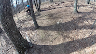
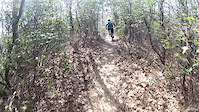
May 17, 2020Videos of North Dakota Mountain Bike
trail: Iwen North
0:07 |
131 |
Sep 6, 2020
trail: Bennett Creek Trail
0:47 |
73 |
Dec 18, 2015
trail: Bennett Creek Trail
6:21 |
122 |
Dec 18, 2015
trail: River View Trail
1:21 |
100 |
Oct 25, 2015
trail: Sleepy Hollow
2:23 |
395 |
Sep 15, 2014
3:55 |
14 |
Mar 30, 2012
4:48 |
275 |
Feb 10, 2010
1:39 |
290 |
Sep 15, 2009
Activity Feed
| username | action | type | title | date | |
|---|---|---|---|---|---|
 | WIFatBike | wishlist | trail | Crooked Crane | Jul 4, 2022 @ 11:02am 2 days |
 | flagxcrider | ridden | trail | Schnell Recreation Area and 1 more | Jul 2, 2022 @ 4:53pm Jul 2, 2022 |
| Adamjl | add | photo | in berlin, New Hampshire, United States and 1 more | Jun 30, 2022 @ 12:29pm Jun 30, 2022 |
| Kramerclay | add | report | Iwen North and 1 more | Jun 30, 2022 @ 9:27am Jun 30, 2022 |
 | Moquin | wishlist | trail | Maah Daah Hey - Sully Creek | Jun 29, 2022 @ 4:08pm Jun 29, 2022 |
Recent Comments
| username | type | title | comment | date | |
|---|---|---|---|---|---|
| trail | There is no sign at the trailhead. DO NOT. I... | Jun 20, 2022 @ 3:25pm Jun 20, 2022 | ||
| trail | Rated as the best trail in the nation...gotta... | May 22, 2022 @ 9:43pm May 22, 2022 | ||
 | trail | The high parts are mostly dry on Iwen North,... | May 7, 2022 @ 9:13am May 7, 2022 | ||
| report | Good conditions, a little sticky low spots,... | Sep 6, 2021 @ 11:06am Sep 6, 2021 | ||
| trail | After 3 days of heavy rain I thought it was... | Aug 29, 2021 @ 9:58am Aug 29, 2021 |
Local Badges
-

Climbing 100k Badge0 awarded -

10 Blue Trails26 awarded -

Epic Ride Descent 2k7 awarded -

Epic Ride Climb 2k7 awarded -

Descent 10k Badge4 awarded -

Climbing 10k Badge4 awarded
National Scenic Trails & Official Routes
-
Maah Daah Hey Trail
- Mountain Bike
- Hike
- Trail Running
- Horse
- Snowshoe
Bike & Skill Parks
| name | type | city | rating |
|---|---|---|---|
| Sunset Park | skill park | Mandan |
Activity Type Stats
| activitytype | trails | distance | descent | descent distance | total vertical | rating | global rank | state rank | photos | reports | routes | ridelogs |
|---|---|---|---|---|---|---|---|---|---|---|---|---|
| Mountain Bike | 704 | 1,107 mile | 57,533 ft | 361 miles | 2,139 ft | #58 | 375 | 1,105 | 5 | 12,777 | ||
| E-Bike | 261 | 450 miles | 7,336 ft | 145 miles | 1,480 ft | #55 | 687 | 1 | 66 | |||
| Hike | 811 | 1,238 mile | 68,435 ft | 399 miles | 2,139 ft | #57 | 1,002 | 2 | 532 | |||
| Trail Running | 797 | 1,211 mile | 67,526 ft | 392 miles | 2,139 ft | #57 | 1,002 | 1 | 139 | |||
| Horse | 91 | 183 miles | 16,132 ft | 54 miles | 1,467 ft | #48 | 172 | 13 | ||||
| Dirtbike/Moto | 13 | 45 miles | 2,178 ft | 12 miles | 1,191 ft | #44 | 172 | |||||
| ATV/ORV/OHV | 18 | 52 miles | 2,825 ft | 14 miles | 1,191 ft | #40 | 172 | 1 | ||||
| Snowmobile | 9 | 23 miles | 407 ft | 9 miles | 351 ft | #39 | ||||||
| Snowshoe | 267 | 420 miles | 12,392 ft | 116 miles | 1,654 ft | #37 | 124 | 2 | 57 | |||
| Backcountry Ski | 7 | 9 miles | 200 ft | 1 mile | 755 ft | #14 | 55 | 7 | ||||
| Nordic Ski | 264 | 412 miles | 11,818 ft | 114 miles | 1,680 ft | #32 | 16 | 82 | 213 |
- By canadaka
 Trailforks & contributors
 - Admins: Map Team, chuktA, msmcfate, WillieJacobsz, PlumbBobM, ReckitRolley, chuktA
- #3182 - 9,842 views
- north dakota activity log | embed map of North Dakota mountain bike trails | north dakota mountain biking points of interest
-
- subscribe
- 3d map
Downloading of trail gps tracks in kml & gpx formats is enabled for North Dakota.
You must login to download files.