close
Trail Conditions
- Unknown
- Snow Groomed
- Snow Packed
- Snow Covered
- Snow Cover Inadequate
- Freeze/thaw Cycle
- Icy
- Prevalent Mud
- Wet
- Variable
- Ideal
- Dry
- Very Dry
Trail Flow (Ridden Direction)
Trailforks scans users ridelogs to determine the most popular direction each trail is ridden. A good flowing trail network will have most trails flowing in a single direction according to their intension.
The colour categories are based on what percentage of riders are riding a trail in its intended direction.
The colour categories are based on what percentage of riders are riding a trail in its intended direction.
- > 96%
- > 90%
- > 80%
- > 70%
- > 50%
- < 50%
- bi-directional trail
- no data
Trail Last Ridden
Trailforks scans ridelogs to determine the last time a trail was ridden.
- < 2 days
- < 1 week
- < 2 weeks
- < 1 month
- < 6 months
- > 6 months
Trail Ridden Direction
The intended direction a trail should be ridden.
- Downhill Only
- Downhill Primary
- Both Directions
- Uphill Primary
- Uphill Only
- One Direction
Contribute Details
Colors indicate trail is missing specified detail.
- Description
- Photos
- Description & Photos
- Videos
Trail Popularity ?
Trailforks scans ridelogs to determine which trails are ridden the most in the last 9 months.
Trails are compared with nearby trails in the same city region with a possible 25 colour shades.
Think of this as a heatmap, more rides = more kinetic energy = warmer colors.
- most popular
- popular
- less popular
- not popular
ATV/ORV/OHV Filter
Max Vehicle Width
inches
Radar Time
x
Activity Recordings
Trailforks users anonymized public ridelogs from the past 6 months.
- mountain biking recent
- mountain biking (>6 month)
- hiking (1 year)
- moto (1 year)
Activity Recordings
Trailforks users anonymized public skilogs from the past 12 months.
- Downhill Ski
- Backcountry Ski
- Nordic Ski
Jump Magnitude Heatmap
Heatmap of where riders jump on trails. Zoom in to see individual jumps, click circles to view jump details.
Trails Deemphasized
Trails are shown in grey.
Only show trails with NO bikes.
Save the current map location and zoom level as your default home location whenever this page is loaded.
Save
No description for Abajo Mountains has been added yet!
Login or register to submit one.
Activities Click to view
- Mountain Bike
17 trails
- E-Bike
12 trails
- Hike
22 trails
- Trail Running
22 trails
Region Details
- 3
- 6
- 6
- 2
Region Status
Caution as of Jul 2, 2021Stats
- Avg Trail Rating
- Trails (view details)
- 21
- Trails Mountain Bike
- 17
- Trails E-Bike
- 12
- Trails Hike
- 22
- Trails Trail Running
- 22
- Trails Horse
- 10
- Trails Dirtbike/Moto
- 10
- Trails ATV/ORV/OHV
- 3
- Total Distance
- 72 miles
- Total Descent
- 16,489 ft
- Total Vertical
- 5,209 ft
- Highest Trailhead
- 11,172 ft
- Reports
- 17
- Photos
- 31
- Ridden Counter
- 213
Popular Abajo Mountains Mountain Biking Trails
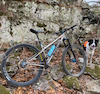
Photos of Abajo Mountains Mountain Bike
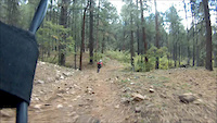
trail: North Creek
0 |
May 28, 2022 @ 5:38pm
May 28, 2022
trail: North Creek
0 |
May 28, 2022 @ 5:38pm
May 28, 2022
trail: North Creek
0 |
May 28, 2022 @ 5:38pm
May 28, 2022
trail: North Creek
1 |
May 28, 2022 @ 5:37pm
May 28, 2022
trail: North Creek
7 |
May 7, 2022 @ 5:35pm
May 7, 2022
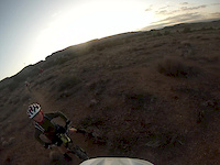
trail: Tower (Upper)
65 |
Dec 7, 2020 @ 10:24pm
Dec 7, 2020
trail: Tower (Upper)
85 |
Dec 7, 2020 @ 10:24pm
Dec 7, 2020
trail: Tower (Upper)
82 |
Dec 7, 2020 @ 10:24pm
Dec 7, 2020Videos of Abajo Mountains Mountain Bike
trail: Bulldog (5504)
4:52 |
398 |
Mar 10, 2015
trail: Tower
1:39 |
379 |
Apr 12, 2013
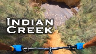
trail: Lower Indian Creek
16:17 |
26 |
May 17, 2022 , Monticello

trail: West Shay (435)
32:36 |
108 |
Sep 2, 2020 , Monticello
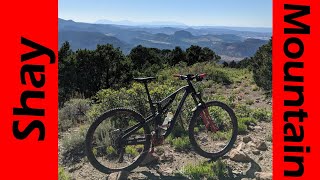
trail: Shay Mountain (098)
32:36 |
183 |
Sep 2, 2020 , Monticello

trail: North Creek
41:39 |
169 |
Aug 27, 2020 , Monticello

trail: Spring Creek
41:39 |
114 |
Aug 27, 2020 , Monticello

trail: Robertson Pasture
41:39 |
150 |
Aug 27, 2020 , Monticello
Recent Trail Reports
| status | trail | date | condition | info | user |
|---|---|---|---|---|---|
| Robertson Pasture | Jun 12, 2022 @ 4:28pm Jun 12, 2022 | Ideal | Aidster87 | ||
| Red Ledges Connector | Sep 11, 2021 @ 7:49am Sep 11, 2021 | Dry | Shawnsrides | ||
| Shay Mountain (098) | Jul 2, 2021 @ 11:14am Jul 2, 2021 | Very Dry | Shawnsrides | ||
| Spring Creek | Jun 30, 2021 @ 11:53am Jun 30, 2021 | Wet | Shawnsrides | ||
| Bulldog (5504) | Jul 7, 2019 @ 10:25am Jul 7, 2019 | Unknown | Brownkid |
Activity Feed
| username | action | type | title | date | |
|---|---|---|---|---|---|
 | 1Hunter-R | update | trail | Dark Canyon Corridor | Jun 15, 2022 @ 10:17am Jun 15, 2022 |
| 1Hunter-R | add | trail | Dark Canyon Corridor and 1 more | Jun 13, 2022 @ 2:22pm Jun 13, 2022 |
| LindsayCarswell | ridden | trail | Robertson Pasture | Jun 12, 2022 @ 4:56pm Jun 12, 2022 |
| Aidster87 | add | report | Robertson Pasture and 1 more | Jun 12, 2022 @ 4:27pm Jun 12, 2022 |
| Aidster87 | comment | trail | Spring Creek and 2 more | Jun 12, 2022 @ 4:25pm Jun 12, 2022 |
Recent Comments
| username | type | title | comment | date | |
|---|---|---|---|---|---|
| trail | Long chunky climb. Well worth it to get to... | Jun 12, 2022 @ 4:30pm Jun 12, 2022 | ||
| trail | Amazing decent! 10/10 would ride again | Jun 12, 2022 @ 4:26pm Jun 12, 2022 | ||
| trail | Fun climb, not easy though some HAB | Jun 12, 2022 @ 4:25pm Jun 12, 2022 | ||
| trail | Rough for a beginner, but I’m glad I did it.... | May 7, 2022 @ 5:32pm May 7, 2022 | ||
 | trail | A good alpine climbing trail- some, but not... | Jun 17, 2021 @ 8:05pm Jun 17, 2021 |
Nearby Areas
| name | distance | ||||
|---|---|---|---|---|---|
| Canyonlands NP-Needles | 2 | 26.4 km | |||
| Cedar Mesa | 26.8 km | ||||
| Canyonlands NP - The Maze | 36 km |
Activity Type Stats
| activitytype | trails | distance | descent | descent distance | total vertical | rating | global rank | state rank | photos | reports | routes | ridelogs |
|---|---|---|---|---|---|---|---|---|---|---|---|---|
| Mountain Bike | 17 | 55 miles | 13,235 ft | 31 miles | 5,180 ft | #7,143 | #3,006 | 31 | 17 | 214 | ||
| E-Bike | 12 | 52 miles | 11,512 ft | 28 miles | 4,528 ft | #2,301 | #526 | 8 | 3 | |||
| Hike | 22 | 72 miles | 16,490 ft | 38 miles | 5,210 ft | #6,216 | #2,856 | 17 | 1 | 31 | ||
| Trail Running | 22 | 72 miles | 16,490 ft | 38 miles | 5,210 ft | #6,232 | #2,857 | 17 | 1 | 12 | ||
| Horse | 10 | 46 miles | 7,428 ft | 21 miles | 3,376 ft | 1 | ||||||
| Dirtbike/Moto | 10 | 48 miles | 10,262 ft | 25 miles | 4,528 ft | 4 | 2 | |||||
| ATV/ORV/OHV | 3 | 10 miles | 2,552 ft | 6 miles | 2,753 ft | 1 |
- By todd
 Trailforks & contributors
 - Admins: apply
- #4864 - 5,980 views
- abajo mountains activity log | embed map of Abajo Mountains mountain bike trails | abajo mountains mountain biking points of interest
Downloading of trail gps tracks in kml & gpx formats is enabled for Abajo Mountains.
You must login to download files.