close
Trail Conditions
- Unknown
- Snow Groomed
- Snow Packed
- Snow Covered
- Snow Cover Inadequate
- Freeze/thaw Cycle
- Icy
- Prevalent Mud
- Wet
- Variable
- Ideal
- Dry
- Very Dry
Trail Flow (Ridden Direction)
Trailforks scans users ridelogs to determine the most popular direction each trail is ridden. A good flowing trail network will have most trails flowing in a single direction according to their intension.
The colour categories are based on what percentage of riders are riding a trail in its intended direction.
The colour categories are based on what percentage of riders are riding a trail in its intended direction.
- > 96%
- > 90%
- > 80%
- > 70%
- > 50%
- < 50%
- bi-directional trail
- no data
Trail Last Ridden
Trailforks scans ridelogs to determine the last time a trail was ridden.
- < 2 days
- < 1 week
- < 2 weeks
- < 1 month
- < 6 months
- > 6 months
Trail Ridden Direction
The intended direction a trail should be ridden.
- Downhill Only
- Downhill Primary
- Both Directions
- Uphill Primary
- Uphill Only
- One Direction
Contribute Details
Colors indicate trail is missing specified detail.
- Description
- Photos
- Description & Photos
- Videos
Trail Popularity ?
Trailforks scans ridelogs to determine which trails are ridden the most in the last 9 months.
Trails are compared with nearby trails in the same city region with a possible 25 colour shades.
Think of this as a heatmap, more rides = more kinetic energy = warmer colors.
- most popular
- popular
- less popular
- not popular
ATV/ORV/OHV Filter
Max Vehicle Width
inches
Radar Time
x
Activity Recordings
Trailforks users anonymized public ridelogs from the past 6 months.
- mountain biking recent
- mountain biking (>6 month)
- hiking (1 year)
- moto (1 year)
Activity Recordings
Trailforks users anonymized public skilogs from the past 12 months.
- Downhill Ski
- Backcountry Ski
- Nordic Ski
Jump Magnitude Heatmap
Heatmap of where riders jump on trails. Zoom in to see individual jumps, click circles to view jump details.
Trails Deemphasized
Trails are shown in grey.
Only show trails with NO bikes.
Save the current map location and zoom level as your default home location whenever this page is loaded.
SavePopular Trail Networks
view all areas »
No description for Oklahoma has been added yet!
Login or register to submit one.
Stats
- Avg Trail Rating
- Trails (view details)
- 331
- Trails Mountain Bike
- 312
- Trails E-Bike
- 68
- Trails Hike
- 322
- Trails Trail Running
- 322
- Trails Horse
- 28
- Trails Dirtbike/Moto
- 2
- Trails ATV/ORV/OHV
- 2
- Total Distance
- 573 miles
- Total Descent
- 52,356 ft
- Total Vertical
- 1,954 ft
- Highest Trailhead
- 2,446 ft
- Reports
- 1,344
- Photos
- 323
- Ridden Counter
- 10,633
 Articles
Video: Andrew Taylor Visits Arkansas, Oklahoma & Texas - AT's Ultimate 48 State Road Trip
Aug 4, 2019 from pinkbike.com
The locals show Andrew Taylor their favourite spots.
Sub Regions
- Comanche (18)
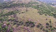
Popular Oklahoma Mountain Biking Trails
| status | title | difficulty | rating |
|---|---|---|---|
| Yellow Loop Lake Stanley Draper Mountain Bike Park | |||
| Blue Loop Lake Stanley Draper Mountain Bike Park | |||
| Red Loop Lake Stanley Draper Mountain Bike Park | |||
| Orange Loop Lake Stanley Draper Mountain Bike Park | |||
| Bluff Creek Trail Bluff Creek Park | |||
| Green Loop Lake Stanley Draper Mountain Bike Park | |||
| Horseshoe Midwest City | |||
| Green - Yellow Bypass Lake Thunderbird State Park | |||
| Bailout Midwest City | |||
| Green Loop Lake Thunderbird State Park | |||
| Plaid Loop Lake Thunderbird State Park | |||
| Kopperhead Tulsa | |||
| Yellow Loop Lake Thunderbird State Park | |||
| Red Loop Lake Thunderbird State Park | |||
| Happy Lake Dam Lake Claremore |
Oklahoma Mountain Bike Routes
| title | rating | distance |
|---|---|---|
| Pecan Pie Sulphur | 9 miles | |
| Scerenity Loop | 13 miles | |
| Fire Road to Old XC Big Ben's Park | 1 mile | |
| Ponca City all trails Gate to Gate Kaw Lake | 7 miles |
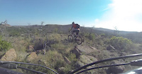
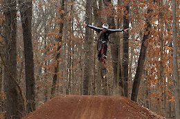
Videos of Oklahoma Mountain Bike
trail: UHF
17 |
Apr 11, 2022
trail: Forney "8"
125 |
Dec 9, 2021

19 |
Apr 14, 2021

trail: Fro Flo
0:06 |
319 |
Apr 10, 2020
trail: Scout Loop
0:18 |
184 |
Sep 18, 2019
trail: Black Trail
5:26 |
140 |
Jun 7, 2017

trail: Black Trail
5:03 |
136 |
May 22, 2017
trail: Black Trail
0:55 |
311 |
Nov 15, 2014
Activity Feed
| username | action | type | title | date | |
|---|---|---|---|---|---|
 | SHOOPS23 | add | report | Plung with a view | Jul 5, 2022 @ 8:46pm 5 hours |
 | jgr1964 | add | report | Swamp Trail and 1 more | Jul 5, 2022 @ 3:37pm 10 hours |
| 9LOmfrtC | add | photo | in Oklahoma City, Oklahoma, United States and 2 more | Jul 4, 2022 @ 12:22pm 2 days |
| sendtochrisking | ridden | trail | Yellow | Jul 3, 2022 @ 11:00am 3 days |
| sendtochrisking | ridden | trail | Zingo and 3 more | Jul 3, 2022 @ 10:59am 3 days |
Recent Comments
| username | type | title | comment | date | |
|---|---|---|---|---|---|
| trail | This is the best trail I have ridden in... | Jul 2, 2022 @ 6:27pm Jul 2, 2022 | ||
 | trail | Very technical uphill :) | Jun 28, 2022 @ 9:15am Jun 28, 2022 | ||
 | trail | Do not waste your time or money here. Wow!... | Jun 13, 2022 @ 1:27pm Jun 13, 2022 | ||
| report | The trail was in good shape. Lone star ticks... | Jun 5, 2022 @ 11:29am Jun 5, 2022 | ||
| trail | Fun trail. Lots of quick flows and fun... | Mar 27, 2022 @ 8:09pm Mar 27, 2022 |
Local Badges
-

10 Blue Trails57 awarded -

Climbing 10k Badge0 awarded -

Big Ride 30k982 awarded -

Epic Ride Climb 2k0 awarded -
Climbing 10k Badge10 awarded -
10 Blue Trails10 awarded
National Scenic Trails & Official Routes
-
Ouachita National Recreation Trail
- Mountain Bike
- Hike
- Trail Running
Pinkbike Articles
Aug 4, 2019
 Video: Andrew Taylor Visits Arkansas, Oklahoma & Texas - AT's Ultimate 48 State Road Trip
The locals show Andrew Taylor their favourite spots.
Activity Type Stats
| activitytype | trails | distance | descent | descent distance | total vertical | rating | global rank | state rank | photos | reports | routes | ridelogs |
|---|---|---|---|---|---|---|---|---|---|---|---|---|
| Mountain Bike | 312 | 549 miles | 49,948 ft | 224 miles | 1,955 ft | #55 | 309 | 1,343 | 4 | 25,276 | ||
| E-Bike | 68 | 86 miles | 7,769 ft | 31 miles | 1,007 ft | #45 | 1,159 | 346 | ||||
| Hike | 322 | 566 miles | 51,260 ft | 229 miles | 1,955 ft | #55 | 4 | 1,342 | 1 | 617 | ||
| Trail Running | 322 | 566 miles | 51,260 ft | 229 miles | 1,955 ft | #55 | 10 | 1,342 | 203 | |||
| Horse | 28 | 82 miles | 11,302 ft | 40 miles | 1,611 ft | #46 | 298 | 1 | ||||
| Dirtbike/Moto | 2 | 7 miles | 512 ft | 2 miles | 666 ft | #46 | 298 | 5 | ||||
| ATV/ORV/OHV | 2 | 7 miles | 512 ft | 2 miles | 666 ft | #44 | 298 | 10 |
- By canadaka
 Trailforks & contributors
 - Admins: Map Team, chuktA, msmcfate, WillieJacobsz, PlumbBobM, ReckitRolley, Turntex
- #3218 - 14,402 views
- oklahoma activity log | embed map of Oklahoma mountain bike trails | oklahoma mountain biking points of interest
-
- subscribe
- 3d map
Downloading of trail gps tracks in kml & gpx formats is enabled for Oklahoma.
You must login to download files.