close
Trail Conditions
- Unknown
- Snow Groomed
- Snow Packed
- Snow Covered
- Snow Cover Inadequate
- Freeze/thaw Cycle
- Icy
- Prevalent Mud
- Wet
- Variable
- Ideal
- Dry
- Very Dry
Trail Flow (Ridden Direction)
Trailforks scans users ridelogs to determine the most popular direction each trail is ridden. A good flowing trail network will have most trails flowing in a single direction according to their intension.
The colour categories are based on what percentage of riders are riding a trail in its intended direction.
The colour categories are based on what percentage of riders are riding a trail in its intended direction.
- > 96%
- > 90%
- > 80%
- > 70%
- > 50%
- < 50%
- bi-directional trail
- no data
Trail Last Ridden
Trailforks scans ridelogs to determine the last time a trail was ridden.
- < 2 days
- < 1 week
- < 2 weeks
- < 1 month
- < 6 months
- > 6 months
Trail Ridden Direction
The intended direction a trail should be ridden.
- Downhill Only
- Downhill Primary
- Both Directions
- Uphill Primary
- Uphill Only
- One Direction
Contribute Details
Colors indicate trail is missing specified detail.
- Description
- Photos
- Description & Photos
- Videos
Trail Popularity ?
Trailforks scans ridelogs to determine which trails are ridden the most in the last 9 months.
Trails are compared with nearby trails in the same city region with a possible 25 colour shades.
Think of this as a heatmap, more rides = more kinetic energy = warmer colors.
- most popular
- popular
- less popular
- not popular
ATV/ORV/OHV Filter
Max Vehicle Width
inches
Radar Time
x
Activity Recordings
Trailforks users anonymized public ridelogs from the past 6 months.
- mountain biking recent
- mountain biking (>6 month)
- hiking (1 year)
- moto (1 year)
Activity Recordings
Trailforks users anonymized public skilogs from the past 12 months.
- Downhill Ski
- Backcountry Ski
- Nordic Ski
Jump Magnitude Heatmap
Heatmap of where riders jump on trails. Zoom in to see individual jumps, click circles to view jump details.
Trails Deemphasized
Trails are shown in grey.
Only show trails with NO bikes.
Save the current map location and zoom level as your default home location whenever this page is loaded.
Save*** PLEASE NOTE: THE AREA SHADED RED HAS BEEN RECLAIMED BY THE PRIVATE PROPERTY OWNER. They have asked that all trail activity cease immediately. This is their land so we have to oblige. Please do not ride this area.**
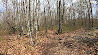
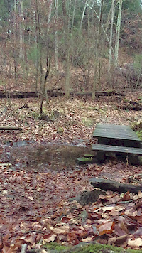
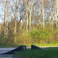
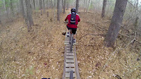
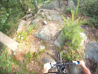
Village Park features several unusual rock formation, aka "pudding-stones" with names like Wildcat Rock and Lion Rock. Some can be ridden but are easier to hike. Hike or bike, they are well worth the climb for a decent view. The Village Park Trails are frequented by hikers, dog walkers, runners, and bikers alike. All trails are maintained throughout the year and are generally in excellent condition. Exception is during wet seasons where you may find some muddy areas, but the many bridges allow safe (and dry) passage over the worst. By looping trails within the park, you can crank out a decent 10 to 12 mile ride. There is some climbing involved but for the most part, a smooth fast ride. Be sure to visit the "Trail Elf" made features such as teeters, rock drops, log-overs, and bridges indicated on the map. Definitely ride Bridges, Two Guys, Rusty Car, Bull Bridge , Thing 2, and Superman (if you dare).
Village Park features several unusual rock formation, aka "pudding-stones" with names like Wildcat Rock and Lion Rock. Some can be ridden but are easier to hike. Hike or bike, they are well worth the climb for a decent view. The Village Park Trails are frequented by hikers, dog walkers, runners, and bikers alike. All trails are maintained throughout the year and are generally in excellent condition. Exception is during wet seasons where you may find some muddy areas, but the many bridges allow safe (and dry) passage over the worst. By looping trails within the park, you can crank out a decent 10 to 12 mile ride. There is some climbing involved but for the most part, a smooth fast ride. Be sure to visit the "Trail Elf" made features such as teeters, rock drops, log-overs, and bridges indicated on the map. Definitely ride Bridges, Two Guys, Rusty Car, Bull Bridge , Thing 2, and Superman (if you dare).
Primary Trail Type: Cross-Country
 google parking directions
Links
Activities Click to view
- Mountain Bike
52 trails
- Hike
49 trails
- Trail Running
49 trails
Region Details
- 3
- 6
- 36
- 5
- 2
Region Status
Open as of Apr 3, 2021Stats
- Avg Trail Rating
- Trails (view details)
- 52
- Trails Mountain Bike
- 52
- Trails Hike
- 49
- Trails Trail Running
- 49
- Trails Snowshoe
- 2
- Trails Nordic Ski
- 2
- Total Distance
- 12 miles
- Total Descent
- 1,122 ft
- Total Vertical
- 88 ft
- Highest Trailhead
- 127 ft
- Reports
- 396
- Photos
- 109
- Ridden Counter
- 16,576
Popular Abrams Rock / Village Park Trails
Mountain Bike Routes
| title | rating | distance |
|---|---|---|
| 5 mile Village Park, Abrams Rock | 5 miles |
Photos of Abrams Rock / Village Park Mountain Bike
trail: Double Over Time
13 |
May 1, 2022 @ 2:28pm
May 1, 2022
trail: Double Over Time
17 |
May 1, 2022 @ 2:28pm
May 1, 2022
trail: Double Over Time
18 |
May 1, 2022 @ 2:28pm
May 1, 2022
trail: Double Over Time
9 |
May 1, 2022 @ 2:28pm
May 1, 2022
trail: YOLO
18 |
May 1, 2022 @ 2:27pm
May 1, 2022
trail: YOLO
31 |
May 1, 2022 @ 2:27pm
May 1, 2022
trail: Double Over Time
185 |
Sep 22, 2020 @ 10:04am
Sep 22, 2020
trail: Double Over Time
195 |
Sep 22, 2020 @ 8:17am
Sep 22, 2020Videos of Abrams Rock / Village Park Mountain Bike
trail: YOLO
|
May 10, 2022
trail: Bridges
0:08 |
93 |
Nov 25, 2016

trail: Bridges
0:10 |
112 |
Jun 2, 2015
trail: YOLO
0:16 |
135 |
Jun 2, 2015
trail: YOLO
0:08 |
227 |
Feb 2, 2015

trail: YOLO
1:05 |
129 |
Aug 12, 2014
trail: Bridges
1:09 |
235 |
Nov 18, 2013
trail: Two Guys
9:21 |
357 |
Dec 5, 2012
Current Trail Warnings
| status | trail | date | condition | user | info |
|---|---|---|---|---|---|
| Jawbone | Jul 4, 2022 @ 7:15am 2 days | Dry | tkilcommons2 | Bee hive at end of bridge. Unsure of... | |
| Rooster | Jun 26, 2022 @ 12:25pm Jun 26, 2022 | Unknown | BFalke69 |
Recent Trail Reports
| status | trail | date | condition | info | user |
|---|---|---|---|---|---|
| YOLO | Jul 4, 2022 @ 7:15am 2 days | Ideal | tkilcommons2 | ||
| Thing 1 | Jul 4, 2022 @ 7:15am 2 days | Dry | tkilcommons2 | ||
| Rusty Car | Jul 4, 2022 @ 7:15am 2 days | Variable | tkilcommons2 | ||
| Linguica | Jul 4, 2022 @ 7:15am 2 days | Variable | tkilcommons2 | ||
| Graveyard | Jun 26, 2022 @ 12:25pm Jun 26, 2022 | Ideal | BFalke69 | ||
| Abram's Rock East | Jun 26, 2022 @ 12:25pm Jun 26, 2022 | Ideal | BFalke69 | ||
| Two Guys | Jun 26, 2022 @ 12:25pm Jun 26, 2022 | Ideal | BFalke69 | ||
| Fireroad | Jun 26, 2022 @ 12:25pm Jun 26, 2022 | Dry | BFalke69 | ||
| Connector | Jun 26, 2022 @ 12:25pm Jun 26, 2022 | Wet | BFalke69 | ||
| Double Over Time | Jun 26, 2022 @ 12:25pm Jun 26, 2022 | Dry | BFalke69 |
Activity Feed
| username | action | type | title | date | |
|---|---|---|---|---|---|
 | tkilcommons2 | add | report | YOLO and 4 more | Jul 5, 2022 @ 7:14am 20 hours |
| s4aiQ | add | report | Jawbone | Jul 5, 2022 @ 6:43am 20 hours |
| Jen12345 | wishlist | route | 5 mile Village Park, Abrams Rock | Jun 29, 2022 @ 5:46pm Jun 29, 2022 |
| BFalke69 | add | report | Graveyard and 15 more | Jun 26, 2022 @ 3:30pm Jun 26, 2022 |
| Mxpx2032 | add | report | Jawbone | Jun 26, 2022 @ 6:35am Jun 26, 2022 |
Recent Comments
| username | type | title | comment | date | |
|---|---|---|---|---|---|
 | trail | Its fun, but not really a double black. The... | Jun 25, 2021 @ 1:38pm Jun 25, 2021 | ||
| report | See z as/ . | Jun 5, 2021 @ 10:24am Jun 5, 2021 | ||
| trail | Rollers, couple berms, table top, A-frame and... | Jan 19, 2021 @ 7:47am Jan 19, 2021 | ||
| trail | Spin fast and lean into the buffed smooth and... | Nov 29, 2020 @ 7:05pm Nov 29, 2020 | ||
| trail | Fun trail towards the end is a fun stepdown jump | Nov 28, 2020 @ 11:27am Nov 28, 2020 |
Nearby Areas
| name | distance | ||||
|---|---|---|---|---|---|
| Dighton Rock State Park | 5.9 km | ||||
| Freetown-Fall River SF / SEMASS Bioreserve Trails | 54 | 147 | 13 | 6.2 km | |
| Rocky Woods (Taunton) | 7 | 9.8 km | |||
| Weetamoo Woods | 7 | 6 | 1 | 11.7 km | |
| Massasoit State Park | 28 | 31 | 6 | 13.3 km |
Local Badges
-

Completionist10 awarded
Local Mountain Biking Directory
-
Bike WorksBike Shop
Activity Type Stats
| activitytype | trails | distance | descent | descent distance | total vertical | rating | global rank | state rank | photos | reports | routes | ridelogs |
|---|---|---|---|---|---|---|---|---|---|---|---|---|
| Mountain Bike | 52 | 12 miles | 1,122 ft | 4 miles | 89 ft | #274 | #124 | 109 | 396 | 1 | 2,544 | |
| Hike | 49 | 11 miles | 1,014 ft | 4 miles | 89 ft | #199 | #107 | 389 | 21 | |||
| Trail Running | 49 | 11 miles | 1,014 ft | 4 miles | 89 ft | #198 | #104 | 389 | 5 | |||
| Snowshoe | 2 | 1,765 ft | 144 ft | 46 ft | 3 | |||||||
| Nordic Ski | 2 | 1,765 ft | 144 ft | 46 ft |
- By brenthillier
 NSMBA TRAILFORKS & contributors
 - Admins: SEMASS NEMBA, Southcoast
- #8230 - 7,237 views
- abrams rock / village park activity log | embed map of Abrams Rock / Village Park mountain bike trails | abrams rock / village park mountain biking points of interest polygons
Downloading of trail gps tracks in kml & gpx formats is enabled for Abrams Rock / Village Park.
You must login to download files.