close
Trail Conditions
- Unknown
- Snow Groomed
- Snow Packed
- Snow Covered
- Snow Cover Inadequate
- Freeze/thaw Cycle
- Icy
- Prevalent Mud
- Wet
- Variable
- Ideal
- Dry
- Very Dry
Trail Flow (Ridden Direction)
Trailforks scans users ridelogs to determine the most popular direction each trail is ridden. A good flowing trail network will have most trails flowing in a single direction according to their intension.
The colour categories are based on what percentage of riders are riding a trail in its intended direction.
The colour categories are based on what percentage of riders are riding a trail in its intended direction.
- > 96%
- > 90%
- > 80%
- > 70%
- > 50%
- < 50%
- bi-directional trail
- no data
Trail Last Ridden
Trailforks scans ridelogs to determine the last time a trail was ridden.
- < 2 days
- < 1 week
- < 2 weeks
- < 1 month
- < 6 months
- > 6 months
Trail Ridden Direction
The intended direction a trail should be ridden.
- Downhill Only
- Downhill Primary
- Both Directions
- Uphill Primary
- Uphill Only
- One Direction
Contribute Details
Colors indicate trail is missing specified detail.
- Description
- Photos
- Description & Photos
- Videos
Trail Popularity ?
Trailforks scans ridelogs to determine which trails are ridden the most in the last 9 months.
Trails are compared with nearby trails in the same city region with a possible 25 colour shades.
Think of this as a heatmap, more rides = more kinetic energy = warmer colors.
- most popular
- popular
- less popular
- not popular
ATV/ORV/OHV Filter
Max Vehicle Width
inches
Radar Time
x
Activity Recordings
Trailforks users anonymized public ridelogs from the past 6 months.
- mountain biking recent
- mountain biking (>6 month)
- hiking (1 year)
- moto (1 year)
Activity Recordings
Trailforks users anonymized public skilogs from the past 12 months.
- Downhill Ski
- Backcountry Ski
- Nordic Ski
Jump Magnitude Heatmap
Heatmap of where riders jump on trails. Zoom in to see individual jumps, click circles to view jump details.
Trails Deemphasized
Trails are shown in grey.
Only show trails with NO bikes.
Save the current map location and zoom level as your default home location whenever this page is loaded.
SaveThe Abriachan Kelpies mountain bike trails are set high up in the highlands of Scotland above from the shores of Loch Ness.
This is a family friendly mountain bike trail centre with three trails:
A green 3km route
A 7km blue route
A 4km red run
A jump park
Green Trail
The green trail is family friendly as an introduction to the sport and connects onto the blue with a footpath feel.
Blue Trail
The blue trail is a family friendly 7km ride.
Red Trail
The red trail has steeper slopes, on narrow single-track which as a loop also onto connects onto the jump park
Jump Park
The jump park has eight table tops, bermed corners and gap jumps.
History
Together the Abriachan trails are known as the Kelpies' Trails - after the famous and mythical local water horse.
The Abriachan Trail centre is owned by the Abriachan Forest Trust community who in 1998 purchased the 534 hectares of forest. They are a Trust owned by the 140 local inhabitants scattered around the rural community. As a social enterprise they have created a network of paths, MTB trails and educational opportunities.
Primary Trail Type: Cross-Country
 google parking directions
This region uses the Uk/Euro style trail grading system.
Activities Click to view
- Mountain Bike
29 trails
- Hike
22 trails
- Trail Running
22 trails
Region Details
- 5
- 10
- 11
- 3
Region Status
Caution as of Jan 16, 2022Stats
- Avg Trail Rating
- Trails (view details)
- 29
- Trails Mountain Bike
- 29
- Trails E-Bike
- 29
- Trails Hike
- 22
- Trails Trail Running
- 22
- Total Distance
- 18 miles
- Total Descent Distance
- 8 miles
- Total Descent
- 2,422 ft
- Total Vertical
- 628 ft
- Highest Trailhead
- 1,403 ft
- Reports
- 14
- Photos
- 8
- Ridden Counter
- 838
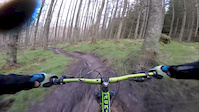
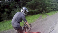
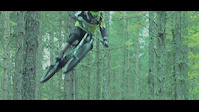
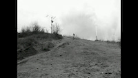
Popular Abriachan Kelpies Mountain Biking Trails
Videos of Abriachan Kelpies Mountain Bike

trail: Green
2:42 |
52 |
Sep 3, 2019
trail: Green
3:09 |
76 |
Mar 14, 2017
trail: Green
2:34 |
57 |
Sep 19, 2016

trail: Green
4:16 |
143 |
May 16, 2016
trail: Green
1:53 |
839 |
Oct 22, 2014

trail: Green
3:00 |
304 |
Jul 8, 2014
trail: Green
0:52 |
185 |
Mar 8, 2014
trail: Green
3:47 |
186 |
Jan 30, 2012
Recent Trail Reports
| status | trail | date | condition | info | user |
|---|---|---|---|---|---|
| Two Way Halt | Oct 7, 2021 @ 3:23pm Oct 7, 2021 | Dry | KKiam | ||
| Red | Oct 7, 2021 @ 3:22pm Oct 7, 2021 | Dry | KKiam | ||
| Rattle & Hum | Oct 7, 2021 @ 3:22pm Oct 7, 2021 | Dry | KKiam | ||
| Blue Trail Start | Oct 7, 2021 @ 3:21pm Oct 7, 2021 | Dry | KKiam | ||
| Jump Park | Oct 7, 2021 @ 3:21pm Oct 7, 2021 | Dry | KKiam | ||
| Access Road | Oct 7, 2021 @ 3:17pm Oct 7, 2021 | Prevalent Mud | KKiam | ||
| Forest Road | Sep 5, 2020 @ 12:22am Sep 5, 2020 | Ideal | b7shs | ||
| Blue Climb | May 12, 2019 @ 12:37am May 12, 2019 | Dry | mainwookie | ||
| Creag Ard Twist | May 12, 2019 @ 12:35am May 12, 2019 | Dry | mainwookie | ||
| Elevator | May 12, 2019 @ 12:34am May 12, 2019 | Dry | mainwookie |
Activity Feed
| username | action | type | title | date | |
|---|---|---|---|---|---|
 | RavOne | add | photo | in Inverness, United Kingdom | May 17, 2022 @ 10:41am May 17, 2022 |
| Marfin27 | ridden | trail | Trail and 1 more | Mar 14, 2022 @ 2:42pm Mar 14, 2022 |
| Marfin27 | comment | trail | Red | Mar 14, 2022 @ 2:40pm Mar 14, 2022 |
| KKiam | add | photo | in Drumnadrochit, United Kingdom and 2 more | Oct 7, 2021 @ 4:09pm Oct 7, 2021 |
| KKiam | add | report | Access Road and 5 more | Oct 7, 2021 @ 3:18pm Oct 7, 2021 |
Recent Comments
| username | type | title | comment | date | |
|---|---|---|---|---|---|
| trail | Trail is no more | Mar 14, 2022 @ 2:40pm Mar 14, 2022 | ||
| trail | 80% rideable but fallen to neglect | Jul 28, 2020 @ 6:41am Jul 28, 2020 |
Nearby Areas
| name | distance | ||||
|---|---|---|---|---|---|
| Cnoc A' Bhuachaille | 4 | 4.1 km | |||
| Black Wood | 2 | 5 km | |||
| Lochend | 5.6 km | ||||
| Squaland Bike Park | 1 | 6.2 km | |||
| Aigas Community Forest | 2 | 6.6 km |
Local Badges
-

Completionist0 awarded
Activity Type Stats
| activitytype | trails | distance | descent | descent distance | total vertical | rating | global rank | state rank | photos | reports | routes | ridelogs |
|---|---|---|---|---|---|---|---|---|---|---|---|---|
| Mountain Bike | 29 | 18 miles | 2,421 ft | 8 miles | 630 ft | #7,755 | #365 | 8 | 14 | 298 | ||
| E-Bike | 29 | 18 miles | 2,421 ft | 8 miles | 630 ft | 10 | 9 | |||||
| Hike | 22 | 15 miles | 2,054 ft | 6 miles | 630 ft | #6,720 | #276 | 11 | 14 | |||
| Trail Running | 22 | 15 miles | 2,054 ft | 6 miles | 630 ft | #6,714 | #273 | 11 | 19 |
- By londondl
 & contributors
 - Admins: apply
- #17750 - 5,355 views
- abriachan kelpies activity log | embed map of Abriachan Kelpies mountain bike trails | abriachan kelpies mountain biking points of interest polygons
Downloading of trail gps tracks in kml & gpx formats is enabled for Abriachan Kelpies.
You must login to download files.