close
Trail Conditions
- Unknown
- Snow Groomed
- Snow Packed
- Snow Covered
- Snow Cover Inadequate
- Freeze/thaw Cycle
- Icy
- Prevalent Mud
- Wet
- Variable
- Ideal
- Dry
- Very Dry
Trail Flow (Ridden Direction)
Trailforks scans users ridelogs to determine the most popular direction each trail is ridden. A good flowing trail network will have most trails flowing in a single direction according to their intension.
The colour categories are based on what percentage of riders are riding a trail in its intended direction.
The colour categories are based on what percentage of riders are riding a trail in its intended direction.
- > 96%
- > 90%
- > 80%
- > 70%
- > 50%
- < 50%
- bi-directional trail
- no data
Trail Last Ridden
Trailforks scans ridelogs to determine the last time a trail was ridden.
- < 2 days
- < 1 week
- < 2 weeks
- < 1 month
- < 6 months
- > 6 months
Trail Ridden Direction
The intended direction a trail should be ridden.
- Downhill Only
- Downhill Primary
- Both Directions
- Uphill Primary
- Uphill Only
- One Direction
Contribute Details
Colors indicate trail is missing specified detail.
- Description
- Photos
- Description & Photos
- Videos
Trail Popularity ?
Trailforks scans ridelogs to determine which trails are ridden the most in the last 9 months.
Trails are compared with nearby trails in the same city region with a possible 25 colour shades.
Think of this as a heatmap, more rides = more kinetic energy = warmer colors.
- most popular
- popular
- less popular
- not popular
ATV/ORV/OHV Filter
Max Vehicle Width
inches
Radar Time
x
Activity Recordings
Trailforks users anonymized public ridelogs from the past 6 months.
- mountain biking recent
- mountain biking (>6 month)
- hiking (1 year)
- moto (1 year)
Activity Recordings
Trailforks users anonymized public skilogs from the past 12 months.
- Downhill Ski
- Backcountry Ski
- Nordic Ski
Jump Magnitude Heatmap
Heatmap of where riders jump on trails. Zoom in to see individual jumps, click circles to view jump details.
Trails Deemphasized
Trails are shown in grey.
Only show trails with NO bikes.
Save the current map location and zoom level as your default home location whenever this page is loaded.
SavePopular Trail Networks
view all areas »
No description for South Carolina has been added yet!
Login or register to submit one.
Region Details
- 57
- 27
- 156
- 180
- 15
Stats
- Avg Trail Rating
- Trails (view details)
- 563
- Trails Mountain Bike
- 436
- Trails E-Bike
- 51
- Trails Hike
- 547
- Trails Trail Running
- 547
- Trails Horse
- 34
- Trails Dirtbike/Moto
- 15
- Trails Observed Trials
- 6
- Trails ATV/ORV/OHV
- 15
- Total Distance
- 1,107 mile
- Total Descent
- 121,589 ft
- Total Vertical
- 3,682 ft
- Highest Trailhead
- 3,684 ft
- Reports
- 2,517
- Photos
- 855
- Ridden Counter
- 38,743
Sub Regions
- Central Savannah River Area (42)
- Low Country (2)
- Midlands Region (83)
- Upstate (48)
Popular South Carolina Mountain Biking Trails
| status | title | difficulty | rating |
|---|---|---|---|
| Jorge F. Arango Trail Pleasant Ridge County Park | |||
| Sulphur Springs Trail Paris Mountain State Park | |||
| Brown Wave Forks Area Trail System | |||
| Pipsissewa Trail Paris Mountain State Park | |||
| Mountain Creek Trail Paris Mountain State Park | |||
| Skinny Forks Area Trail System | |||
| Fire Tower Trail Paris Mountain State Park | |||
| Connector Paris Mountain State Park | |||
| Great Wall Forks Area Trail System | |||
| Short Loop Connector Pleasant Ridge County Park | |||
| Brissy Ridge Trail Paris Mountain State Park | |||
| Prairie Loop Anne Springs Close Greenway | |||
| Paradise Loop Anne Springs Close Greenway | |||
| Tunnel Trail Anne Springs Close Greenway | |||
| Connector Anne Springs Close Greenway |
South Carolina Mountain Bike Routes
| title | rating | distance |
|---|---|---|
| Tour of Issaqueena Clemson | 20 miles | |
| Holston Creek Lap Holston Creek Park | 3 miles | |
| Palmetto Trail: Croft Passage Croft State Park | 9 miles | |
| Cane Creek Classic RaceCourse Slater-Marietta | 6 miles | |
| Stumphouse 1 Stumphouse Mountain Bike Park | 7 miles | |
| Bloody Mary 2x loop Cleveland Park | 5 miles | |
| GYSOT Loop Harbison State Forest | 19 miles | |
| 7 miles in heaven Croft State Park | 7 miles | |
| Palmetto Trail: Hub City Connector Spartanburg | 12 miles | |
| The Perfect 10...miles Croft State Park | 10 miles |
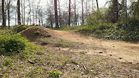
Photos of South Carolina Mountain Bike
trail: Skinny
3 |
Jun 22, 2022 @ 11:46am
Jun 22, 2022
trail: Pipsissewa Trail
11 |
Jun 9, 2022 @ 1:48pm
Jun 9, 2022
trail: Brown Wave
18 |
May 26, 2022 @ 3:08pm
May 26, 2022
trail: Skinny
12 |
May 26, 2022 @ 3:08pm
May 26, 2022
trail: Brown Wave
11 |
May 26, 2022 @ 3:08pm
May 26, 2022
trail: Gecko
39 |
Jan 19, 2022 @ 9:20am
Jan 19, 2022
trail: Clemson Freeride DH
505 |
Mar 19, 2013 @ 9:16am
Mar 19, 2013
trail: Clemson Freeride DH
672 |
Mar 19, 2013 @ 9:16am
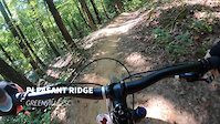
Mar 19, 2013Videos of South Carolina Mountain Bike

37 |
Nov 9, 2021
trail: Gateway Park Loop
99 |
Jan 22, 2021
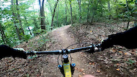
trail: Jorge F. Arango Trail
165 |
Nov 30, 2020
trail: Lake Whelchel Trail
2:43 |
53 |
Sep 22, 2020

trail: Mountain Creek Trail
1:57 |
|
Nov 19, 2019

trail: Loopty Connector
6:55 |
98 |
Dec 30, 2017

trail: Fast
4:21 |
271 |
Dec 30, 2017

trail: Clemson Freeride DH
5:10 |
345 |
Dec 29, 2017
Activity Feed
| username | action | type | title | date | |
|---|---|---|---|---|---|
 | Bkbeeker | wishlist | region | Paris Mountain State Park | Jul 5, 2022 @ 6:51pm 7 hours |
| JohnMcmillenyd1 | wishlist | region | Stumphouse Mountain Bike Park | Jul 4, 2022 @ 11:32am 2 days |
| JessieInguagiato | ridden | trail | Idaho Trail | Jul 4, 2022 @ 5:50am 2 days |
| Al5465 | ridden | trail | Deep Step | Jul 3, 2022 @ 7:06pm 2 days |
| eonmellitz | add | report | Midlands - Firebreak and 4 more | Jul 3, 2022 @ 11:39am 3 days |
Recent Comments
| username | type | title | comment | date | |
|---|---|---|---|---|---|
 | report | I knew it was on borrowed time, thanks for... | Jun 19, 2022 @ 5:16pm Jun 19, 2022 | ||
 | trail | Great trail, was in the area for work, so went... | Jun 4, 2022 @ 12:48pm Jun 4, 2022 | ||
 | trail | $6 entrance fee. Not worth it, unless you are... | May 31, 2022 @ 4:59pm May 31, 2022 | ||
 | report | Flat but fun. | May 29, 2022 @ 11:27am May 29, 2022 | ||
 | report | Totally sick gnar. Nailed Everything in about... | May 10, 2022 @ 1:52am May 10, 2022 |
Local Badges
-

10 Blue Trails109 awarded -

Big Ride 30k3,231 awarded -

Trail Explorer 100261 awarded -

10 Green Trails70 awarded -
Big Ride 30k471 awarded -

Completionist0 awarded
National Scenic Trails & Official Routes
-
The Palmetto Trail
- Mountain Bike
- Hike
- Trail Running
- Horse
Bike & Skill Parks
| name | type | city | rating |
|---|---|---|---|
| Andre S. Pope MTB Skills Park | skill park | Myrtle Beach | |
| Central SWU Bike Park | skill park | Central | |
| Gateway Park | skill park | Travelers Rest | |
| Vic Bailey Subaru Bike Park | skill park | Spartanburg |
Upcoming Local Events
Activity Type Stats
| activitytype | trails | distance | descent | descent distance | total vertical | rating | global rank | state rank | photos | reports | routes | ridelogs |
|---|---|---|---|---|---|---|---|---|---|---|---|---|
| Mountain Bike | 436 | 834 miles | 76,552 ft | 286 miles | 3,373 ft | #48 | 828 | 2,510 | 23 | 80,032 | ||
| E-Bike | 51 | 86 miles | 4,245 ft | 20 miles | 3,360 ft | #53 | 1,978 | 4 | 333 | |||
| Hike | 547 | 1,087 mile | 120,302 ft | 399 miles | 3,681 ft | #46 | 22 | 2,470 | 9 | 2,371 | ||
| Trail Running | 547 | 1,089 mile | 120,279 ft | 400 miles | 3,681 ft | #46 | 3 | 2,470 | 6 | 979 | ||
| Horse | 34 | 193 miles | 10,545 ft | 51 miles | 3,360 ft | #38 | 518 | 2 | 31 | |||
| Dirtbike/Moto | 15 | 44 miles | 2,680 ft | 9 miles | 2,077 ft | #29 | 516 | 10 | ||||
| Observed Trials | 6 | 9 miles | 2,421 ft | 5 miles | 965 ft | 18 | 7 | |||||
| ATV/ORV/OHV | 15 | 44 miles | 2,680 ft | 9 miles | 2,077 ft | #25 | 2 | 516 | 3 |
- By canadaka
 Trailforks & contributors
 - Admins: Map Team, chuktA, msmcfate, WillieJacobsz, PlumbBobM, ReckitRolley, SORBA, trailtraverser
- #3219 - 16,775 views
- south carolina activity log | embed map of South Carolina mountain bike trails | south carolina mountain biking points of interest
-
- subscribe
- 3d map
Downloading of trail gps tracks in kml & gpx formats is enabled for South Carolina.
You must login to download files.