close
Trail Conditions
- Unknown
- Snow Groomed
- Snow Packed
- Snow Covered
- Snow Cover Inadequate
- Freeze/thaw Cycle
- Icy
- Prevalent Mud
- Wet
- Variable
- Ideal
- Dry
- Very Dry
Trail Flow (Ridden Direction)
Trailforks scans users ridelogs to determine the most popular direction each trail is ridden. A good flowing trail network will have most trails flowing in a single direction according to their intension.
The colour categories are based on what percentage of riders are riding a trail in its intended direction.
The colour categories are based on what percentage of riders are riding a trail in its intended direction.
- > 96%
- > 90%
- > 80%
- > 70%
- > 50%
- < 50%
- bi-directional trail
- no data
Trail Last Ridden
Trailforks scans ridelogs to determine the last time a trail was ridden.
- < 2 days
- < 1 week
- < 2 weeks
- < 1 month
- < 6 months
- > 6 months
Trail Ridden Direction
The intended direction a trail should be ridden.
- Downhill Only
- Downhill Primary
- Both Directions
- Uphill Primary
- Uphill Only
- One Direction
Contribute Details
Colors indicate trail is missing specified detail.
- Description
- Photos
- Description & Photos
- Videos
Trail Popularity ?
Trailforks scans ridelogs to determine which trails are ridden the most in the last 9 months.
Trails are compared with nearby trails in the same city region with a possible 25 colour shades.
Think of this as a heatmap, more rides = more kinetic energy = warmer colors.
- most popular
- popular
- less popular
- not popular
ATV/ORV/OHV Filter
Max Vehicle Width
inches
Radar Time
x
Activity Recordings
Trailforks users anonymized public ridelogs from the past 6 months.
- mountain biking recent
- mountain biking (>6 month)
- hiking (1 year)
- moto (1 year)
Activity Recordings
Trailforks users anonymized public skilogs from the past 12 months.
- Downhill Ski
- Backcountry Ski
- Nordic Ski
Jump Magnitude Heatmap
Heatmap of where riders jump on trails. Zoom in to see individual jumps, click circles to view jump details.
Trails Deemphasized
Trails are shown in grey.
Only show trails with NO bikes.
Save the current map location and zoom level as your default home location whenever this page is loaded.
SaveThis region is Unsanctioned, Ride at your own Risk!
No description for Adamov has been added yet! Login or register to submit one.Primary Trail Type: Cross-Country
Shuttleable: YES
This region uses the Uk/Euro style trail grading system.
Activities Click to view
- Mountain Bike
14 trails
- E-Bike
5 trails
- Hike
14 trails
- Trail Running
14 trails
Region Details
- 1
- 7
- 4
Region Status
Caution as of May 30, 2022Stats
- Avg Trail Rating
- Trails (view details)
- 14
- Trails Mountain Bike
- 14
- Trails E-Bike
- 5
- Trails Hike
- 14
- Trails Trail Running
- 14
- Total Distance
- 17 miles
- Total Descent
- 8,446 ft
- Total Vertical
- 1,103 ft
- Highest Trailhead
- 1,898 ft
- Reports
- 116
- Photos
- 2
- Ridden Counter
- 406
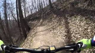
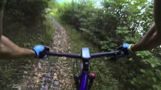
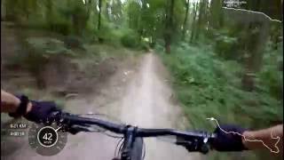
Popular Adamov Mountain Biking Trails
Photos of Adamov Mountain Bike
trail: Hemzal
67 |
Dec 29, 2020 @ 11:05pm
Dec 29, 2020Videos of Adamov Mountain Bike
trail: Hemzal vrch
6:22 |
412 |
Mar 7, 2018 , Brno
trail: Po žluté do Josefovského
2:46 |
355 |
Jan 23, 2018 , Brno
trail: Ronovský
1108 |
Nov 17, 2017 , Brno

trail: Hemzal
519 |
Nov 1, 2016 , Brno

trail: Hemzal
524 |
Mar 12, 2016 , Brno
Recent Trail Reports
| status | trail | date | condition | info | user |
|---|---|---|---|---|---|
| Hřbitovní kvítí | May 30, 2022 @ 10:46pm May 30, 2022 | Ideal | ufoncz | ||
| Svatá Kateřina | May 6, 2022 @ 6:56am May 6, 2022 | Variable | TheJD | ||
| Hemzal vrch | Nov 14, 2021 @ 1:21am Nov 14, 2021 | Wet | zvpe | ||
| Starý hrad | Nov 14, 2021 @ 1:21am Nov 14, 2021 | Wet | zvpe | ||
| Hemzal | Oct 3, 2021 @ 2:39am Oct 3, 2021 | Dry | kalupp | ||
| Ke Kateřině | Jun 24, 2021 @ 8:51am Jun 24, 2021 | Ideal | Valentin1945 | ||
| Ronovský | Jun 9, 2021 @ 12:41am Jun 9, 2021 | Dry | ufoncz | ||
| Po žluté do Josefovského | May 29, 2021 @ 12:53am May 29, 2021 | Dry | TheJD | ||
| Čertův hrádek | Apr 10, 2021 @ 6:15am Apr 10, 2021 | Dry | ufoncz | ||
| Baba | Feb 14, 2021 @ 3:41am Feb 14, 2021 | Icy | Honzull |
Activity Feed
| username | action | type | title | date | |
|---|---|---|---|---|---|
 | ufoncz | add | report | Hřbitovní kvítí | Jun 9, 2022 @ 12:52pm Jun 9, 2022 |
 | TheJD | add | report | Svatá Kateřina | May 6, 2022 @ 1:01pm May 6, 2022 |
 | definitelynotatrailbuilder | wishlist | trail | Ronovský and 4 more | Feb 16, 2022 @ 12:10pm Feb 16, 2022 |
 | zvpe | add | report | Hemzal vrch and 2 more | Nov 14, 2021 @ 8:11am Nov 14, 2021 |
 | kalupp | add | report | Hemzal | Oct 3, 2021 @ 1:06pm Oct 3, 2021 |
Recent Comments
| username | type | title | comment | date | |
|---|---|---|---|---|---|
| trail | Moje srdcovka, trail nepatří k nejlehčím.... | Jul 20, 2020 @ 3:25am Jul 20, 2020 | ||
| trail | Freeride v kombinaci DH | Aug 18, 2018 @ 2:55am Aug 18, 2018 |
Nearby Areas
| name | distance | ||||
|---|---|---|---|---|---|
| Brno sever | 8 | 10 | 3.3 km | ||
| Kanice | 5 | 3 | 3.5 km | ||
| Singletrail Moravský kras | Jedovnické stezky | 4 | 3 | 4.6 km | ||
| Hády | 3 | 2 | 2 | 4.9 km | |
| Zamilec Trails | 1 | 3 | 5 km |
Local Mountain Biking Directory
-
HaPe CYKLO SPORTClub
-
HaPe SportBike Shop
Activity Type Stats
| activitytype | trails | distance | descent | descent distance | total vertical | rating | global rank | state rank | photos | reports | routes | ridelogs |
|---|---|---|---|---|---|---|---|---|---|---|---|---|
| Mountain Bike | 14 | 17 miles | 8,445 ft | 11 miles | 1,102 ft | #6,554 | #58 | 2 | 116 | 608 | ||
| E-Bike | 5 | 7 miles | 2,930 ft | 4 miles | 938 ft | #4,011 | #25 | 113 | 6 | |||
| Hike | 14 | 17 miles | 8,445 ft | 11 miles | 1,102 ft | #5,659 | #38 | 116 | 24 | |||
| Trail Running | 14 | 17 miles | 8,445 ft | 11 miles | 1,102 ft | #5,667 | #39 | 116 | 7 |
- By Bogar & contributors
- Admins: apply
- #21702 - 4,165 views
- adamov activity log | embed map of Adamov mountain bike trails |
Downloading of trail gps tracks in kml & gpx formats is enabled for Adamov.
You must login to download files.