close
Trail Conditions
- Unknown
- Snow Groomed
- Snow Packed
- Snow Covered
- Snow Cover Inadequate
- Freeze/thaw Cycle
- Icy
- Prevalent Mud
- Wet
- Variable
- Ideal
- Dry
- Very Dry
Trail Flow (Ridden Direction)
Trailforks scans users ridelogs to determine the most popular direction each trail is ridden. A good flowing trail network will have most trails flowing in a single direction according to their intension.
The colour categories are based on what percentage of riders are riding a trail in its intended direction.
The colour categories are based on what percentage of riders are riding a trail in its intended direction.
- > 96%
- > 90%
- > 80%
- > 70%
- > 50%
- < 50%
- bi-directional trail
- no data
Trail Last Ridden
Trailforks scans ridelogs to determine the last time a trail was ridden.
- < 2 days
- < 1 week
- < 2 weeks
- < 1 month
- < 6 months
- > 6 months
Trail Ridden Direction
The intended direction a trail should be ridden.
- Downhill Only
- Downhill Primary
- Both Directions
- Uphill Primary
- Uphill Only
- One Direction
Contribute Details
Colors indicate trail is missing specified detail.
- Description
- Photos
- Description & Photos
- Videos
Trail Popularity ?
Trailforks scans ridelogs to determine which trails are ridden the most in the last 9 months.
Trails are compared with nearby trails in the same city region with a possible 25 colour shades.
Think of this as a heatmap, more rides = more kinetic energy = warmer colors.
- most popular
- popular
- less popular
- not popular
ATV/ORV/OHV Filter
Max Vehicle Width
inches
Radar Time
x
Activity Recordings
Trailforks users anonymized public ridelogs from the past 6 months.
- mountain biking recent
- mountain biking (>6 month)
- hiking (1 year)
- moto (1 year)
Activity Recordings
Trailforks users anonymized public skilogs from the past 12 months.
- Downhill Ski
- Backcountry Ski
- Nordic Ski
Jump Magnitude Heatmap
Heatmap of where riders jump on trails. Zoom in to see individual jumps, click circles to view jump details.
Trails Deemphasized
Trails are shown in grey.
Only show trails with NO bikes.
Save the current map location and zoom level as your default home location whenever this page is loaded.
SavePopular Trail Networks
view all areas »
No description for South Dakota has been added yet!
Login or register to submit one.
Region Details
- 65
- 28
- 141
- 215
- 80
- 11
Stats
- Avg Trail Rating
- Trails (view details)
- 667
- Trails Mountain Bike
- 540
- Trails E-Bike
- 146
- Trails Hike
- 654
- Trails Trail Running
- 647
- Trails Horse
- 54
- Trails Dirtbike/Moto
- 8
- Trails Observed Trials
- 3
- Trails ATV/ORV/OHV
- 7
- Trails Snowmobile
- 4
- Trails Snowshoe
- 81
- Trails Downhill Ski
- 3
- Trails Backcountry Ski
- 4
- Trails Nordic Ski
- 79
- Total Distance
- 1,073 mile
- Total Descent
- 124,153 ft
- Total Vertical
- 6,259 ft
- Highest Trailhead
- 7,231 ft
- Reports
- 1,408
- Photos
- 749
- Ridden Counter
- 28,792
 Articles
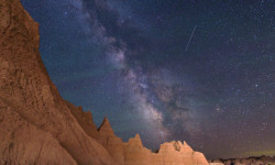
This Badlands Overnight is the Perfect Stargazing Hike for Beginners
Aug 19, 2021 from backpacker.com
Take a newbie hiker on this perfect Badlands stargazing hike.
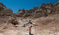
I Saw an Epic Sunset at Badlands National Park
Nov 2, 2020 from outsideonline.com
Our 62 Parks Traveler meets bison and sees surreal geography at this South Dakota stop, the 23rd visit on her journey to see every U.S. national park
Visiting Sacred Ground at Wind Cave National Park
Oct 11, 2020 from outsideonline.com
Our 62 Parks Traveler explores miles of hiking trails and one of the largest remaining mixed-grass prairie ecosystems in the country at South...
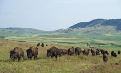
Spot Bison in Wind Cave National Park, South Dakota
Jun 15, 2018 from backpacker.com
Rediscover the bison on this three-day, weekend trek through the prairieland of Wind Cave National Park, South Dakota with advice from Backpacker...
Sub Regions
- SD - Black Hills and Badlands Region (366)
- Bennett County (0)
- Butte County (0)
- Custer County (20)
- Fall River County (6)
- Harding County (3)
- Jackson County (1)
- Lawrence County (68)
- Meade County (43)
- Pennington County (223)
- Perkins County (2)
- SD - Glacial Lakes & Prairies Region (11)
- Roberts County (11)
- SD - Missouri River Region (52)
- Hughes County (35)
- Hyde County (2)
- Lyman County (5)
- Stanley County (11)
- Walworth County (1)
- SD - South Eastern Region (97)
- Davison County (31)
- Minnehaha County (43)
- Union County (7)
Popular South Dakota Mountain Biking Trails
| status | title | difficulty | rating |
|---|---|---|---|
| Tinton 2019 Updated Black Hills | |||
| Sunset South Hanson-Larsen Memorial Park | |||
| Upper Wild Turkey Hanson-Larsen Memorial Park | |||
| T Trail Hanson-Larsen Memorial Park | |||
| Founders Park Connect Hanson-Larsen Memorial Park | |||
| Twin Bridges Black Hills | |||
| Mid Wild Turkey Hanson-Larsen Memorial Park | |||
| Far West Hanson-Larsen Memorial Park | |||
| T Trail Connector Hanson-Larsen Memorial Park | |||
| Founders Valley Connector Hanson-Larsen Memorial Park | |||
| Founders Valley Hanson-Larsen Memorial Park | |||
| SM TH - #1 Storm Mountain Trails | |||
| M West Hanson-Larsen Memorial Park | |||
| Sun Climb Hanson-Larsen Memorial Park | |||
| Sunset North Hanson-Larsen Memorial Park |
South Dakota Mountain Bike Routes
| title | rating | distance |
|---|---|---|
| Hell Canyon Loop Jewel Cave National Monument | 5 miles | |
| Doug's Sick Rip Down M Hill Hanson-Larsen Memorial Park | 5 miles | |
| Music on Main #5 2021 7th Cavalry Trail System | 9 miles | |
| The official Dakota Five-o course, 2019 Spearfish | 50 miles | |
| Foster-Deadman Loop on a Stick Storm Mountain Trails | 16 miles | |
| Tinton Trail Loop Spearfish | 14 miles | |
| Dakota Five-O 2019 Spearfish | 50 miles | |
| Winter Fat Classic 24mi Deadwood | 24 miles | |
| Finding nemo Shanks Trail System | 10 miles | |
| Sturgis Figure 8 Sturgis Trail System | 22 miles |
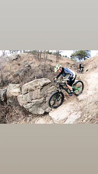
Photos of South Dakota Mountain Bike
trail: Homestake Trail
1 |
Jun 26, 2022 @ 6:49pm
Jun 26, 2022
trail: Homestake Trail
0 |
Jun 22, 2022 @ 5:59pm
Jun 22, 2022
trail: Homestake Trail
0 |
Jun 22, 2022 @ 5:59pm
Jun 22, 2022
trail: Homestake Trail
1 |
Jun 22, 2022 @ 5:58pm
Jun 22, 2022
trail: Homestake Trail
1 |
Jun 22, 2022 @ 5:58pm
Jun 22, 2022
trail: 2017 (loop)
77 |
Sep 29, 2020 @ 9:02am
Sep 29, 2020
trail: 1805 (Waterfront)
95 |
Aug 26, 2019 @ 10:45am
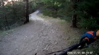
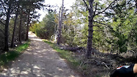
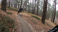
Aug 26, 2019Videos of South Dakota Mountain Bike

trail: Dark Forest
43 |
May 8, 2022
trail: Twizzler
8 |
Jul 4, 2021
trail: Colby Jack
23 |
Apr 26, 2021
trail: Jonette's Way
22 |
Apr 26, 2021
trail: Loop 15, Victoria's Secret
89 |
Feb 1, 2021

trail: Dirk's Draw Red Dragon
|
Jan 13, 2021
trail: Dirk's Draw Red Dragon
|
Jan 13, 2021
trail: Pet Cemetery
0:09 |
219 |
Jul 10, 2020
Activity Feed
| username | action | type | title | date | |
|---|---|---|---|---|---|
 | dirtworthy | wishlist | trail | Deerfield / Trail 40 | Jul 5, 2022 @ 10:27am 16 hours |
| TravisPhillipstE | ridden | trail | Tinton 2019 Updated and 1 more | Jul 4, 2022 @ 7:20am 2 days |
| agent6d6 | add | report | Sandy Beach Trail and 2 more | Jul 2, 2022 @ 9:11pm Jul 2, 2022 |
 | cackerman3 | add | report | Ridge Trail and 2 more | Jul 1, 2022 @ 1:14pm Jul 1, 2022 |
| cackerman3 | add | report | Alkali Ridge and 3 more | Jul 1, 2022 @ 1:09pm Jul 1, 2022 |
Recent Comments
| username | type | title | comment | date | |
|---|---|---|---|---|---|
| trail | This trail is unrideable now. Unfortunate... | Jun 27, 2022 @ 8:34am Jun 27, 2022 | ||
| trail | For my 3rd trail ride this about kicked my... | Jun 22, 2022 @ 9:19am Jun 22, 2022 | ||
| trail | Dry the whole way. First trail ever, think I... | Jun 19, 2022 @ 9:46am Jun 19, 2022 | ||
| trail | Ok, but would be a better ride counter... | May 14, 2022 @ 9:48pm May 14, 2022 | ||
| trail | Closed northern section of the trail,... | Mar 20, 2022 @ 9:09am Mar 20, 2022 |
Local Badges
-

Completionist8 awarded -

10 Blue Trails201 awarded -

Big Ride 30k897 awarded -

10 Black Trails113 awarded -
Big Ride 30k821 awarded -

Epic Ride Climb 2k89 awarded
Bike & Skill Parks
| name | type | city | rating |
|---|---|---|---|
| Sturgis Skillpark | skill park | Sturgis | |
| Woodlot Pump Track | skill park | Mitchell |
Upcoming Local Events
Activity Type Stats
| activitytype | trails | distance | descent | descent distance | total vertical | rating | global rank | state rank | photos | reports | routes | ridelogs |
|---|---|---|---|---|---|---|---|---|---|---|---|---|
| Mountain Bike | 540 | 885 miles | 106,125 ft | 365 miles | 5,509 ft | #49 | 697 | 1,398 | 26 | 33,298 | ||
| E-Bike | 146 | 318 miles | 27,323 ft | 142 miles | 5,052 ft | #33 | 1,136 | 1 | 517 | |||
| Hike | 654 | 1,054 mile | 121,772 ft | 425 miles | 6,260 ft | #48 | 46 | 1,402 | 16 | 3,670 | ||
| Trail Running | 647 | 1,048 mile | 120,860 ft | 422 miles | 6,260 ft | #48 | 2 | 1,399 | 6 | 1,271 | ||
| Horse | 54 | 124 miles | 13,629 ft | 46 miles | 5,856 ft | #54 | 365 | 4 | 14 | |||
| Dirtbike/Moto | 8 | 31 miles | 4,485 ft | 13 miles | 1,693 ft | #33 | 353 | 16 | ||||
| Observed Trials | 3 | 15 miles | 2,582 ft | 7 miles | 1,693 ft | 3 | 1 | |||||
| ATV/ORV/OHV | 7 | 23 miles | 3,543 ft | 10 miles | 1,693 ft | 3 | 359 | 9 | ||||
| Snowmobile | 4 | 8 miles | 994 ft | 2 miles | 4,012 ft | #24 | 7 | |||||
| Snowshoe | 81 | 138 miles | 14,514 ft | 50 miles | 6,122 ft | #36 | 30 | 80 | ||||
| Downhill Ski | 3 | 8 miles | 541 ft | 3 miles | 850 ft | #6 | 2 | 479 | ||||
| Backcountry Ski | 4 | 9 miles | 548 ft | 3 miles | 850 ft | #24 | 3 | 85 | ||||
| Nordic Ski | 79 | 101 miles | 8,570 ft | 37 miles | 5,509 ft | #43 | 1 | 4 | 489 |
- By canadaka
 Trailforks & contributors
 - Admins: Map Team, chuktA, msmcfate, WillieJacobsz, PlumbBobM, ReckitRolley, chuktA
- #3153 - 14,172 views
- south dakota activity log | embed map of South Dakota mountain bike trails | south dakota mountain biking points of interest polygons
-
- subscribe
- 3d map
Downloading of trail gps tracks in kml & gpx formats is enabled for South Dakota.
You must login to download files.