close
Trail Conditions
- Unknown
- Snow Groomed
- Snow Packed
- Snow Covered
- Snow Cover Inadequate
- Freeze/thaw Cycle
- Icy
- Prevalent Mud
- Wet
- Variable
- Ideal
- Dry
- Very Dry
Trail Flow (Ridden Direction)
Trailforks scans users ridelogs to determine the most popular direction each trail is ridden. A good flowing trail network will have most trails flowing in a single direction according to their intension.
The colour categories are based on what percentage of riders are riding a trail in its intended direction.
The colour categories are based on what percentage of riders are riding a trail in its intended direction.
- > 96%
- > 90%
- > 80%
- > 70%
- > 50%
- < 50%
- bi-directional trail
- no data
Trail Last Ridden
Trailforks scans ridelogs to determine the last time a trail was ridden.
- < 2 days
- < 1 week
- < 2 weeks
- < 1 month
- < 6 months
- > 6 months
Trail Ridden Direction
The intended direction a trail should be ridden.
- Downhill Only
- Downhill Primary
- Both Directions
- Uphill Primary
- Uphill Only
- One Direction
Contribute Details
Colors indicate trail is missing specified detail.
- Description
- Photos
- Description & Photos
- Videos
Trail Popularity ?
Trailforks scans ridelogs to determine which trails are ridden the most in the last 9 months.
Trails are compared with nearby trails in the same city region with a possible 25 colour shades.
Think of this as a heatmap, more rides = more kinetic energy = warmer colors.
- most popular
- popular
- less popular
- not popular
ATV/ORV/OHV Filter
Max Vehicle Width
inches
Radar Time
x
Activity Recordings
Trailforks users anonymized public ridelogs from the past 6 months.
- mountain biking recent
- mountain biking (>6 month)
- hiking (1 year)
- moto (1 year)
Activity Recordings
Trailforks users anonymized public skilogs from the past 12 months.
- Downhill Ski
- Backcountry Ski
- Nordic Ski
Jump Magnitude Heatmap
Heatmap of where riders jump on trails. Zoom in to see individual jumps, click circles to view jump details.
Trails Deemphasized
Trails are shown in grey.
Only show trails with NO bikes.
Save the current map location and zoom level as your default home location whenever this page is loaded.
Save
No description for Adobe Jack has been added yet!
Login or register to submit one.
 google parking directions
google parking directions Activities Click to view
- Mountain Bike
34 trails
- Hike
37 trails
- Trail Running
36 trails
- Horse
10 trails
Region Details
- 3
- 4
- 13
- 13
- 1
Region Status
Open as of Mar 3, 2020Stats
- Avg Trail Rating
- Trails (view details)
- 42
- Trails Mountain Bike
- 34
- Trails E-Bike
- 1
- Trails Hike
- 37
- Trails Trail Running
- 36
- Trails Horse
- 10
- Total Distance
- 35 miles
- Total Descent
- 4,702 ft
- Total Vertical
- 2,006 ft
- Highest Trailhead
- 6,245 ft
- Reports
- 387
- Photos
- 199
- Ridden Counter
- 22,031
 Articles
The 10 Best Hikes in Sedona
May 31, 2019 from backpacker.com
Looking for the best hikes in Sedona? Glory in Arizona's red rock country on these perfect southwest desert adventures.
Popular Adobe Jack Mountain Biking Trails
Adobe Jack Mountain Bike Routes
| title | rating | distance |
|---|---|---|
| Soldier Wash Loop | 5 miles | |
| Munds Wagon, Cowpies, Hangover Loop | 8 miles | |
| Soldier Pass Trail | 5 miles | |
| Sugarloaf Loop Trail | 2 miles |
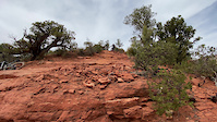
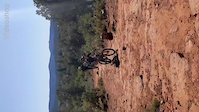
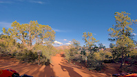
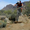
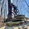
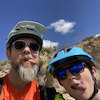
Photos of Adobe Jack Mountain Bike
trail: Soldier Pass
122 |
Jun 2, 2020 @ 9:08am
Jun 2, 2020
trail: Soldier Pass
87 |
May 26, 2020 @ 3:46pm
May 26, 2020
trail: Teacup
139 |
Mar 3, 2020 @ 9:06am
Mar 3, 2020
trail: Teacup
158 |
Mar 3, 2020 @ 9:06am
Mar 3, 2020
trail: Thunder Mountain
189 |
Dec 18, 2018 @ 10:55am
Dec 18, 2018
trail: Grand Central
273 |
Mar 29, 2018 @ 7:47am
Mar 29, 2018
trail: Thunder Mountain
280 |
Oct 3, 2017 @ 1:17pm
Oct 3, 2017
trail: Grand Central
523 |
May 19, 2016 @ 9:49am
May 19, 2016Videos of Adobe Jack Mountain Bike
trail: Ant Hill
|
Mar 28, 2022
trail: Teacup
1:11 |
92 |
Mar 24, 2020
trail: Wildcat Flow Trail
0:42 |
300 |
Apr 10, 2019

trail: Dual Slalom
1:47 |
147 |
Nov 11, 2017
trail: Adobe Jack
1:47 |
255 |
Feb 14, 2017
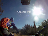
trail: Andante
3:53 |
215 |
Feb 8, 2017
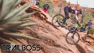
trail: Grand Central
14:07 |
513 |
Feb 15, 2015
Recent Trail Reports
| status | trail | date | condition | info | user |
|---|---|---|---|---|---|
| Soldier Pass | May 27, 2022 @ 11:20am May 27, 2022 | Dry | kndl | ||
| Crusty | May 9, 2022 @ 10:24am May 9, 2022 | Ideal | Tony8tNr4i | ||
| Ant Hill | May 9, 2022 @ 10:24am May 9, 2022 | Ideal | Tony8tNr4i | ||
| Adobe Jack | Apr 28, 2022 @ 9:22am Apr 28, 2022 | Ideal | MATHISCA | ||
| Soldier Pass | Apr 28, 2022 @ 9:22am Apr 28, 2022 | Dry | MATHISCA | ||
| Javelina | Apr 28, 2022 @ 9:22am Apr 28, 2022 | Dry | MATHISCA | ||
| Soldier Pass Conn | Apr 8, 2022 @ 11:10am Apr 8, 2022 | Dry | CraigHinCA | ||
| FSR 09904C | Apr 8, 2022 @ 11:10am Apr 8, 2022 | Dry | CraigHinCA | ||
| Coyote | Apr 3, 2022 @ 4:02pm Apr 3, 2022 | Dry | jpcrockett | ||
| Grand Central | Apr 3, 2022 @ 4:02pm Apr 3, 2022 | Dry | jpcrockett |
Activity Feed
| username | action | type | title | date | |
|---|---|---|---|---|---|
 | markholloway | update | trail | Adobe Jack | Jun 30, 2022 @ 4:34am Jun 30, 2022 |
 | msmcfate | add | photo | in Cottonwood, Arizona, United States | Jun 25, 2022 @ 9:08am Jun 25, 2022 |
 | tbrucer | wishlist | region | Adobe Jack | Jun 13, 2022 @ 8:44am Jun 13, 2022 |
| Bmmalone | vote | trail | Lower Chimney Rock | Jun 8, 2022 @ 8:49am Jun 8, 2022 |
| Swaymac | ridden | trail | Lower Chimney Rock | Jun 6, 2022 @ 9:11pm Jun 6, 2022 |
Recent Comments
| username | type | title | comment | date | |
|---|---|---|---|---|---|
 | trail | If you ride it CCW you get a steep punchy... | Mar 5, 2022 @ 8:26am Mar 5, 2022 | ||
| trail | No parking. Ever. Neighbors don’t allow... | Feb 17, 2022 @ 1:37pm Feb 17, 2022 | ||
| report | Yes | Feb 11, 2022 @ 11:21am Feb 11, 2022 | ||
| trail | Good connector. Especially if you want to go... | Jan 27, 2022 @ 12:56am Jan 27, 2022 | ||
 | trail | I've ridden this only in the downhill (north... | Nov 23, 2021 @ 11:25am Nov 23, 2021 |
Nearby Areas
| name | distance | ||||
|---|---|---|---|---|---|
| Schnebly Hill | 3 | 3 | 1 | 3 km | |
| Carroll Canyon | 1 | 10 | 12 | 3.2 km | |
| Broken Arrow | 1 | 6 | 7 | 2 | 3.3 km |
| Dry Creek | 3 | 25 | 9 | 3.8 km | |
| Western Gateway | 3 | 7 | 5 | 4.2 km |
Local Badges
-

Completionist0 awarded
Activity Type Stats
| activitytype | trails | distance | descent | descent distance | total vertical | rating | global rank | state rank | photos | reports | routes | ridelogs |
|---|---|---|---|---|---|---|---|---|---|---|---|---|
| Mountain Bike | 34 | 25 miles | 3,638 ft | 13 miles | 568 ft | #137 | #57 | 191 | 387 | 4 | 6,597 | |
| E-Bike | 1 | 1,568 ft | 13 ft | 323 | 49 | |||||||
| Hike | 37 | 35 miles | 4,475 ft | 14 miles | 2,005 ft | #120 | #61 | 8 | 379 | 14 | 668 | |
| Trail Running | 36 | 34 miles | 4,475 ft | 14 miles | 2,005 ft | #120 | #60 | 379 | 6 | 152 | ||
| Horse | 10 | 18 miles | 2,014 ft | 6 miles | 1,768 ft | #43 | #37 | 115 | 4 | 2 |
- By markholloway
 Trailforks & contributors
 - Admins: SRRTF, MollyJoyce
- #35664 - 2,938 views
- adobe jack activity log | embed map of Adobe Jack mountain bike trails | adobe jack mountain biking points of interest
Downloading of trail gps tracks in kml & gpx formats is enabled for Adobe Jack.
You must login to download files.