close
Trail Conditions
- Unknown
- Snow Groomed
- Snow Packed
- Snow Covered
- Snow Cover Inadequate
- Freeze/thaw Cycle
- Icy
- Prevalent Mud
- Wet
- Variable
- Ideal
- Dry
- Very Dry
Trail Flow (Ridden Direction)
Trailforks scans users ridelogs to determine the most popular direction each trail is ridden. A good flowing trail network will have most trails flowing in a single direction according to their intension.
The colour categories are based on what percentage of riders are riding a trail in its intended direction.
The colour categories are based on what percentage of riders are riding a trail in its intended direction.
- > 96%
- > 90%
- > 80%
- > 70%
- > 50%
- < 50%
- bi-directional trail
- no data
Trail Last Ridden
Trailforks scans ridelogs to determine the last time a trail was ridden.
- < 2 days
- < 1 week
- < 2 weeks
- < 1 month
- < 6 months
- > 6 months
Trail Ridden Direction
The intended direction a trail should be ridden.
- Downhill Only
- Downhill Primary
- Both Directions
- Uphill Primary
- Uphill Only
- One Direction
Contribute Details
Colors indicate trail is missing specified detail.
- Description
- Photos
- Description & Photos
- Videos
Trail Popularity ?
Trailforks scans ridelogs to determine which trails are ridden the most in the last 9 months.
Trails are compared with nearby trails in the same city region with a possible 25 colour shades.
Think of this as a heatmap, more rides = more kinetic energy = warmer colors.
- most popular
- popular
- less popular
- not popular
ATV/ORV/OHV Filter
Max Vehicle Width
inches
Radar Time
x
Activity Recordings
Trailforks users anonymized public ridelogs from the past 6 months.
- mountain biking recent
- mountain biking (>6 month)
- hiking (1 year)
- moto (1 year)
Activity Recordings
Trailforks users anonymized public skilogs from the past 12 months.
- Downhill Ski
- Backcountry Ski
- Nordic Ski
Jump Magnitude Heatmap
Heatmap of where riders jump on trails. Zoom in to see individual jumps, click circles to view jump details.
Trails Deemphasized
Trails are shown in grey.
Only show trails with NO bikes.
Save the current map location and zoom level as your default home location whenever this page is loaded.
SaveAiako Harriak Parke Naturala
Primary Trail Type: All-Mountain & Downhill
eBikes Allowed:
Yes
Land Status: Community Forest
 google parking directions
This region uses the Uk/Euro style trail grading system.
Activities Click to view
- Mountain Bike
73 trails
- E-Bike
69 trails
- Hike
64 trails
- Trail Running
64 trails
Region Details
- 29
- 3
- 27
- 11
- 3
Region Status
Open as of Feb 1, 2022Stats
- Avg Trail Rating
- Trails (view details)
- 73
- Trails Mountain Bike
- 73
- Trails E-Bike
- 69
- Trails Hike
- 64
- Trails Trail Running
- 64
- Trails Horse
- 2
- Trails Dirtbike/Moto
- 1
- Total Distance
- 88 miles
- Total Descent Distance
- 42 miles
- Total Descent
- 25,693 ft
- Total Vertical
- 2,153 ft
- Highest Trailhead
- 2,223 ft
- Reports
- 89
- Photos
- 6
- Ridden Counter
- 595
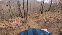
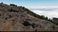
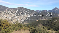
Popular Aiako Harriak Mountain Biking Trails
Videos of Aiako Harriak Mountain Bike
trail: MakWhistler
29 |
Mar 14, 2022
trail: Wild
32 |
Mar 20, 2021

trail: Wild
1:00 |
20921 |
Sep 27, 2015
trail: Wild
8:46 |
438 |
Nov 18, 2014
Recent Trail Reports
| status | trail | date | condition | info | user |
|---|---|---|---|---|---|
| Karrika-Zaldin | Jun 21, 2022 @ 6:37am Jun 21, 2022 | Ideal | cyper85 | ||
| Salamandra Medio | Jun 21, 2022 @ 6:37am Jun 21, 2022 | Variable | cyper85 | ||
| Xau Erreka | Jun 6, 2022 @ 3:35am Jun 6, 2022 | Unknown | Tioholtzman | ||
| Otraitz | Jun 6, 2022 @ 3:34am Jun 6, 2022 | Unknown | Tioholtzman | ||
| Salamandra Superior | Jun 6, 2022 @ 3:32am Jun 6, 2022 | Ideal | Tioholtzman | ||
| Blue pill | May 2, 2022 @ 12:11am May 2, 2022 | Variable | krasty1002 TMD | ||
| Wild | May 2, 2022 @ 12:11am May 2, 2022 | Variable | krasty1002 TMD | ||
| Susperregi | Apr 30, 2022 @ 11:08pm Apr 30, 2022 | Ideal | jdiazrozo | ||
| Akola-Benta Txiki | Apr 10, 2022 @ 12:54am Apr 10, 2022 | Unknown | Tioholtzman | ||
| Benta Txiki-Malmazar | Apr 10, 2022 @ 12:54am Apr 10, 2022 | Unknown | Tioholtzman |
Activity Feed
| username | action | type | title | date | |
|---|---|---|---|---|---|
 | gmehl | wishlist | region | Aiako Harriak | Jul 5, 2022 @ 2:49am 1 day |
 | Marlon87 | ridden | trail | NSL | Jul 1, 2022 @ 1:57am Jul 1, 2022 |
 | cyper85 | ridden | trail | Salamandra Medio | Jun 21, 2022 @ 2:12pm Jun 21, 2022 |
| cyper85 | add | report | Karrika-Zaldin and 1 more | Jun 21, 2022 @ 2:08pm Jun 21, 2022 |
| Dcont | wishlist | trail | Akerbidea / El Cerro | Jun 19, 2022 @ 11:23am Jun 19, 2022 |
Recent Comments
| username | type | title | comment | date | |
|---|---|---|---|---|---|
| trail | Perfecto | May 4, 2022 @ 5:00am May 4, 2022 | ||
| report | Seco, perfecta | Apr 2, 2022 @ 12:18pm Apr 2, 2022 | ||
| trail | Han limpiado y arreglado varias curvas y pasos... | Feb 27, 2022 @ 6:40am Feb 27, 2022 | ||
| trail | La subida esta llena de surcos de los camiones... | Feb 6, 2022 @ 7:28am Feb 6, 2022 | ||
| trail | Han acondicionado un paso complicado que... | Jan 15, 2022 @ 6:03am Jan 15, 2022 |
Nearby Areas
| name | distance | ||||
|---|---|---|---|---|---|
| Elatzeta - Zubeltzu | 1 | 4.2 km | |||
| Artikutza | 1 | 9 | 4.2 km | ||
| SanMar | 3 | 4.4 km | |||
| Jaizkibel | 19 | 6.1 km | |||
| Bera | 1 | 3 | 6.2 km |
Activity Type Stats
| activitytype | trails | distance | descent | descent distance | total vertical | rating | global rank | state rank | photos | reports | routes | ridelogs |
|---|---|---|---|---|---|---|---|---|---|---|---|---|
| Mountain Bike | 73 | 88 miles | 25,692 ft | 42 miles | 2,152 ft | #6,319 | #232 | 6 | 89 | 124 | ||
| E-Bike | 69 | 82 miles | 23,671 ft | 38 miles | 2,152 ft | #2,416 | #170 | 72 | 22 | |||
| Hike | 64 | 81 miles | 21,004 ft | 36 miles | 2,152 ft | #6,316 | #244 | 76 | 3 | |||
| Trail Running | 64 | 81 miles | 21,552 ft | 36 miles | 2,152 ft | #5,800 | #216 | 78 | 1 | |||
| Horse | 2 | 3 miles | 1,158 ft | 2 miles | 1,148 ft | |||||||
| Dirtbike/Moto | 1 | 2 miles | 1,152 ft | 2 miles | 1,148 ft |
- By Tioholtzman
 & contributors
 - Admins: apply
- #48484 - 296 views
- aiako harriak activity log | embed map of Aiako Harriak mountain bike trails | aiako harriak mountain biking points of interest
Downloading of trail gps tracks in kml & gpx formats is enabled for Aiako Harriak.
You must login to download files.