close
Trail Conditions
- Unknown
- Snow Groomed
- Snow Packed
- Snow Covered
- Snow Cover Inadequate
- Freeze/thaw Cycle
- Icy
- Prevalent Mud
- Wet
- Variable
- Ideal
- Dry
- Very Dry
Trail Flow (Ridden Direction)
Trailforks scans users ridelogs to determine the most popular direction each trail is ridden. A good flowing trail network will have most trails flowing in a single direction according to their intension.
The colour categories are based on what percentage of riders are riding a trail in its intended direction.
The colour categories are based on what percentage of riders are riding a trail in its intended direction.
- > 96%
- > 90%
- > 80%
- > 70%
- > 50%
- < 50%
- bi-directional trail
- no data
Trail Last Ridden
Trailforks scans ridelogs to determine the last time a trail was ridden.
- < 2 days
- < 1 week
- < 2 weeks
- < 1 month
- < 6 months
- > 6 months
Trail Ridden Direction
The intended direction a trail should be ridden.
- Downhill Only
- Downhill Primary
- Both Directions
- Uphill Primary
- Uphill Only
- One Direction
Contribute Details
Colors indicate trail is missing specified detail.
- Description
- Photos
- Description & Photos
- Videos
Trail Popularity ?
Trailforks scans ridelogs to determine which trails are ridden the most in the last 9 months.
Trails are compared with nearby trails in the same city region with a possible 25 colour shades.
Think of this as a heatmap, more rides = more kinetic energy = warmer colors.
- most popular
- popular
- less popular
- not popular
ATV/ORV/OHV Filter
Max Vehicle Width
inches
Radar Time
x
Activity Recordings
Trailforks users anonymized public ridelogs from the past 6 months.
- mountain biking recent
- mountain biking (>6 month)
- hiking (1 year)
- moto (1 year)
Activity Recordings
Trailforks users anonymized public skilogs from the past 12 months.
- Downhill Ski
- Backcountry Ski
- Nordic Ski
Jump Magnitude Heatmap
Heatmap of where riders jump on trails. Zoom in to see individual jumps, click circles to view jump details.
Trails Deemphasized
Trails are shown in grey.
Only show trails with NO bikes.
Save the current map location and zoom level as your default home location whenever this page is loaded.
SaveStats
- Avg Trail Rating
- Trails (view details)
- 7,494
- Trails Mountain Bike
- 6,121
- Trails E-Bike
- 2,226
- Trails Hike
- 6,898
- Trails Trail Running
- 6,665
- Trails Horse
- 1,868
- Trails Dirtbike/Moto
- 1,347
- Trails Observed Trials
- 37
- Trails ATV/ORV/OHV
- 1,073
- Trails Snowmobile
- 503
- Trails Snowshoe
- 348
- Trails Downhill Ski
- 148
- Trails Backcountry Ski
- 64
- Trails Nordic Ski
- 209
- Total Distance
- 13,512 miles
- Total Descent
- 2,087,818 ft
- Total Vertical
- 13,389 ft
- Highest Trailhead
- 13,495 ft
- Reports
- 65,947
- Photos
- 25,074
- Ridden Counter
- 1,751,612
 Articles
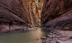
The Narrows: How to Hike Zion's Ultimate Adventure
Jan 24, 2022 from backpacker.com
The Narrows at Zion National Park offers an incredible adventure in America's most amazing slot canyons. Here's how to safely explore them.
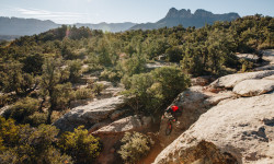
Destination Showcase - Greater Zion, UT
Jan 4, 2022 from pinkbike.com
Everything you need to know before you head to the Greater Zion area in Southwestern Utah.
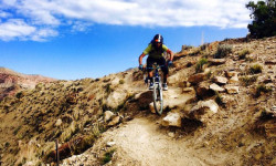
Registration Opens For 2022 BetterRide Skills Courses
Dec 29, 2021 from pinkbike.com
Three-day coaching courses in Nevada, Colorado, Utah, Arizona, and more.
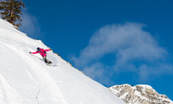
Skiers and Snowboarders Show Us Why They Love Utah’s Solitude Resort
Dec 13, 2021 from outsideonline.com
Solitude, southeast of Salt Lake City, may first appear like a sleepy mountain resort with ample groomers. But it’s so much more.
Popular Trail Networks
view all areas »Sub Regions
- Bates Canyon (1)
- Beaver Bench Trail System (8)
- Boulder Mountain/Aquarius Plateau (52)
- Davis/ Weber Counties (391)
- Ephraim Canyon (0)
- Grand County (425)
- Grand Staircase-Escalante National Monument (9)
- Iron County (106)
- Markagunt Plateau (6)
- Northern Utah (0)
- Salt Lake County (763)
- Jordan River Parkway (11)
- San Juan County (67)
- San Rafael Swell (120)
- Sanpete-Emery-Carbon (226)
- Sevier County (17)
- Southern Utah (16)
- Summit County (621)
- Kamas Valley (15)
- Tooele County (14)
- Tushar Mountains (46)
- Uintas (64)
- Utah County (1,091)
- Wasatch County (265)
- Washington County (18)
Popular Utah Mountain Biking Trails
| status | title | difficulty | rating |
|---|---|---|---|
| Porcupine Rim La Sal Mountains | |||
| LPS La Sal Mountains | |||
| UPS Lower La Sal Mountains | |||
| UPS La Sal Mountains | |||
| The Snotch La Sal Mountains | |||
| Upper Porcupine ST La Sal Mountains | |||
| Captain Ahab (lower) Amasa Back | |||
| HyMasa (upper) Amasa Back | |||
| HyMasa Amasa Back | |||
| Captain Ahab (upper) Amasa Back | |||
| Bull Run (lower) Mag 7 | |||
| Bull Run Mag 7 | |||
| Exit Stage Left (Rush) Corner Canyon | |||
| Slickrock Sand Flats Recreation Area | |||
| Wasatch Crest (South) Brighton |
Utah Mountain Bike Routes
| title | rating | distance |
|---|---|---|
| Thunder Mountain Shuttle Yourself Red Canyon | 15 miles | |
| Vertigo Loop Highland Hollow | 4 miles | |
| Provo Canyon Dragon Provo Canyon | 9 miles | |
| The Real Mighty 5 Corner Canyon | 28 miles | |
| Red Fleet Ultimate Red Fleet Reservoir | 8 miles | |
| Best of High Starr Ranch High Star Ranch | 8 miles | |
| AFC Fight Night Sundance | 9 miles | |
| Crest Shuttle with Bonus Flow Park City Mountain Resort | 31 miles | |
| Round Valley Super 8 Round Valley | 9 miles | |
| Ruin the Rodeo Lambert Park | 5 miles |
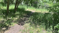
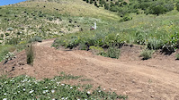
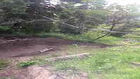
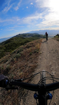
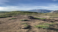
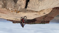
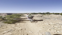
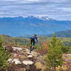
Photos of Utah Mountain Bike
trail: Salt on the Rim
184 |
Oct 19, 2017 @ 3:37pm
Oct 19, 2017
trail: Exit Stage Left (Rush)
381 |
Aug 11, 2017 @ 4:50pm
Aug 11, 2017
trail: Ridge Trail
545 |
Dec 28, 2016 @ 10:45pm
Dec 28, 2016
trail: Barrel Roll
516 |
Dec 28, 2016 @ 9:41am
Dec 28, 2016
trail: Wasatch Crest (South)
831 |
Oct 4, 2016 @ 9:34pm
Oct 4, 2016
trail: Grove Creek
339 |
Sep 28, 2016 @ 7:18pm
Sep 28, 2016
trail: Ridge Trail
276 |
Sep 28, 2016 @ 7:13pm
Sep 28, 2016
trail: Maple Hollow DH (Lower)
1,001 |
Jul 14, 2016 @ 4:28pm
Jul 14, 2016Videos of Utah Mountain Bike
trail: Providence Canyon
2 |
Jun 26, 2022
trail: Phil's Playground
6 |
Jun 26, 2022
trail: North Canyon Trail
|
Jun 12, 2022
trail: Jacobs Ladder, Middle
15 |
May 31, 2022
trail: Squaw Peak Overlook Trail
|
May 28, 2022

trail: The C Trail
8 |
May 27, 2022
trail: Gooseberry Point
9 |
May 27, 2022
trail: Good Water Rim (E)
|
May 9, 2022
Activity Feed
| username | action | type | title | date | |
|---|---|---|---|---|---|
 | Bociancz | wishlist | trail | Spin Cycle | Jul 6, 2022 @ 12:20am 2 hours |
 | maddy03 | add | route | Rob's Trail | Jul 5, 2022 @ 11:04pm 3 hours |
| maddy03 | add | trail | Right Fork Trail | Jul 5, 2022 @ 10:58pm 3 hours |
| maddy03 | add | route | Ridge Trail 157 and 2 more | Jul 5, 2022 @ 10:45pm 3 hours |
 | Xanderxcl | vote | trail | Peruvian Gulch | Jul 5, 2022 @ 10:45pm 3 hours |
Recent Comments
| username | type | title | comment | date | |
|---|---|---|---|---|---|
 | trail | Closed to bikes. Not sure where Trailforks is... | Jul 5, 2022 @ 8:31pm 6 hours | ||
| trail | Not open to bikes. Plus it’s completely... | Jul 5, 2022 @ 8:29pm 6 hours | ||
| trail | The only reason I would want to take this... | Jul 5, 2022 @ 8:07pm 6 hours | ||
| trail | I always passed this one up going down to... | Jul 5, 2022 @ 6:52pm 7 hours | ||
 | trail | Absolute blast. Super blown out and raw. | Jul 5, 2022 @ 1:56pm 12 hours |
Local Badges
-

Completionist1 awarded -
UTCO Bike 1007,380 awarded -
UC Bike 10 Blue10,697 awarded -
UC Bike 10 Green5,206 awarded -
UC Bike 10 Black2,212 awarded -

Utah County BST Bike0 awarded
National Scenic Trails & Official Routes
-
Bonneville Shoreline Trail
- Mountain Bike
- E-Bike
- Hike
- Trail Running
- Horse
- Snowshoe
- Nordic Ski
-
Great Western Trail
- Mountain Bike
- E-Bike
- Hike
- Trail Running
- Horse
- Dirtbike/Moto
- ATV/ORV/OHV


Bike & Skill Parks
| name | type | city | rating |
|---|---|---|---|
| Brian Head Resort | bike park | Brian Head | |
| Deer Valley Resort | bike park | Park City | |
| Nordic Valley | bike park | Eden | |
| Snowbasin Resort | bike park | Ogden | |
| Snowbird | bike park | Sandy |
Upcoming Local Events
-
-
-
-
-
-
-
-
Pinkbike Articles
Jul 1, 2020
![Video: Flowy Freeride in 'Surfing in Utah' with Alan Mandel]() Video: Flowy Freeride in 'Surfing in Utah' with Alan Mandel
Mountain bikes, Utah desert, long hikes, steep chutes, and brown pow.
Nov 21, 2019
Video: Flowy Freeride in 'Surfing in Utah' with Alan Mandel
Mountain bikes, Utah desert, long hikes, steep chutes, and brown pow.
Nov 21, 2019
![Video: Remy Metailler POV Clips on Untouched Freeride Lines in Utah]() Video: Remy Metailler POV Clips on Untouched Freeride Lines in Utah
Just tires straight to dirt.
Sep 26, 2019
Video: Remy Metailler POV Clips on Untouched Freeride Lines in Utah
Just tires straight to dirt.
Sep 26, 2019
![Behind the Build: Brett Rheeder's 'Moments of Clarity' Section from Return to Earth]() Behind the Build: Brett Rheeder's 'Moments of Clarity' Section from Return to Earth
The work behind Brett Rheeder's 'Moments of Clarity' section in southern Utah.
Behind the Build: Brett Rheeder's 'Moments of Clarity' Section from Return to Earth
The work behind Brett Rheeder's 'Moments of Clarity' section in southern Utah.
Pinkbike Articles
Jul 1, 2020
 Video: Flowy Freeride in 'Surfing in Utah' with Alan Mandel
Mountain bikes, Utah desert, long hikes, steep chutes, and brown pow.
Nov 21, 2019
 Video: Remy Metailler POV Clips on Untouched Freeride Lines in Utah
Just tires straight to dirt.
Sep 26, 2019
 Behind the Build: Brett Rheeder's 'Moments of Clarity' Section from Return to Earth
The work behind Brett Rheeder's 'Moments of Clarity' section in southern Utah.
Activity Type Stats
| activitytype | trails | distance | descent | descent distance | total vertical | rating | global rank | state rank | photos | reports | routes | ridelogs |
|---|---|---|---|---|---|---|---|---|---|---|---|---|
| Mountain Bike | 6,121 | 10,680 miles | 1,564,744 ft | 4,575 miles | 12,034 ft | #2 | 23,201 | 65,595 | 1,424 | 978,840 | ||
| E-Bike | 2,226 | 4,966 miles | 588,127 ft | 2,052 miles | 11,325 ft | #2 | 44 | 55,799 | 102 | 19,681 | ||
| Hike | 6,898 | 12,831 miles | 1,913,520 ft | 5,371 miles | 13,389 ft | #3 | 1,532 | 64,071 | 852 | 71,701 | ||
| Trail Running | 6,665 | 12,228 miles | 1,828,238 ft | 5,120 miles | 12,566 ft | #3 | 118 | 64,036 | 825 | 43,931 | ||
| Horse | 1,868 | 5,035 miles | 702,953 ft | 2,081 miles | 12,566 ft | #3 | 2 | 25,116 | 34 | 93 | ||
| Dirtbike/Moto | 1,347 | 3,812 miles | 460,886 ft | 1,572 mile | 11,325 ft | #1 | 82 | 24,715 | 26 | 1,657 | ||
| Observed Trials | 37 | 68 miles | 6,598 ft | 21 miles | 5,732 ft | #10 | 6 | 277 | 157 | |||
| ATV/ORV/OHV | 1,073 | 3,182 miles | 330,604 ft | 1,272 mile | 11,325 ft | #4 | 42 | 24,290 | 14 | 505 | ||
| Snowmobile | 503 | 877 miles | 99,980 ft | 337 miles | 11,138 ft | #15 | 15 | 111 | 8 | 76 | ||
| Snowshoe | 348 | 434 miles | 54,806 ft | 143 miles | 6,437 ft | #6 | 11 | 1,276 | 222 | 1,473 | ||
| Downhill Ski | 148 | 72 miles | 58,301 ft | 59 miles | 6,250 ft | 2 | 258 | 27,736 | ||||
| Backcountry Ski | 64 | 91 miles | 13,281 ft | 31 miles | 6,214 ft | #5 | 798 | 3 | 16,180 | |||
| Nordic Ski | 209 | 276 miles | 24,537 ft | 100 miles | 5,869 ft | #9 | 1 | 716 | 3 | 9,175 |
- By canadaka
 Trailforks & contributors
 - Admins: Map Team, chuktA, msmcfate, WillieJacobsz, PlumbBobM, ReckitRolley, UtahJohn, jpmcghee, jasonmalczyk
- #3142 - 324,205 views
- utah activity log | embed map of Utah mountain bike trails | utah mountain biking points of interest polygons
-
- subscribe
- 3d map
Downloading of trail gps tracks in kml & gpx formats is enabled for Utah.
You must login to download files.