close
Trail Conditions
- Unknown
- Snow Groomed
- Snow Packed
- Snow Covered
- Snow Cover Inadequate
- Freeze/thaw Cycle
- Icy
- Prevalent Mud
- Wet
- Variable
- Ideal
- Dry
- Very Dry
Trail Flow (Ridden Direction)
Trailforks scans users ridelogs to determine the most popular direction each trail is ridden. A good flowing trail network will have most trails flowing in a single direction according to their intension.
The colour categories are based on what percentage of riders are riding a trail in its intended direction.
The colour categories are based on what percentage of riders are riding a trail in its intended direction.
- > 96%
- > 90%
- > 80%
- > 70%
- > 50%
- < 50%
- bi-directional trail
- no data
Trail Last Ridden
Trailforks scans ridelogs to determine the last time a trail was ridden.
- < 2 days
- < 1 week
- < 2 weeks
- < 1 month
- < 6 months
- > 6 months
Trail Ridden Direction
The intended direction a trail should be ridden.
- Downhill Only
- Downhill Primary
- Both Directions
- Uphill Primary
- Uphill Only
- One Direction
Contribute Details
Colors indicate trail is missing specified detail.
- Description
- Photos
- Description & Photos
- Videos
Trail Popularity ?
Trailforks scans ridelogs to determine which trails are ridden the most in the last 9 months.
Trails are compared with nearby trails in the same city region with a possible 25 colour shades.
Think of this as a heatmap, more rides = more kinetic energy = warmer colors.
- most popular
- popular
- less popular
- not popular
ATV/ORV/OHV Filter
Max Vehicle Width
inches
Radar Time
x
Activity Recordings
Trailforks users anonymized public ridelogs from the past 6 months.
- mountain biking recent
- mountain biking (>6 month)
- hiking (1 year)
- moto (1 year)
Activity Recordings
Trailforks users anonymized public skilogs from the past 12 months.
- Downhill Ski
- Backcountry Ski
- Nordic Ski
Jump Magnitude Heatmap
Heatmap of where riders jump on trails. Zoom in to see individual jumps, click circles to view jump details.
Trails Deemphasized
Trails are shown in grey.
Only show trails with NO bikes.
Save the current map location and zoom level as your default home location whenever this page is loaded.
Save
No description for Alameda Park has been added yet!
Login or register to submit one.
 google parking directions
Primary Trail Type: Cross-Country
google parking directions Access Info:
134 Alameda Park Rd, Butler, PA 16001
Region Supporters & Maintainers
trail builderSponsor- DaveK13Maintainer
Activities Click to view
- Mountain Bike
31 trails
- Hike
28 trails
- Trail Running
28 trails
Region Details
- 1
- 12
- 13
- 4
- 1
Region Status
Open as of Aug 2, 2020Local Trail Association
Stats
- Avg Trail Rating
- Trails (view details)
- 31
- Trails Mountain Bike
- 31
- Trails Hike
- 28
- Trails Trail Running
- 28
- Total Distance
- 11 miles
- Total Descent
- 1,617 ft
- Total Vertical
- 228 ft
- Highest Trailhead
- 1,253 ft
- Reports
- 258
- Photos
- 3
- Ridden Counter
- 5,309
Popular Alameda Park Mountain Biking Trails
Alameda Park Mountain Bike Routes
| title | rating | distance |
|---|---|---|
| Alameda Overview Ride 1 | 10 miles | |
| The Whole Alameda | 10 miles |
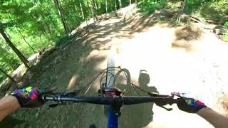
Photos of Alameda Park Mountain Bike
trail: Stacy's Mom
132 |
Oct 18, 2020 @ 11:31am
Oct 18, 2020
trail: Stacy's Mom
113 |
Oct 18, 2020 @ 11:30am
Oct 18, 2020Videos of Alameda Park Mountain Bike
trail: Janis Jumpline
0:41 |
222 |
Sep 14, 2021 , Butler

8:38 |
152 |
Jun 21, 2021

10:46 |
131 |
Jun 21, 2021

trail: Flying Squirrel
2:30 |
1109 |
Oct 8, 2020 , Butler
Recent Trail Reports
| status | trail | date | condition | info | user |
|---|---|---|---|---|---|
| Rocky & Bullwinkle | Jun 19, 2022 @ 8:02am Jun 19, 2022 | Dry | ucho777 | ||
| Flying Squirrel | Jun 19, 2022 @ 8:02am Jun 19, 2022 | Dry | ucho777 | ||
| Rocky & Bullwinkle Loop | Jun 19, 2022 @ 8:02am Jun 19, 2022 | Dry | ucho777 | ||
| Janis Jumpline | Jun 19, 2022 @ 8:02am Jun 19, 2022 | Ideal | ucho777 | ||
| Pool Boy | Jun 18, 2022 @ 5:51am Jun 18, 2022 | Ideal | geoffdburch | ||
| Finger Splint | Jun 18, 2022 @ 5:51am Jun 18, 2022 | Ideal | geoffdburch | ||
| Yinz G.O.Y.S. | Jun 18, 2022 @ 5:51am Jun 18, 2022 | Ideal | geoffdburch | ||
| Welcome Mat | Jun 18, 2022 @ 5:51am Jun 18, 2022 | Ideal | geoffdburch | ||
| Tunnel Vision | Jun 18, 2022 @ 5:51am Jun 18, 2022 | Ideal | geoffdburch | ||
| Jesse's Girl | Jun 18, 2022 @ 5:51am Jun 18, 2022 | Ideal | geoffdburch |
Activity Feed
| username | action | type | title | date | |
|---|---|---|---|---|---|
 | Bats1999 | ridden | trail | Yinz G.O.Y.S. and 5 more | Jun 25, 2022 @ 12:48pm Jun 25, 2022 |
| jrza | wishlist | route | The Whole Alameda | Jun 24, 2022 @ 7:48pm Jun 24, 2022 |
| Gsid71 | wishlist | route | The Whole Alameda | Jun 23, 2022 @ 2:32pm Jun 23, 2022 |
| warpigg | vote | route | The Whole Alameda | Jun 20, 2022 @ 3:55pm Jun 20, 2022 |
| warpigg | ridden | route | The Whole Alameda | Jun 20, 2022 @ 3:55pm Jun 20, 2022 |
Recent Comments
| username | type | title | comment | date | |
|---|---|---|---|---|---|
 | trail | Definitely a lot of fun. Pretty much a short... | Jun 13, 2022 @ 5:37am Jun 13, 2022 | ||
| trail | For being a local, I give a lot of credit to... | Nov 7, 2021 @ 2:43pm Nov 7, 2021 | ||
 | report | Bingo...really nice condition... using a... | Oct 8, 2021 @ 2:04pm Oct 8, 2021 | ||
| trail | Awesome trail! Ride it slow the first couple... | Sep 4, 2021 @ 6:57am Sep 4, 2021 | ||
 | trail | This trail is tons of fun. It is fast and had... | Jul 4, 2021 @ 8:05pm Jul 4, 2021 |
Nearby Areas
| name | distance | ||||
|---|---|---|---|---|---|
| Moraine State Park | 12 | 5 | 2 | 2 | 8.9 km |
| Brush Creek County Park | 5 | 17.1 km | |||
| Deer Lakes Park | 15 | 18.2 km | |||
| Harrison Hills Park | 4 | 3 | 19.3 km | ||
| North Park | 34 | 58 | 3 | 19.4 km |
Local Badges
-

Completionist12 awarded
Activity Type Stats
| activitytype | trails | distance | descent | descent distance | total vertical | rating | global rank | state rank | photos | reports | routes | ridelogs |
|---|---|---|---|---|---|---|---|---|---|---|---|---|
| Mountain Bike | 31 | 11 miles | 1,617 ft | 5 miles | 230 ft | #1,181 | #630 | 3 | 258 | 2 | 1,619 | |
| Hike | 28 | 11 miles | 1,352 ft | 5 miles | 230 ft | #1,033 | #641 | 252 | 1 | 5 | ||
| Trail Running | 28 | 11 miles | 1,352 ft | 5 miles | 230 ft | #1,040 | #639 | 252 | 1 | 21 |
- By kartracer3
 & contributors
 - Admins: PGH-Steward
- #16259 - 10,905 views
- alameda park activity log | embed map of Alameda Park mountain bike trails | alameda park mountain biking points of interest
Downloading of trail gps tracks in kml & gpx formats is enabled for Alameda Park.
You must login to download files.