close
Trail Conditions
- Unknown
- Snow Groomed
- Snow Packed
- Snow Covered
- Snow Cover Inadequate
- Freeze/thaw Cycle
- Icy
- Prevalent Mud
- Wet
- Variable
- Ideal
- Dry
- Very Dry
Trail Flow (Ridden Direction)
Trailforks scans users ridelogs to determine the most popular direction each trail is ridden. A good flowing trail network will have most trails flowing in a single direction according to their intension.
The colour categories are based on what percentage of riders are riding a trail in its intended direction.
The colour categories are based on what percentage of riders are riding a trail in its intended direction.
- > 96%
- > 90%
- > 80%
- > 70%
- > 50%
- < 50%
- bi-directional trail
- no data
Trail Last Ridden
Trailforks scans ridelogs to determine the last time a trail was ridden.
- < 2 days
- < 1 week
- < 2 weeks
- < 1 month
- < 6 months
- > 6 months
Trail Ridden Direction
The intended direction a trail should be ridden.
- Downhill Only
- Downhill Primary
- Both Directions
- Uphill Primary
- Uphill Only
- One Direction
Contribute Details
Colors indicate trail is missing specified detail.
- Description
- Photos
- Description & Photos
- Videos
Trail Popularity ?
Trailforks scans ridelogs to determine which trails are ridden the most in the last 9 months.
Trails are compared with nearby trails in the same city region with a possible 25 colour shades.
Think of this as a heatmap, more rides = more kinetic energy = warmer colors.
- most popular
- popular
- less popular
- not popular
ATV/ORV/OHV Filter
Max Vehicle Width
inches
Radar Time
x
Activity Recordings
Trailforks users anonymized public ridelogs from the past 6 months.
- mountain biking recent
- mountain biking (>6 month)
- hiking (1 year)
- moto (1 year)
Activity Recordings
Trailforks users anonymized public skilogs from the past 12 months.
- Downhill Ski
- Backcountry Ski
- Nordic Ski
Jump Magnitude Heatmap
Heatmap of where riders jump on trails. Zoom in to see individual jumps, click circles to view jump details.
Trails Deemphasized
Trails are shown in grey.
Only show trails with NO bikes.
Save the current map location and zoom level as your default home location whenever this page is loaded.
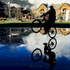
SaveAla Medin is beautiful in the fall, but it was surreal in the spring. We were enveloped in green. The snow-capped peaks were straight out of a Romantic painting. It feels like riding in the Garden of Eden.
Primary Trail Type: Cross-Country
Activities Click to view
- Mountain Bike
7 trails
- Hike
7 trails
- Trail Running
7 trails
Region Details
- 1
- 3
- 3
Region Status
Open as of Jun 19, 2022Stats
- Avg Trail Rating
- Trails (view details)
- 7
- Trails Mountain Bike
- 7
- Trails Hike
- 7
- Trails Trail Running
- 7
- Total Distance
- 60 miles
- Total Descent
- 20,947 ft
- Total Vertical
- 9,055 ft
- Highest Trailhead
- 14,902 ft
- Reports
- 3
- Ridden Counter
- 5
Popular Alamedin Mountain Biking Trails
Recent Trail Reports
no previous reports, add one now!
Activity Feed
| username | action | type | title | date | |
|---|---|---|---|---|---|
 | sebasg3r | comment | trail | Lesgrafta Pass, Cotation 2B | May 24, 2020 @ 9:57pm May 24, 2020 |
 | iamcoryfr | wishlist | trail | Ak Say Mountain Pass | May 22, 2019 @ 7:36am May 22, 2019 |
| thegow | wishlist | trail | Lesgrafta Pass, Cotation 2B | Feb 26, 2018 @ 12:52pm Feb 26, 2018 |
| mathiasdoerig | comment | trail | Ak Say Mountain Pass | Sep 11, 2017 @ 5:56pm Sep 11, 2017 |
 | boxxerace | wishlist | trail | Lesgrafta Pass, Cotation 2B | Jan 4, 2017 @ 7:12pm Jan 4, 2017 |
Recent Comments
| username | type | title | comment | date | |
|---|---|---|---|---|---|
| trail | When it's riddeable (snow condition optimal)? | May 24, 2020 @ 9:57pm May 24, 2020 | ||
| trail | I tried the uphill, not possible to ride up,... | Sep 11, 2017 @ 5:56pm Sep 11, 2017 |
Nearby Areas
| name | distance | ||||
|---|---|---|---|---|---|
| Issyk Ata | 1 | 3 | 3 | 1 | 9.6 km |
Activity Type Stats
| activitytype | trails | distance | descent | descent distance | total vertical | rating | global rank | state rank | photos | reports | routes | ridelogs |
|---|---|---|---|---|---|---|---|---|---|---|---|---|
| Mountain Bike | 7 | 60 miles | 20,948 ft | 27 miles | 9,055 ft | #6,486 | #1 | 3 | 7 | |||
| Hike | 7 | 60 miles | 20,948 ft | 27 miles | 9,055 ft | #5,596 | #1 | 3 | 1 | 4 | ||
| Trail Running | 7 | 60 miles | 20,948 ft | 27 miles | 9,055 ft | #5,610 | #1 | 3 |
- By boxxerace
 TRAILFORKS J-GULCH & contributors
 - Admins: boxxerace
- #17334 - 2,028 views
- alamedin activity log | embed map of Alamedin mountain bike trails | alamedin mountain biking points of interest
Downloading of trail gps tracks in kml & gpx formats is enabled for Alamedin.
You must login to download files.