close
Trail Conditions
- Unknown
- Snow Groomed
- Snow Packed
- Snow Covered
- Snow Cover Inadequate
- Freeze/thaw Cycle
- Icy
- Prevalent Mud
- Wet
- Variable
- Ideal
- Dry
- Very Dry
Trail Flow (Ridden Direction)
Trailforks scans users ridelogs to determine the most popular direction each trail is ridden. A good flowing trail network will have most trails flowing in a single direction according to their intension.
The colour categories are based on what percentage of riders are riding a trail in its intended direction.
The colour categories are based on what percentage of riders are riding a trail in its intended direction.
- > 96%
- > 90%
- > 80%
- > 70%
- > 50%
- < 50%
- bi-directional trail
- no data
Trail Last Ridden
Trailforks scans ridelogs to determine the last time a trail was ridden.
- < 2 days
- < 1 week
- < 2 weeks
- < 1 month
- < 6 months
- > 6 months
Trail Ridden Direction
The intended direction a trail should be ridden.
- Downhill Only
- Downhill Primary
- Both Directions
- Uphill Primary
- Uphill Only
- One Direction
Contribute Details
Colors indicate trail is missing specified detail.
- Description
- Photos
- Description & Photos
- Videos
Trail Popularity ?
Trailforks scans ridelogs to determine which trails are ridden the most in the last 9 months.
Trails are compared with nearby trails in the same city region with a possible 25 colour shades.
Think of this as a heatmap, more rides = more kinetic energy = warmer colors.
- most popular
- popular
- less popular
- not popular
ATV/ORV/OHV Filter
Max Vehicle Width
inches
Radar Time
x
Activity Recordings
Trailforks users anonymized public ridelogs from the past 6 months.
- mountain biking recent
- mountain biking (>6 month)
- hiking (1 year)
- moto (1 year)
Activity Recordings
Trailforks users anonymized public skilogs from the past 12 months.
- Downhill Ski
- Backcountry Ski
- Nordic Ski
Jump Magnitude Heatmap
Heatmap of where riders jump on trails. Zoom in to see individual jumps, click circles to view jump details.
Trails Deemphasized
Trails are shown in grey.
Only show trails with NO bikes.
Save the current map location and zoom level as your default home location whenever this page is loaded.
SaveForet Singetrack.
Primary Trail Type: All-Mountain & Downhill
Land Status: National Forest
This region uses the Uk/Euro style trail grading system.
Activities Click to view
- Mountain Bike
15 trails
- E-Bike
14 trails
- Hike
15 trails
- Trail Running
15 trails
Region Details
- 2
- 4
- 9
Region Status
OpenStats
- Avg Trail Rating
- Trails (view details)
- 15
- Trails Mountain Bike
- 15
- Trails E-Bike
- 14
- Trails Hike
- 15
- Trails Trail Running
- 15
- Total Distance
- 16 miles
- Total Descent
- 5,887 ft
- Total Vertical
- 2,057 ft
- Highest Trailhead
- 3,556 ft
- Reports
- 5
- Photos
- 7
- Ridden Counter
- 31
Popular Alauzon Mountain Biking Trails
Photos of Alauzon Mountain Bike
trail: La Flèche Rouge
39 |
Jul 29, 2018 @ 12:26pm
Jul 29, 2018
trail: Geronimo
24 |
Jul 27, 2018 @ 12:29pm
Jul 27, 2018
trail: La Foret Enchanté
23 |
Jul 27, 2018 @ 12:23pm
Jul 27, 2018
trail: La Foret Enchanté
23 |
Jul 27, 2018 @ 12:23pm
Jul 27, 2018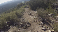

Recent Trail Reports
| status | trail | date | condition | info | user |
|---|---|---|---|---|---|
| La Foret Enchanté | Jul 27, 2018 @ 12:25pm Jul 27, 2018 | Dry | AlauzonAudrey | ||
| Fantasia | Jul 27, 2018 @ 11:50am Jul 27, 2018 | Dry | AlauzonAudrey | ||
| Geronimo | Jul 27, 2018 @ 11:50am Jul 27, 2018 | Dry | AlauzonAudrey | ||
| Les Ruines | Jul 27, 2018 @ 11:50am Jul 27, 2018 | Dry | AlauzonAudrey |
Activity Feed
| username | action | type | title | date | |
|---|---|---|---|---|---|
 | Franckapics | add | trail | Descente de Pierre Belle and 2 more | Jul 5, 2021 @ 4:29am Jul 5, 2021 |
 | monstermash1989 | ridden | trail | Le Raccourci | Aug 30, 2020 @ 12:24am Aug 30, 2020 |
| AlauzonAudrey | vote | trail | Swoosh! | Jun 26, 2019 @ 8:52am Jun 26, 2019 |
 | Whipperman | update | trail | La Source (Haute) and 5 more | Apr 2, 2019 @ 7:04am Apr 2, 2019 |
| Max84310 | wishlist | region | Alauzon | Oct 21, 2018 @ 2:38am Oct 21, 2018 |
Nearby Areas
| name | distance | ||||
|---|---|---|---|---|---|
| Parc Naturel Régional du Mont-Ventoux | 2 | 59 | 13.2 km | ||
| Dentelles de Montmirail | 1 | 17.7 km | |||
| Vallée de la Méouge | 20.7 km | ||||
| Dieulefit | 1 | 5 | 1 | 23.2 km | |
| Vallée du Jabron | 25.8 km |
Activity Type Stats
| activitytype | trails | distance | descent | descent distance | total vertical | rating | global rank | state rank | photos | reports | routes | ridelogs |
|---|---|---|---|---|---|---|---|---|---|---|---|---|
| Mountain Bike | 15 | 16 miles | 5,886 ft | 10 miles | 2,057 ft | #4,763 | #84 | 7 | 5 | 12 | ||
| E-Bike | 14 | 16 miles | 5,840 ft | 10 miles | 2,057 ft | #1,853 | #73 | 5 | ||||
| Hike | 15 | 16 miles | 5,886 ft | 10 miles | 2,057 ft | #4,004 | #58 | 5 | 1 | |||
| Trail Running | 15 | 16 miles | 5,886 ft | 10 miles | 2,057 ft | #4,014 | #56 | 5 | 1 |
- By AdrianBerry
 & contributors
 - Admins: apply
- #24689 - 1,423 views
- alauzon activity log | embed map of Alauzon mountain bike trails |
Downloading of trail gps tracks in kml & gpx formats is enabled for Alauzon.
You must login to download files.