close
Trail Conditions
- Unknown
- Snow Groomed
- Snow Packed
- Snow Covered
- Snow Cover Inadequate
- Freeze/thaw Cycle
- Icy
- Prevalent Mud
- Wet
- Variable
- Ideal
- Dry
- Very Dry
Trail Flow (Ridden Direction)
Trailforks scans users ridelogs to determine the most popular direction each trail is ridden. A good flowing trail network will have most trails flowing in a single direction according to their intension.
The colour categories are based on what percentage of riders are riding a trail in its intended direction.
The colour categories are based on what percentage of riders are riding a trail in its intended direction.
- > 96%
- > 90%
- > 80%
- > 70%
- > 50%
- < 50%
- bi-directional trail
- no data
Trail Last Ridden
Trailforks scans ridelogs to determine the last time a trail was ridden.
- < 2 days
- < 1 week
- < 2 weeks
- < 1 month
- < 6 months
- > 6 months
Trail Ridden Direction
The intended direction a trail should be ridden.
- Downhill Only
- Downhill Primary
- Both Directions
- Uphill Primary
- Uphill Only
- One Direction
Contribute Details
Colors indicate trail is missing specified detail.
- Description
- Photos
- Description & Photos
- Videos
Trail Popularity ?
Trailforks scans ridelogs to determine which trails are ridden the most in the last 9 months.
Trails are compared with nearby trails in the same city region with a possible 25 colour shades.
Think of this as a heatmap, more rides = more kinetic energy = warmer colors.
- most popular
- popular
- less popular
- not popular
ATV/ORV/OHV Filter
Max Vehicle Width
inches
Radar Time
x
Activity Recordings
Trailforks users anonymized public ridelogs from the past 6 months.
- mountain biking recent
- mountain biking (>6 month)
- hiking (1 year)
- moto (1 year)
Activity Recordings
Trailforks users anonymized public skilogs from the past 12 months.
- Downhill Ski
- Backcountry Ski
- Nordic Ski
Jump Magnitude Heatmap
Heatmap of where riders jump on trails. Zoom in to see individual jumps, click circles to view jump details.
Trails Deemphasized
Trails are shown in grey.
Only show trails with NO bikes.
Save the current map location and zoom level as your default home location whenever this page is loaded.
SaveThe Fort Ord National Monument offers world-class recreation for residents and visitors to the Central California Coast. Lands of the former Fort Ord offer 86 miles of trail on approximately 7,200 acres - open every day from dawn to dusk for hikers, mountain bikers, horseback riders, wildlife/wildflower photographers and nature enthusiasts. Visitors can choose to walk or ride the narrow single track trails atop the grassland hills or the generous winding trails through oak woodlands and maritime chaparral.
source: blm.gov
Primary Trail Type: Cross-Country
eBikes Allowed:
Yes
Land Status: National Park
 google parking directions
 Access Info:
Fort Ord National Monument Know Before You Go - Public use is allowed from dawn to dusk. These closures and restrictions are under the authority of 43 CFR 8341.2. Persons violating these closures and restrictions shall be subject to the penalties provided in 43 DFR 8360.0-7 and 8340.0-7, including a fine not to exceed $100,000 and/or imprisonment not to exceed 12 months.
Files
- Fort_Ord_Trail_Map_2020.pdf (2.32 MB)
- Fort_Ord_Brochure_2020.pdf (9.56 MB)
Activities Click to view
- Mountain Bike
121 trails
- E-Bike
123 trails
- Hike
123 trails
- Trail Running
121 trails
- Horse
61 trails
Region Details
- 33
- 1
- 67
- 19
- 1
Region Status
Open as of Feb 28, 2020Stats
- Avg Trail Rating
- Trails (view details)
- 123
- Trails Mountain Bike
- 121
- Trails E-Bike
- 123
- Trails Hike
- 123
- Trails Trail Running
- 121
- Trails Horse
- 61
- Total Distance
- 108 miles
- Total Descent
- 17,478 ft
- Total Vertical
- 893 ft
- Highest Trailhead
- 937 ft
- Reports
- 899
- Photos
- 119
- Ridden Counter
- 35,065
Popular Fort Ord National Monument Trails
Mountain Bike Routes
| title | rating | distance |
|---|---|---|
| Creekside Tour | 15 miles | |
| Tour de Ord (10mi & 949') | 10 miles | |
| girlsrocksantacruz/fort ord 1/2022 ride | 18 miles | |
| Enduro Race Stage 2 Map race | 1 mile | |
| Enduro Race Stage 3 Map race | 1 mile | |
| race | 39 miles | |
| 14 mile Fort Ord National Monument Ride | popular ridelog | 14 miles |
| 6 mile Fort Ord National Monument Cross-country Ride | popular ridelog | 6 miles |
| 31 mile Fort Ord National Monument Cross-country Ride | popular ridelog | 31 miles |
| 22 mile Fort Ord National Monument Cross-country Ride | popular ridelog | 22 miles |
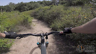
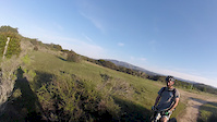
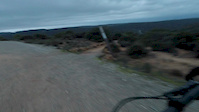
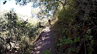
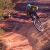
Photos of Fort Ord National Monument Mountain Bike
trail: Trail 81
5 |
May 22, 2022 @ 9:03am
May 22, 2022
trail: Gigling Road
5 |
May 6, 2022 @ 6:08pm
May 6, 2022
trail: Three Sisters Road
49 |
Jan 14, 2022 @ 4:07pm
Jan 14, 2022
trail: Trail 41 (Lower)
36 |
Jan 8, 2022 @ 4:01pm
Jan 8, 2022
trail: Trail 47
31 |
Sep 26, 2021 @ 7:11pm
Sep 26, 2021
trail: Trail 47
39 |
Sep 26, 2021 @ 7:11pm
Sep 26, 2021
trail: Trail 71
34 | | 1 comments
Sep 3, 2021 @ 2:41pm
Sep 3, 2021
trail: Trail 49 - South
114 | | 1 comments
Sep 3, 2021 @ 11:55am
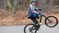
Sep 3, 2021Videos of Fort Ord National Monument Mountain Bike
trail: Trail 47
5:25 |
414 |
May 29, 2019
trail: Trail 82
5:28 |
792 |
Mar 14, 2017

trail: Trail 42
1:13 |
560 |
Feb 10, 2017
trail: Trail 42
1:13 |
145 |
Feb 10, 2017
trail: Trail 69 - North
2:31 |
1276 |
Jan 3, 2017
trail: Toro Creek Road
0:15 |
754 |
Jun 15, 2015

trail: Trail 42
6:08 |
667 |
Apr 30, 2015

trail: Trail 43
6:02 |
20 |
May 23, 2022 , Monterey
Recent Trail Reports
| status | trail | date | condition | info | user |
|---|---|---|---|---|---|
| Trail 50 - South | Jul 4, 2022 @ 3:54pm 1 day | Very Dry | Jonahall | ||
| Trail 30 | Jul 2, 2022 @ 2:02pm Jul 2, 2022 | Very Dry | LoneFalcon | ||
| Trail 25 | Jul 2, 2022 @ 2:02pm Jul 2, 2022 | Very Dry | LoneFalcon | ||
| Trail 32 | Jul 2, 2022 @ 2:02pm Jul 2, 2022 | Very Dry | LoneFalcon | ||
| Trail 39 | Jul 2, 2022 @ 2:02pm Jul 2, 2022 | Very Dry | LoneFalcon | ||
| Trail 78 | Jul 2, 2022 @ 2:02pm Jul 2, 2022 | Very Dry | LoneFalcon | ||
| Trail 42 Alt Entrance | Jul 2, 2022 @ 2:02pm Jul 2, 2022 | Very Dry | LoneFalcon | ||
| Trail 44 | Jul 2, 2022 @ 2:02pm Jul 2, 2022 | Very Dry | LoneFalcon | ||
| Trail 41 (Upper) | Jul 2, 2022 @ 2:02pm Jul 2, 2022 | Very Dry | LoneFalcon | ||
| Trail 41 (Lower) | Jul 2, 2022 @ 2:02pm Jul 2, 2022 | Very Dry | LoneFalcon |
Activity Feed
| username | action | type | title | date | |
|---|---|---|---|---|---|
 | Jonahall | add | report | Trail 50 - South | Jul 4, 2022 @ 3:54pm 1 day |
 | LoneFalcon | add | report | Trail 30 and 9 more | Jul 3, 2022 @ 12:15pm 3 days |
| Scoutdannyboy | ridden | trail | Trail 47 and 6 more | Jul 3, 2022 @ 11:07am 3 days |
| dguinasso24 | ridden | route | Tour de Ord (10mi & 949') | Jun 28, 2022 @ 10:36am Jun 28, 2022 |
| huntsykes | ridden | trail | Barloy Canyon Road and 4 more | Jun 26, 2022 @ 10:42pm Jun 26, 2022 |
Recent Comments
| username | type | title | comment | date | |
|---|---|---|---|---|---|
| trail | Moderately rutted and dry, but easy to stay on... | Sep 26, 2021 @ 12:32pm Sep 26, 2021 | ||
 | trail | Fun fast and flowy | Sep 20, 2021 @ 12:37pm Sep 20, 2021 | ||
| trail | Not blue. Green maybe. | Sep 20, 2021 @ 12:35pm Sep 20, 2021 | ||
 | trail | This old Army route is CLOSED to public... | Sep 11, 2021 @ 7:32pm Sep 11, 2021 | ||
 | trail | It's a surfing descent. So fun. The sand is... | Feb 15, 2021 @ 12:01pm Feb 15, 2021 |
Nearby Areas
| name | distance | ||||
|---|---|---|---|---|---|
| Happy Trails | 89 | 5 | 2.5 km | ||
| Laguna Seca | 1 | 2 | 3.1 km | ||
| Toro Regional Park | 3 | 7 | 3 | 1 | 4.9 km |
| Bottchers Recreation Site | 19.1 km | ||||
| Hollister Hills SVRA (Lower Ranch) | 1 | 19.4 km |
Local Badges
-

Completionist0 awarded
Activity Type Stats
| activitytype | trails | distance | descent | descent distance | total vertical | rating | global rank | state rank | photos | reports | routes | ridelogs |
|---|---|---|---|---|---|---|---|---|---|---|---|---|
| Mountain Bike | 121 | 107 miles | 17,260 ft | 59 miles | 892 ft | #103 | #40 | 118 | 890 | 6 | 21,162 | |
| E-Bike | 123 | 108 miles | 17,477 ft | 60 miles | 892 ft | #38 | #11 | 733 | 1 | 827 | ||
| Hike | 123 | 108 miles | 17,477 ft | 60 miles | 892 ft | #61 | #30 | 1 | 890 | 1 | 432 | |
| Trail Running | 121 | 107 miles | 17,260 ft | 59 miles | 892 ft | #60 | #29 | 889 | 1 | 467 | ||
| Horse | 61 | 44 miles | 6,745 ft | 23 miles | 833 ft | #6 | #5 | 254 | 2 | 1 |
- By jboom & contributors
- Admins: MORCA, SOC
- #7736 - 27,743 views
- fort ord national monument activity log | embed map of Fort Ord National Monument mountain bike trails | fort ord national monument mountain biking points of interest
Downloading of trail gps tracks in kml & gpx formats is enabled for Fort Ord National Monument.
You must login to download files.