close
Trail Conditions
- Unknown
- Snow Groomed
- Snow Packed
- Snow Covered
- Snow Cover Inadequate
- Freeze/thaw Cycle
- Icy
- Prevalent Mud
- Wet
- Variable
- Ideal
- Dry
- Very Dry
Trail Flow (Ridden Direction)
Trailforks scans users ridelogs to determine the most popular direction each trail is ridden. A good flowing trail network will have most trails flowing in a single direction according to their intension.
The colour categories are based on what percentage of riders are riding a trail in its intended direction.
The colour categories are based on what percentage of riders are riding a trail in its intended direction.
- > 96%
- > 90%
- > 80%
- > 70%
- > 50%
- < 50%
- bi-directional trail
- no data
Trail Last Ridden
Trailforks scans ridelogs to determine the last time a trail was ridden.
- < 2 days
- < 1 week
- < 2 weeks
- < 1 month
- < 6 months
- > 6 months
Trail Ridden Direction
The intended direction a trail should be ridden.
- Downhill Only
- Downhill Primary
- Both Directions
- Uphill Primary
- Uphill Only
- One Direction
Contribute Details
Colors indicate trail is missing specified detail.
- Description
- Photos
- Description & Photos
- Videos
Trail Popularity ?
Trailforks scans ridelogs to determine which trails are ridden the most in the last 9 months.
Trails are compared with nearby trails in the same city region with a possible 25 colour shades.
Think of this as a heatmap, more rides = more kinetic energy = warmer colors.
- most popular
- popular
- less popular
- not popular
ATV/ORV/OHV Filter
Max Vehicle Width
inches
Radar Time
x
Activity Recordings
Trailforks users anonymized public ridelogs from the past 6 months.
- mountain biking recent
- mountain biking (>6 month)
- hiking (1 year)
- moto (1 year)
Activity Recordings
Trailforks users anonymized public skilogs from the past 12 months.
- Downhill Ski
- Backcountry Ski
- Nordic Ski
Jump Magnitude Heatmap
Heatmap of where riders jump on trails. Zoom in to see individual jumps, click circles to view jump details.
Trails Deemphasized
Trails are shown in grey.
Only show trails with NO bikes.
Save the current map location and zoom level as your default home location whenever this page is loaded.
SaveThis region is Unsanctioned, Ride at your own Risk!
This trail system is primarily in the Open Space to the north of the Fort Ord National Monument along Gigling Road. These trails link into the Fort Ord National Monument trails but are on unincorporated Monterey County Lands. They are primarily easy flowing trails suitable for beginning riders (thus the "Happy Trails").
Primary Trail Type: Cross-Country
 google parking directions
 Access Info:
Jerry Smith Trail Corridor and Inter Garrison Road or 8th Avenue and Gigling Road.
Activities Click to view
- Mountain Bike
105 trails
- Hike
105 trails
- Trail Running
104 trails
Region Details
- 11
- 89
- 5
Region Status
Open as of Jun 17, 2022Stats
- Avg Trail Rating
- Trails (view details)
- 106
- Trails Mountain Bike
- 105
- Trails E-Bike
- 1
- Trails Hike
- 105
- Trails Trail Running
- 104
- Total Distance
- 41 miles
- Total Descent
- 3,924 ft
- Total Vertical
- 343 ft
- Highest Trailhead
- 493 ft
- Reports
- 351
- Photos
- 36
- Ridden Counter
- 17,890
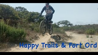
Popular Happy Trails Mountain Biking Trails
Happy Trails Mountain Bike Routes
| title | rating | distance |
|---|---|---|
| MORCA May Group Ride | 12 miles | |
| Beverly's route GR Beginner Plus | 14 miles | |
| Trail 82 Ride | 16 miles | |
| Scout Fun 9 Dec 2021 | 7 miles |
Photos of Happy Trails Mountain Bike
trail: Trail C-50
57 |
Aug 24, 2021 @ 1:37am
Aug 24, 2021
trail: Trail C-49
62 |
Apr 6, 2021 @ 2:25pm
Apr 6, 2021
trail: Trail C-49
52 |
Apr 6, 2021 @ 2:25pm
Apr 6, 2021
trail: Trail C-49
53 |
Apr 6, 2021 @ 2:24pm
Apr 6, 2021
trail: Cemetery Connector
32 |
Jan 9, 2021 @ 5:16am
Jan 9, 2021
trail: Cemetery Connector
22 |
Jan 9, 2021 @ 5:16am
Jan 9, 2021
trail: Old Trail 24
42 |
Oct 10, 2020 @ 8:12pm
Oct 10, 2020
trail: Old Trail 24
79 |
Jul 22, 2017 @ 4:04pm
Jul 22, 2017Videos of Happy Trails Mountain Bike
trail: Powerline Trail
2:11 |
101 |
Jan 10, 2016
trail: Powerline Trail
3:22 |
99 |
Jan 10, 2016
trail: Powerline Trail
3:17 |
186 |
Jan 10, 2016
trail: Trail C-50
7:36 |
146 |
Nov 5, 2020 , Marina

trail: Trail C-61
7:36 |
94 |
Nov 5, 2020 , Marina
trail: Old Trail 24
10:02 |
267 |
Jul 22, 2020 , Marina

trail: Trail C-49
8:37 |
308 |
May 20, 2020 , Marina

trail: Trail C-41
8:37 |
287 |
May 20, 2020 , Marina
Recent Trail Reports
| status | trail | date | condition | info | user |
|---|---|---|---|---|---|
| Watkins Loop | Jun 17, 2022 @ 6:32pm Jun 17, 2022 | Dry | ACdeLBC | ||
| World Connector | Jun 10, 2022 @ 9:53am Jun 10, 2022 | Very Dry | aguynamedjoe SCMTS Staff | ||
| Trail C-50 | Jun 10, 2022 @ 9:53am Jun 10, 2022 | Very Dry | aguynamedjoe SCMTS Staff | ||
| Trail C-53 | Jun 10, 2022 @ 9:53am Jun 10, 2022 | Very Dry | aguynamedjoe SCMTS Staff | ||
| Trail C-49 | Jun 10, 2022 @ 9:53am Jun 10, 2022 | Very Dry | aguynamedjoe SCMTS Staff | ||
| Trail C-48 | Jun 10, 2022 @ 9:53am Jun 10, 2022 | Very Dry | aguynamedjoe SCMTS Staff | ||
| Trail C-41 | Jun 10, 2022 @ 9:53am Jun 10, 2022 | Very Dry | aguynamedjoe SCMTS Staff | ||
| Trail C-28 | Jun 10, 2022 @ 9:53am Jun 10, 2022 | Very Dry | aguynamedjoe SCMTS Staff | ||
| Tracer Trail | Jun 10, 2022 @ 9:53am Jun 10, 2022 | Very Dry | aguynamedjoe SCMTS Staff | ||
| Ranger Trail | Jun 10, 2022 @ 9:53am Jun 10, 2022 | Very Dry | aguynamedjoe SCMTS Staff |
Activity Feed
| username | action | type | title | date | |
|---|---|---|---|---|---|
 | Ambrose1988 | wishlist | route | Scout Fun 9 Dec 2021 | Jul 1, 2022 @ 2:07pm Jul 1, 2022 |
| ACdeLBC | ridden | trail | Christmas Tree Trail and 1 more | Jun 21, 2022 @ 11:18pm Jun 21, 2022 |
| Ronno | wishlist | trail | Bushy Pass | Jun 21, 2022 @ 4:34pm Jun 21, 2022 |
| ACdeLBC | add | report | Watkins Loop | Jun 19, 2022 @ 10:38pm Jun 19, 2022 |
| Ambrose1988 | wishlist | route | Beverly's route GR Beginner Plus and 1 more | Jun 18, 2022 @ 4:31am Jun 18, 2022 |
Recent Comments
| username | type | title | comment | date | |
|---|---|---|---|---|---|
| trail | One little and big booster on this trail | Jan 26, 2022 @ 6:53pm Jan 26, 2022 | ||
| trail | More of a general comment on the whole system.... | Jan 17, 2022 @ 6:23pm Jan 17, 2022 | ||
| trail | Trail is all down hill with a rather steep... | Dec 7, 2021 @ 3:41pm Dec 7, 2021 | ||
| trail | Super fast w some spice | Sep 21, 2021 @ 5:47pm Sep 21, 2021 | ||
 | trail | Correction, this short path is currently... | Sep 11, 2021 @ 8:25pm Sep 11, 2021 |
Nearby Areas
| name | distance | ||||
|---|---|---|---|---|---|
| Fort Ord National Monument | 67 | 19 | 1 | 2.5 km | |
| Laguna Seca | 1 | 2 | 4.2 km | ||
| Toro Regional Park | 3 | 7 | 3 | 1 | 7.4 km |
| Bottchers Recreation Site | 20.2 km | ||||
| Hollister Hills SVRA (Lower Ranch) | 1 | 20.4 km |
Local Badges
-

Completionist0 awarded
Activity Type Stats
| activitytype | trails | distance | descent | descent distance | total vertical | rating | global rank | state rank | photos | reports | routes | ridelogs |
|---|---|---|---|---|---|---|---|---|---|---|---|---|
| Mountain Bike | 105 | 39 miles | 3,753 ft | 17 miles | 341 ft | #312 | #149 | 36 | 351 | 4 | 2,693 | |
| E-Bike | 1 | 1 mile | 148 ft | 4,088 ft | 95 ft | 330 | 1 | 39 | ||||
| Hike | 105 | 41 miles | 3,924 ft | 18 miles | 341 ft | #201 | #109 | 351 | 150 | |||
| Trail Running | 104 | 39 miles | 3,753 ft | 17 miles | 341 ft | #202 | #108 | 351 | 203 |
- By serfrider
 MORCA & contributors
 - Admins: MORCA, SOC
- #13993 - 5,302 views
- happy trails activity log | embed map of Happy Trails mountain bike trails | happy trails mountain biking points of interest
Downloading of trail gps tracks in kml & gpx formats is enabled for Happy Trails.
You must login to download files.