close
Trail Conditions
- Unknown
- Snow Groomed
- Snow Packed
- Snow Covered
- Snow Cover Inadequate
- Freeze/thaw Cycle
- Icy
- Prevalent Mud
- Wet
- Variable
- Ideal
- Dry
- Very Dry
Trail Flow (Ridden Direction)
Trailforks scans users ridelogs to determine the most popular direction each trail is ridden. A good flowing trail network will have most trails flowing in a single direction according to their intension.
The colour categories are based on what percentage of riders are riding a trail in its intended direction.
The colour categories are based on what percentage of riders are riding a trail in its intended direction.
- > 96%
- > 90%
- > 80%
- > 70%
- > 50%
- < 50%
- bi-directional trail
- no data
Trail Last Ridden
Trailforks scans ridelogs to determine the last time a trail was ridden.
- < 2 days
- < 1 week
- < 2 weeks
- < 1 month
- < 6 months
- > 6 months
Trail Ridden Direction
The intended direction a trail should be ridden.
- Downhill Only
- Downhill Primary
- Both Directions
- Uphill Primary
- Uphill Only
- One Direction
Contribute Details
Colors indicate trail is missing specified detail.
- Description
- Photos
- Description & Photos
- Videos
Trail Popularity ?
Trailforks scans ridelogs to determine which trails are ridden the most in the last 9 months.
Trails are compared with nearby trails in the same city region with a possible 25 colour shades.
Think of this as a heatmap, more rides = more kinetic energy = warmer colors.
- most popular
- popular
- less popular
- not popular
ATV/ORV/OHV Filter
Max Vehicle Width
inches
Radar Time
x
Activity Recordings
Trailforks users anonymized public ridelogs from the past 6 months.
- mountain biking recent
- mountain biking (>6 month)
- hiking (1 year)
- moto (1 year)
Activity Recordings
Trailforks users anonymized public skilogs from the past 12 months.
- Downhill Ski
- Backcountry Ski
- Nordic Ski
Jump Magnitude Heatmap
Heatmap of where riders jump on trails. Zoom in to see individual jumps, click circles to view jump details.
Trails Deemphasized
Trails are shown in grey.
Only show trails with NO bikes.
Save the current map location and zoom level as your default home location whenever this page is loaded.
SaveGreat local spot for anything from quick afterwork rides to long XC missions. Huge variety of trails from flowy and mellow to rocky downhill gnar with jumps. Most of the region is dry Great Basin flora/terrain, but some pleasant forest exists at higher elevations.
These trails are multi-use with runners/hikers, so please be courteous. Although its obvious that the area is primarily used by bikers. Biggest Little Trail Stewardship (the Poedunks:) have been doing an amazing job at building and maintaining MTB-focused trails in this area. The region also hosts many races and other local events.
These trails are multi-use with runners/hikers, so please be courteous. Although its obvious that the area is primarily used by bikers. Biggest Little Trail Stewardship (the Poedunks:) have been doing an amazing job at building and maintaining MTB-focused trails in this area. The region also hosts many races and other local events.
Primary Trail Type: Cross-Country
 google parking directions
 Activities Click to view
- Mountain Bike
53 trails
- E-Bike
52 trails
- Hike
55 trails
- Trail Running
55 trails
- Horse
4 trails
- Dirtbike/Moto
3 trails
- ATV/ORV/OHV
0 trails
- Nordic Ski
2 trails
Region Details
- 10
- 3
- 8
- 22
- 7
- 3
Region Status
Open as of Mar 14, 2022Stats
- Avg Trail Rating
- Trails (view details)
- 55
- Trails Mountain Bike
- 53
- Trails E-Bike
- 52
- Trails Hike
- 55
- Trails Trail Running
- 55
- Trails Horse
- 4
- Trails Dirtbike/Moto
- 3
- Trails Nordic Ski
- 2
- Total Distance
- 63 miles
- Total Descent
- 10,500 ft
- Total Vertical
- 3,623 ft
- Highest Trailhead
- 8,247 ft
- Reports
- 1,011
- Photos
- 275
- Ridden Counter
- 16,276
Popular Peavine Mountain Mountain Biking Trails
Peavine Mountain Mountain Bike Routes
| title | rating | distance |
|---|---|---|
| Hoge - Colpo Loop | 6 miles | |
| Peavine Mega Super Ultra | 36 miles | |
| Hotdog Loop | 8 miles | |
| Evans Canyon Loop | 4 miles | |
| Peavine West Side | 13 miles | |
| Seneca Loop | 4 miles | |
| Seneca Loop | 4 miles | |
| 7 mile Peavine Mountain All-Mountain Ride | popular ridelog | 7 miles |
| 6 mile Peavine Mountain All-Mountain Ride | popular ridelog | 6 miles |
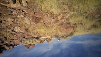
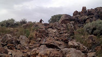
Photos of Peavine Mountain Mountain Bike
trail: Bacon Strip
0 |
Jul 4, 2022 @ 2:21pm
2 days
trail: Las Brisas Trail
10 |
Apr 9, 2022 @ 2:14pm
Apr 9, 2022
trail: Las Brisas Trail
12 |
Apr 9, 2022 @ 2:14pm
Apr 9, 2022
trail: Secret Trail
20 |
Nov 24, 2021 @ 7:43pm
Nov 24, 2021
trail: Evans Canyon
33 |
Sep 19, 2021 @ 7:45am
Sep 19, 2021
trail: Norton's Toll Road
14 |
Sep 3, 2021 @ 6:48am
Sep 3, 2021
trail: Colpo Canyon
60 |
Sep 3, 2021 @ 6:46am
Sep 3, 2021
trail: Peavine Road
33 |
Sep 3, 2021 @ 6:44am
Sep 3, 2021Videos of Peavine Mountain Mountain Bike
trail: UNR DH
0:11 |
594 |
Nov 15, 2016
trail: UNR DH
0:28 |
965 |
May 8, 2015
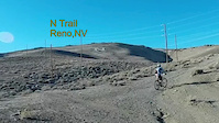
trail: Lower "N" Trail
2:35 |
509 |
Mar 22, 2014
trail: Lower "N" Trail
4:57 |
679 |
Oct 14, 2012

trail: Lower "N" Trail
2:18 |
225 |
May 4, 2012
trail: Lower "N" Trail
5:50 |
186 |
Feb 14, 2011

trail: Stage Coach
8:01 |
21 |
Jun 13, 2022 , Reno
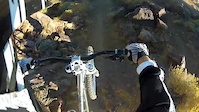
![Peavine Mountain - Bacon Strip [DH]](https://ev1.pinkbike.org/tf/vt/1/yvt-125757-4.jpg)
trail: Bacon Strip
5:27 |
13 |
Jun 9, 2022 , Reno
Recent Trail Reports
| status | trail | date | condition | info | user |
|---|---|---|---|---|---|
| Bacon Strip | Jul 5, 2022 @ 6:00pm 9 hours | Dry | MikeBallz | ||
| Colpo Canyon | Jul 5, 2022 @ 5:33pm 9 hours | Very Dry | he110me | ||
| Sandestin Sidehill | Jul 3, 2022 @ 7:12am 3 days | Dry | yeeyeemtb | ||
| Secret Trail | Jul 3, 2022 @ 7:12am 3 days | Dry | yeeyeemtb | ||
| Total Recall | Jul 1, 2022 @ 12:20pm Jul 1, 2022 | Dry | lowelbegonia | ||
| Poeville Lane Access | Jun 19, 2022 @ 11:29am Jun 19, 2022 | Dry | renotwo | ||
| B-Lite | Jun 19, 2022 @ 11:29am Jun 19, 2022 | Dry | renotwo | ||
| Snow Terrace | Jun 19, 2022 @ 11:29am Jun 19, 2022 | Dry | renotwo | ||
| Halo Trail (Total Recall to Snow Terrace) | May 20, 2022 @ 9:06am May 20, 2022 | Dry | DenisePhillipszEe | ||
| Stage Coach | May 20, 2022 @ 9:06am May 20, 2022 | Ideal | DenisePhillipszEe |
Activity Feed
| username | action | type | title | date | |
|---|---|---|---|---|---|
 | MikeBallz | add | report | Bacon Strip | Jul 5, 2022 @ 6:00pm 9 hours |
 | he110me | comment | report | Colpo Canyon | Jul 5, 2022 @ 5:34pm 9 hours |
| he110me | add | report | Colpo Canyon | Jul 5, 2022 @ 5:33pm 9 hours |
| Pitchshifter50 | add | photo | in Reno, Nevada, United States | Jul 4, 2022 @ 2:21pm 2 days |
 | JLMTB | ridden | trail | Kings Row Connector (West Keystone to Kings Row Portal) | Jul 3, 2022 @ 6:29pm 2 days |
Recent Comments
| username | type | title | comment | date | |
|---|---|---|---|---|---|
| report | Brake* bumps | Jul 5, 2022 @ 5:34pm 9 hours | ||
 | trail | I seemed to have caught this during a... | Apr 21, 2022 @ 10:44am Apr 21, 2022 | ||
| trail | Great shape! There’s almost no water on the... | Apr 10, 2022 @ 1:06pm Apr 10, 2022 | ||
| trail | Ruts and really wet spots… not the best to... | Jan 22, 2022 @ 12:51am Jan 22, 2022 | ||
| trail | Totally agree with Meesh23. Fun, fast and... | Nov 6, 2021 @ 4:42pm Nov 6, 2021 |
Nearby Areas
| name | distance | ||||
|---|---|---|---|---|---|
| North Valleys | 2.5 km | ||||
| Sierra Vista Park | 18 | 7 | 2 | 3.8 km | |
| North Valleys Regional Park | 8 | 4.4 km | |||
| Verdi | 2 | 14 | 5 | 1 | 6.8 km |
| Caughlin Ranch | 1 | 6 | 4 | 1 | 7 km |
Local Badges
-

Completionist0 awarded
Activity Type Stats
| activitytype | trails | distance | descent | descent distance | total vertical | rating | global rank | state rank | photos | reports | routes | ridelogs |
|---|---|---|---|---|---|---|---|---|---|---|---|---|
| Mountain Bike | 53 | 63 miles | 10,463 ft | 27 miles | 3,622 ft | #316 | #153 | 269 | 1,011 | 7 | 14,312 | |
| E-Bike | 52 | 63 miles | 10,463 ft | 27 miles | 3,622 ft | #91 | #27 | 6 | 921 | 2 | 300 | |
| Hike | 55 | 63 miles | 10,502 ft | 27 miles | 3,622 ft | #208 | #114 | 1,008 | 1 | 182 | ||
| Trail Running | 55 | 63 miles | 10,502 ft | 27 miles | 3,622 ft | #207 | #111 | 1,008 | 1 | 826 | ||
| Horse | 4 | 1 mile | 400 ft | 4,741 ft | 827 ft | #205 | #147 | 471 | 1 | |||
| Dirtbike/Moto | 3 | 2 miles | 1,952 ft | 2 miles | 1,601 ft | #230 | #153 | 471 | 9 | |||
| Nordic Ski | 2 | 1,729 ft | 82 ft | 1,604 ft | 72 ft | #1,061 | 2 |
- By TheAngryTomato
 TRAILFORKS & contributors
 - Admins: BLTS
- #6667 - 27,753 views
- peavine mountain activity log | embed map of Peavine Mountain mountain bike trails | peavine mountain mountain biking points of interest
Downloading of trail gps tracks in kml & gpx formats is enabled for Peavine Mountain.
You must login to download files.