close
Trail Conditions
- Unknown
- Snow Groomed
- Snow Packed
- Snow Covered
- Snow Cover Inadequate
- Freeze/thaw Cycle
- Icy
- Prevalent Mud
- Wet
- Variable
- Ideal
- Dry
- Very Dry
Trail Flow (Ridden Direction)
Trailforks scans users ridelogs to determine the most popular direction each trail is ridden. A good flowing trail network will have most trails flowing in a single direction according to their intension.
The colour categories are based on what percentage of riders are riding a trail in its intended direction.
The colour categories are based on what percentage of riders are riding a trail in its intended direction.
- > 96%
- > 90%
- > 80%
- > 70%
- > 50%
- < 50%
- bi-directional trail
- no data
Trail Last Ridden
Trailforks scans ridelogs to determine the last time a trail was ridden.
- < 2 days
- < 1 week
- < 2 weeks
- < 1 month
- < 6 months
- > 6 months
Trail Ridden Direction
The intended direction a trail should be ridden.
- Downhill Only
- Downhill Primary
- Both Directions
- Uphill Primary
- Uphill Only
- One Direction
Contribute Details
Colors indicate trail is missing specified detail.
- Description
- Photos
- Description & Photos
- Videos
Trail Popularity ?
Trailforks scans ridelogs to determine which trails are ridden the most in the last 9 months.
Trails are compared with nearby trails in the same city region with a possible 25 colour shades.
Think of this as a heatmap, more rides = more kinetic energy = warmer colors.
- most popular
- popular
- less popular
- not popular
ATV/ORV/OHV Filter
Max Vehicle Width
inches
Radar Time
x
Activity Recordings
Trailforks users anonymized public ridelogs from the past 6 months.
- mountain biking recent
- mountain biking (>6 month)
- hiking (1 year)
- moto (1 year)
Activity Recordings
Trailforks users anonymized public skilogs from the past 12 months.
- Downhill Ski
- Backcountry Ski
- Nordic Ski
Jump Magnitude Heatmap
Heatmap of where riders jump on trails. Zoom in to see individual jumps, click circles to view jump details.
Trails Deemphasized
Trails are shown in grey.
Only show trails with NO bikes.
Save the current map location and zoom level as your default home location whenever this page is loaded.
Save
No description for Santa Cruz has been added yet!
Login or register to submit one.
Activities Click to view
- Mountain Bike
130 trails
- E-Bike
10 trails
- Hike
210 trails
- Trail Running
211 trails
- Horse
79 trails
Region Details
- 47
- 2
- 19
- 41
- 20
Region Status
Caution as of 2 daysStats
- Avg Trail Rating
- Trails (view details)
- 212
- Trails Mountain Bike
- 130
- Trails E-Bike
- 10
- Trails Hike
- 210
- Trails Trail Running
- 211
- Trails Horse
- 79
- Trails Observed Trials
- 1
- Total Distance
- 189 miles
- Total Descent
- 35,246 ft
- Total Vertical
- 2,516 ft
- Highest Trailhead
- 2,541 ft
- Reports
- 2,786
- Photos
- 742
- Ridden Counter
- 116,229
Sub Regions
-
Bear Mountain
-
DeLaveaga Park
- 2
- 4
-
Henry Cowell Redwoods State Park
- 1
- 5
- 8
-
Pogonip Open Space
- 1
- 2
-
Soquel Demonstration State Forest
- 9
- 2
-
UCSC
- 4
- 7
- 6
-
Wilder Ranch
- 2
- 9
- 14
- 3
Popular Santa Cruz Mountain Biking Trails
Santa Cruz Mountain Bike Routes
| title | rating | distance |
|---|---|---|
| Flow/Braille Double Lap | 18 miles | |
| Flow Loop via Bussard | 14 miles | |
| Demo Braille Bomber | 12 miles | |
| Demo: 3 Musketeers | 24 miles | |
| Santa Cruz Tour | 27 miles | |
| Wilder Ranch Loop | 10 miles | |
| Wilder-McCrary Loop | 18 miles | |
| Trail One List - Double Demo Flow | 16 miles | |
| Wilder Ranch Loop | 21 miles | |
| Demo: Flow/Sawpit | 20 miles |
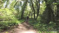
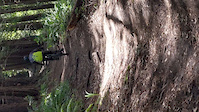
Photos of Santa Cruz Mountain Bike
trail: Flow Trail 1
721 |
Apr 17, 2019 @ 11:22pm
Apr 17, 2019
trail: Flow Trail 1
339 |
Aug 19, 2018 @ 12:22pm
Aug 19, 2018
trail: Flow Trail 3
328 |
Jun 26, 2018 @ 9:52pm
Jun 26, 2018
trail: Flow Trail 3
270 |
Jun 26, 2018 @ 9:42pm
Jun 26, 2018
trail: Ridge Trail
426 | | 1 comments
Feb 3, 2015 @ 8:05pm
Feb 3, 2015
trail: Flow Trail 6
3,481 | | 1 comments
Nov 14, 2014 @ 12:08am
Nov 14, 2014
trail: Flow Trail 6
1,643 |
Jun 24, 2014 @ 5:43pm
Jun 24, 2014
trail: Ridge Trail
875 |
May 8, 2013 @ 3:59pm
May 8, 2013Videos of Santa Cruz Mountain Bike
trail: Strawberry Shortcut
18 |
Feb 14, 2021

trail: Braille DH
5:48 |
19 |
Jul 23, 2020
trail: Emma McCrary Trail
4:24 |
171 |
Jun 20, 2020
trail: Branciforte Creek Trail
2:21 |
270 |
May 31, 2019
trail: Rincon Connector Trail
2:00 |
207 |
May 31, 2019
trail: Lower Redwood Trail
4:43 |
164 |
May 31, 2019
trail: Old Cabin
0:18 |
170 |
May 29, 2019
trail: Ohlone Bluff Trail
0:25 |
245 |
May 29, 2019
Current Trail Warnings
| status | trail | date | condition | user | info |
|---|---|---|---|---|---|
| Connector 1 | Jun 23, 2022 @ 8:43am Jun 23, 2022 | Dry | aguynamedjoe SCMTS Staff | E-Bike | |
| Bobcat | Jun 20, 2022 @ 6:35pm Jun 20, 2022 | Dry | tlfukuda | Tree down | |
| Twin Oaks | Jun 17, 2022 @ 9:12am Jun 17, 2022 | Dry | tlfukuda | Tree down on connector from eucalyptus.... |
Recent Trail Reports
| status | trail | date | condition | info | user |
|---|---|---|---|---|---|
| Flow Trail 1 | Jul 4, 2022 @ 7:58pm 1 day | Dry | Christopher8vQUfC | ||
| Ridge Trail | Jul 3, 2022 @ 10:09am 3 days | Dry | shill | ||
| Sawpit Trail | Jul 3, 2022 @ 10:09am 3 days | Dry | shill | ||
| Sulphur Spring Road | Jul 3, 2022 @ 10:09am 3 days | Dry | shill | ||
| Braille DH | Jul 3, 2022 @ 10:09am 3 days | Ideal | shill | ||
| U-Con Trail | Jun 26, 2022 @ 10:46am Jun 26, 2022 | Dry | shill | ||
| Enchanted Loop | Jun 25, 2022 @ 10:41am Jun 25, 2022 | Ideal | wmichul | ||
| Baldwin Loop | Jun 25, 2022 @ 10:41am Jun 25, 2022 | Dry | wmichul | ||
| Emma McCrary Trail | Jun 25, 2022 @ 9:12am Jun 25, 2022 | Dry | aguynamedjoe SCMTS Staff | ||
| Englesman/Long Meadow | Jun 25, 2022 @ 9:12am Jun 25, 2022 | Dry | aguynamedjoe SCMTS Staff |
Activity Feed
| username | action | type | title | date | |
|---|---|---|---|---|---|
 | MTBDan23 | ridden | trail | Ridge Trail and 6 more | Jul 5, 2022 @ 4:46pm 10 hours |
| jasonwhite7113 | wishlist | route | Wilder Ranch Loop | Jul 5, 2022 @ 3:10pm 12 hours |
| jasonwhite7113 | wishlist | trail | Cowboy Loop Trail and 3 more | Jul 5, 2022 @ 3:01pm 12 hours |
| Christopher8vQUfC | add | report | Flow Trail 1 | Jul 4, 2022 @ 7:58pm 1 day |
 | shill | add | report | Braille DH | Jul 4, 2022 @ 9:27am 2 days |
Recent Comments
| username | type | title | comment | date | |
|---|---|---|---|---|---|
 | trail | Exactly | Jul 2, 2022 @ 6:00pm Jul 2, 2022 | ||
| trail | True but I see them there quite a bit | Jul 2, 2022 @ 1:22pm Jul 2, 2022 | ||
 | trail | The best official trail in Wilder Ranch. | Jun 27, 2022 @ 12:57pm Jun 27, 2022 | ||
| trail | Big tree down at the bottom of the first drainage | Jun 7, 2022 @ 10:54am Jun 7, 2022 | ||
| trail | Epic DH line. Not to advanced, but lots of chunder | May 27, 2022 @ 2:44pm May 27, 2022 |
Local Badges
-

Big Ride 30k10,294 awarded -

10 Black Trails882 awarded -

10 Blue Trails1,929 awarded -

Climbing 10k Badge636 awarded -

Top 10 Trails550 awarded -

10 Green Trails507 awarded
Bike & Skill Parks
| name | type | city | rating |
|---|---|---|---|
| Fun Spot at Depot Park | skill park | Santa Cruz | |
| Harvey West Pump Track | skill park | Santa Cruz | |
| San Lorenzo Park Pumptrack | skill park | Santa Cruz | |
| Westside Pump Track | skill park | Santa Cruz |
Pinkbike Articles
Jun 24, 2019
 Last Chance: Donate $5 to Support Trails & You Could Win an Ibis
The Ante Up for Trails campaign is open until 11:59pm PDT on Monday, June 24, 2019!
Apr 22, 2016
 Support Trail Advocacy and Win a Santa Cruz Bike
Donate to Mountain Bikers of Santa Cruz (MBoSC) and you will be entered to win the Santa Cruz bike of your choice.
May 15, 2015
 Trailforks Trail of the Month: Santa Cruz Flow Trail
Santa Cruz was once famous for illegal trails, but thanks to organized riders there is a change in the air with new developments like the recently...
Activity Type Stats
| activitytype | trails | distance | descent | descent distance | total vertical | rating | global rank | state rank | photos | reports | routes | ridelogs |
|---|---|---|---|---|---|---|---|---|---|---|---|---|
| Mountain Bike | 130 | 133 miles | 26,942 ft | 72 miles | 2,516 ft | #65 | #28 | 716 | 2,762 | 31 | 75,841 | |
| E-Bike | 10 | 16 miles | 2,320 ft | 8 miles | 2,185 ft | #334 | #96 | 2,232 | 2 | 3,317 | ||
| Hike | 210 | 187 miles | 33,770 ft | 90 miles | 2,516 ft | #50 | #25 | 26 | 2,748 | 2 | 1,750 | |
| Trail Running | 211 | 187 miles | 34,255 ft | 90 miles | 2,516 ft | #50 | #24 | 2,753 | 1 | 591 | ||
| Horse | 79 | 79 miles | 12,149 ft | 38 miles | 1,870 ft | #7 | #6 | 827 | 7 | |||
| Observed Trials | 1 | 25 | 10 |
- By ericfoltz
 TRAILFORKS & contributors
 - Admins: SCMTS Staff, sanfret
- #13002 - 32,561 views
- santa cruz activity log | embed map of Santa Cruz mountain bike trails | santa cruz mountain biking points of interest polygons
Downloading of trail gps tracks in kml & gpx formats is enabled for Santa Cruz.
You must login to download files.