close
Trail Conditions
- Unknown
- Snow Groomed
- Snow Packed
- Snow Covered
- Snow Cover Inadequate
- Freeze/thaw Cycle
- Icy
- Prevalent Mud
- Wet
- Variable
- Ideal
- Dry
- Very Dry
Trail Flow (Ridden Direction)
Trailforks scans users ridelogs to determine the most popular direction each trail is ridden. A good flowing trail network will have most trails flowing in a single direction according to their intension.
The colour categories are based on what percentage of riders are riding a trail in its intended direction.
The colour categories are based on what percentage of riders are riding a trail in its intended direction.
- > 96%
- > 90%
- > 80%
- > 70%
- > 50%
- < 50%
- bi-directional trail
- no data
Trail Last Ridden
Trailforks scans ridelogs to determine the last time a trail was ridden.
- < 2 days
- < 1 week
- < 2 weeks
- < 1 month
- < 6 months
- > 6 months
Trail Ridden Direction
The intended direction a trail should be ridden.
- Downhill Only
- Downhill Primary
- Both Directions
- Uphill Primary
- Uphill Only
- One Direction
Contribute Details
Colors indicate trail is missing specified detail.
- Description
- Photos
- Description & Photos
- Videos
Trail Popularity ?
Trailforks scans ridelogs to determine which trails are ridden the most in the last 9 months.
Trails are compared with nearby trails in the same city region with a possible 25 colour shades.
Think of this as a heatmap, more rides = more kinetic energy = warmer colors.
- most popular
- popular
- less popular
- not popular
ATV/ORV/OHV Filter
Max Vehicle Width
inches
Radar Time
x
Activity Recordings
Trailforks users anonymized public ridelogs from the past 6 months.
- mountain biking recent
- mountain biking (>6 month)
- hiking (1 year)
- moto (1 year)
Activity Recordings
Trailforks users anonymized public skilogs from the past 12 months.
- Downhill Ski
- Backcountry Ski
- Nordic Ski
Jump Magnitude Heatmap
Heatmap of where riders jump on trails. Zoom in to see individual jumps, click circles to view jump details.
Trails Deemphasized
Trails are shown in grey.
Only show trails with NO bikes.
Save the current map location and zoom level as your default home location whenever this page is loaded.
SavePopular Trail Networks
view all areas »
No description for West Virginia has been added yet!
Login or register to submit one.
Stats
- Avg Trail Rating
- Trails (view details)
- 1,186
- Trails Mountain Bike
- 1,092
- Trails E-Bike
- 93
- Trails Hike
- 1,017
- Trails Trail Running
- 1,014
- Trails Horse
- 39
- Trails Dirtbike/Moto
- 1
- Trails ATV/ORV/OHV
- 1
- Trails Snowshoe
- 34
- Trails Backcountry Ski
- 2
- Trails Nordic Ski
- 5
- Total Distance
- 2,014 miles
- Total Descent
- 305,802 ft
- Total Vertical
- 4,602 ft
- Highest Trailhead
- 4,864 ft
- Reports
- 2,835
- Photos
- 1,934
- Ridden Counter
- 44,424
 Articles

The Ultimate New River Gorge National Park Travel Guide
Jul 19, 2021 from outsideonline.com
At the most recently declared national park, the adventure starts and ends with the 1,000-foot-deep New River Gorge. The 73,000-acre stretch of...

Max Morgan's Race Diary: Racing on Home Soil at the Snowshoe DH World Cup
Sep 12, 2019 from pinkbike.com
Unlike the majority of the riders in the field, Max Morgan had raced at Snowshoe plenty of times. But that doesn't mean anything when the World...

[Updated] Team Videos: Snowshoe DH World Cup 2019
Sep 11, 2019 from pinkbike.com
Updated with a race recap from Intense Factory Racing.

Video: A Podium for Annie Last & Team KMC Ekoï Orbea - Snowshoe World Cup XC 2019
Sep 10, 2019 from pinkbike.com
A great way to cap of the World Cup season.
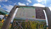
Sub Regions
- Braxton County (4)
- Canaan Valley (91)
- Eastern Panhandle (42)
- Hardy County (16)
- Pocahontas County (173)
- Southern West Virginia (155)
Popular West Virginia Mountain Biking Trails
| status | title | difficulty | rating |
|---|---|---|---|
| Upper Dreamweaver Snowshoe Bike Park | |||
| Lucid Snowshoe Bike Park | |||
| Raging Bull Snowshoe Bike Park | |||
| Skyline Snowshoe Bike Park | |||
| Hootenanny (access) Snowshoe Bike Park | |||
| Lower Dreamweaver Snowshoe Bike Park | |||
| 10 Gallon Snowshoe Bike Park | |||
| Portal Snowshoe Bike Park | |||
| Lower Ninja Bob Snowshoe Bike Park | |||
| Powerline Snowshoe Bike Park | |||
| Ball-N-Jack Snowshoe Bike Park | |||
| Giant Slalom Snowshoe Bike Park | |||
| Trail M Snowshoe Bike Park | |||
| Easy Street Snowshoe Bike Park | |||
| Dirt Beaver Snowshoe Bike Park |
West Virginia Mountain Bike Routes
| title | rating | distance |
|---|---|---|
| Gauley Headwaters EPIC Tea Creek Area | 43 miles | |
| Mine Rd. Base Trails Loop Tea Creek Area | 5 miles | |
| Big Bear Sampler Big Bear Lake Trail Center | 16 miles | |
| Spruce Knob - Allegheny Spruce Knob-Seneca Rocks National Recreation Area | 14 miles | |
| BKXC 50 State Shred - West Virginia Canaan Valley National Wildlife Refuge | 16 miles | |
| Red/White Meeks Mountain Trails | 3 miles | |
| Silver Creek Snowshoe Bike Park | 8 miles | |
| Red Green Meeks Mountain Trails | 5 miles | |
| Charlies Trail to lower red cardinal Grafton | 1 mile | |
| Stonecoal loop Cheat Canyon Wildlife Management Area | 13 miles |
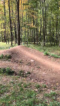
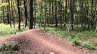
Photos of West Virginia Mountain Bike
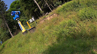
trail: Missing Link
148 |
Sep 15, 2018 @ 4:23pm
Sep 15, 2018
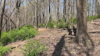
trail: Lower Dreamweaver
328 |
Jun 28, 2015 @ 7:13pm
Jun 28, 2015
trail: Lower Dreamweaver
372 |
Jun 28, 2015 @ 7:11pm
Jun 28, 2015
trail: Skyline
313 |
Mar 20, 2015 @ 12:01pm
Mar 20, 2015
trail: Skyline
633 | | 1 comments
Nov 2, 2014 @ 10:29am
Nov 2, 2014
trail: 10 Gallon
908 |
Jul 15, 2014 @ 6:09pm
Jul 15, 2014
trail: 10 Gallon
409 |
Jul 15, 2014 @ 6:08pm
Jul 15, 2014
trail: Missing Link
283 |
Jul 14, 2009 @ 7:22am
Jul 14, 2009Videos of West Virginia Mountain Bike
trail: Lucid
8 |
Jun 28, 2022
trail: Copperhead Trail
12 |
Jun 25, 2022
trail: Road Side Trail
14 |
Jun 25, 2022
trail: Sasquatch Trail
146 |
Apr 24, 2022
trail: Big Ash
54 |
Jan 18, 2022

trail: Big Ash
|
Jan 18, 2022
trail: Big Ash
|
Jan 18, 2022
trail: Dirt Beaver
22 |
Jan 4, 2022
Activity Feed
| username | action | type | title | date | |
|---|---|---|---|---|---|
 | Macandgina | wishlist | region | Snowshoe Bike Park | Jul 5, 2022 @ 2:19pm 12 hours |
 | InvertedFlight | ridden | trail | 6000 Steps and 1 more | Jul 4, 2022 @ 7:23pm 1 day |
| Robertoreza | wishlist | trail | West Fork Trail | Jul 4, 2022 @ 2:43pm 1 day |
 | jrad505 | wishlist | route | Enduro Training Loop and 1 more | Jul 4, 2022 @ 9:04am 2 days |
| drummstick | wishlist | route | Big Bear Sampler | Jul 3, 2022 @ 6:22pm 2 days |
Recent Comments
| username | type | title | comment | date | |
|---|---|---|---|---|---|
 | trail | I would like to ride this trail, if anyone... | Jun 26, 2022 @ 5:40pm Jun 26, 2022 | ||
| report | Actually overgrown throughout. makes the trail... | Jun 20, 2022 @ 4:59pm Jun 20, 2022 | ||
| report | Entire trail has been deliberately trashed. ... | Jun 3, 2022 @ 9:06am Jun 3, 2022 | ||
 | trail | This is actually named McGraw Trail | May 30, 2022 @ 11:22am May 30, 2022 | ||
| trail | Li I’m | May 28, 2022 @ 4:24pm May 28, 2022 |
Local Badges
-

10 Black Trails228 awarded -

Epic Ride Descent 2k1,141 awarded -

10 Blue Trails452 awarded -

Big Ride 30k957 awarded -

Completionist0 awarded -
Completionist0 awarded
Bike & Skill Parks
| name | type | city | rating |
|---|---|---|---|
| Big Bear Lake Trail Center | bike park | Bruceton Mills | |
| Camp ROYAL | bike park | Glen Jean | |
| Snowshoe Bike Park | bike park | Snowshoe | |
| The Summit Bechtel Reserve | bike park | Glen Jean | |
| Action Point BMX | skill park | Oak Hill |
Upcoming Local Events
Activity Type Stats
| activitytype | trails | distance | descent | descent distance | total vertical | rating | global rank | state rank | photos | reports | routes | ridelogs |
|---|---|---|---|---|---|---|---|---|---|---|---|---|
| Mountain Bike | 1,092 | 1,876 mile | 284,006 ft | 850 miles | 4,528 ft | #44 | 1,870 | 2,833 | 52 | 35,260 | ||
| E-Bike | 93 | 405 miles | 30,686 ft | 167 miles | 4,213 ft | #43 | 7 | 2,261 | 2 | 675 | ||
| Hike | 1,017 | 1,874 mile | 265,725 ft | 829 miles | 4,603 ft | #52 | 44 | 2,722 | 3 | 2,687 | ||
| Trail Running | 1,014 | 1,873 mile | 265,614 ft | 829 miles | 4,603 ft | #51 | 13 | 2,720 | 3 | 641 | ||
| Horse | 39 | 345 miles | 25,909 ft | 142 miles | 3,878 ft | #45 | 685 | 4 | ||||
| Dirtbike/Moto | 1 | 10 miles | 1,325 ft | 4 miles | 276 ft | 691 | 21 | |||||
| ATV/ORV/OHV | 1 | 10 miles | 1,325 ft | 4 miles | 276 ft | #48 | 679 | 24 | ||||
| Snowshoe | 34 | 193 miles | 26,224 ft | 104 miles | 3,510 ft | #40 | 21 | 12 | ||||
| Backcountry Ski | 2 | 3 miles | 394 ft | 2 miles | 217 ft | #29 | 119 | |||||
| Nordic Ski | 5 | 106 miles | 4,006 ft | 46 miles | 1,542 ft | #44 | 236 |
- By canadaka
 Trailforks & contributors
 - Admins: Map Team, chuktA, msmcfate, WillieJacobsz, PlumbBobM, ReckitRolley, theWVPedaler, Turntex, PlumbBobM, Chris-Campbell
- #3208 - 19,153 views
- west virginia activity log | embed map of West Virginia mountain bike trails | west virginia mountain biking points of interest polygons
-
- subscribe
- 3d map
Downloading of trail gps tracks in kml & gpx formats is enabled for West Virginia.
You must login to download files.