close
Trail Conditions
- Unknown
- Snow Groomed
- Snow Packed
- Snow Covered
- Snow Cover Inadequate
- Freeze/thaw Cycle
- Icy
- Prevalent Mud
- Wet
- Variable
- Ideal
- Dry
- Very Dry
Trail Flow (Ridden Direction)
Trailforks scans users ridelogs to determine the most popular direction each trail is ridden. A good flowing trail network will have most trails flowing in a single direction according to their intension.
The colour categories are based on what percentage of riders are riding a trail in its intended direction.
The colour categories are based on what percentage of riders are riding a trail in its intended direction.
- > 96%
- > 90%
- > 80%
- > 70%
- > 50%
- < 50%
- bi-directional trail
- no data
Trail Last Ridden
Trailforks scans ridelogs to determine the last time a trail was ridden.
- < 2 days
- < 1 week
- < 2 weeks
- < 1 month
- < 6 months
- > 6 months
Trail Ridden Direction
The intended direction a trail should be ridden.
- Downhill Only
- Downhill Primary
- Both Directions
- Uphill Primary
- Uphill Only
- One Direction
Contribute Details
Colors indicate trail is missing specified detail.
- Description
- Photos
- Description & Photos
- Videos
Trail Popularity ?
Trailforks scans ridelogs to determine which trails are ridden the most in the last 9 months.
Trails are compared with nearby trails in the same city region with a possible 25 colour shades.
Think of this as a heatmap, more rides = more kinetic energy = warmer colors.
- most popular
- popular
- less popular
- not popular
ATV/ORV/OHV Filter
Max Vehicle Width
inches
Radar Time
x
Activity Recordings
Trailforks users anonymized public ridelogs from the past 6 months.
- mountain biking recent
- mountain biking (>6 month)
- hiking (1 year)
- moto (1 year)
Activity Recordings
Trailforks users anonymized public skilogs from the past 12 months.
- Downhill Ski
- Backcountry Ski
- Nordic Ski
Jump Magnitude Heatmap
Heatmap of where riders jump on trails. Zoom in to see individual jumps, click circles to view jump details.
Trails Deemphasized
Trails are shown in grey.
Only show trails with NO bikes.
Save the current map location and zoom level as your default home location whenever this page is loaded.
Save
No description for Tahoe City has been added yet!
Login or register to submit one.
Activities Click to view
- Mountain Bike
229 trails
- E-Bike
17 trails
- Hike
236 trails
- Trail Running
236 trails
- Horse
154 trails
- Dirtbike/Moto
15 trails
- Observed Trials
4 trails
- ATV/ORV/OHV
14 trails
- Snowmobile
6 trails
- Snowshoe
3 trails
- Downhill Ski
107 trails
- Backcountry Ski
7 trails
- Nordic Ski
40 trails
Region Details
- 73
- 11
- 64
- 57
- 22
- 2
Region Status
Caution as of Feb 4, 2020Stats
- Avg Trail Rating
- Trails (view details)
- 385
- Trails Mountain Bike
- 229
- Trails E-Bike
- 17
- Trails Hike
- 236
- Trails Trail Running
- 236
- Trails Horse
- 154
- Trails Dirtbike/Moto
- 15
- Trails Observed Trials
- 4
- Trails ATV/ORV/OHV
- 14
- Trails Snowmobile
- 6
- Trails Snowshoe
- 3
- Trails Downhill Ski
- 107
- Trails Backcountry Ski
- 7
- Trails Nordic Ski
- 40
- Total Distance
- 262 miles
- Total Descent
- 72,686 ft
- Total Vertical
- 2,733 ft
- Highest Trailhead
- 8,762 ft
- Reports
- 2,151
- Photos
- 418
- Ridden Counter
- 77,429
 Articles
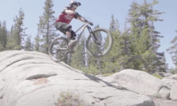
Video: Greg Watts Explores the Trails of Woodward Tahoe
Aug 13, 2020 from pinkbike.com
Slabs, skate parks and more in Tahoe
Sub Regions
-
Alpine Meadows
- 2
- 8
- 3
-
Mount Watson
- 8
- 23
- 13
- 2
-
Paige Meadows
- 1
- 23
- 8
- 2
-
Tahoe Cross Country
- 1
- 24
- 13
- 1
-
Ward Canyon
- 7
- 5
- 3
Popular Tahoe City Mountain Biking Trails
Tahoe City Mountain Bike Routes
| title | rating | distance |
|---|---|---|
| Tahoe City Tahoe Rim Trail Loop (4 Hours) | 19 miles | |
| Tahoe XC to Rim Trail & down Powerline | 14 miles | |
| Glass Mountain Loop | 13 miles | |
| Tahoe XC Lakeview Ridge Loop | 6 miles | |
| Dollar Reservoir Loop TXC | 3 miles | |
| Lorena's TCXC to Carnelian Bay | 11 miles | |
| Lake Tahoe Mountain Bike Race 2022 | 12 miles | |
| Rawhide /Flintstone's ~1 hr Loop | 7 miles | |
| Dollar Creek to Big Chief and back via Watson Lake | 26 miles | |
| Glass Mountain and Missing Link | 16 miles |
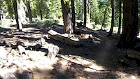
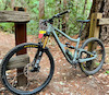
Photos of Tahoe City Mountain Bike
trail: Dirk's
3 |
Jun 20, 2022 @ 7:32pm
Jun 20, 2022
trail: Paige Meadows: Old TRT
6 |
Jun 13, 2022 @ 5:14pm
Jun 13, 2022
trail: Paver Way
2 |
Jun 13, 2022 @ 5:13pm
Jun 13, 2022
trail: Chamonix/TRT Connector
2 |
Jun 13, 2022 @ 5:12pm
Jun 13, 2022
trail: Chamonix/TRT Connector
2 |
Jun 13, 2022 @ 5:12pm
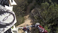
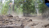
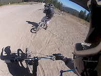
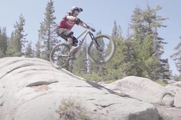
Jun 13, 2022Videos of Tahoe City Mountain Bike
1:28 |
61 |
Jul 28, 2019
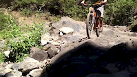
trail: Waterfall
0:42 |
292 |
Jul 9, 2014
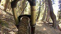
trail: Waterfall
2:36 |
318 |
May 4, 2013
trail: Waterfall
5:15 |
769 |
Jan 14, 2013
1:31 |
811 |
Nov 1, 2012
trail: Twilight Zone
2:18 |
135 |
Sep 20, 2012
trail: Meadow
0:46 |
111 |
Apr 14, 2010

trail: Burton Creek Singletrack
2:50 |
13 |
Jun 9, 2022 , Tahoe City
Current Trail Warnings
| status | trail | date | condition | user | info |
|---|---|---|---|---|---|
| Paver/Rawhide Crossover | Jun 25, 2022 @ 10:25am Jun 25, 2022 | Ideal | jameskayser | ||
| Trailhead Road (South) | Jun 8, 2022 @ 4:20pm Jun 8, 2022 | Snow Covered | spellpsyche |
Recent Trail Reports
| status | trail | date | condition | info | user |
|---|---|---|---|---|---|
| Lakeview Road (Lower) | Jul 4, 2022 @ 10:35am 2 days | Dry | spellpsyche | ||
| Lakeview Road (Upper) | Jul 4, 2022 @ 10:35am 2 days | Dry | spellpsyche | ||
| Lakeview Ridge Trail | Jul 4, 2022 @ 10:35am 2 days | Ideal | spellpsyche | ||
| Elevator Shaft | Jul 4, 2022 @ 10:35am 2 days | Dry | spellpsyche | ||
| Lower Lakeview Trail | Jul 4, 2022 @ 10:35am 2 days | Dry | spellpsyche | ||
| Water Tank Trail | Jul 4, 2022 @ 10:35am 2 days | Ideal | spellpsyche | ||
| Water Tank Trail Connector | Jul 4, 2022 @ 10:35am 2 days | Ideal | spellpsyche | ||
| Trailhead Singletrack | Jul 4, 2022 @ 10:35am 2 days | Ideal | spellpsyche | ||
| Tahoe Rim Trail (Painted Rock) | Jul 3, 2022 @ 6:19pm 2 days | Dry | JuanTons | ||
| Public Access Drive | Jun 25, 2022 @ 10:25am Jun 25, 2022 | Ideal | jameskayser |
Activity Feed
| username | action | type | title | date | |
|---|---|---|---|---|---|
 | windsurfsf | add | photo | in San Francisco, California, United States | Jul 6, 2022 @ 12:10am 3 hours |
 | SantaRosa13 | comment | trail | Deer Creek | Jul 5, 2022 @ 9:56pm 5 hours |
| dsmedt | ridden | trail | Lakeview Ridge Trail | Jul 5, 2022 @ 7:41pm 7 hours |
| Nirgs | ridden | trail | Upper Watson Creek | Jul 5, 2022 @ 1:10pm 14 hours |
 | johnnyXride | comment | trail | Stumpy Meadows | Jul 4, 2022 @ 5:08pm 1 day |
Recent Comments
| username | type | title | comment | date | |
|---|---|---|---|---|---|
| trail | I have crossed at bridge 3 in 2020. The owner... | Jul 5, 2022 @ 9:56pm 5 hours | ||
| trail | The Stumpy Meadow Trail, also known as Stumpy... | Jul 4, 2022 @ 5:08pm 1 day | ||
 | trail | I’ll try next week and let you know but... | Jun 25, 2022 @ 3:55pm Jun 25, 2022 | ||
| trail | This is a great little trail, flowy and pretty... | Jun 24, 2022 @ 12:23pm Jun 24, 2022 | ||
| trail | Amazing descent. More of a blue than a black, imo. | Jun 13, 2022 @ 5:54pm Jun 13, 2022 |
Local Badges
-

Big Ride 30k2,289 awarded -

10 Blue Trails515 awarded -

Completionist1 awarded -

Epic Ride 50k755 awarded -
Completionist1 awarded -
Completionist1 awarded
Local Mountain Biking Directory
-
Tahoe Cross-Country Ski Area
-
Gravity ShopBike Shop
-
Olympic Bike ShopBike Shop
Pinkbike Articles
Aug 13, 2020
 Video: Greg Watts Explores the Trails of Woodward Tahoe
Slabs, skate parks and more in Tahoe
Activity Type Stats
| activitytype | trails | distance | descent | descent distance | total vertical | rating | global rank | state rank | photos | reports | routes | ridelogs |
|---|---|---|---|---|---|---|---|---|---|---|---|---|
| Mountain Bike | 229 | 195 miles | 30,043 ft | 84 miles | 2,402 ft | #121 | #52 | 413 | 2,124 | 40 | 18,767 | |
| E-Bike | 17 | 37 miles | 3,537 ft | 12 miles | 2,087 ft | #1,166 | #238 | 1,714 | 2 | 837 | ||
| Hike | 236 | 207 miles | 30,512 ft | 86 miles | 2,733 ft | #86 | #42 | 5 | 2,122 | 9 | 1,239 | |
| Trail Running | 236 | 207 miles | 30,610 ft | 86 miles | 2,733 ft | #85 | #40 | 2,123 | 8 | 1,697 | ||
| Horse | 154 | 142 miles | 21,955 ft | 63 miles | 2,375 ft | #6 | #5 | 1,129 | 8 | |||
| Dirtbike/Moto | 15 | 33 miles | 3,136 ft | 10 miles | 2,018 ft | #157 | #99 | 866 | 11 | |||
| Observed Trials | 4 | 4 miles | 600 ft | 2 miles | 669 ft | #118 | 399 | 4 | ||||
| ATV/ORV/OHV | 14 | 33 miles | 2,717 ft | 10 miles | 2,018 ft | #106 | #58 | 866 | 5 | |||
| Snowmobile | 6 | 24 miles | 1,936 ft | 7 miles | 2,018 ft | #53 | #23 | 405 | 4 | |||
| Snowshoe | 3 | 17 miles | 1,755 ft | 6 miles | 2,018 ft | #337 | #176 | 401 | 302 | |||
| Downhill Ski | 107 | 25 miles | 36,650 ft | 23 miles | 1,637 ft | #129 | 398 | 2,916 | ||||
| Backcountry Ski | 7 | 14 miles | 4,219 ft | 7 miles | 1,430 ft | #368 | 400 | 1 | 2,302 | |||
| Nordic Ski | 40 | 38 miles | 3,104 ft | 15 miles | 2,018 ft | #274 | #138 | 403 | 1 | 1,741 |
- By TheAngryTomato
 TRAILFORKS & contributors
 - Admins: TAMBA, TRTA, SBTS, TheAngryTomato, Indorhino
- #6866 - 16,239 views
- tahoe city activity log | embed map of Tahoe City mountain bike trails | tahoe city mountain biking points of interest
Downloading of trail gps tracks in kml & gpx formats is enabled for Tahoe City.
You must login to download files.