close
Trail Conditions
- Unknown
- Snow Groomed
- Snow Packed
- Snow Covered
- Snow Cover Inadequate
- Freeze/thaw Cycle
- Icy
- Prevalent Mud
- Wet
- Variable
- Ideal
- Dry
- Very Dry
Trail Flow (Ridden Direction)
Trailforks scans users ridelogs to determine the most popular direction each trail is ridden. A good flowing trail network will have most trails flowing in a single direction according to their intension.
The colour categories are based on what percentage of riders are riding a trail in its intended direction.
The colour categories are based on what percentage of riders are riding a trail in its intended direction.
- > 96%
- > 90%
- > 80%
- > 70%
- > 50%
- < 50%
- bi-directional trail
- no data
Trail Last Ridden
Trailforks scans ridelogs to determine the last time a trail was ridden.
- < 2 days
- < 1 week
- < 2 weeks
- < 1 month
- < 6 months
- > 6 months
Trail Ridden Direction
The intended direction a trail should be ridden.
- Downhill Only
- Downhill Primary
- Both Directions
- Uphill Primary
- Uphill Only
- One Direction
Contribute Details
Colors indicate trail is missing specified detail.
- Description
- Photos
- Description & Photos
- Videos
Trail Popularity ?
Trailforks scans ridelogs to determine which trails are ridden the most in the last 9 months.
Trails are compared with nearby trails in the same city region with a possible 25 colour shades.
Think of this as a heatmap, more rides = more kinetic energy = warmer colors.
- most popular
- popular
- less popular
- not popular
ATV/ORV/OHV Filter
Max Vehicle Width
inches
Radar Time
x
Activity Recordings
Trailforks users anonymized public ridelogs from the past 6 months.
- mountain biking recent
- mountain biking (>6 month)
- hiking (1 year)
- moto (1 year)
Activity Recordings
Trailforks users anonymized public skilogs from the past 12 months.
- Downhill Ski
- Backcountry Ski
- Nordic Ski
Jump Magnitude Heatmap
Heatmap of where riders jump on trails. Zoom in to see individual jumps, click circles to view jump details.
Trails Deemphasized
Trails are shown in grey.
Only show trails with NO bikes.
Save the current map location and zoom level as your default home location whenever this page is loaded.
Save
No description for Ladera Ranch has been added yet!
Login or register to submit one.
Activities Click to view
- Mountain Bike
96 trails
- E-Bike
8 trails
- Hike
94 trails
- Trail Running
94 trails
Region Details
- 8
- 4
- 34
- 49
- 1
Region Status
Open as of Dec 3, 2020Local Trail Association
Stats
- Avg Trail Rating
- Trails (view details)
- 96
- Trails Mountain Bike
- 96
- Trails E-Bike
- 8
- Trails Hike
- 94
- Trails Trail Running
- 94
- Total Distance
- 74 miles
- Total Descent
- 14,126 ft
- Total Vertical
- 1,307 ft
- Highest Trailhead
- 1,489 ft
- Reports
- 1,473
- Photos
- 1,335
- Ridden Counter
- 24,954
Sub Regions
-
O'Neill Regional Park
- 26
- 36
- 1
Popular Ladera Ranch Mountain Biking Trails
Ladera Ranch Mountain Bike Routes
| title | rating | distance |
|---|---|---|
| dabeasttrail | 4 miles | |
| O’Neill Park/Waterworks - Advanced Route | 20 miles | |
| O’Neill Park/Waterworks - Intermediate Route | 13 miles | |
| Vista Loop | 4 miles | |
| Ladera Ranch Ripper | 10 miles | |
| SJHHS Training Loop | 6 miles | |
| Arroyo Trabuco (Crown Valley to O'Neill) | 7 miles | |
| 21 mile O'Neill Regional Park All-Mountain Ride | popular ridelog | 21 miles |
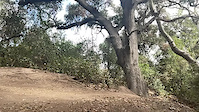
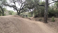
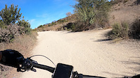
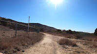
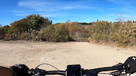
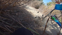
Photos of Ladera Ranch Mountain Bike
trail: Ripper
1 |
Jun 27, 2022 @ 10:47am
Jun 27, 2022
trail: Twisty Tire
3 |
Apr 24, 2022 @ 9:29pm
Apr 24, 2022
trail: Twisty Tire
8 |
Apr 24, 2022 @ 9:29pm
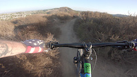
Apr 24, 2022Videos of Ladera Ranch Mountain Bike
trail: Waterworks
20 |
May 14, 2022
trail: Waterworks
22 |
May 14, 2022
trail: Escalator
35 |
Jan 19, 2021

23 |
Jan 19, 2021
trail: Waterworks
36 |
Jan 19, 2021
trail: Little Finger
20 |
Jan 19, 2021
trail: Rut Buddy
110 |
Oct 21, 2020
trail: Spitfire
0:47 |
75 |
Oct 11, 2020
Recent Trail Reports
| status | trail | date | condition | info | user |
|---|---|---|---|---|---|
| Machete | Jul 2, 2022 @ 9:22am Jul 2, 2022 | Dry | MTBMOR | ||
| Rusty Drum | Jul 2, 2022 @ 9:22am Jul 2, 2022 | Dry | MTBMOR | ||
| Landslide Traverse | Jun 25, 2022 @ 7:32am Jun 25, 2022 | Dry | MTBMOR | ||
| Escalator | Jun 24, 2022 @ 7:57am Jun 24, 2022 | Dry | MTBMOR | ||
| Sidetrack | Jun 24, 2022 @ 7:57am Jun 24, 2022 | Dry | MTBMOR | ||
| Mother's | Jun 21, 2022 @ 8:26pm Jun 21, 2022 | Dry | justinnorth | ||
| Ladera Ranch Trail | Jun 12, 2022 @ 12:57pm Jun 12, 2022 | Very Dry | drturay | ||
| Ladera Ridge Entrance | Jun 12, 2022 @ 12:57pm Jun 12, 2022 | Very Dry | drturay | ||
| Narrow Canyon Trail | Jun 12, 2022 @ 12:57pm Jun 12, 2022 | Very Dry | drturay | ||
| Waterworks | Jun 8, 2022 @ 6:47am Jun 8, 2022 | Dry | MTBMOR |
Activity Feed
| username | action | type | title | date | |
|---|---|---|---|---|---|
 | Youndo | wishlist | trail | Waterworks | Jul 5, 2022 @ 4:02am 23 hours |
| Youndo | wishlist | route | O’Neill Park/Waterworks - Advanced Route | Jul 4, 2022 @ 3:53pm 1 day |
| DPTR | vote | youtube_channels | MTB MOR | Jul 4, 2022 @ 6:52am 2 days |
 | MTBMOR | add | report | Machete and 1 more | Jul 3, 2022 @ 12:50pm 3 days |
| JimmycZUvHo | ridden | trail | Arroyo Trabuco Trail (Oso to O'Neill) | Jul 2, 2022 @ 4:33pm Jul 2, 2022 |
Recent Comments
| username | type | title | comment | date | |
|---|---|---|---|---|---|
 | report | Almost ate shit on that hole today | Jun 10, 2022 @ 9:51pm Jun 10, 2022 | ||
| trail | Park at Santa Margarita Water District. It is... | Jul 5, 2021 @ 11:15pm Jul 5, 2021 | ||
 | trail | Great flow trail love it. I litterally raged... | Apr 2, 2021 @ 7:59pm Apr 2, 2021 | ||
| trail | DONT CUT SWITCHBACKS PLEASE | Mar 6, 2021 @ 8:40pm Mar 6, 2021 | ||
| trail | Not the funnest trail, more uphill then... | Feb 24, 2021 @ 8:26pm Feb 24, 2021 |
Local Badges
-

Big Ride 30k2,956 awarded -

10 Green Trails545 awarded -

10 Blue Trails502 awarded -

Epic Ride 50k1,040 awarded -

Top 10 Trails0 awarded -

Completionist0 awarded
Bike & Skill Parks
| name | type | city | rating |
|---|---|---|---|
| Skate Park Hill Jumps | skill park | Ladera Ranch |
Activity Type Stats
| activitytype | trails | distance | descent | descent distance | total vertical | rating | global rank | state rank | photos | reports | routes | ridelogs |
|---|---|---|---|---|---|---|---|---|---|---|---|---|
| Mountain Bike | 96 | 74 miles | 14,127 ft | 35 miles | 1,306 ft | #153 | #69 | 1,334 | 1,468 | 7 | 25,873 | |
| E-Bike | 8 | 3 miles | 246 ft | 5,108 ft | 610 ft | #1,288 | #254 | 1,229 | 944 | |||
| Hike | 94 | 73 miles | 13,717 ft | 35 miles | 1,306 ft | #112 | #60 | 1 | 1,453 | 502 | ||
| Trail Running | 94 | 73 miles | 13,717 ft | 35 miles | 1,306 ft | #113 | #60 | 1,453 | 472 |
- By socalstokie & contributors
- Admins: SHARE, SDMBA
- #12937 - 14,693 views
- ladera ranch activity log | embed map of Ladera Ranch mountain bike trails | ladera ranch mountain biking points of interest
Downloading of trail gps tracks in kml & gpx formats is enabled for Ladera Ranch.
You must login to download files.