close
Trail Conditions
- Unknown
- Snow Groomed
- Snow Packed
- Snow Covered
- Snow Cover Inadequate
- Freeze/thaw Cycle
- Icy
- Prevalent Mud
- Wet
- Variable
- Ideal
- Dry
- Very Dry
Trail Flow (Ridden Direction)
Trailforks scans users ridelogs to determine the most popular direction each trail is ridden. A good flowing trail network will have most trails flowing in a single direction according to their intension.
The colour categories are based on what percentage of riders are riding a trail in its intended direction.
The colour categories are based on what percentage of riders are riding a trail in its intended direction.
- > 96%
- > 90%
- > 80%
- > 70%
- > 50%
- < 50%
- bi-directional trail
- no data
Trail Last Ridden
Trailforks scans ridelogs to determine the last time a trail was ridden.
- < 2 days
- < 1 week
- < 2 weeks
- < 1 month
- < 6 months
- > 6 months
Trail Ridden Direction
The intended direction a trail should be ridden.
- Downhill Only
- Downhill Primary
- Both Directions
- Uphill Primary
- Uphill Only
- One Direction
Contribute Details
Colors indicate trail is missing specified detail.
- Description
- Photos
- Description & Photos
- Videos
Trail Popularity ?
Trailforks scans ridelogs to determine which trails are ridden the most in the last 9 months.
Trails are compared with nearby trails in the same city region with a possible 25 colour shades.
Think of this as a heatmap, more rides = more kinetic energy = warmer colors.
- most popular
- popular
- less popular
- not popular
ATV/ORV/OHV Filter
Max Vehicle Width
inches
Radar Time
x
Activity Recordings
Trailforks users anonymized public ridelogs from the past 6 months.
- mountain biking recent
- mountain biking (>6 month)
- hiking (1 year)
- moto (1 year)
Activity Recordings
Trailforks users anonymized public skilogs from the past 12 months.
- Downhill Ski
- Backcountry Ski
- Nordic Ski
Jump Magnitude Heatmap
Heatmap of where riders jump on trails. Zoom in to see individual jumps, click circles to view jump details.
Trails Deemphasized
Trails are shown in grey.
Only show trails with NO bikes.
Save the current map location and zoom level as your default home location whenever this page is loaded.
Save
No description for Orange has been added yet!
Login or register to submit one.
Activities Click to view
- Mountain Bike
49 trails
- Hike
54 trails
- Trail Running
54 trails
- Horse
23 trails
Region Details
- 8
- 16
- 17
- 6
- 2
Region Status
Open as of Jun 19, 2022Local Trail Association
Stats
- Avg Trail Rating
- Trails (view details)
- 55
- Trails Mountain Bike
- 49
- Trails Hike
- 54
- Trails Trail Running
- 54
- Trails Horse
- 23
- Total Distance
- 35 miles
- Total Descent
- 7,305 ft
- Total Vertical
- 1,356 ft
- Highest Trailhead
- 1,679 ft
- Reports
- 1,057
- Photos
- 144
- Ridden Counter
- 26,498
Sub Regions
-
Irvine Regional Park
- 10
- 1
-
Peter's Canyon Regional Park
- 2
- 4
- 1
-
Santiago Oaks
- 4
- 13
- 4
- 2
Popular Orange Mountain Biking Trails
Orange Mountain Bike Routes
| title | rating | distance |
|---|---|---|
| Santiago Oaks - Advanced Route 1 | 8 miles | |
| Santiago Oaks - Advanced Route 2 | 10 miles | |
| Santiago Oaks: Intermediate Dad Bod Loop | 8 miles | |
| Santiago Oaks - Beginner Route 1 | 5 miles | |
| Santiago Oaks - Intermediate Route 1 | 8 miles | |
| Blackstar to Motorway - Advanced Route | 24 miles | |
| Santiago Oaks - Intermediate Route 2 | 8 miles | |
| Ride Series - Test | 7 miles | |
| Orange Hill to Serrano Creek Park via Santiago Oaks | 17 miles | |
| Santiago Oaks - Intermediate Route 3 | 9 miles |
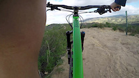
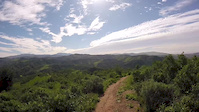
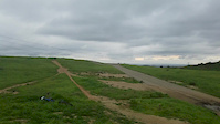
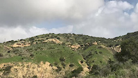
Photos of Orange Mountain Bike
trail: Roadrunner Flow
0 |
Jun 26, 2022 @ 9:32pm
Jun 26, 2022
trail: Roadrunner Flow
0 |
Jun 26, 2022 @ 9:32pm
Jun 26, 2022
trail: Roadrunner Flow
3 |
Jun 26, 2022 @ 9:32pm
Jun 26, 2022
trail: Chutes Ridgeline
34 |
Apr 16, 2022 @ 3:24pm
Apr 16, 2022
trail: Waterfall
28 |
Apr 15, 2022 @ 7:12am
Apr 15, 2022
trail: Chutes Ridgeline
37 |
Apr 15, 2022 @ 7:10am
Apr 15, 2022
trail: Chutes
155 |
May 25, 2020 @ 11:15pm
May 25, 2020
trail: Chutes
326 |
May 16, 2016 @ 9:23pm
May 16, 2016Videos of Orange Mountain Bike
trail: Cactus
8 |
May 8, 2022
trail: Cactus
2:36 |
5 |
Dec 17, 2017
trail: Barham Ridge
1:57 |
264 |
Jun 24, 2017
trail: Bumble Bee
1:54 |
139 |
Mar 21, 2017
trail: Chutes Ridgeline
4:04 |
335 |
Feb 26, 2017
trail: Deer
2:01 |
232 |
Feb 18, 2017
trail: Barham Ridge
0:12 |
173 |
Feb 16, 2017
trail: Yucca
2:06 |
176 |
Feb 4, 2017
Recent Trail Reports
| status | trail | date | condition | info | user |
|---|---|---|---|---|---|
| Lake View | Jun 19, 2022 @ 12:43am Jun 19, 2022 | Dry | Martinyyxcn4 | ||
| Grasshopper | Jun 11, 2022 @ 7:03pm Jun 11, 2022 | Very Dry | pwarnock | ||
| Fred Barrera Connector | Jun 9, 2022 @ 12:22pm Jun 9, 2022 | Very Dry | jasonmfry | ||
| Edition Ridge | Jun 9, 2022 @ 12:22pm Jun 9, 2022 | Very Dry | jasonmfry | ||
| Yucca Doubletrack | Jun 9, 2022 @ 12:22pm Jun 9, 2022 | Very Dry | jasonmfry | ||
| Yucca | Jun 9, 2022 @ 12:22pm Jun 9, 2022 | Very Dry | jasonmfry | ||
| Coachwhip | Jun 9, 2022 @ 12:22pm Jun 9, 2022 | Very Dry | jasonmfry | ||
| Chutes Ridgeline | Jun 9, 2022 @ 12:22pm Jun 9, 2022 | Very Dry | jasonmfry | ||
| Lower Bumblebee | Jun 9, 2022 @ 12:22pm Jun 9, 2022 | Very Dry | jasonmfry | ||
| Santiago Oaks Access Road | Jun 9, 2022 @ 12:22pm Jun 9, 2022 | Very Dry | jasonmfry |
Activity Feed
| username | action | type | title | date | |
|---|---|---|---|---|---|
 | Rpryor3 | wishlist | route | Santiago Oaks - Beginner Route 1 | Jul 3, 2022 @ 6:26pm 2 days |
 | srichards | wishlist | trail | Waterfall and 3 more | Jun 29, 2022 @ 6:09pm Jun 29, 2022 |
| RD4l53 | wishlist | route | Santiago Oaks - Advanced Route 2 | Jun 28, 2022 @ 4:45am Jun 28, 2022 |
| Rapparicio | add | photo | in My City, California, United States and 2 more | Jun 26, 2022 @ 9:32pm Jun 26, 2022 |
| Iclimb4thedowns | wishlist | route | Santiago Oaks - Advanced Route 1 | Jun 25, 2022 @ 3:40pm Jun 25, 2022 |
Recent Comments
| username | type | title | comment | date | |
|---|---|---|---|---|---|
| report | Super fun, flowy trail. You can get air or... | Mar 26, 2022 @ 11:17am Mar 26, 2022 | ||
 | trail | Zone is apparently not friendly to unleashed... | Feb 21, 2022 @ 4:02pm Feb 21, 2022 | ||
| trail | Fun to descend, just okay to climb | Jan 3, 2022 @ 3:58pm Jan 3, 2022 | ||
| trail | Z | Nov 28, 2021 @ 11:20am Nov 28, 2021 | ||
 | trail | I think this is my favorite trail in the park.... | Sep 26, 2021 @ 2:19pm Sep 26, 2021 |
Local Badges
-

10 Blue Trails669 awarded -

10 Green Trails412 awarded -

Top 10 Trails179 awarded -

Big Ride 30k1,245 awarded -

Climbing 10k Badge190 awarded -

Completionist8 awarded
Bike & Skill Parks
| name | type | city | rating |
|---|---|---|---|
| Orange Y BMX | skill park | Orange |
Activity Type Stats
| activitytype | trails | distance | descent | descent distance | total vertical | rating | global rank | state rank | photos | reports | routes | ridelogs |
|---|---|---|---|---|---|---|---|---|---|---|---|---|
| Mountain Bike | 49 | 33 miles | 6,932 ft | 16 miles | 1,355 ft | #161 | #74 | 142 | 1,056 | 13 | 28,129 | |
| Hike | 54 | 34 miles | 6,850 ft | 16 miles | 1,355 ft | #121 | #67 | 2 | 1,054 | 3 | 698 | |
| Trail Running | 54 | 34 miles | 6,850 ft | 16 miles | 1,355 ft | #122 | #67 | 1,054 | 556 | |||
| Horse | 23 | 16 miles | 3,524 ft | 6 miles | 735 ft | #9 | #8 | 289 | 1 |
- By ericfoltz
 TRAILFORKS & contributors
 - Admins: SHARE, SDMBA
- #13007 - 3,158 views
- orange activity log | embed map of Orange mountain bike trails | orange mountain biking points of interest
Downloading of trail gps tracks in kml & gpx formats is enabled for Orange.
You must login to download files.