close
Trail Conditions
- Unknown
- Snow Groomed
- Snow Packed
- Snow Covered
- Snow Cover Inadequate
- Freeze/thaw Cycle
- Icy
- Prevalent Mud
- Wet
- Variable
- Ideal
- Dry
- Very Dry
Trail Flow (Ridden Direction)
Trailforks scans users ridelogs to determine the most popular direction each trail is ridden. A good flowing trail network will have most trails flowing in a single direction according to their intension.
The colour categories are based on what percentage of riders are riding a trail in its intended direction.
The colour categories are based on what percentage of riders are riding a trail in its intended direction.
- > 96%
- > 90%
- > 80%
- > 70%
- > 50%
- < 50%
- bi-directional trail
- no data
Trail Last Ridden
Trailforks scans ridelogs to determine the last time a trail was ridden.
- < 2 days
- < 1 week
- < 2 weeks
- < 1 month
- < 6 months
- > 6 months
Trail Ridden Direction
The intended direction a trail should be ridden.
- Downhill Only
- Downhill Primary
- Both Directions
- Uphill Primary
- Uphill Only
- One Direction
Contribute Details
Colors indicate trail is missing specified detail.
- Description
- Photos
- Description & Photos
- Videos
Trail Popularity ?
Trailforks scans ridelogs to determine which trails are ridden the most in the last 9 months.
Trails are compared with nearby trails in the same city region with a possible 25 colour shades.
Think of this as a heatmap, more rides = more kinetic energy = warmer colors.
- most popular
- popular
- less popular
- not popular
ATV/ORV/OHV Filter
Max Vehicle Width
inches
Radar Time
x
Activity Recordings
Trailforks users anonymized public ridelogs from the past 6 months.
- mountain biking recent
- mountain biking (>6 month)
- hiking (1 year)
- moto (1 year)
Activity Recordings
Trailforks users anonymized public skilogs from the past 12 months.
- Downhill Ski
- Backcountry Ski
- Nordic Ski
Jump Magnitude Heatmap
Heatmap of where riders jump on trails. Zoom in to see individual jumps, click circles to view jump details.
Trails Deemphasized
Trails are shown in grey.
Only show trails with NO bikes.
Save the current map location and zoom level as your default home location whenever this page is loaded.
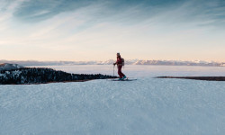
SaveReno (otherwise known as the Biggest Little City in the World) is home to several beautiful and amazing mountain biking trails. Situated right next to Tahoe and the Sierra Nevadas, this city offers and variety of trails from jumps on a former golf course to just plain old speed riding down the Peavine Mountain. This city is sure to offer you some good-natured fun This area is e-bike friendly, but please be careful and acknowledge the places in which e-bikes are not allowed.
Activities Click to view
- Mountain Bike
323 trails
- E-Bike
319 trails
- Hike
323 trails
- Trail Running
323 trails
- Horse
23 trails
- Dirtbike/Moto
21 trails
- ATV/ORV/OHV
4 trails
- Nordic Ski
4 trails
Region Details
- 138
- 9
- 43
- 82
- 24
- 12
Region Status
Open as of Feb 2, 2022Stats
- Avg Trail Rating
- Trails (view details)
- 346
- Trails Mountain Bike
- 323
- Trails E-Bike
- 319
- Trails Hike
- 323
- Trails Trail Running
- 323
- Trails Horse
- 23
- Trails Dirtbike/Moto
- 21
- Trails Observed Trials
- 1
- Trails ATV/ORV/OHV
- 4
- Trails Downhill Ski
- 28
- Trails Nordic Ski
- 4
- Total Distance
- 333 miles
- Total Descent
- 62,281 ft
- Total Vertical
- 5,530 ft
- Highest Trailhead
- 9,771 ft
- Reports
- 2,685
- Photos
- 622
- Ridden Counter
- 34,634
 Articles
Slopes to City: The Best Way to Spend 48 Hours in Reno and Tahoe
Jan 11, 2022 from skimag.com
With plenty of good food and drinks, events, and nightlife, there’s a lot more to Reno-Tahoe than its phenomenal skiing
Sub Regions
-
Ballardini Ranch
- 3
- 1
-
Caughlin Ranch
- 4
- 1
- 6
- 4
- 1
-
Hidden Valley
- 2
- 3
- 1
-
North Valleys
-
North Valleys Regional Park
- 8
-
Peavine Mountain
- 3
- 8
- 22
- 7
- 3
-
Sierra Vista Park
- 1
- 18
- 7
- 2
-
Sky Tavern
- 1
- 1
-
Spanish Springs
- 3
- 8
- 2
- 1
-
Thomas Creek/Whites Creek
- 5
- 9
- 3
- 4
-
Toiyable National Forest
-
Verdi
- 2
- 14
- 5
- 1
Popular Reno Mountain Biking Trails
Reno Mountain Bike Routes
| title | rating | distance |
|---|---|---|
| Hoge - Colpo Loop | 6 miles | |
| Peavine Mega Super Ultra | 36 miles | |
| Sierra Vista Perimeter Loop | 2 miles | |
| Sierra Vista Loop | 5,020 ft | |
| Hotdog Loop | 8 miles | |
| Brewers Cabinet Loop Ride | 8 miles | |
| Dry Pond Loop | 6 miles | |
| Evans Canyon Loop | 4 miles | |
| Peavine West Side | 13 miles | |
| Sierra Vista Advanced Loop | 3,031 ft |
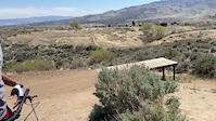
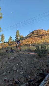
Photos of Reno Mountain Bike
trail: Bacon Strip
0 |
Jul 4, 2022 @ 2:21pm
2 days
trail: Steamboat Ditch Trail
1 |
Jul 1, 2022 @ 8:31am
Jul 1, 2022
trail: Steamboat Ditch Trail
1 |
Jul 1, 2022 @ 8:31am
Jul 1, 2022
trail: Steamboat Ditch Trail
1 | | 1 comments
Jul 1, 2022 @ 8:31am
Jul 1, 2022
trail: Steamboat Ditch Trail
1 | | 1 comments
Jul 1, 2022 @ 8:30am
Jul 1, 2022
trail: Steamboat Ditch Trail
0 |
Jul 1, 2022 @ 8:30am
Jul 1, 2022
trail: Blue Truck
0 |
Jun 27, 2022 @ 8:27pm
Jun 27, 2022
trail: Hunter Lake Road
0 |
Jun 27, 2022 @ 8:26pm
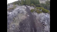
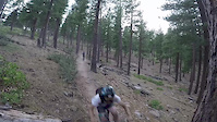
Jun 27, 2022Videos of Reno Mountain Bike
239 |
Apr 23, 2021

0:49 |
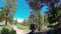
401 |
Sep 21, 2020
trail: Lower Alum Creek Trail
0:24 |
169 |
Jul 1, 2020
trail: Whites Creek Trail
0:37 |
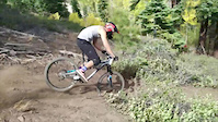
322 |
Mar 22, 2018
trail: Brown's Creek
0:54 |
405 |
Aug 12, 2017
trail: Canyon
6:04 |
69 |
Jun 29, 2017
trail: UNR DH
0:11 |
594 |
Nov 15, 2016
trail: Sky Tavern DH
2:31 |
597 |
Oct 2, 2015
Current Trail Warnings
| status | trail | date | condition | user | info |
|---|---|---|---|---|---|
| Two Track Access Road | Jul 1, 2022 @ 7:08am Jul 1, 2022 | Dry | yeeyeemtb | E-Bike |
Recent Trail Reports
| status | trail | date | condition | info | user |
|---|---|---|---|---|---|
| Bacon Strip | Jul 5, 2022 @ 6:00pm 9 hours | Dry | MikeBallz | ||
| Colpo Canyon | Jul 5, 2022 @ 5:33pm 9 hours | Very Dry | he110me | ||
| Sprocket (Old Northgate) | Jul 5, 2022 @ 8:38am 18 hours | Dry | yeeyeemtb | ||
| Sprocket Access from Heatherwood Dr | Jul 5, 2022 @ 7:20am 20 hours | Dry | yeeyeemtb | ||
| Sierra Vista Access from Dakota Ridge 1 | Jul 5, 2022 @ 7:20am 20 hours | Dry | yeeyeemtb | ||
| Ground Asphalt Golf Cart Path | Jul 5, 2022 @ 7:20am 20 hours | Dry | yeeyeemtb | ||
| Sierra Vista Access from Glen Eagle Dr | Jul 5, 2022 @ 7:20am 20 hours | Dry | yeeyeemtb | ||
| Sandestin Sidehill | Jul 3, 2022 @ 7:12am 3 days | Dry | yeeyeemtb | ||
| Melton School Access Trail | Jul 3, 2022 @ 7:12am 3 days | Dry | yeeyeemtb | ||
| Northwest Reno Paved Path Fox Trail Dr to Avenida De Landa | Jul 3, 2022 @ 7:12am 3 days | Dry | yeeyeemtb |
Activity Feed
| username | action | type | title | date | |
|---|---|---|---|---|---|
 | tannerd | vote | trail | High Fives | Jul 5, 2022 @ 9:12pm 6 hours |
 | MikeBallz | add | report | Bacon Strip | Jul 5, 2022 @ 6:00pm 9 hours |
 | he110me | comment | report | Colpo Canyon | Jul 5, 2022 @ 5:34pm 9 hours |
| he110me | add | report | Colpo Canyon | Jul 5, 2022 @ 5:33pm 9 hours |
| steez82 | wishlist | trail | Over Haul | Jul 5, 2022 @ 3:27pm 12 hours |
Recent Comments
| username | type | title | comment | date | |
|---|---|---|---|---|---|
| report | Brake* bumps | Jul 5, 2022 @ 5:34pm 9 hours | ||
| trail | Basically a 4x4 road offering some incredible... | Jun 27, 2022 @ 8:24pm Jun 27, 2022 | ||
| trail | Tried this out today just exploring the area.... | Jun 27, 2022 @ 8:20pm Jun 27, 2022 | ||
| trail | this is a moto trail. .relatively gnarly moto... | Jun 14, 2022 @ 6:59pm Jun 14, 2022 | ||
| trail | It is only a double black because of the sheer... | Jun 13, 2022 @ 8:53pm Jun 13, 2022 |
Local Badges
-

10 Blue Trails481 awarded -

Big Ride 30k3,879 awarded -

10 Green Trails299 awarded -

Epic Ride 50k1,197 awarded -

Completionist0 awarded -

10 Black Trails144 awarded
Bike & Skill Parks
| name | type | city | rating |
|---|---|---|---|
| Mt. Rose Ski Tahoe | bike park | Reno |
Activity Type Stats
| activitytype | trails | distance | descent | descent distance | total vertical | rating | global rank | state rank | photos | reports | routes | ridelogs |
|---|---|---|---|---|---|---|---|---|---|---|---|---|
| Mountain Bike | 323 | 296 miles | 48,740 ft | 125 miles | 4,544 ft | #171 | #79 | 596 | 2,684 | 17 | 40,484 | |
| E-Bike | 319 | 303 miles | 47,500 ft | 122 miles | 5,531 ft | #58 | #14 | 6 | 2,513 | 7 | 1,205 | |
| Hike | 323 | 323 miles | 50,840 ft | 131 miles | 5,531 ft | #139 | #78 | 11 | 2,653 | 2 | 1,651 | |
| Trail Running | 323 | 323 miles | 50,840 ft | 131 miles | 5,531 ft | #141 | #78 | 9 | 2,653 | 2 | 2,169 | |
| Horse | 23 | 50 miles | 8,560 ft | 20 miles | 4,295 ft | #123 | #87 | 665 | 1 | 1 | ||
| Dirtbike/Moto | 21 | 42 miles | 12,221 ft | 20 miles | 4,104 ft | #142 | #90 | 665 | 34 | |||
| Observed Trials | 1 | 5,203 ft | 469 ft | 3 | 3 | |||||||
| ATV/ORV/OHV | 4 | 11 miles | 289 ft | 2 miles | 3,694 ft | #158 | #87 | 658 | 4 | |||
| Downhill Ski | 28 | 9 miles | 11,273 ft | 9 miles | 1,306 ft | 1 | 525 | |||||
| Nordic Ski | 4 | 2 miles | 325 ft | 1 mile | 367 ft | #685 | 4 | 37 |
- By TheAngryTomato
 TRAILFORKS & contributors
 - Admins: BLTS
- #6633 - 39,994 views
- reno activity log | embed map of Reno mountain bike trails | reno mountain biking points of interest
Downloading of trail gps tracks in kml & gpx formats is enabled for Reno.
You must login to download files.