close
Trail Conditions
- Unknown
- Snow Groomed
- Snow Packed
- Snow Covered
- Snow Cover Inadequate
- Freeze/thaw Cycle
- Icy
- Prevalent Mud
- Wet
- Variable
- Ideal
- Dry
- Very Dry
Trail Flow (Ridden Direction)
Trailforks scans users ridelogs to determine the most popular direction each trail is ridden. A good flowing trail network will have most trails flowing in a single direction according to their intension.
The colour categories are based on what percentage of riders are riding a trail in its intended direction.
The colour categories are based on what percentage of riders are riding a trail in its intended direction.
- > 96%
- > 90%
- > 80%
- > 70%
- > 50%
- < 50%
- bi-directional trail
- no data
Trail Last Ridden
Trailforks scans ridelogs to determine the last time a trail was ridden.
- < 2 days
- < 1 week
- < 2 weeks
- < 1 month
- < 6 months
- > 6 months
Trail Ridden Direction
The intended direction a trail should be ridden.
- Downhill Only
- Downhill Primary
- Both Directions
- Uphill Primary
- Uphill Only
- One Direction
Contribute Details
Colors indicate trail is missing specified detail.
- Description
- Photos
- Description & Photos
- Videos
Trail Popularity ?
Trailforks scans ridelogs to determine which trails are ridden the most in the last 9 months.
Trails are compared with nearby trails in the same city region with a possible 25 colour shades.
Think of this as a heatmap, more rides = more kinetic energy = warmer colors.
- most popular
- popular
- less popular
- not popular
ATV/ORV/OHV Filter
Max Vehicle Width
inches
Radar Time
x
Activity Recordings
Trailforks users anonymized public ridelogs from the past 6 months.
- mountain biking recent
- mountain biking (>6 month)
- hiking (1 year)
- moto (1 year)
Activity Recordings
Trailforks users anonymized public skilogs from the past 12 months.
- Downhill Ski
- Backcountry Ski
- Nordic Ski
Jump Magnitude Heatmap
Heatmap of where riders jump on trails. Zoom in to see individual jumps, click circles to view jump details.
Trails Deemphasized
Trails are shown in grey.
Only show trails with NO bikes.
Save the current map location and zoom level as your default home location whenever this page is loaded.
Save
No description for Oakland has been added yet!
Login or register to submit one.
Activities Click to view
- Mountain Bike
57 trails
- Hike
83 trails
- Trail Running
83 trails
- Horse
23 trails
Region Details
- 10
- 2
- 22
- 18
- 3
- 2
Region Status
Open as of Mar 4, 2020Stats
- Avg Trail Rating
- Trails (view details)
- 83
- Trails Mountain Bike
- 57
- Trails E-Bike
- 1
- Trails Hike
- 83
- Trails Trail Running
- 83
- Trails Horse
- 23
- Total Distance
- 62 miles
- Total Descent
- 15,189 ft
- Total Vertical
- 1,363 ft
- Highest Trailhead
- 1,576 ft
- Reports
- 1,601
- Photos
- 145
- Ridden Counter
- 34,909
Sub Regions
-
Joaquin Miller Park (JMP)
- 2
- 9
- 14
- 2
- 1
-
Leona Canyon Regional Open Space Preserve
- 4
-
Leona Heights Park
- 3
- 1
- 1
-
Redwood Regional Park
- 6
- 3
- 1
Popular Oakland Mountain Biking Trails
Oakland Mountain Bike Routes
| title | rating | distance |
|---|---|---|
| Sequoia Bayview to Big Trees Loop | 2 miles | |
| Joaquin Miller Killer | 10 miles | |
| East Ridge / West Ridge Loop | 8 miles | |
| Lake Chabot Gravel Ride | 37 miles | |
| Joaquin Miller Park Big Trees and Cinderella loop | 8 miles | |
| 2018 East Bay Dirt Classic Short Course | 24 miles | |
| JMP Blue and Green Loop | 5 miles | |
| Cinderella And Big Trees (Inner And Outer) Route | 6 miles | |
| sequoia, castle, sunset loop | 4 miles | |
| 2021 East Bay Dirt Classic Course | 25 miles |
Photos of Oakland Mountain Bike
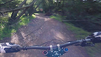
trail: Cinderella
14 |
Jun 14, 2022 @ 9:16pm
Jun 14, 2022
trail: Cinderella
12 |
Jun 14, 2022 @ 9:15pm
Jun 14, 2022
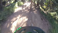
trail: Castle Park (DH)
7 |
Jun 14, 2022 @ 9:13pm
Jun 14, 2022
trail: Castle Park (DH)
11 |
Jun 14, 2022 @ 9:13pm
Jun 14, 2022
trail: Cinderella
51 |
Apr 6, 2022 @ 3:47pm
Apr 6, 2022
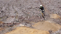
trail: Chaparral
42 |
Apr 6, 2022 @ 3:47pm
Apr 6, 2022
trail: Chaparral
371 |
Apr 17, 2019 @ 11:26pm
Apr 17, 2019
trail: Chaparral
875 |
Jul 3, 2015 @ 10:04am
Jul 3, 2015Videos of Oakland Mountain Bike

trail: Cinderella
100 |
Mar 25, 2021

trail: Cinderella
|
Dec 9, 2020

trail: Chaparral
24 |
Nov 20, 2020

trail: Chaparral
1:57 |
145 |
Jun 19, 2019

trail: Cinderella
1:04 |
781 |
Jun 22, 2017
trail: Cinderella
1:46 |
504 |
Jan 29, 2017
trail: West Ridge
3:20 |
321 |
Oct 5, 2016
trail: Chaparral
2:32 |
287 |
Aug 27, 2016
Recent Trail Reports
| status | trail | date | condition | info | user |
|---|---|---|---|---|---|
| Graham | Jul 2, 2022 @ 12:12pm Jul 2, 2022 | Variable | rpaguilar | ||
| McDonell | Jul 2, 2022 @ 12:12pm Jul 2, 2022 | Variable | rpaguilar | ||
| McDonell | Jul 2, 2022 @ 12:12pm Jul 2, 2022 | Variable | rpaguilar | ||
| Tinker Bell | Jul 2, 2022 @ 12:12pm Jul 2, 2022 | Variable | rpaguilar | ||
| Castle Park (XC) | Jun 29, 2022 @ 10:11am Jun 29, 2022 | Ideal | LiamHoefer | ||
| Connector | Jun 22, 2022 @ 9:08am Jun 22, 2022 | Ideal | Duckygang | ||
| Orchard Trail | Jun 22, 2022 @ 9:08am Jun 22, 2022 | Dry | Duckygang | ||
| Sequoia-Bayview Trail | Jun 22, 2022 @ 9:08am Jun 22, 2022 | Dry | Duckygang | ||
| Cinderella | Jun 22, 2022 @ 9:06am Jun 22, 2022 | Very Dry | Duckygang | ||
| Sinawik | Jun 22, 2022 @ 9:06am Jun 22, 2022 | Ideal | Duckygang |
Activity Feed
| username | action | type | title | date | |
|---|---|---|---|---|---|
 | StiggyPop | wishlist | route | 2018 East Bay Dirt Classic Short Course | Jul 5, 2022 @ 10:22pm 5 hours |
| StiggyPop | wishlist | route | 2021 East Bay Dirt Classic Course | Jul 5, 2022 @ 10:22pm 5 hours |
| Simoned4HUp | wishlist | route | East Ridge / West Ridge Loop | Jul 5, 2022 @ 7:09pm 8 hours |
| rpaguilar | add | report | McDonell and 2 more | Jul 3, 2022 @ 7:39am 3 days |
| rpaguilar | add | report | Graham and 1 more | Jul 3, 2022 @ 7:39am 3 days |
Recent Comments
| username | type | title | comment | date | |
|---|---|---|---|---|---|
| trail | This guy secretly loves Joaquin Miller but... | Jun 29, 2022 @ 11:06am Jun 29, 2022 | ||
 | trail | This trail is closed to bikers. | Jun 22, 2022 @ 9:07am Jun 22, 2022 | ||
 | trail | Pretty rowdy right now. Between the dry dusty... | Jun 11, 2022 @ 1:16pm Jun 11, 2022 | ||
 | trail | This is a fun e-MTB climb, challenging in a... | Jun 1, 2022 @ 7:26pm Jun 1, 2022 | ||
| trail | Fun little connector, hardly ever see anyone... | Jun 1, 2022 @ 7:21pm Jun 1, 2022 |
Local Badges
-

Big Ride 30k5,011 awarded -

10 Blue Trails540 awarded -

Completionist6 awarded -

10 Green Trails402 awarded -

Climbing 10k Badge275 awarded -

Epic Ride Climb 2k263 awarded
Bike & Skill Parks
| name | type | city | rating |
|---|---|---|---|
| Oakland Pump Track | skill park | Oakland |
Activity Type Stats
| activitytype | trails | distance | descent | descent distance | total vertical | rating | global rank | state rank | photos | reports | routes | ridelogs |
|---|---|---|---|---|---|---|---|---|---|---|---|---|
| Mountain Bike | 57 | 42 miles | 8,215 ft | 22 miles | 1,322 ft | #174 | #81 | 140 | 1,596 | 17 | 31,313 | |
| E-Bike | 1 | 5 miles | 535 ft | 2 miles | 974 ft | 1,363 | 754 | |||||
| Hike | 83 | 62 miles | 15,190 ft | 30 miles | 1,362 ft | #120 | #66 | 5 | 1,590 | 1 | 1,390 | |
| Trail Running | 83 | 62 miles | 15,190 ft | 30 miles | 1,362 ft | #121 | #66 | 1,590 | 1 | 534 | ||
| Horse | 23 | 18 miles | 6,841 ft | 8 miles | 1,037 ft | #496 | #287 | 389 | 10 |
- By splatworldwide & contributors
- Admins: spokesmanmtb, BTCEB, sanfret
- #7706 - 10,639 views
- oakland activity log | embed map of Oakland mountain bike trails | oakland mountain biking points of interest
Downloading of trail gps tracks in kml & gpx formats is enabled for Oakland.
You must login to download files.