close
Trail Conditions
- Unknown
- Snow Groomed
- Snow Packed
- Snow Covered
- Snow Cover Inadequate
- Freeze/thaw Cycle
- Icy
- Prevalent Mud
- Wet
- Variable
- Ideal
- Dry
- Very Dry
Trail Flow (Ridden Direction)
Trailforks scans users ridelogs to determine the most popular direction each trail is ridden. A good flowing trail network will have most trails flowing in a single direction according to their intension.
The colour categories are based on what percentage of riders are riding a trail in its intended direction.
The colour categories are based on what percentage of riders are riding a trail in its intended direction.
- > 96%
- > 90%
- > 80%
- > 70%
- > 50%
- < 50%
- bi-directional trail
- no data
Trail Last Ridden
Trailforks scans ridelogs to determine the last time a trail was ridden.
- < 2 days
- < 1 week
- < 2 weeks
- < 1 month
- < 6 months
- > 6 months
Trail Ridden Direction
The intended direction a trail should be ridden.
- Downhill Only
- Downhill Primary
- Both Directions
- Uphill Primary
- Uphill Only
- One Direction
Contribute Details
Colors indicate trail is missing specified detail.
- Description
- Photos
- Description & Photos
- Videos
Trail Popularity ?
Trailforks scans ridelogs to determine which trails are ridden the most in the last 9 months.
Trails are compared with nearby trails in the same city region with a possible 25 colour shades.
Think of this as a heatmap, more rides = more kinetic energy = warmer colors.
- most popular
- popular
- less popular
- not popular
ATV/ORV/OHV Filter
Max Vehicle Width
inches
Radar Time
x
Activity Recordings
Trailforks users anonymized public ridelogs from the past 6 months.
- mountain biking recent
- mountain biking (>6 month)
- hiking (1 year)
- moto (1 year)
Activity Recordings
Trailforks users anonymized public skilogs from the past 12 months.
- Downhill Ski
- Backcountry Ski
- Nordic Ski
Jump Magnitude Heatmap
Heatmap of where riders jump on trails. Zoom in to see individual jumps, click circles to view jump details.
Trails Deemphasized
Trails are shown in grey.
Only show trails with NO bikes.
Save the current map location and zoom level as your default home location whenever this page is loaded.
SavePopular Trail Networks
view all areas »
No description for Wisconsin has been added yet!
Login or register to submit one.
Region Details
- 259
- 76
- 427
- 574
- 145
- 18
Stats
- Avg Trail Rating
- Trails (view details)
- 2,205
- Trails Mountain Bike
- 1,541
- Trails E-Bike
- 374
- Trails Hike
- 1,825
- Trails Trail Running
- 1,812
- Trails Horse
- 261
- Trails Dirtbike/Moto
- 10
- Trails Observed Trials
- 7
- Trails ATV/ORV/OHV
- 22
- Trails Snowmobile
- 51
- Trails Snowshoe
- 236
- Trails Downhill Ski
- 4
- Trails Backcountry Ski
- 21
- Trails Nordic Ski
- 496
- Total Distance
- 3,367 miles
- Total Descent
- 199,456 ft
- Total Vertical
- 1,387 ft
- Highest Trailhead
- 1,966 ft
- Reports
- 11,311
- Photos
- 1,449
- Ridden Counter
- 101,671
 Articles

Study Shows $7.8 Million Economic Impact of Mountain Bike Trails
Nov 20, 2020 from pinkbike.com
A study conducted by the University of Wisconsin and CAMBA has shown that mountain bike trails brought $7.8 million a year to Northwest Wisconsin.

Minneapolis, MN: Light Up Your Life (Superior Hiking Trail)
Nov 11, 2016 from backpacker.com
Sample the 310-mile Superior Hiking Trail on this overnight past Oberg Mountain and Lake Agnes. Fall bonus: Northern Lights. BY KATHLEEN FERRARO
Sub Regions
- East Central (28)
- Northeast Region (156)
- Brown County (25)
- Calumet County (10)
- Door County (21)
- Fond du Lac County (20)
- Green Lake County (1)
- Kewaunee County (6)
- Manitowoc County (2)
- Marinette County (6)
- Marquette County (0)
- Menominee County (1)
- Oconto County (3)
- Outagamie County (20)
- Shawano County (0)
- Waupaca County (10)
- Waushara County (22)
- Winnebago County (3)
- Northern Region (482)
- Ashland County (22)
- Barron County (32)
- Bayfield County (141)
- Burnett County (8)
- Douglas County (38)
- Florence County (1)
- Forest County (23)
- Forest County (1)
- Iron County (1)
- Langlade County (28)
- Lincoln County (1)
- Oneida County (47)
- Polk County (15)
- Price County (1)
- Rusk County (0)
- Sawyer County (10)
- St. Croix Valley (50)
- Taylor County (3)
- Vilas County (58)
- Washburn County (58)
- South Central (208)
- Dane County (114)
- Iowa County (11)
- Jefferson County (9)
- Lafayette County (5)
- Richland County (10)
- Rock County (35)
- Sauk County (23)
- Southeast (140)
- Kenosha County (17)
- Milwaukee Area (32)
- Ozaukee County (11)
- Sheboygan County (7)
- Walworth County (21)
- Washington County (44)
- Waukesha County (6)
- Southwest (218)
- Clark County (66)
- Crawford County (12)
- Grant County (16)
- Jackson County (0)
- La Crosse County (46)
- Sauk County (5)
- Vernon County (45)
- West Central (351)
- Chippewa County (31)
- Eau Claire County (89)
- Lincoln County (16)
- Marathon County (93)
- Pierce County (7)
- Portage County (68)
- Saint Croix County (30)
- Wood County (17)
Popular Wisconsin Mountain Biking Trails
| status | title | difficulty | rating |
|---|---|---|---|
| Blue Loop John Muir Trails | |||
| AREA 51 CamRock | |||
| Corp Connector CamRock | |||
| Turn It Up CamRock | |||
| Gettin' Started CamRock | |||
| Rattle Snake CamRock | |||
| Rewind Quarry Ridge | |||
| Corkscrew CamRock | |||
| StoneFly CamRock | |||
| Three Bridges Whitetail Ridge | |||
| Wood Chuck? CamRock | |||
| Drop Zone Quarry Ridge | |||
| Bottoms Up Quarry Ridge | |||
| FlowMama Chequamegon Area (CAMBA) | |||
| Ride Clearly Whitetail Ridge |
Wisconsin Mountain Bike Routes
| title | rating | distance |
|---|---|---|
| 2021 MCA/NICA Race Course #7 - Whitetail Ridge Whitetail Ridge | 4 miles | |
| PN12FIFTY Vernon County | 6 miles | |
| Parking Lot to Puff Ball Loop Kinnickinnic State Park | 3 miles | |
| The Whole 9 Yards Nine Mile | 12 miles | |
| Hartman Creek State Park Loop Hartman Creek State Park | 9 miles | |
| Green Circle Schmeeckle Reserve | 24 miles | |
| Rock Lake Epic-er Chequamegon Area (CAMBA) | 51 miles | |
| pertNear 20 Long Route Vernon County | 21 miles | |
| P.U.K.E. AM Route Kickapoo Valley Reserve | 23 miles | |
| Wildcat 16 or 32 Wildcat Mountain Bike Trail | 16 miles |
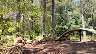
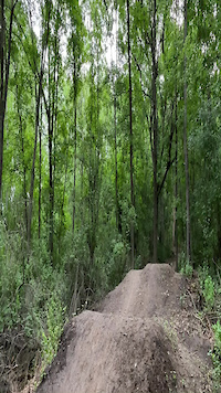
Photos of Wisconsin Mountain Bike
trail: Vader DH
270 |
Dec 16, 2020 @ 9:47am
Dec 16, 2020
trail: Vader DH
372 |
Aug 13, 2019 @ 4:06am
Aug 13, 2019
trail: JEDi
483 |
Jul 28, 2019 @ 5:53pm
Jul 28, 2019
trail: JEDi
499 |
Jul 28, 2019 @ 5:51pm
Jul 28, 2019
trail: Blue Trail
100 |
Jul 5, 2017 @ 6:29am
Jul 5, 2017
trail: Blue Trail
77 |
Jul 4, 2017 @ 7:01pm
Jul 4, 2017
trail: South Trace
334 |
Dec 5, 2011 @ 12:18am
Dec 5, 2011
trail: South Trace
258 |
Dec 5, 2011 @ 12:17am
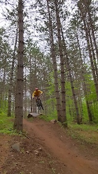
Dec 5, 2011Videos of Wisconsin Mountain Bike
trail: Bridge Trail
1 |
Jul 5, 2022
trail: Bottoms Up
|
Jul 4, 2022
trail: Send It
15 |
May 31, 2022

trail: Send It
11 |
Jan 6, 2022
trail: Gene Machine
17 |
Oct 16, 2021
trail: Gene Machine
8 |
Oct 16, 2021
trail: Flowage
17 |
Aug 24, 2021
trail: Flowage
19 |
Aug 24, 2021
Activity Feed
| username | action | type | title | date | |
|---|---|---|---|---|---|
 | jannkm | wishlist | region | Washburn Lake Silent Sports Trails Area | Jul 5, 2022 @ 10:04pm 4 hours |
| Docfortots | wishlist | region | Alpha Trail | Jul 5, 2022 @ 5:10pm 9 hours |
| Docfortots | wishlist | region | Hoyt Park | Jul 5, 2022 @ 5:09pm 9 hours |
| Docfortots | wishlist | region | Kettle Moraine SF - Lapham Peak Unit | Jul 5, 2022 @ 5:07pm 9 hours |
 | seanpaulpizza | add | photo | in Minneapolis, Minnesota, United States | Jul 5, 2022 @ 2:23pm 12 hours |
Recent Comments
| username | type | title | comment | date | |
|---|---|---|---|---|---|
| trail | This is a fun local trail system. There are... | Jun 21, 2022 @ 1:15pm Jun 21, 2022 | ||
 | trail | Biked it this past weekend and it was in great... | Jun 8, 2022 @ 8:21am Jun 8, 2022 | ||
| trail | A “fun” challenge. I can’t think of a... | Jun 7, 2022 @ 10:55am Jun 7, 2022 | ||
| trail | The proper way to get back up top after going... | Jun 7, 2022 @ 10:32am Jun 7, 2022 | ||
| trail | My comments refer to the whole Vista trail;... | Jun 7, 2022 @ 10:21am Jun 7, 2022 |
Local Badges
-

Trail Explorer 100543 awarded -

Big Ride 30k2,785 awarded -

Epic Ride 50k1,080 awarded -

Completionist21 awarded -

10 Blue Trails146 awarded -
Completionist12 awarded
National Scenic Trails & Official Routes
-
American Birkebeiner Trail
- Mountain Bike
- Hike
- Trail Running
- Nordic Ski
Bike & Skill Parks
| name | type | city | rating |
|---|---|---|---|
| Little Switzerland Bike Park | bike park | slinger | |
| Cable Bike Park | skill park | Cable | |
| CamRock Bike Park | skill park | Cambridge | |
| Lueth Park Bicycle Playground and Skate Park | skill park | La Crosse | |
| Middle River Bike Park | skill park | Superior |
Upcoming Local Events
Activity Type Stats
| activitytype | trails | distance | descent | descent distance | total vertical | rating | global rank | state rank | photos | reports | routes | ridelogs |
|---|---|---|---|---|---|---|---|---|---|---|---|---|
| Mountain Bike | 1,541 | 2,279 miles | 131,211 ft | 889 miles | 1,368 ft | #32 | 1,337 | 11,250 | 67 | 133,625 | ||
| E-Bike | 374 | 510 miles | 27,546 ft | 200 miles | 1,194 ft | #29 | 3 | 6,778 | 4 | 1,019 | ||
| Hike | 1,825 | 2,994 miles | 171,470 ft | 1,154 mile | 1,388 ft | #34 | 104 | 11,025 | 6 | 4,538 | ||
| Trail Running | 1,812 | 2,980 miles | 170,551 ft | 1,150 mile | 1,388 ft | #34 | 2 | 11,024 | 7 | 1,537 | ||
| Horse | 261 | 678 miles | 35,554 ft | 260 miles | 1,332 ft | #53 | 2,624 | 40 | ||||
| Dirtbike/Moto | 10 | 21 miles | 932 ft | 13 miles | 866 ft | #40 | 2,612 | 2 | 15 | |||
| Observed Trials | 7 | 3 miles | 190 ft | 1 mile | 866 ft | 3 | 8 | 56 | ||||
| ATV/ORV/OHV | 22 | 106 miles | 2,106 ft | 47 miles | 902 ft | #34 | 2,614 | 7 | ||||
| Snowmobile | 51 | 360 miles | 4,698 ft | 144 miles | 925 ft | #22 | 526 | 10 | ||||
| Snowshoe | 236 | 467 miles | 17,802 ft | 166 miles | 1,342 ft | #30 | 1 | 3,779 | 3 | 623 | ||
| Downhill Ski | 4 | 1 mile | 243 ft | 3,704 ft | 689 ft | 56 | 916 | |||||
| Backcountry Ski | 21 | 28 miles | 820 ft | 7 miles | 1,175 ft | 46 | 109 | |||||
| Nordic Ski | 496 | 791 miles | 32,772 ft | 306 miles | 1,227 ft | #37 | 2 | 668 | 2 | 4,853 |
- By canadaka
 Trailforks & contributors
 - Admins: Map Team, chuktA, msmcfate, WillieJacobsz, PlumbBobM, ReckitRolley, feardabeast
- #3210 - 34,708 views
- wisconsin activity log | embed map of Wisconsin mountain bike trails | wisconsin mountain biking points of interest polygons
-
- subscribe
- 3d map
Downloading of trail gps tracks in kml & gpx formats is enabled for Wisconsin.
You must login to download files.