close
Trail Conditions
- Unknown
- Snow Groomed
- Snow Packed
- Snow Covered
- Snow Cover Inadequate
- Freeze/thaw Cycle
- Icy
- Prevalent Mud
- Wet
- Variable
- Ideal
- Dry
- Very Dry
Trail Flow (Ridden Direction)
Trailforks scans users ridelogs to determine the most popular direction each trail is ridden. A good flowing trail network will have most trails flowing in a single direction according to their intension.
The colour categories are based on what percentage of riders are riding a trail in its intended direction.
The colour categories are based on what percentage of riders are riding a trail in its intended direction.
- > 96%
- > 90%
- > 80%
- > 70%
- > 50%
- < 50%
- bi-directional trail
- no data
Trail Last Ridden
Trailforks scans ridelogs to determine the last time a trail was ridden.
- < 2 days
- < 1 week
- < 2 weeks
- < 1 month
- < 6 months
- > 6 months
Trail Ridden Direction
The intended direction a trail should be ridden.
- Downhill Only
- Downhill Primary
- Both Directions
- Uphill Primary
- Uphill Only
- One Direction
Contribute Details
Colors indicate trail is missing specified detail.
- Description
- Photos
- Description & Photos
- Videos
Trail Popularity ?
Trailforks scans ridelogs to determine which trails are ridden the most in the last 9 months.
Trails are compared with nearby trails in the same city region with a possible 25 colour shades.
Think of this as a heatmap, more rides = more kinetic energy = warmer colors.
- most popular
- popular
- less popular
- not popular
ATV/ORV/OHV Filter
Max Vehicle Width
inches
Radar Time
x
Activity Recordings
Trailforks users anonymized public ridelogs from the past 6 months.
- mountain biking recent
- mountain biking (>6 month)
- hiking (1 year)
- moto (1 year)
Activity Recordings
Trailforks users anonymized public skilogs from the past 12 months.
- Downhill Ski
- Backcountry Ski
- Nordic Ski
Jump Magnitude Heatmap
Heatmap of where riders jump on trails. Zoom in to see individual jumps, click circles to view jump details.
Trails Deemphasized
Trails are shown in grey.
Only show trails with NO bikes.
Save the current map location and zoom level as your default home location whenever this page is loaded.
Save
No description for Kitchener-Waterloo has been added yet!
Login or register to submit one.
Activities Click to view
- Mountain Bike
194 trails
- E-Bike
81 trails
- Hike
178 trails
- Trail Running
179 trails
Region Details
- 11
- 37
- 50
- 67
- 23
- 6
Region Status
Caution as of Dec 24, 2021Stats
- Avg Trail Rating
- Trails (view details)
- 194
- Trails Mountain Bike
- 194
- Trails E-Bike
- 81
- Trails Hike
- 178
- Trails Trail Running
- 179
- Trails Horse
- 13
- Trails Dirtbike/Moto
- 11
- Trails Snowshoe
- 6
- Trails Downhill Ski
- 1
- Trails Nordic Ski
- 5
- Total Distance
- 101 miles
- Total Descent
- 8,757 ft
- Total Vertical
- 477 ft
- Highest Trailhead
- 1,379 ft
- Reports
- 2,900
- Photos
- 375
- Ridden Counter
- 61,689
Sub Regions
-
Bechtel Park
- 3
- 2
-
Chicopee Ski Hill
- 1
- 2
- 5
- 2
-
Columbia Forest/Vista Hills
- 3
- 14
- 11
- 6
- 1
-
Huron Natural Area
- 10
- 10
- 3
- 1
-
Natchez Woods
- 4
- 3
- 3
-
The Hydrocut
- 3
- 25
- 9
- 4
Popular Kitchener-Waterloo Mountain Biking Trails
Kitchener-Waterloo Mountain Bike Routes
| title | rating | distance |
|---|---|---|
| Hydrocut 2019 Time Trial | 13 miles | |
| Hydrocut Full Foute - from Snyder's Entrance | 17 miles | |
| Downhill Express (DHX) | 6 miles | |
| Hydrocut Full Route 22 - Glasgow | 17 miles | |
| Grand Nith Ramble | 215 miles | |
| Hydro Cut Frankenstein Loop | 5 miles | |
| Columbia Forest Loop | 4 miles | |
| HNA Fast Lap | 3 miles | |
| Bike Around The World 2021 Home Church | 17 miles | |
| Vista Hills/Columbia Forest | 6 miles |
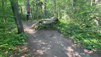
Photos of Kitchener-Waterloo Mountain Bike
trail: Falcon's Loop
1 |
Jun 1, 2022 @ 2:41pm
Jun 1, 2022
trail: Falcon's Loop
1 |
Jun 1, 2022 @ 2:41pm
Jun 1, 2022
trail: Falcon's Loop
2 |
Jun 1, 2022 @ 2:40pm
Jun 1, 2022
trail: Falcon's Loop
1 |
Jun 1, 2022 @ 2:40pm
Jun 1, 2022
trail: Falcon's Loop
2 |
Jun 1, 2022 @ 2:40pm
Jun 1, 2022
trail: Falcon's Loop
2 |
Jun 1, 2022 @ 2:40pm
Jun 1, 2022
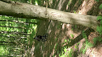
trail: Godzilla (2017)
384 |
Jul 28, 2020 @ 3:08pm
Jul 28, 2020
trail: Godzilla (2017)
237 |
May 24, 2020 @ 6:44pm
May 24, 2020Videos of Kitchener-Waterloo Mountain Bike
trail: Adam's Run
215 |
Aug 5, 2021

trail: Emotional Roller Coaster
199 |
May 7, 2021
trail: The 4 Ities
0:10 |
439 |
Aug 8, 2020
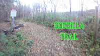
trail: Godzilla (2017)
5:22 |
350 |
Nov 3, 2018
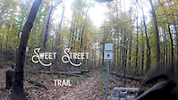
trail: Sweet Street
5:54 |
155 |
Oct 28, 2018
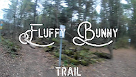
trail: Fluffy Bunny
2:28 |
178 |
Oct 26, 2018
trail: Godzilla (2017)
0:05 |
749 |
Jan 2, 2018

trail: Adam's Run
0:09 |
1832 |
Jan 2, 2018
Recent Trail Reports
| status | trail | date | condition | info | user |
|---|---|---|---|---|---|
| Spur Line Trail | Jun 28, 2022 @ 12:51pm Jun 28, 2022 | Wet | Karolkami | ||
| Laurel Trail | Jun 28, 2022 @ 4:46am Jun 28, 2022 | Dry | Karolkami | ||
| Huron Trail | Jun 5, 2022 @ 5:27am Jun 5, 2022 | Dry | spaetzel | ||
| Forest Climb | Jun 5, 2022 @ 5:27am Jun 5, 2022 | Dry | spaetzel | ||
| Connector | Jun 5, 2022 @ 5:27am Jun 5, 2022 | Dry | spaetzel | ||
| Huron Single Track | Jun 5, 2022 @ 5:27am Jun 5, 2022 | Dry | spaetzel | ||
| Huron | Jun 5, 2022 @ 5:27am Jun 5, 2022 | Dry | spaetzel | ||
| Upper Natchen-Bean | May 31, 2022 @ 4:06am May 31, 2022 | Variable | Karolkami | ||
| Natchen-Bean | May 31, 2022 @ 4:06am May 31, 2022 | Variable | Karolkami | ||
| Natchen Hill Loop | May 31, 2022 @ 4:06am May 31, 2022 | Variable | Karolkami |
Activity Feed
| username | action | type | title | date | |
|---|---|---|---|---|---|
 | Dprockz | ridden | trail | Creepy Corner and 4 more | Jul 5, 2022 @ 9:09am 18 hours |
| Karolkami | add | report | Jake's Attack and 22 more | Jul 5, 2022 @ 5:36am 21 hours |
| NolanBikes11 | wishlist | region | The Hydrocut | Jul 5, 2022 @ 3:53am 23 hours |
| Avalanche29er | wishlist | region | The Hydrocut | Jul 5, 2022 @ 3:23am 24 hours |
| Hugues1970 | ridden | trail | Jessica | Jul 4, 2022 @ 9:48am 2 days |
Recent Comments
| username | type | title | comment | date | |
|---|---|---|---|---|---|
| trail | Today was my first time at the hydrocut and... | Jun 18, 2022 @ 6:04pm Jun 18, 2022 | ||
| trail | I found this trail to be overgrown, long and... | Jun 18, 2022 @ 6:02pm Jun 18, 2022 | ||
| trail | Awesome trail Thanks so much builders. So... | Jun 18, 2022 @ 2:22pm Jun 18, 2022 | ||
| trail | Thanks builders and thanks Arriscraft. Clearly... | Jun 18, 2022 @ 4:51am Jun 18, 2022 | ||
| trail | Fun trail with some rocks and log over! | Jun 10, 2022 @ 5:31am Jun 10, 2022 |
Local Badges
-

Completionist242 awarded -

10 Blue Trails1,315 awarded -

Big Ride 30k2,939 awarded -

Climbing 10k Badge115 awarded -

Top 10 Trails1,066 awarded -

Descent 10k Badge115 awarded
Bike & Skill Parks
| name | type | city | rating |
|---|---|---|---|
| Chicopee Pines Stunt Park | skill park | Kitchener-Waterloo | |
| Chicopee Pump Track | skill park | Kitchener-Waterloo | |
| McLennan Park | skill park | Kitchener-Waterloo |
Local Trail Supporters
![]()
- Waterloo Cycling Club Trail Committee
Activity Type Stats
| activitytype | trails | distance | descent | descent distance | total vertical | rating | global rank | state rank | photos | reports | routes | ridelogs |
|---|---|---|---|---|---|---|---|---|---|---|---|---|
| Mountain Bike | 194 | 101 miles | 8,757 ft | 40 miles | 476 ft | #49 | #4 | 374 | 2,900 | 10 | 31,764 | |
| E-Bike | 81 | 44 miles | 3,442 ft | 17 miles | 351 ft | #15 | #2 | 2,674 | 2 | 152 | ||
| Hike | 178 | 94 miles | 8,068 ft | 36 miles | 476 ft | #47 | #5 | 2,865 | 1 | 635 | ||
| Trail Running | 179 | 97 miles | 8,182 ft | 38 miles | 476 ft | #48 | #5 | 1 | 2,866 | 1 | 813 | |
| Horse | 13 | 4 miles | 344 ft | 2 miles | 131 ft | 794 | 1 | |||||
| Dirtbike/Moto | 11 | 4 miles | 331 ft | 2 miles | 131 ft | 796 | 1 | 1 | ||||
| Snowshoe | 6 | 2 miles | 148 ft | 3,458 ft | 262 ft | 18 | 51 | |||||
| Downhill Ski | 1 | 2,244 ft | 66 ft | 1,079 ft | 66 ft | 15 | 19 | |||||
| Nordic Ski | 5 | 2 miles | 105 ft | 2,651 ft | 62 ft | 1 | 326 |
- By brenthillier
 NSMBA TRAILFORKS & contributors
 - Admins: WCC, HTC
- #3286 - 16,533 views
- kitchener-waterloo activity log | embed map of Kitchener-Waterloo mountain bike trails | kitchener-waterloo mountain biking points of interest polygons
Downloading of trail gps tracks in kml & gpx formats is enabled for Kitchener-Waterloo.
You must login to download files.