close
Trail Conditions
- Unknown
- Snow Groomed
- Snow Packed
- Snow Covered
- Snow Cover Inadequate
- Freeze/thaw Cycle
- Icy
- Prevalent Mud
- Wet
- Variable
- Ideal
- Dry
- Very Dry
Trail Flow (Ridden Direction)
Trailforks scans users ridelogs to determine the most popular direction each trail is ridden. A good flowing trail network will have most trails flowing in a single direction according to their intension.
The colour categories are based on what percentage of riders are riding a trail in its intended direction.
The colour categories are based on what percentage of riders are riding a trail in its intended direction.
- > 96%
- > 90%
- > 80%
- > 70%
- > 50%
- < 50%
- bi-directional trail
- no data
Trail Last Ridden
Trailforks scans ridelogs to determine the last time a trail was ridden.
- < 2 days
- < 1 week
- < 2 weeks
- < 1 month
- < 6 months
- > 6 months
Trail Ridden Direction
The intended direction a trail should be ridden.
- Downhill Only
- Downhill Primary
- Both Directions
- Uphill Primary
- Uphill Only
- One Direction
Contribute Details
Colors indicate trail is missing specified detail.
- Description
- Photos
- Description & Photos
- Videos
Trail Popularity ?
Trailforks scans ridelogs to determine which trails are ridden the most in the last 9 months.
Trails are compared with nearby trails in the same city region with a possible 25 colour shades.
Think of this as a heatmap, more rides = more kinetic energy = warmer colors.
- most popular
- popular
- less popular
- not popular
ATV/ORV/OHV Filter
Max Vehicle Width
inches
Radar Time
x
Activity Recordings
Trailforks users anonymized public ridelogs from the past 6 months.
- mountain biking recent
- mountain biking (>6 month)
- hiking (1 year)
- moto (1 year)
Activity Recordings
Trailforks users anonymized public skilogs from the past 12 months.
- Downhill Ski
- Backcountry Ski
- Nordic Ski
Jump Magnitude Heatmap
Heatmap of where riders jump on trails. Zoom in to see individual jumps, click circles to view jump details.
Trails Deemphasized
Trails are shown in grey.
Only show trails with NO bikes.
Save the current map location and zoom level as your default home location whenever this page is loaded.
Save
No description for Caledon has been added yet!
Login or register to submit one.
Activities Click to view
- Mountain Bike
120 trails
- Hike
150 trails
- Trail Running
150 trails
Region Details
- 21
- 2
- 30
- 36
- 30
Region Status
Open as of Apr 10, 2022Stats
- Avg Trail Rating
- Trails (view details)
- 158
- Trails Mountain Bike
- 120
- Trails E-Bike
- 47
- Trails Hike
- 150
- Trails Trail Running
- 150
- Trails Horse
- 3
- Trails Snowshoe
- 28
- Trails Nordic Ski
- 16
- Total Distance
- 162 miles
- Total Descent
- 10,985 ft
- Total Vertical
- 823 ft
- Highest Trailhead
- 1,527 ft
- Reports
- 4,325
- Photos
- 237
- Ridden Counter
- 54,960
Sub Regions
-
Albion Hills
- 1
- 8
- 15
- 20
-
Glen Haffy Conservation Park
- 5
- 6
- 6
-
Palgrave Conservation Area
- 12
- 10
- 4
Popular Caledon Mountain Biking Trails
Caledon Mountain Bike Routes
| title | rating | distance |
|---|---|---|
| Albion Hills Full Loop | 14 miles | |
| Palgrave with the pals | 10 miles | |
| Palgrave Technical Route 18km | 11 miles | |
| Palgrave All 10 Sections | 11 miles | |
| Palgrave - Saturns Circuit | 9 miles | |
| Palgrave Circuit | 9 miles | |
| The Red Trail Route | 5 miles | |
| The Blue Trail Route | 3 miles | |
| The Yellow Trail | 2 miles | |
| 14 mile Albion Hills Ride | popular ridelog | 14 miles |
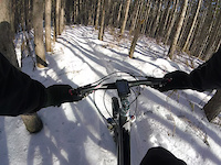
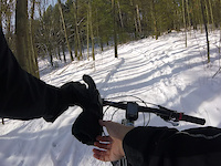
Photos of Caledon Mountain Bike
trail: The Red Trail (Summer)
6 |
Jun 27, 2022 @ 7:58am
Jun 27, 2022
trail: Section 5
11 |
Mar 3, 2022 @ 8:08pm
Mar 3, 2022
trail: Pine Ridge
278 |
Mar 4, 2012 @ 2:58pm
Mar 4, 2012
trail: Pine Ridge
564 |
Feb 26, 2012 @ 7:23pm
Feb 26, 2012Videos of Caledon Mountain Bike

trail: High Roller Bypass
5 |
Apr 6, 2022
trail: Section 8
49 |
Jan 10, 2021

trail: The North Connection
25 |
Jan 10, 2021
trail: Section 7
23 |
Jan 10, 2021

trail: Pally Section 3
2:20 |
494 |
Mar 26, 2019

trail: Downtown
3:03 |
425 |
Aug 15, 2014

trail: Downtown
3:43 |
243 |
Aug 11, 2014
trail: Downtown
5:47 |
137 |
Aug 8, 2014
Current Trail Warnings
| status | trail | date | condition | user | info |
|---|---|---|---|---|---|
| Singletrack Connector | Jul 3, 2022 @ 7:58am 3 days | Variable | billhaf |
Recent Trail Reports
| status | trail | date | condition | info | user |
|---|---|---|---|---|---|
| Pally Section 1 | Jul 4, 2022 @ 2:13pm 2 days | Dry | extremumadventura | ||
| Pally Section 3 | Jul 4, 2022 @ 2:12pm 2 days | Dry | extremumadventura | ||
| IMBA Alley | Jul 3, 2022 @ 12:51pm 3 days | Dry | jonathanthemedic | ||
| Before Berms | Jul 3, 2022 @ 12:51pm 3 days | Dry | jonathanthemedic | ||
| Gnarly Berms | Jul 3, 2022 @ 12:51pm 3 days | Dry | jonathanthemedic | ||
| Goat Path | Jul 3, 2022 @ 12:51pm 3 days | Dry | jonathanthemedic | ||
| Woo Wu | Jul 3, 2022 @ 12:51pm 3 days | Dry | jonathanthemedic | ||
| Sugar Shack Shuffle | Jul 3, 2022 @ 12:51pm 3 days | Dry | jonathanthemedic | ||
| Sugar Rush | Jul 3, 2022 @ 12:51pm 3 days | Dry | jonathanthemedic | ||
| Get Groen | Jul 3, 2022 @ 12:51pm 3 days | Dry | jonathanthemedic |
Activity Feed
| username | action | type | title | date | |
|---|---|---|---|---|---|
 | extremumadventura | comment | report | Pally Section 3 | Jul 4, 2022 @ 7:41pm 1 day |
| extremumadventura | ridden | trail | Pally Section 4 and 22 more | Jul 4, 2022 @ 2:46pm 2 days |
| extremumadventura | vote | trail | Pally Section 4 and 7 more | Jul 4, 2022 @ 2:46pm 2 days |
| extremumadventura | comment | trail | Ridge Trail and 2 more | Jul 4, 2022 @ 2:44pm 2 days |
| extremumadventura | add | report | Pally Section 3 and 1 more | Jul 4, 2022 @ 2:12pm 2 days |
Recent Comments
| username | type | title | comment | date | |
|---|---|---|---|---|---|
| report | Trimmed. Many thanks. | Jul 4, 2022 @ 7:41pm 1 day | ||
| trail | Updates Lots of horse shite, no ufos.... | Jul 4, 2022 @ 2:45pm 2 days | ||
| trail | Lots of horse shite, no ufos. | Jul 4, 2022 @ 2:44pm 2 days | ||
| trail | Lots of horse shite, no ufos. | Jul 4, 2022 @ 2:44pm 2 days | ||
| trail | Thanks to those going clockwise recognizing... | Jun 25, 2022 @ 10:19am Jun 25, 2022 |
Local Badges
-

10 Blue Trails668 awarded -

10 Green Trails687 awarded -

10 Black Trails710 awarded -

Big Ride 30k1,378 awarded -

Completionist2 awarded -

Epic Ride Descent 2k41 awarded
Activity Type Stats
| activitytype | trails | distance | descent | descent distance | total vertical | rating | global rank | state rank | photos | reports | routes | ridelogs |
|---|---|---|---|---|---|---|---|---|---|---|---|---|
| Mountain Bike | 120 | 126 miles | 7,287 ft | 52 miles | 823 ft | #79 | #7 | 226 | 4,263 | 9 | 16,552 | |
| E-Bike | 47 | 31 miles | 2,671 ft | 11 miles | 299 ft | 7 | 3,335 | 37 | ||||
| Hike | 150 | 147 miles | 9,948 ft | 61 miles | 823 ft | #59 | #6 | 3 | 4,232 | 388 | ||
| Trail Running | 150 | 147 miles | 9,948 ft | 61 miles | 823 ft | #60 | #6 | 4,223 | 3 | 106 | ||
| Horse | 3 | 3 miles | 180 ft | 5,148 ft | 69 ft | 1,350 | ||||||
| Snowshoe | 28 | 19 miles | 1,381 ft | 7 miles | 650 ft | 1 | 223 | 18 | ||||
| Nordic Ski | 16 | 20 miles | 1,345 ft | 8 miles | 305 ft | 280 | 122 |
- By brendanjacome & contributors
- Admins: apply
- #5125 - 9,420 views
- caledon activity log | embed map of Caledon mountain bike trails | caledon mountain biking points of interest
-
- subscribe
- 3d map
Downloading of trail gps tracks in kml & gpx formats is enabled for Caledon.
You must login to download files.