close
Trail Conditions
- Unknown
- Snow Groomed
- Snow Packed
- Snow Covered
- Snow Cover Inadequate
- Freeze/thaw Cycle
- Icy
- Prevalent Mud
- Wet
- Variable
- Ideal
- Dry
- Very Dry
Trail Flow (Ridden Direction)
Trailforks scans users ridelogs to determine the most popular direction each trail is ridden. A good flowing trail network will have most trails flowing in a single direction according to their intension.
The colour categories are based on what percentage of riders are riding a trail in its intended direction.
The colour categories are based on what percentage of riders are riding a trail in its intended direction.
- > 96%
- > 90%
- > 80%
- > 70%
- > 50%
- < 50%
- bi-directional trail
- no data
Trail Last Ridden
Trailforks scans ridelogs to determine the last time a trail was ridden.
- < 2 days
- < 1 week
- < 2 weeks
- < 1 month
- < 6 months
- > 6 months
Trail Ridden Direction
The intended direction a trail should be ridden.
- Downhill Only
- Downhill Primary
- Both Directions
- Uphill Primary
- Uphill Only
- One Direction
Contribute Details
Colors indicate trail is missing specified detail.
- Description
- Photos
- Description & Photos
- Videos
Trail Popularity ?
Trailforks scans ridelogs to determine which trails are ridden the most in the last 9 months.
Trails are compared with nearby trails in the same city region with a possible 25 colour shades.
Think of this as a heatmap, more rides = more kinetic energy = warmer colors.
- most popular
- popular
- less popular
- not popular
ATV/ORV/OHV Filter
Max Vehicle Width
inches
Radar Time
x
Activity Recordings
Trailforks users anonymized public ridelogs from the past 6 months.
- mountain biking recent
- mountain biking (>6 month)
- hiking (1 year)
- moto (1 year)
Activity Recordings
Trailforks users anonymized public skilogs from the past 12 months.
- Downhill Ski
- Backcountry Ski
- Nordic Ski
Jump Magnitude Heatmap
Heatmap of where riders jump on trails. Zoom in to see individual jumps, click circles to view jump details.
Trails Deemphasized
Trails are shown in grey.
Only show trails with NO bikes.
Save the current map location and zoom level as your default home location whenever this page is loaded.
Save
No description for Burnaby has been added yet!
Login or register to submit one.
Activities Click to view
- Mountain Bike
120 trails
- E-Bike
50 trails
- Hike
115 trails
- Trail Running
115 trails
Region Details
- 12
- 65
- 11
- 25
- 5
- 2
Region Status
Open as of Apr 30, 2022Stats
- Avg Trail Rating
- Trails (view details)
- 122
- Trails Mountain Bike
- 120
- Trails E-Bike
- 50
- Trails Hike
- 115
- Trails Trail Running
- 115
- Trails Horse
- 1
- Trails Snowshoe
- 1
- Trails Nordic Ski
- 1
- Total Distance
- 77 miles
- Total Descent
- 9,979 ft
- Total Vertical
- 1,129 ft
- Highest Trailhead
- 1,134 ft
- Reports
- 2,710
- Photos
- 652
- Ridden Counter
- 37,626
Sub Regions
-
Burnaby Mountain / SFU
- 21
- 6
- 21
- 5
- 2
-
Robert Burnaby Park
- 3
Popular Burnaby Mountain Biking Trails
Burnaby Mountain Bike Routes
| title | rating | distance |
|---|---|---|
| SFU Loop | 5 miles | |
| Burnaby Mountain Super Lap | 15 miles | |
| Mel's Gearjammer, Snake | 3 miles | |
| Burnaby Long Loop | 10 miles | |
| After Work Special | 4 miles | |
| Burnaby Mountain Begintermediate Rip | 4 miles | |
| Burnaby Blue Lap | 5 miles | |
| Quick Rip on SFU | 4 miles | |
| Burnaby Mountain Lower Trails Rip | 5 miles | |
| Side Mel's Gear Cut | 4 miles |
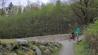
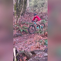
Photos of Burnaby Mountain Bike
trail: Nicoles
705 |
Jan 21, 2018 @ 8:50pm
Jan 21, 2018
trail: Lower Snake
265 |
Sep 1, 2017 @ 3:40pm
Sep 1, 2017
trail: Jim's Jungle
203 |
Sep 1, 2017 @ 3:38pm
Sep 1, 2017
trail: Upper Gearjammer
369 |
Sep 30, 2016 @ 6:43pm
Sep 30, 2016
trail: North Road Trail
270 |
Sep 25, 2016 @ 9:27pm
Sep 25, 2016
trail: Dead Moped Trail
251 |
Sep 25, 2016 @ 9:24pm
Sep 25, 2016
trail: Upper Lower Gearjammer
577 |
May 18, 2016 @ 6:07pm
May 18, 2016
trail: Upper Lower Gearjammer
863 |
Oct 27, 2015 @ 9:15pm
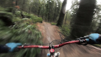
Oct 27, 2015Videos of Burnaby Mountain Bike
68 |
Apr 25, 2022
trail: Upper Gearjammer
67 |
Jan 26, 2022
trail: Nicoles
53 |
Mar 8, 2021
trail: Nicoles
203 |
Jan 1, 2021
trail: Burnaby Mountain Urban Trail
5:26 |
76 |
Aug 6, 2020
trail: Burnaby Mountain Urban Trail
0:20 |
42 |
Aug 6, 2020
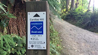
trail: Cardiac Hill
0:52 |
388 |
Jul 23, 2020
trail: Upper Gearjammer
0:50 |
213 |
Mar 20, 2020
Current Trail Warnings
| status | trail | date | condition | user | info |
|---|---|---|---|---|---|
| Burnaby Heights Trail | Jun 13, 2022 @ 12:02pm Jun 13, 2022 | Ideal | Christine101 | portion under the bridge is closed and... |
Recent Trail Reports
| status | trail | date | condition | info | user |
|---|---|---|---|---|---|
| Central Valley Greenway (Cariboo Road Connector) | Jul 1, 2022 @ 10:37am Jul 1, 2022 | Ideal | Christine101 | ||
| Burnaby Mountain Urban Trail | Jul 1, 2022 @ 10:37am Jul 1, 2022 | Ideal | Christine101 | ||
| Dead Moped Trail | Jun 26, 2022 @ 8:58am Jun 26, 2022 | Ideal | emlyn | ||
| Cardiac Hill | Jun 26, 2022 @ 8:58am Jun 26, 2022 | Ideal | emlyn | ||
| Upper Gearjammer | Jun 26, 2022 @ 8:58am Jun 26, 2022 | Ideal | emlyn | ||
| Upper Lower Gearjammer | Jun 26, 2022 @ 8:58am Jun 26, 2022 | Ideal | emlyn | ||
| Uppercut | Jun 26, 2022 @ 8:58am Jun 26, 2022 | Ideal | emlyn | ||
| Lower Snake | Jun 26, 2022 @ 8:58am Jun 26, 2022 | Ideal | emlyn | ||
| Sidewinder | Jun 26, 2022 @ 8:58am Jun 26, 2022 | Ideal | emlyn | ||
| Naheeno/Upper Mel's | Jun 26, 2022 @ 8:58am Jun 26, 2022 | Ideal | emlyn |
Activity Feed
| username | action | type | title | date | |
|---|---|---|---|---|---|
 | ipunnett | wishlist | trail | Trans Canada Trail - Burnaby Mountain and 2 more | Jul 5, 2022 @ 10:23pm 5 hours |
| PhFDN9 | wishlist | trail | Jim's Jungle | Jul 5, 2022 @ 9:13pm 6 hours |
 | coffeecoffeemug | ridden | trail | Nicoles | Jul 5, 2022 @ 8:47pm 6 hours |
| vfkc8 | ridden | trail | Lower Sidewinder and 5 more | Jul 5, 2022 @ 9:31am 17 hours |
| nater05 | add | video | Upper Cut | Jul 4, 2022 @ 1:15pm 2 days |
Recent Comments
| username | type | title | comment | date | |
|---|---|---|---|---|---|
| trail | Contrary to what the earlier comment said,... | May 29, 2022 @ 4:39pm May 29, 2022 | ||
| trail | More of a green trail with roots and boardwalks | Apr 22, 2022 @ 2:01pm Apr 22, 2022 | ||
 | report | Thank you for clearing it up! | Mar 9, 2022 @ 8:26pm Mar 9, 2022 | ||
| report | This has been cleared - but the one further... | Dec 6, 2021 @ 10:12am Dec 6, 2021 | ||
| trail | Very steep - both ways! | Oct 10, 2021 @ 3:48pm Oct 10, 2021 |
Local Badges
-

Big Ride 30k4,577 awarded -

Completionist6 awarded -

10 Blue Trails584 awarded -

Epic Ride 50k2,161 awarded -

Climbing 10k Badge226 awarded -

Epic Ride Climb 2k69 awarded
Bike & Skill Parks
| name | type | city | rating |
|---|---|---|---|
| Mountain Air Bike Skills Park | skill park | Burnaby | |
| SFU Dirt Jumps | skill park | Burnaby | |
| Taylor Park Skills Park | skill park | Burnaby |
Local Mountain Biking Directory
-
Trek Bicycle Burnaby
![Trek Bicycle Burnaby]()
-
Burnaby Mountain Biking AssociationTrail Association
![Burnaby Mountain Biking Association]()
-
Jubilee CycleBike Shop
-
Edmonds CycleBike Shop
Local Trail Supporters
- Burnaby
Activity Type Stats
| activitytype | trails | distance | descent | descent distance | total vertical | rating | global rank | state rank | photos | reports | routes | ridelogs |
|---|---|---|---|---|---|---|---|---|---|---|---|---|
| Mountain Bike | 120 | 73 miles | 9,964 ft | 34 miles | 1,129 ft | #115 | #20 | 650 | 2,707 | 14 | 47,183 | |
| E-Bike | 50 | 41 miles | 2,106 ft | 17 miles | 564 ft | #883 | #44 | 2,119 | 837 | |||
| Hike | 115 | 75 miles | 9,236 ft | 34 miles | 1,129 ft | #81 | #17 | 2 | 2,668 | 2 | 1,165 | |
| Trail Running | 115 | 75 miles | 9,236 ft | 34 miles | 1,129 ft | #83 | #18 | 2,668 | 1 | 2,324 | ||
| Horse | 1 | 2 miles | 23 ft | 4,308 ft | 20 ft | 1,148 | 1 | |||||
| Snowshoe | 1 | 2,687 ft | 20 ft | 1,309 ft | 23 ft | 1 | ||||||
| Nordic Ski | 1 | 2,687 ft | 20 ft | 1,309 ft | 23 ft | 6 |
- By canadaka
 Trailforks & contributors
 - Admins: BCBR, TrailsBC, BCORMA, DSBC, wheelmaniac3, bcpunk, BMBA
- #3111 - 13,964 views
- burnaby activity log | embed map of Burnaby mountain bike trails | burnaby mountain biking points of interest
Downloading of trail gps tracks in kml & gpx formats is enabled for Burnaby.
You must login to download files.