close
Trail Conditions
- Unknown
- Snow Groomed
- Snow Packed
- Snow Covered
- Snow Cover Inadequate
- Freeze/thaw Cycle
- Icy
- Prevalent Mud
- Wet
- Variable
- Ideal
- Dry
- Very Dry
Trail Flow (Ridden Direction)
Trailforks scans users ridelogs to determine the most popular direction each trail is ridden. A good flowing trail network will have most trails flowing in a single direction according to their intension.
The colour categories are based on what percentage of riders are riding a trail in its intended direction.
The colour categories are based on what percentage of riders are riding a trail in its intended direction.
- > 96%
- > 90%
- > 80%
- > 70%
- > 50%
- < 50%
- bi-directional trail
- no data
Trail Last Ridden
Trailforks scans ridelogs to determine the last time a trail was ridden.
- < 2 days
- < 1 week
- < 2 weeks
- < 1 month
- < 6 months
- > 6 months
Trail Ridden Direction
The intended direction a trail should be ridden.
- Downhill Only
- Downhill Primary
- Both Directions
- Uphill Primary
- Uphill Only
- One Direction
Contribute Details
Colors indicate trail is missing specified detail.
- Description
- Photos
- Description & Photos
- Videos
Trail Popularity ?
Trailforks scans ridelogs to determine which trails are ridden the most in the last 9 months.
Trails are compared with nearby trails in the same city region with a possible 25 colour shades.
Think of this as a heatmap, more rides = more kinetic energy = warmer colors.
- most popular
- popular
- less popular
- not popular
ATV/ORV/OHV Filter
Max Vehicle Width
inches
Radar Time
x
Activity Recordings
Trailforks users anonymized public ridelogs from the past 6 months.
- mountain biking recent
- mountain biking (>6 month)
- hiking (1 year)
- moto (1 year)
Activity Recordings
Trailforks users anonymized public skilogs from the past 12 months.
- Downhill Ski
- Backcountry Ski
- Nordic Ski
Jump Magnitude Heatmap
Heatmap of where riders jump on trails. Zoom in to see individual jumps, click circles to view jump details.
Trails Deemphasized
Trails are shown in grey.
Only show trails with NO bikes.
Save the current map location and zoom level as your default home location whenever this page is loaded.
Save
No description for Salmon Arm has been added yet!
Login or register to submit one.
Activities Click to view
- Mountain Bike
346 trails
- E-Bike
285 trails
- Hike
350 trails
- Trail Running
349 trails
- Horse
112 trails
- Dirtbike/Moto
55 trails
- Observed Trials
1 trails
- ATV/ORV/OHV
60 trails
- Snowmobile
2 trails
- Snowshoe
86 trails
- Downhill Ski
1 trails
- Backcountry Ski
44 trails
- Nordic Ski
112 trails
Region Details
- 106
- 19
- 109
- 97
- 15
Region Status
Caution as of Jun 29, 2022Stats
- Avg Trail Rating
- Trails (view details)
- 395
- Trails Mountain Bike
- 346
- Trails E-Bike
- 285
- Trails Hike
- 350
- Trails Trail Running
- 349
- Trails Horse
- 112
- Trails Dirtbike/Moto
- 55
- Trails Observed Trials
- 1
- Trails ATV/ORV/OHV
- 60
- Trails Snowmobile
- 2
- Trails Snowshoe
- 86
- Trails Downhill Ski
- 1
- Trails Backcountry Ski
- 44
- Trails Nordic Ski
- 112
- Total Distance
- 244 miles
- Total Descent
- 44,867 ft
- Total Vertical
- 4,013 ft
- Highest Trailhead
- 5,149 ft
- Reports
- 2,060
- Photos
- 481
- Ridden Counter
- 40,036
 Articles
Video: An Ode To Fall with Jo Peters in Kelowna, BC
Sep 30, 2020 from pinkbike.com
Nothing quite like fall riding.
Sub Regions
-
Coyote Park
- 8
- 5
-
Larch Hills Nordic Trails
- 6
- 5
- 2
-
Little Mountain Park
- 17
- 3
-
Mt Ida
- 2
-
Park Hill
- 29
- 4
-
Rubberhead Trail System
- 20
- 7
-
Salmon Arm Greenways
- 19
- 20
- 24
-
Shuswap Memorial Cemetery Trails
- 8
- 2
-
South Canoe
- 18
- 32
- 4
Popular Salmon Arm Mountain Biking Trails
Salmon Arm Mountain Bike Routes
| title | rating | distance |
|---|---|---|
| New School Loop | 7 miles | |
| South Canoe Long | 10 miles | |
| Rubberhead to Larch Hills Traverse | 21 miles | |
| Larch Hills Toms Shelter Loop Route | 7 miles | |
| Rubberhead Climbing Route | 7 miles | |
| BCBR Stage 2 2022 MTB Draft | 31 miles | |
| Cec's Cabin Loop | 7 miles | |
| Shuswap Cycling Club Advanced XC Route | 10 miles | |
| Local Dog | 7 miles | |
| Salmon Arm Town Loop | 20 miles |
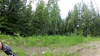
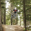
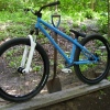
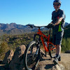
Photos of Salmon Arm Mountain Bike
trail: Lower Schizo
4 |
Jun 15, 2022 @ 11:48am
Jun 15, 2022
trail: Lower Schizo
7 |
Jun 15, 2022 @ 11:18am
Jun 15, 2022
trail: Lumpy
13 |
May 1, 2022 @ 4:38pm
May 1, 2022
trail: Rubberhead (Climb)
25 |
Oct 27, 2021 @ 9:16pm
Oct 27, 2021
trail: Very Bad Wizard
37 |
Sep 23, 2021 @ 3:29pm
Sep 23, 2021
trail: Ravine
93 |
Jul 1, 2020 @ 11:19am
Jul 1, 2020
trail: Ravine
464 |
Apr 20, 2016 @ 11:50pm
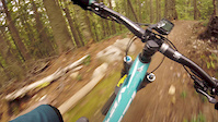
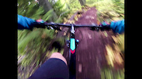
Apr 20, 2016Videos of Salmon Arm Mountain Bike
trail: Upper Meatgrinder
2722 |
Nov 21, 2021
trail: The Flying Nun (lower)
7:05 |
145 |
Sep 16, 2020
trail: Troll Trail
0:29 |
90 |
Sep 16, 2020
trail: Mo Buddha
10:07 |
97 |
Jun 22, 2020
trail: Sansom
1:44 |
100 |
Jan 8, 2020
trail: Ravine (7km)
4:39 |
190 |
Sep 21, 2018
trail: Mo Buddha
4:26 |
95 |
Sep 18, 2018
trail: Coffee Time
1:15 |
429 |
Jun 28, 2018
Recent Trail Reports
| status | trail | date | condition | info | user |
|---|---|---|---|---|---|
| Ravine | Jun 29, 2022 @ 7:19pm Jun 29, 2022 | Dry | JoeDick STAB | ||
| Black Dog | Jun 28, 2022 @ 7:53pm Jun 28, 2022 | Ideal | RustyRake | ||
| Ravine (9km) | Jun 7, 2022 @ 9:08am Jun 7, 2022 | Ideal | Sanderson22 | ||
| Ravine (10km) | Jun 7, 2022 @ 9:06am Jun 7, 2022 | Ideal | Sanderson22 | ||
| Muffin Top | May 23, 2022 @ 10:58am May 23, 2022 | Ideal | Maje SCC | ||
| Upper Meatgrinder | May 23, 2022 @ 10:58am May 23, 2022 | Ideal | Maje SCC | ||
| Lower Meat Grinder | May 23, 2022 @ 10:58am May 23, 2022 | Ideal | Maje SCC | ||
| Outer Loop | May 21, 2022 @ 12:16pm May 21, 2022 | Wet | cdnmtbkr | ||
| Salmon Arm Wharf | May 18, 2022 @ 1:35pm May 18, 2022 | Variable | CSIGuy67 | ||
| East Perimeter Trail | May 18, 2022 @ 12:18pm May 18, 2022 | Variable | CSIGuy67 |
Activity Feed
| username | action | type | title | date | |
|---|---|---|---|---|---|
 | amarchbank | ridden | trail | Purple Pony Trail and 1 more | Jul 5, 2022 @ 7:50pm 7 hours |
 | DoctorWatson | wishlist | route | Rubberhead to Larch Hills Traverse | Jul 4, 2022 @ 9:39pm 1 day |
 | northshoredreamer | wishlist | route | New School Loop | Jul 4, 2022 @ 1:49pm 2 days |
| Churchillrow | wishlist | route | New School Loop | Jul 4, 2022 @ 8:05am 2 days |
 | 96Brigadier | wishlist | route | Shuswap Cycling Club Advanced XC Route | Jul 3, 2022 @ 4:00pm 2 days |
Recent Comments
| username | type | title | comment | date | |
|---|---|---|---|---|---|
 | trail | Needs some riding in but was pretty fun, once... | Jul 1, 2022 @ 7:21pm Jul 1, 2022 | ||
| trail | Butter smooth, makes the most of the vertical,... | Jun 13, 2022 @ 7:02am Jun 13, 2022 | ||
 | trail | Logging put deactivation ditches in the road... | Jun 7, 2022 @ 8:18pm Jun 7, 2022 | ||
| trail | A little confusing at the beginning as this... | May 15, 2022 @ 10:11am May 15, 2022 | ||
| trail | The Wizard - Rubberhead DH combo is the... | Apr 25, 2022 @ 2:55pm Apr 25, 2022 |
Local Badges
-

SCC Dirt Lovers Week 31 awarded -

10 Blue Trails584 awarded -

10 Green Trails233 awarded -

Completionist0 awarded -

Descent 10k Badge80 awarded -

10 Black Trails55 awarded
Local Mountain Biking Directory
-
Larch Hills Nordic Society
-
Shuswap Trail AllianceTrail Association
![Shuswap Trail Alliance]()
-
Skookum Cycle And SkiBike Shop
![Skookum Cycle And Ski]()
Local Trail Supporters
![]()
![]()
- Shuswap Dirt Riders
- Larch Hills Nordic Society
![]()
- Chris Fowler
- Shuswap Outdoors
Pinkbike Articles
 Video: An Ode To Fall with Jo Peters in Kelowna, BC
Jul 21, 2016
 A Vantastic Voyage Through the Thompson-Okanagan - Video and Photo Epic
The Free Radicals drag themselves away from the Sea to Sky to sample the trails of BC's interior Thompson-Okanagan region.
May 27, 2015
 Video: Exploring the Thompson Okanagan with Mountain Biking BC
Episode four follows the Rocky Mountain Team as they head into the interior to explore the history, local culture and some spectacular riding in...
Activity Type Stats
| activitytype | trails | distance | descent | descent distance | total vertical | rating | global rank | state rank | photos | reports | routes | ridelogs |
|---|---|---|---|---|---|---|---|---|---|---|---|---|
| Mountain Bike | 346 | 219 miles | 41,309 ft | 86 miles | 4,012 ft | #133 | #22 | 472 | 2,045 | 23 | 13,811 | |
| E-Bike | 285 | 192 miles | 36,693 ft | 79 miles | 3,816 ft | #43 | #10 | 1,883 | 6 | 243 | ||
| Hike | 350 | 227 miles | 40,755 ft | 87 miles | 4,012 ft | #131 | #26 | 6 | 1,888 | 3 | 579 | |
| Trail Running | 349 | 226 miles | 40,459 ft | 87 miles | 4,012 ft | #133 | #26 | 1 | 1,885 | 7 | 843 | |
| Horse | 112 | 82 miles | 10,617 ft | 35 miles | 3,140 ft | #47 | #5 | 851 | 2 | 12 | ||
| Dirtbike/Moto | 55 | 65 miles | 9,783 ft | 28 miles | 3,530 ft | #243 | #19 | 835 | 5 | 23 | ||
| Observed Trials | 1 | 7 miles | 89 ft | 315 ft | 443 ft | #12 | 61 | |||||
| ATV/ORV/OHV | 60 | 70 miles | 9,833 ft | 29 miles | 3,530 ft | #155 | #11 | 836 | 13 | |||
| Snowmobile | 2 | 3 miles | 10 ft | 220 ft | 1,440 ft | #101 | #4 | 9 | 1 | |||
| Snowshoe | 86 | 46 miles | 10,968 ft | 19 miles | 3,750 ft | #12 | #2 | 2 | 128 | 259 | ||
| Downhill Ski | 1 | 220 ft | 10 ft | #20 | #1 | 9 | 1,119 | |||||
| Backcountry Ski | 44 | 24 miles | 1,936 ft | 8 miles | 2,795 ft | #78 | #3 | 13 | 1 | 143 | ||
| Nordic Ski | 112 | 83 miles | 11,266 ft | 38 miles | 3,140 ft | #190 | #12 | 24 | 1 | 2,038 |
- By smoke
 Simpcw & contributors
 - Admins: STAB, SCC
- #6165 - 25,874 views
- salmon arm activity log | embed map of Salmon Arm mountain bike trails | salmon arm mountain biking points of interest polygons
Downloading of trail gps tracks in kml & gpx formats is enabled for Salmon Arm.
You must login to download files.