close
Trail Conditions
- Unknown
- Snow Groomed
- Snow Packed
- Snow Covered
- Snow Cover Inadequate
- Freeze/thaw Cycle
- Icy
- Prevalent Mud
- Wet
- Variable
- Ideal
- Dry
- Very Dry
Trail Flow (Ridden Direction)
Trailforks scans users ridelogs to determine the most popular direction each trail is ridden. A good flowing trail network will have most trails flowing in a single direction according to their intension.
The colour categories are based on what percentage of riders are riding a trail in its intended direction.
The colour categories are based on what percentage of riders are riding a trail in its intended direction.
- > 96%
- > 90%
- > 80%
- > 70%
- > 50%
- < 50%
- bi-directional trail
- no data
Trail Last Ridden
Trailforks scans ridelogs to determine the last time a trail was ridden.
- < 2 days
- < 1 week
- < 2 weeks
- < 1 month
- < 6 months
- > 6 months
Trail Ridden Direction
The intended direction a trail should be ridden.
- Downhill Only
- Downhill Primary
- Both Directions
- Uphill Primary
- Uphill Only
- One Direction
Contribute Details
Colors indicate trail is missing specified detail.
- Description
- Photos
- Description & Photos
- Videos
Trail Popularity ?
Trailforks scans ridelogs to determine which trails are ridden the most in the last 9 months.
Trails are compared with nearby trails in the same city region with a possible 25 colour shades.
Think of this as a heatmap, more rides = more kinetic energy = warmer colors.
- most popular
- popular
- less popular
- not popular
ATV/ORV/OHV Filter
Max Vehicle Width
inches
Radar Time
x
Activity Recordings
Trailforks users anonymized public ridelogs from the past 6 months.
- mountain biking recent
- mountain biking (>6 month)
- hiking (1 year)
- moto (1 year)
Activity Recordings
Trailforks users anonymized public skilogs from the past 12 months.
- Downhill Ski
- Backcountry Ski
- Nordic Ski
Jump Magnitude Heatmap
Heatmap of where riders jump on trails. Zoom in to see individual jumps, click circles to view jump details.
Trails Deemphasized
Trails are shown in grey.
Only show trails with NO bikes.
Save the current map location and zoom level as your default home location whenever this page is loaded.
Save
No description for Hurricane has been added yet!
Login or register to submit one.
Activities Click to view
- Mountain Bike
171 trails
- E-Bike
32 trails
- Hike
209 trails
- Trail Running
194 trails
- Horse
22 trails
- Dirtbike/Moto
6 trails
- ATV/ORV/OHV
5 trails
Region Details
- 49
- 1
- 30
- 48
- 37
- 5
Region Status
Open as of Jun 23, 2022Stats
- Avg Trail Rating
- Trails (view details)
- 209
- Trails Mountain Bike
- 171
- Trails E-Bike
- 32
- Trails Hike
- 209
- Trails Trail Running
- 194
- Trails Horse
- 22
- Trails Dirtbike/Moto
- 6
- Trails ATV/ORV/OHV
- 5
- Total Distance
- 403 miles
- Total Descent
- 53,700 ft
- Total Vertical
- 7,730 ft
- Highest Trailhead
- 10,369 ft
- Reports
- 2,173
- Photos
- 1,774
- Ridden Counter
- 95,525
 Articles

Destination Showcase - Greater Zion, UT
Jan 4, 2022 from pinkbike.com
Everything you need to know before you head to the Greater Zion area in Southwestern Utah.
Sub Regions
-
Gooseberry Mesa
- 2
- 7
- 3
- 1
-
Grafton Mesa
- 3
- 7
- 2
-
Hurricane Cliffs
- 1
- 9
- 7
- 3
-
Hurricane Cliffs Trail Network
- 1
-
Little Creek Mountain
- 6
- 1
-
Red Cliffs BLM National Conservation Area
- 2
- 6
- 2
-
Red Cliffs BLM National Conservation Area-Sand Cove Unit
- 1
- 2
- 2
-
Rhythm & Blues
- 4
- 9
- 6
- 1
-
Wire Mesa
- 3
- 3
Popular Hurricane Mountain Biking Trails
Hurricane Mountain Bike Routes
| title | rating | distance |
|---|---|---|
| Best of Gooseberry Mesa | 11 miles | |
| Rad Flow Route | 11 miles | |
| Hurricane Rim Loop (IMBA Epic) | 24 miles | |
| Mellow JEM | 11 miles | |
| Prospector to Church Rocks | 8 miles | |
| Little Creek Mountain | 13 miles | |
| Intro Loop at Hurricane Cliffs | 16 miles | |
| Hurricane Rim Alt | 20 miles | |
| Jem Trail aMTB Out and Back | 9 miles | |
| Gooseberry Mesa Loop: N Rim-Gander | 13 miles |
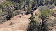
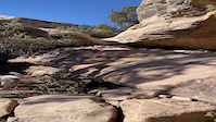
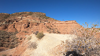
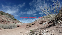
Photos of Hurricane Mountain Bike
trail: Practice
123 |
Sep 16, 2019 @ 4:07pm
Sep 16, 2019
trail: Gould DOUBLE track
69 |
Apr 7, 2019 @ 8:35pm
Apr 7, 2019
trail: Jem
326 |
Apr 6, 2019 @ 7:11am
Apr 6, 2019
trail: Leeds Reef upper
71 |
Oct 12, 2018 @ 5:41pm
Oct 12, 2018
trail: Leeds Reef upper
70 |
Oct 12, 2018 @ 5:40pm
Oct 12, 2018
trail: Dead Ringer
206 |
Jul 19, 2018 @ 8:11am
Jul 19, 2018
trail: South Rim
903 |
Oct 29, 2017 @ 8:12pm
Oct 29, 2017
trail: Jem
367 |
Mar 4, 2017 @ 9:20am
Mar 4, 2017Videos of Hurricane Mountain Bike

trail: Gooseberry Point
9 |
May 27, 2022

trail: Gooseberry Mesa North
25 |
Apr 26, 2022
trail: Bowls And Ledges
19 |
Mar 29, 2022

trail: Jem
|
Feb 24, 2022
trail: West Loop
209 |
Nov 29, 2021
trail: Grafton Mesa
176 |
Oct 26, 2021

trail: Gooseberry Mesa North
36 |
Oct 13, 2021
trail: Grafton Wash
168 |
Apr 26, 2021
Recent Trail Reports
| status | trail | date | condition | info | user |
|---|---|---|---|---|---|
| Carne Asada | Jun 19, 2022 @ 6:13pm Jun 19, 2022 | Very Dry | aimeelar | ||
| Cub Scout Upper | Jun 6, 2022 @ 8:06am Jun 6, 2022 | Dry | Zachbh | ||
| Adventure Scout | Jun 6, 2022 @ 8:06am Jun 6, 2022 | Dry | Zachbh | ||
| Wash | Jun 6, 2022 @ 8:06am Jun 6, 2022 | Ideal | Zachbh | ||
| Cub Scout Lower | Jun 6, 2022 @ 8:06am Jun 6, 2022 | Ideal | Zachbh | ||
| Wire Mesa | May 31, 2022 @ 7:11am May 31, 2022 | Ideal | Spedden | ||
| Practice Acc | May 30, 2022 @ 9:57am May 30, 2022 | Ideal | cbcscone BAMB | ||
| White Trail | May 30, 2022 @ 9:57am May 30, 2022 | Ideal | cbcscone BAMB | ||
| Gooseberry Point | May 30, 2022 @ 9:57am May 30, 2022 | Ideal | cbcscone BAMB | ||
| North Rim | May 30, 2022 @ 9:57am May 30, 2022 | Ideal | cbcscone BAMB |
Activity Feed
| username | action | type | title | date | |
|---|---|---|---|---|---|
 | CalebGmv3Cn | ridden | trail | Wire Mesa | Jul 4, 2022 @ 8:29am 2 days |
| radcastle | ridden | trail | Cottonwood Canyon Trail (lower) | Jul 3, 2022 @ 1:05pm 3 days |
| radcastle | ridden | trail | Prospector and 3 more | Jul 3, 2022 @ 1:03pm 3 days |
| Jokersbike | wishlist | region | Gooseberry Mesa | Jul 2, 2022 @ 12:36pm Jul 2, 2022 |
| jadendstone | ridden | trail | White Trail | Jul 2, 2022 @ 6:21am Jul 2, 2022 |
Recent Comments
| username | type | title | comment | date | |
|---|---|---|---|---|---|
 | trail | Incredible views and great winding exploring... | Jun 15, 2022 @ 3:07pm Jun 15, 2022 | ||
 | trail | Great trail on the Goose. I like it better... | Jun 4, 2022 @ 4:17am Jun 4, 2022 | ||
| trail | Lots of pedaling, nice desert ride... | Jun 2, 2022 @ 6:00pm Jun 2, 2022 | ||
| trail | Note the lower section of JEM near the river... | May 27, 2022 @ 9:15am May 27, 2022 | ||
| trail | LOVE this trail. Might be my favorite in the... | May 16, 2022 @ 6:10pm May 16, 2022 |
Local Badges
-

Big Ride 30k2,789 awarded -

10 Blue Trails686 awarded -

10 Green Trails420 awarded -

10 Black Trails290 awarded -

Climbing 10k Badge93 awarded -

Epic Ride Climb 2k90 awarded
Bike & Skill Parks
| name | type | city | rating |
|---|---|---|---|
| Hurricane Bike Park | skill park | Hurricane |
Activity Type Stats
| activitytype | trails | distance | descent | descent distance | total vertical | rating | global rank | state rank | photos | reports | routes | ridelogs |
|---|---|---|---|---|---|---|---|---|---|---|---|---|
| Mountain Bike | 171 | 253 miles | 29,685 ft | 107 miles | 6,171 ft | #57 | #23 | 1,720 | 2,163 | 42 | 39,005 | |
| E-Bike | 32 | 74 miles | 8,140 ft | 34 miles | 2,582 ft | #65 | #15 | 1,770 | 891 | |||
| Hike | 209 | 390 miles | 52,254 ft | 171 miles | 7,730 ft | #38 | #20 | 41 | 2,163 | 1 | 1,485 | |
| Trail Running | 194 | 340 miles | 46,178 ft | 148 miles | 7,730 ft | #38 | #20 | 13 | 2,163 | 1 | 383 | |
| Horse | 22 | 54 miles | 5,302 ft | 27 miles | 5,978 ft | #212 | #134 | 667 | 4 | |||
| Dirtbike/Moto | 6 | 25 miles | 2,392 ft | 9 miles | 2,536 ft | #158 | #100 | 665 | 66 | |||
| ATV/ORV/OHV | 5 | 14 miles | 951 ft | 4 miles | 2,536 ft | #104 | #56 | 671 | 54 |
- By canadaka
 Trailforks & contributors
 - Admins: UtahJohn, jpmcghee, jasonmalczyk
- #4730 - 57,416 views
- hurricane activity log | embed map of Hurricane mountain bike trails | hurricane mountain biking points of interest
Downloading of trail gps tracks in kml & gpx formats is enabled for Hurricane.
You must login to download files.