close
Trail Conditions
- Unknown
- Snow Groomed
- Snow Packed
- Snow Covered
- Snow Cover Inadequate
- Freeze/thaw Cycle
- Icy
- Prevalent Mud
- Wet
- Variable
- Ideal
- Dry
- Very Dry
Trail Flow (Ridden Direction)
Trailforks scans users ridelogs to determine the most popular direction each trail is ridden. A good flowing trail network will have most trails flowing in a single direction according to their intension.
The colour categories are based on what percentage of riders are riding a trail in its intended direction.
The colour categories are based on what percentage of riders are riding a trail in its intended direction.
- > 96%
- > 90%
- > 80%
- > 70%
- > 50%
- < 50%
- bi-directional trail
- no data
Trail Last Ridden
Trailforks scans ridelogs to determine the last time a trail was ridden.
- < 2 days
- < 1 week
- < 2 weeks
- < 1 month
- < 6 months
- > 6 months
Trail Ridden Direction
The intended direction a trail should be ridden.
- Downhill Only
- Downhill Primary
- Both Directions
- Uphill Primary
- Uphill Only
- One Direction
Contribute Details
Colors indicate trail is missing specified detail.
- Description
- Photos
- Description & Photos
- Videos
Trail Popularity ?
Trailforks scans ridelogs to determine which trails are ridden the most in the last 9 months.
Trails are compared with nearby trails in the same city region with a possible 25 colour shades.
Think of this as a heatmap, more rides = more kinetic energy = warmer colors.
- most popular
- popular
- less popular
- not popular
ATV/ORV/OHV Filter
Max Vehicle Width
inches
Radar Time
x
Activity Recordings
Trailforks users anonymized public ridelogs from the past 6 months.
- mountain biking recent
- mountain biking (>6 month)
- hiking (1 year)
- moto (1 year)
Activity Recordings
Trailforks users anonymized public skilogs from the past 12 months.
- Downhill Ski
- Backcountry Ski
- Nordic Ski
Jump Magnitude Heatmap
Heatmap of where riders jump on trails. Zoom in to see individual jumps, click circles to view jump details.
Trails Deemphasized
Trails are shown in grey.
Only show trails with NO bikes.
Save the current map location and zoom level as your default home location whenever this page is loaded.
SaveMaple Valley is home to 4 underrated and expansive mostly XC riding areas. Lake Sawyer is an older development, and the largest of the 4, offering mostly twisty, narrow XC singletrack. It connects to BDOS & Summit Ridge across a road. Black Diamond Open Space, or BDOS for short, is a project by Evergreen Mtb Alliance in conjunction with King County parks. It offers mostly more flowy XC singletrack, with some downhill trails. It connects to Summit Ridge, via the 'Connector' trail off Route 66, connects to Henry's Ridge across the train tracks on both Route 66 and Master Link, and connects to Lake Sawyer across the road. Summit Ridge is probably the most famous of the 4. While easily the smallest, it offers the only real downhill and jump trails of the area, such as Gannonball, one of the largest Jump Trails in Washington. It has both a freeride park with trails for every difficulty and an XC area, which also contains many high rated trails. It connects to BDOS at it's main entrance, and to Lake Sawyer across the road. Finally, Henry's Ridge is another area. Similar to Lake Sawyer and BDOS, it's a mostly XC area with some more flowy trails. It has more elevation change on its XC trails than other areas, but there aren't very many real climbs or descents to be found. It connects to BDOS across the rail tracks.
Activities Click to view
- Mountain Bike
190 trails
- E-Bike
40 trails
- Hike
186 trails
- Trail Running
186 trails
- Horse
25 trails
Region Details
- 30
- 3
- 49
- 91
- 13
- 4
Region Status
Open as of Apr 20, 2021Stats
- Avg Trail Rating
- Trails (view details)
- 209
- Trails Mountain Bike
- 190
- Trails E-Bike
- 40
- Trails Hike
- 186
- Trails Trail Running
- 186
- Trails Horse
- 25
- Trails Dirtbike/Moto
- 4
- Trails Observed Trials
- 4
- Trails ATV/ORV/OHV
- 4
- Total Distance
- 112 miles
- Total Descent
- 13,511 ft
- Total Vertical
- 829 ft
- Highest Trailhead
- 870 ft
- Reports
- 4,188
- Photos
- 546
- Ridden Counter
- 68,341
Sub Regions
-
Black Diamond Open Space
- 10
- 9
- 3
-
Henry's Ridge Open Space
- 9
- 20
- 5
-
Kanaskat-Palmer State Park
- 12
- 1
-
Lake Sawyer
- 10
- 52
- 2
-
Summit Ridge
- 7
- 8
- 3
- 4
Popular Maple Valley Mountain Biking Trails
Maple Valley Mountain Bike Routes
| title | rating | distance |
|---|---|---|
| BuDu 2022 Henry's Ridge | 5 miles | |
| Diamond Loop | 24 miles | |
| All Diamonds | 15 miles | |
| Griffins at Black Diamond 2018 | 5 miles | |
| race | 5 miles | |
| 16 mile Henry's Ridge All-Mountain Ride | popular ridelog | 16 miles |
| 13 mile Black Diamond Open Space Ride | popular ridelog | 13 miles |
| 11 mile Black Diamond Open Space All-Mountain Ride | popular ridelog | 11 miles |
| 10 mile Black Diamond Open Space All-Mountain Ride | popular ridelog | 10 miles |
| 9 mile Black Diamond Open Space All-Mountain Ride | popular ridelog | 9 miles |
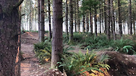
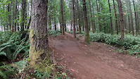
Photos of Maple Valley Mountain Bike
trail: TNT
5 |
Jul 2, 2022 @ 11:07am
Jul 2, 2022
trail: 'Lil Beaver
6 |
Jun 11, 2022 @ 6:21pm
Jun 11, 2022
trail: BDOS-Lake Sawyer Connector
85 |
Jan 28, 2022 @ 12:22am
Jan 28, 2022
trail: BDOS-Lake Sawyer Connector
51 |
Jan 28, 2022 @ 12:21am
Jan 28, 2022
trail: Tribulation
46 |
Dec 24, 2021 @ 12:22pm
Dec 24, 2021
trail: Big Tree
463 |
May 5, 2013 @ 5:50pm
May 5, 2013
trail: Big Tree
406 | | 2 comments
Jan 1, 2013 @ 3:39pm
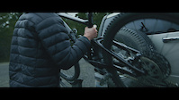
Jan 1, 2013Videos of Maple Valley Mountain Bike
trail: ATM
221 |
Feb 25, 2021
trail: ATM
88 |
Feb 2, 2021
trail: ATM
102 |
Nov 29, 2020
trail: ATM
2:24 |
178 |
Oct 5, 2020
trail: Thirsty Thursday
0:41 |
|
Aug 11, 2020
trail: Purgatory
1:21 |
251 |
Jul 27, 2020
trail: Gannonball Run
0:24 |
551 |
May 26, 2020
trail: Gannonball Run
4:19 |
9465 |
May 19, 2020
Current Trail Warnings
| status | trail | date | condition | user | info |
|---|---|---|---|---|---|
| Exodus | Jul 2, 2022 @ 7:03pm Jul 2, 2022 | Dry | kokofosho | Heavily overgrown | |
| Salvation | Jul 2, 2022 @ 7:03pm Jul 2, 2022 | Dry | kokofosho | Heavily overgrown |
Recent Trail Reports
| status | trail | date | condition | info | user |
|---|---|---|---|---|---|
| Big Beaver | Jun 30, 2022 @ 12:01pm Jun 30, 2022 | Ideal | Rageshtag | ||
| Connector | Jun 30, 2022 @ 12:01pm Jun 30, 2022 | Ideal | Rageshtag | ||
| Iron Brigade | Jun 25, 2022 @ 1:33pm Jun 25, 2022 | Ideal | gnarlord | ||
| Viper | Jun 25, 2022 @ 1:31pm Jun 25, 2022 | Ideal | gnarlord | ||
| Python | Jun 25, 2022 @ 1:29pm Jun 25, 2022 | Ideal | gnarlord | ||
| Remaster | Jun 19, 2022 @ 2:02pm Jun 19, 2022 | Ideal | Rageshtag | ||
| Garter Snake | Jun 16, 2022 @ 10:54am Jun 16, 2022 | Variable | Rageshtag | ||
| Master Link | Jun 12, 2022 @ 8:51pm Jun 12, 2022 | Wet | valko206 | ||
| Crooshal | Jun 4, 2022 @ 4:10pm Jun 4, 2022 | Ideal | Alspins | ||
| Supercharger | Jun 4, 2022 @ 4:10pm Jun 4, 2022 | Ideal | Alspins |
Activity Feed
| username | action | type | title | date | |
|---|---|---|---|---|---|
 | DARRENi4yNqc | wishlist | trail | Salvation and 1 more | Jul 5, 2022 @ 9:43pm 5 hours |
| tlochi | ridden | trail | Creek Side West | Jul 4, 2022 @ 12:36pm 2 days |
| Kevinkoolx | comment | trail | Max Eagle | Jul 3, 2022 @ 12:19am Jul 3, 2022 |
 | kokofosho | add | report | Exodus and 1 more | Jul 2, 2022 @ 7:03pm Jul 2, 2022 |
| twayland | ridden | trail | Roll'r Derby | Jul 2, 2022 @ 3:09pm Jul 2, 2022 |
Recent Comments
| username | type | title | comment | date | |
|---|---|---|---|---|---|
| trail | Overgrown with thorn bushes and low hanging... | Jul 3, 2022 @ 12:19am Jul 3, 2022 | ||
| trail | Currently closed towards the end. No alternate... | Jul 2, 2022 @ 11:07am Jul 2, 2022 | ||
| report | Actually still a small tree down on the uphill leg | Jun 4, 2022 @ 4:27pm Jun 4, 2022 | ||
| trail | Right at the end you start to get more speed... | Jun 4, 2022 @ 4:14pm Jun 4, 2022 | ||
| trail | Punchy but short downhill. Uphill portion... | Jun 1, 2022 @ 11:53am Jun 1, 2022 |
Local Badges
-

10 Blue Trails619 awarded -

10 Black Trails219 awarded -

Top 10 Trails52 awarded -

10 Green Trails518 awarded -

Completionist20 awarded -
Completionist6 awarded
Bike & Skill Parks
| name | type | city | rating |
|---|---|---|---|
| Summit Ridge Skilz Area | skill park | Maple Valley |
Activity Type Stats
| activitytype | trails | distance | descent | descent distance | total vertical | rating | global rank | state rank | photos | reports | routes | ridelogs |
|---|---|---|---|---|---|---|---|---|---|---|---|---|
| Mountain Bike | 190 | 102 miles | 12,844 ft | 51 miles | 830 ft | #64 | #27 | 528 | 4,153 | 5 | 22,432 | |
| E-Bike | 40 | 19 miles | 2,949 ft | 10 miles | 420 ft | #99 | #26 | 3,638 | 194 | |||
| Hike | 186 | 107 miles | 11,939 ft | 52 miles | 830 ft | #80 | #38 | 18 | 3,977 | 440 | ||
| Trail Running | 186 | 107 miles | 11,939 ft | 52 miles | 830 ft | #82 | #38 | 3,977 | 549 | |||
| Horse | 25 | 23 miles | 2,572 ft | 11 miles | 364 ft | #180 | #116 | 1,352 | 1 | |||
| Dirtbike/Moto | 4 | 5,003 ft | 95 ft | 3,517 ft | 62 ft | 1,349 | 1 | |||||
| Observed Trials | 4 | 5,003 ft | 95 ft | 3,517 ft | 62 ft | 1 | ||||||
| ATV/ORV/OHV | 4 | 5,003 ft | 95 ft | 3,517 ft | 62 ft | 1,349 | 12 |
- By ACree
 & contributors
 - Admins: EMBA, NMA, codyolsen, boxxerace, jmahler, Alexbeard9, sanfret, mattcr, BDTC
- #6154 - 14,138 views
- maple valley activity log | embed map of Maple Valley mountain bike trails | maple valley mountain biking points of interest
Downloading of trail gps tracks in kml & gpx formats is enabled for Maple Valley.
You must login to download files.